
महाराष्ट्रातील लिंगाणा,इरशाळगड यासारख्या अनेक गडकिल्ल्यांची शिखरे दुर्गप्रेमीना व साहसवीरांना गिर्यारोहणाची आव्हान देत उभी आहेत. या मालिकेतील असाच एक सुळका म्हणजे चंदेरी किल्ला. चंदेरीच्या पायथ्याशी असलेली घनदाट वृक्षराजी, गवताळ घसरडी वाट अन् मुरमाड निसरडा कातळमाथा म्हणजे सह्याद्रीतील एक बेजोड आव्हान आहे


११ व्या शतकात शिलाहारांच्या ताब्यात असलेला हा किल्ला इ.स.१६५६ मध्ये शिवरायांनी कल्याण,भिवंडी ,रायरीपर्यंतचा सारा मुलूख घेतला त्यात हा गडही मराठ्यांच्या ताब्यात आला असावा. संभाजी महाराजांच्या मृत्युनंतर इ.स.१६८९ साली मातब्बर खान या मुघल सरदाराने कल्याण,मलंगगड या किल्ल्याबरोबर चंदेरी किल्ला ताब्यात घेतला. अल्प विस्तार,पाण्याची कमी साठवणूक, बांधकामाचा अभाव, मर्यादित लोकांची मुक्कामाची सोय, अतिशय अवघड वाट हे सारे पाहून हा किल्ला नसून, एक लष्करी चौकी असावी असेच वाटते.
 काही जणांच्या मते ७ ऑक्टोबर १९५७ रोजी चंदेरी किल्ल्याच्या सुळक्यावर संघटित प्रस्तरारोहणाचा प्रारंभ झाला.
आधी आपण चिंचवली मार्गे जाणार्या वाटेची माहिती करुन घेउया. चिंचवली गाव मध्य लोहमार्गावरील बदलापुर स्थानकापासुन ११ कि.मी.अंतरावर तर वांगणी स्थानकातुन ८ कि.मी. अंतरावर असुन या दोन्ही स्थानकातुन चिंचवली गावात जाण्यासाठी रिक्षाची सोय आहे. मुंबई - कर्जत लोहमार्गावरील ‘वांगणी’ या रेल्वे स्थानकावर उतरावे. तेथून लोहमार्गाच्या कडेकडेने (बदलापूरच्या दिशेस) जाणार्या वाटेने गोरेगाव गाठावे. मुख्य रस्त्यावरून डावीकडे जाणारी वाट चिंचोली या पायथ्याच्या गावी घेऊन जाते. बदलापूर स्थानकात उतरून चिंचोलीस साधारण पाऊण तासाची पायपीट करूनही पोहचता येते. (वांगणी स्थानकातून गोरेगाव पर्यंत जाण्यास भाड्याची वहानेही मिळतात.) स्वतःचे वाहन असेल तर वांगणी - बदलापुर रस्त्यावर चिंचवली गावाचा फाटा लक्षात ठेवण्याची खुण म्हणजे रस्त्याच्या उजवीकडे दिसणारे हॉटेल चंदेरी.
या रस्त्याने साधरण दोन कि.मी.वर असलेल्या चिंचवली गावात आहे. या रस्त्याला अनेक श्रीमंत लोकांनी फार्महाउस बांधलेली आहेत. जर स्वताची गाडी नसेल गोरेगाव फाट्याला उतरुन चिंचवली गाव गाठणे किंवा खाजगी सहा आसनी रिक्षाने चिंचवली पर्यंत येणे हे दोन पर्याय आहेत. चिंचवली गावात आवश्यकता भासल्यास वाटाड्या घ्यावा. इथेच हल्ली चहा, नाष्टा, जेवण आदीची सोय होउ शकते.चिंचवली गावामागे असलेल्या लहानशा टेकडामुळे गावात गेल्यावर चंदेरी किल्ला नजरेस पडत नाही पण या टेकडावर असलेल्या पठारावरून किल्ल्यावर जाण्यासाठी मळलेली वाट आहे.

चिंचवली गावास उजवीकडे ठेऊन वर जाणार्या दोन वाटा आहेत. एका लहानश्या टेकाडाच्या दोन बाजूंनी ह्या वाटा जातात. टेकडीच्या उजवीकडून जाणारी वाट दगडधोंड्यांमधून जाणारी खडकाळ आहे. तर टेकडीच्या डावीकडून जाणारी वाट घसरडया लाल मातीवरील झाडांझुडपांतून जाणारी आहे. ह्या दोन्हीही वाटा मध्यभागी असणार्या एका लहानशा पठारावर घेऊन जातात.






१ ) साद सह्याद्रीची ! भटकंती किल्ल्यांची !!- प्र.के. घाणेकर
२ ) www.trekshitiz.com हि वेबसाईट
३ ) रायगड जिल्हा गॅझेटियर
4 ) सांगाती सह्याद्रीचा- यंग झिंगारो ट्रेकर्स
५ ) डोंगरयात्रा - आनंद पाळंदे
६ ) हा ब्लॉग
हिवाळी भटकंती: चंदेरी ( Chanderi )
काही जणांच्या मते ७ ऑक्टोबर १९५७ रोजी चंदेरी किल्ल्याच्या सुळक्यावर संघटित प्रस्तरारोहणाचा प्रारंभ झाला.

पहाट झाली, थोडे पोटात ढकलले आणि अंधारातच चाचपडत चंदेरीच्या दिशेने निघालो. चिंचोली गावास उजवीकडे ठेऊन वर जाणार्या दोन वाटा आहेत. एका लहानश्या टेकाडाच्या दोन बाजूंनी ह्या वाटा जातात. टेकडीच्या उजवीकडून जाणारी वाट दगडधोंड्यांमधून जाणारी खडकाळ आहे. तर टेकडीच्या डावीकडून जाणारी वाट घसरडया लाल मातीवरील झाडांझुडपांतून जाणारी आहे. ह्या दोन्हीही वाटा मध्यभागी असणार्या एका लहानशा पठारावर घेऊन जातात.
गंमत या सर्व चालीत डोक्यावरून सतत उडणार्या विमानांची आपणास साथ असते. चेन्नई, सिंगापुर, ईंडोनेशिया, ऑस्ट्रेलिया या आग्नेय दिशेने मुंबईकडे येणारी विमाने दिसत असतात. एकदा या विमानाच्या खिडकीतून हि रांग पहायची आहे.
लांबवर दिसणारा चंदेरी जवळ आला.


ओढ्यातूनच आम्ही चढाई सुरू केली आणि चिंचवली सोडल्यापासून साधारण तासाभरात चंदेरी आणि म्हैसमाळच्या इंग्रजी व्हि ( V ) आकाराच्या खिंडीत जाउन बसलो.
पलीकडच्या बाजुचे प्रबळगड आणी माथेरानच्या मधील खोरे उलगडून सामोरे आले. समोर गाढेश्वर तलाव दिसत होता. या बाजुला पायथ्याशी तामसई नावाचे खेडे आहे. इथूनही चंदेरीवर येता येते. तामसईला जायचे झाल्यास पनवेलवरून बसची सोय आहे. याच खिंडीत तामसईची वाट वर आली होती.
आता उत्तरेची वाट म्हैसमाळ सुळक्याकडे तर दक्षिणेची वाट चंदेरी गडाकडे जात होती. बरोबर आणलेला दिवाळीचा फराळ संपवून आम्ही चंदेरीकडे कुच केले. काहीशी खडी असणारी हि वाट चांगलाच दम काढते.
अखेरीस चंदेरीच्या सुळक्याच्या अलिकडे असणार्या थोडक्या सपाटीपाशी पोहचलो. इथे दगडी पायर्या आहेत आणि थोडीफार बांधीव तटबंदी आहे. चंदेरीच्या किल्लेपणाची हिच काय ती खुण.
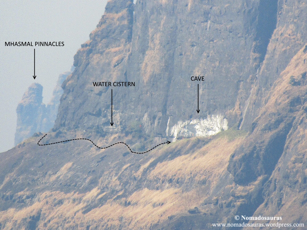
या गुहेच्या आधी एक पाण्याचे टाके आहे त्यात पिण्यायोग्य पाणी आहे. गुहेच्या थोडे पुढे सुळक्याच्या पायथ्याशी देखील एक टाके आहे.
या गुहेतून थेट समोर प्रबळगड व कलावंतीण सुळका दिसतात.
आता बेत होता माथ्यावर जाण्याचा. कातळमाथ्याचा विस्तार फक्त लांबी पुरताच आहे. रुंदी जवळजवळ नाहीच. दरड कोसळल्यामुळे सुळक्याचा माथा गाठणे फारच कठीण झाले आहे. तरीही प्रस्तरारोहण कलेची आवड असणार्या गिर्यारोहकांचे हा सुळका खास आकर्षण आहे.
उजव्या बाजुला खोल दिसणारी दरी थरकाप उडवत असते तर पायखालचे बॉलबेरींग सारखे सटकणारे छोटे खडे गाळण उडवतात. कच्चा दिलाचे भिडू असतील तर इथे रोप बांधलेला चांगला. त्यासाठी डाव्या बाजुच्या खडकात एक पिटॉन मारलेला आहे. कसाबसा हा पॅच मागे टाकून जेमतेम पाउलभर रुंद वाटेने चंदेरीच्या दक्षिण टोकाशी आलो.
इथे एक पाण्याचे टाके आहे पण कोरडे.

असह्य चटके सहन करून आणि घसरड्या वाटेचे दिव्य पार करून गुहेत आलो आणि अक्षरशः थंड्गार जमिनीवर आडवे झालो. पंधरा मिनीटे कोणीही एकमेकांशी चकार शब्दही बोलेले नाही. शेवटी एकेकाला कंठ फुटला आणि राहिलेले खाद्यपदार्थ संपवून आम्ही उतरण्यास सुरवात केली. एरवी कोणत्याही किल्ल्यवरून उतरणे सोपे जाते. मात्र थेट सत्तर अंशाचे उतार आणि दोन्ही बाजूला आ वासलेली दरी यामुळे जपुनच उतरून खिंडीत आलो. खालच्या पठारावर पोहचेपर्यंत सुर्य कलला होता. सकाळी पठार पार करताना फार त्रास झाला नव्हता, मात्र आता तीन कि,मी.ची ती चाल चालणे चांगलेच जीवावर आले. अखेरीस गाडीपाशी पोहचलो तोपर्यंत चांगलाच अंधार झाला. थकलेले शरीर सीट्वर टाकून आणि सॅक मागे फेकून सगळेच जण डोळे मिटून शांतपणे झोपलो. ईतके दिवस हुलकावणी देणार्या चंदेरीचा माथा सर केल्याचे समाधान मात्र होते.
तुम्ही माझे आत्तापर्यंतचे सर्व लिखाण माझ्या ब्लॉगवर एकत्र वाचु शकता.
ब्लॉगचा पत्ता:
भटकंती गड-कोटांची
संदर्भ ग्रंथः-
१ ) साद सह्याद्रीची ! भटकंती किल्ल्यांची !!- प्र.के. घाणेकर
२ ) www.trekshitiz.com हि वेबसाईट
३ ) रायगड जिल्हा गॅझेटियर
4 ) सांगाती सह्याद्रीचा- यंग झिंगारो ट्रेकर्स
This post has been divided into two parts: The Ascent to Chanderi Cave via Tamsai (Panvel) and Descent from Chanderi Cave to Chinchavali (Vangani/Badlapur). Link to the second part can be found at the bottom of this page.
#47: Trek to Chanderi fort via Tamsai and Chinchavali.
I felt a hand on my shoulder.
“Bhava, thik aahes na?” (Bro, you alright?)
“Yeah”, I lied without looking up.
Beads of sweat dripped from my forehead as I panted with my hands braced against the thighs, bent over on the ridge between the Col and Chanderi Cave. Fed up of the sharp, throbbing pain that shot through my right knee with every step, I gave into this insane urge to sprint up the steep ridge. A minute and 120 vertical feet later, I was still some way off the cave but my heart was now thumping against the rib cage at an ever increasing pace, cursing me for the foolish sprint.
The tip of Chanderi fort was just about peeking over the ridge and to my left, 5 km away, was the village of Chinchavali looking no bigger than a coin. It was an hour past noon and my still-recovering knee was posing questions I couldn’t answer. The heat and pain were only going to increase here on and I had a decision to make. Cave or the Village?
But first, let me take you all the way back to how it all began!
Folks, brace yourselves for another crazy trek of ‘A Season of Mountains’!

When: Dec ‘17
Where: Chanderi fort (Cave), Maharashtra
GPS coordinates: 19°03’51.3″N 73°14’43.5″E
Base Villages: 1. Tamsai: 16 kms from Panvel (South-west route)
2. Chinchavali: 10 kms from Badlapur/Vangani (North-east route)
Range: Matheran range
USP: Chanderi Cave
Best time to visit: Preferably winter (November-February). Please do not attempt this trek in peak monsoon.
Difficulty: Moderate till the Cave for experienced trekkers
Endurance: 3
Risk Factor: Medium. Do not attempt to climb the pinnacle without professional guidance.
All gradings are for winter trek. How are they classified? Read here!
Map & Elevation graph: GPS trail: Click here to view GPS trail on Wikiloc -> Wikiloc Link
Our Route: Panvel-Tamsai-Col-Chanderi Cave-Col-Chinchavli-Vangani
1. For Tamsai, alight at Panvel railway station and hire a Tumtum from the stand outside ST depot.
Ascent from Tamsai: Panvel-Tamsai-Col-Chanderi cave.
From
Tamsai, walk north along the paddy fields for 400 m before turning east
(right with your back to Tamsai) along a faint trail heading in
Chanderi fort’s direction. After some distance, it circumvents base of
the unnamed hill on left before reaching a stream (dry except in
monsoon) and then cuts across one of Mhasmal’s spurs to enter dense
forest. Following this, a steep climb leads to the col (~3 km from
Tamsai) where Chanderi stands on your right (east) and Mhasmal on left
(west). An easy grade rock patch with a bit of exposure but excellent
holds is all that separates you from the Chanderi Massif. Once at the
base of the massif, turn right and pass a water cistern to reach the
cave.
2. For Chinchavali, alight at Badlapur/Vangani railway station and hire a Tumtum/Auto rickshaw to Chinchavali.
Ascent from Chinchavali: Badlapur/Vangani-Chinchavali-Col-Chanderi cave.
A
prominent trail climbs up the plateau from Chinchavali. The gradual
climb leads you to a flat, clear trail due south that traverses the
plateau to end at a dry basin, about 3.5 kms from Chinchavali. Look out
for markers from this point onwards. The route sometimes climbs through
and at other times, alongside the gully (Naal) to reach the col. With
your back towards Chinchavali, turn left (east) for Chanderi and follow
the route to cave as mentioned above.
Total trail length: 8.3 km
Actual distance covered: 9.2 km (including off-trail movement)
Min. Elevation of the trail: Tamsai: 96 m above MSL & Chinchavali: 45 m above MSL.
Max. Elevation of the trail: 1. Cave: 664 m (2178 ft.) above MSL. (Verified during trek)
2. Peak: 688 m (2257 ft.) above MSL. (As per Google Earth)
Total Time: 11 hours (of which active time: 6 hours)
Food and Water: Carry
at least 3 litres of water per head during winters. Water cisterns with
potable water are located at the southern end of the fort. Rest have
been contaminated by plastic waste.
Accommodation: 15-20 people can stay in Chanderi cave
Night trek: Not recommended
NOTE: If you plan treks on your own, please consider hiring a local guide from base village. There have been fatal accidents and incidents of trekkers getting lost in the forest. Links to a few rescue/stranding incidents on the fort- One, Two, Three & Four.
Our Itinerary:
0700 hrs- Alighted at Juinagar Railway Station
0715 hrs- Boarded ST (State Transport) bus for Panvel
0745 hrs- Reached Panvel Bus depot
0845 hrs- Hired Tumtum to Tamsai
0930 hrs- Reached Tamsai
1245 hrs- Reached Col
1345 hrs- Reached Chanderi Cave
1620 hrs- Started descent from Cave
2035 hrs- Reached Chinchavali
2100 hrs- Hired a Mahindra Maximo from the village to Vangani railway station
2139 hrs- Boarded an UP local train to CSMT
NOTE: For video of a trek with similar itinerary, check out Sujit Mallick’s excellent Chanderi trek video from June 2018!
Our expenses:
Railway ticket: Rs. 40 per head
Bus ticket (Juinagar to Panvel): Rs. 20 per head
Breakfast: Rs. 554/7 = Rs 79 per head (One of the friends joined us post breakfast)
*Tumtum fare from Panvel to Tamsai: Rs. 400/8 = Rs. 50 per head
*Van fare from Chinchavali to Vangani: Rs. 500/8 = Rs. 63 per head
Post-trek snacks: Rs 300/8 = Rs. 38 per head
Total: Rs 290 per head
*Negotiable.
Other transport options: ST buses (aka Laal Dabba) run a couple of times each day between Panvel ST depot and Dundra/Dundra Fata. Sharing Tumtums are available for Tamsai from Dundra.
Alternative Routes/Other trails:
1.
Trail to Chanderi from Ashaswadi: A very rarely used trail climbs up to
the Mhasmal-Chanderi Col from Ashaswadi near Dundra. Hiring a guide is
essential to explore this route.
2. Vaghachi
wadi-Chanderi traverse: A trail from Vaghachi Wadi (base village of
Nakhind) descends to the valley between Chanderi and Nakhind before
climbing up the south-eastern end of Chanderi fort. Caution: This trail is not used anymore.
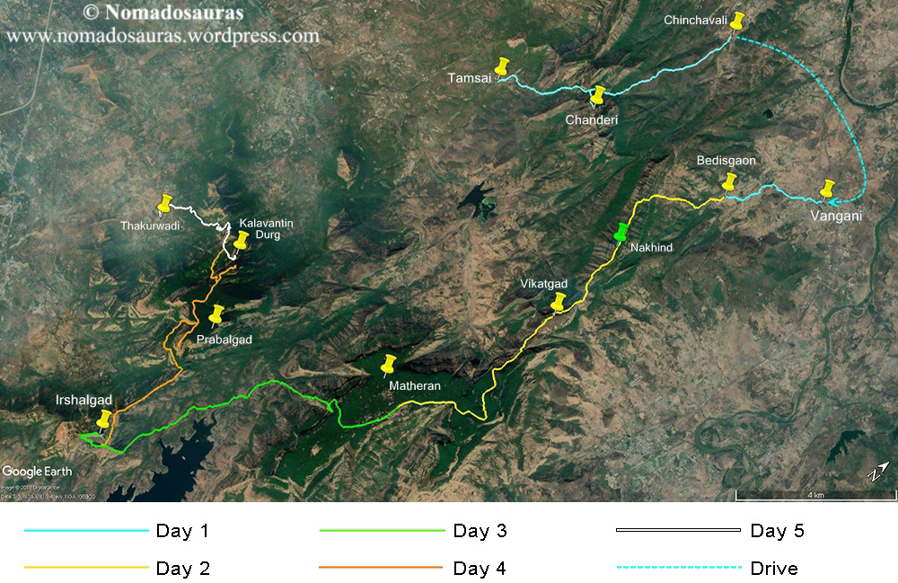
Tentative itinerary for a 5-day Range trek:
Time to let my imagination run wild!
I
have done the entire route mentioned below in segments. Feel free to
drop me a mail using the contact form for more information about any
section of the trail.
Chanderi-Nakhind-Peb (Vikatgad)-Matheran-Irshalgad-Prabalgad-Kalavantin Durg

Overall: 51.2 km with a total elevation gain and loss of approx. 3970m (13024 ft).
NOTE:
- All the pictures used in this post have been clicked by my friends or me, unless stated otherwise.
- Hyperlinks are highlighted in blue and open in a new tab.
- The information provided in this post is for informational purposes only. Any reliance you place on such information is therefore, strictly at your own risk.
Prologue
The flourishing 4th Season
of Mountains came to a screeching halt the moment I re-injured my right
knee in the first week of September ‘17. Common sense (and my Doctor!)
dictated that I take some time off from treks to help the knee
recuperate and I duly kept a low profile in the months that followed.
But when an easy hike failed to satiate my yearning for the mountains, I
knew only one thing could help me- a full-fledged trek, injury be
damned!
The following is an account of the crazy trek
that was borne out of this craving for the hills. The destination? One
of the most notorious hills of the Matheran range- Chanderi fort.
The Gang: Abhishek, Darshana, Gauri, Krunal, Manish, Shardul, Tejas & Me
The 4th Season Of Mountains:
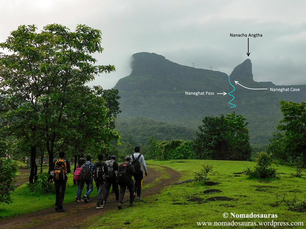
The Monsoon of 2017, which also happened to be the Fourth Season Of Mountains for me, started with the long awaited trek to Bhimashankar via Shidi and Ganesh Ghat. We followed it up with another amazing trek to Naneghat and even though I started experiencing niggling pain in my right knee a few days later, I wilfully ignored it.
I had been to Irshalgad & Prabalgad the year before and when I read about a rarely attempted traverse between the two forts, I knew I had to do it. My usual partner-in-crime during such treks, Sud, gladly agreed to join me and we roped in a guy from Irshalwadi, Sunil, to guide us through the connecting ridge that becomes a challenge to navigate during Monsoons.
As luck would have it, about 10 kms into the trek I slipped on the mossy trail and heard a pop as I landed awkwardly on my knee. Determined to carry on, I pulled on the knee sleeve that we usually carry in our first-aid kit during difficult, isolated treks and somehow trekked another 10 kms to Thakurwadi.
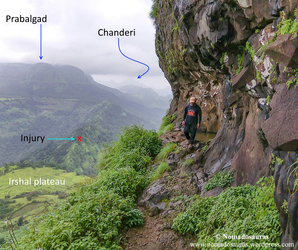
The next day, I was crestfallen when tests revealed I had partially torn the Anterior Cruciate Ligament (ACL) of my right knee. With strict orders from the doctor to avoid straining the knee for 6 months, I reluctantly buried the season then and there.
Resurrection!
But we, the people in love with mountains are an incorrigible breed and rational things don’t make sense to us!
So I was back doing light exercises by the time December rolled in and about a week into the month, decided to test my knee by hiking up to Matheran by one of the easier routes, the Dodhani-Hashyachi patti trail with Tejas. Even though I was limping by the end of it, I knew one thing for certain- I couldn’t stay away from the hills.
The Mountains were calling me and I had to go!
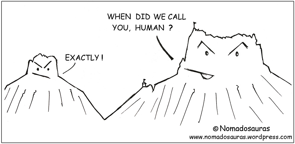
Okay fine! No mountain called me. Mountains have better things to do.
But you get the point, right?
As long as I could walk, I was going to climb and just like that, the 4th Season was alive again!
The Choice:
When the Season had been resurrected, how could the Gang be far behind?
So
we got together to brainstorm and zero in on a place. The conditions-
It had to be an exciting climb and at the same time, well connected to
the city. Everyone bounced a few names but most were shot down due to
one reason or another. Except one.
Chanderi.
As was the case with Irshalgad, I had been apprehensive about trekking to Chanderi due to its unfortunate reputation. But the more I read about it, the more I gravitated towards it.

Chanderi is a peak in the Matheran range with an obscure history. Although no signs of fortification besides three water cisterns & partially blown off steps survive today, British records of the region indicate ruins of several houses were present on the fort till late 19th century (Reference link).
As for the route, several trails climb up to the Chanderi-Mhasmal col from nearby villages but the ones originating from Tamsai (Panvel) and Chinchavali are used most often. From the col onward, the trek ahead can be divided into two phases-
1. Col to Cave: Moderate grade. A steep climb followed by an easy rock patch leads to the cave at an elevation of 2178 ft. above MSL.
2. Cave to Peak: Very
Difficult grade. An exposed traverse beyond the cave ends at a vertical
slab near the southern end of the fort. A few inches-wide groove in the
wall leads to a flight of partially blown off steps from where, a very exposed path
across the peak culminates at the three-foot tall statue of Shivaji
Maharaj (installed by Badlapur-based Ajinkya hikers on the occasion of
their 25th anniversary in 2008). This is the highest point of the fort at an elevation of 2258 ft. above MSL.
None of my friends were keen on scaling the peak after such a long break, an opinion I seconded. Instead, we set our heart on doing something else to make it a little more interesting- traverse all the way from Tamsai to Chinchavali via Chanderi cave!
Most of the blog posts I read had described the Chinchavali trail in great detail but it was incredibly difficult to find a reliable account of the Tamsai trail. Therefore, we decided to explore and document the South-west trail from Tamsai in broad daylight and descend to Chinchavali by the North-east route later in the day.
The Knee Sleeve:
If the hills above seem familiar to you, chances are you have seen ‘Pyaar Kiya To Darna Kya’.
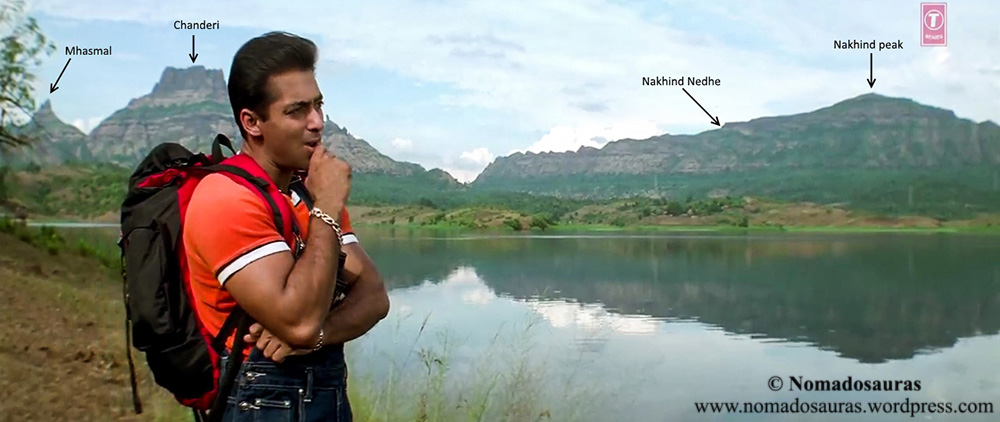
With the research and planning phase more or less done, I shifted my focus to prepping for the trek. Chanderi is also notorious for its scree slopes and if you have ever set foot on one, you know the significance of a grippy pair of shoes. Unfortunately, my pair of Action trekking shoes had worn out by then and breaking into a new pair so close to the trek was out of question. Stuck between a rock and a hard place, I traded grip in favour of blister-free feet and kept faith in my existing pair- a choice that’d come to haunt me later!
Meanwhile,
my knee was feeling no better but I knew I’d somehow pull through the
trek. What really concerned me was that if any of my friends sensed my
discomfort during the ascent, they’d have turned back with me without a
second thought.
So I came up with a Master-Pilaan!
I
would keep the knee sleeve ready at my ankle, hidden under the jeans
and the moment my knee started hurting, I would pull it up without
anyone noticing and continue!
Just as I was smirking
at my evil plan, Mansi informed us that she was dropping out due to
personal reasons but graciously agreed to be our backup* for the trek.
*Backup: A person regularly updated about our location during the trek.
The Megablock Mess:
With
Mansi not being able to make it, the Trek Gang was now down to 8,
including me, coming from all over the city- Abhi (Ghatkopar), Darshana
(Panvel), Gauri (Kurla), Manish (Vasai), Krunal (Gujarat!), Shardul
(Thane) & Tejas (Andheri).
Here’s an infographic to better illustrate this:
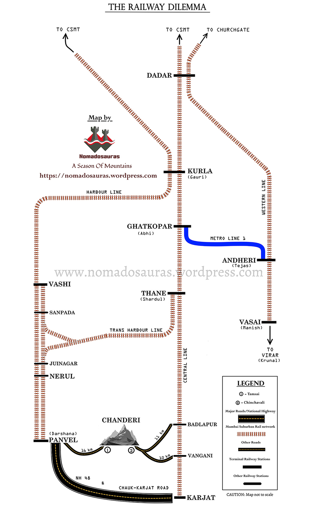
You
must have probably guessed by now that travelling by Railways was
central to our plan. So you can imagine my plight when later that night,
a notification popped up on my screen- Central and Harbour railway
divisions were going to implement a 13(!) hour long Megablock* between
Nerul and Panvel from 2 am to 3 pm!
Kaboom! I could see all the planning go down the drain.
*Megablocks are service blocks undertaken by railway divisions to carry out maintenance work on the suburban line, usually on public holidays to minimize inconvenience to commuters.
But how could we let it bog us down?
After
briefly toying with the idea of reversing the trek direction, we
finally figured that the best way round this new hurdle was to reach
Juinagar by local train and then hop together into an ST bus for Panvel!
With the travel woes (hopefully) sorted, I tried to log a few hours of sleep to make sure my body was primed for the ordeal that I was going to put it through the next day.
The Symphony:
One
of my favourite events of the trek-day is when everyone reaches a
common place from all corners of the city- as if part of a larger
symphony where all notes come together and sync to create music
The other notes of this symphony- Abhi, Gauri, Manish, Krunal & Tejas were on their way to Kurla when I reached Thane railway station, a little before 6 am. Shortly after, Shardul joined me and we boarded the 6.09 am Trans-Harbour train to Vashi while the rest boarded a Harbour line train from Kurla.
When Shardul and I reached our interchange station, Vashi and had about 20 minutes to spare before Abhi & Co.’s train reached there, we went out looking for breakfast. Unfortunately, no restaurant was open that early in the morning and Shardul had to make do with a cup of tea while I couldn’t even find a cup of coffee! *sigh* We trudged back to the station and did our customary Bharat-Milap with the rest of the Gang after boarding the train to Juinagar.

A footbridge from Juinagar railway station leads one to the Mumbai highway passing besides the station and we had barely descended it when Manish let out his trademark war cry! His hawk eyes, tuned to reading the smudged display plates of buses after years of trekking, had spotted a Panvel bus speeding towards the stop and in an instant, everyone was sprinting down the highway faster than Usain bolt. Seeing our desperation for the bus, the poor bewildered passengers already waiting at the bus stop made way for us and a minute later, we were speeding past vehicles sitting comfortably in the rearmost bench of the bus

The rising sun welcomed us in Panvel at half past seven and a quick enquiry with the bus counter confirmed that the only bus to Dundra in the morning had departed long back. So Tumtum it had to be!

But I was still craving for a nice, hot cup of coffee and the rest of the Gang were hungry as well, so we walked over to our usual pre-trek breakfast haunt in Panvel- Rahul restaurant.
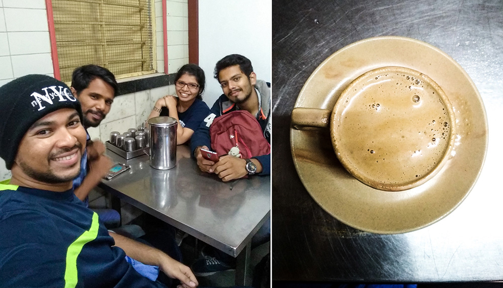
That reminds me- if you ever wish to perk someone up, offer them food. Period.
If
only you’d seen our beaming faces when we left for the Tumtum stand
after gobbling up half the restaurant’s kitchen, you wouldn’t need any
more proof
Coming to the transport options- You can find Tumtums catering to different destinations lined up in queues underneath the Panvel flyover. The drivers at the Tamsai stand initially quoted Rs. 600 for the 17 km ride but after some haggling, settled for Rs. 400 which wasn’t too bad for a group of 8.
And 8 reminds me of the last note of the day’s symphony- Darshana!
She
was already waiting for us some way ahead along with Mansi, who had
come to see off her sister and meet us as well. As you might have
already guessed, the Gang didn’t let go off the opportunity to berate
(in jest, of course) poor Mansi for missing another trek and I actually
had to urge the driver to speed off before our Tom & Jerry duo of
Mansi and Manish got down to a WWE-style match in the middle of the
street.

As we moved farther from the city, the urban structures were gradually replaced by fields, glowing golden through the morning haze and what appeared as a faint spec in the horizon, grew steadily to take on the distinctive shape of Chanderi.

The Performer:
When
we finally got off in Tamsai at 9.30 am, we were greeted by the most
violent of hosts- A bull charging straight at us! But even before we
could react to the unusual sight, the bull swiftly turned direction and
set off for a circle round the village.
Yes, it was a trained bull who performed for the crowds and earned money for its masters. A very sad sight it was to see such a majestic specimen performing like a clown, but even we couldn’t help stand there transfixed by the spectacle for a good 10 minutes before remembering that we had a mountain to climb!
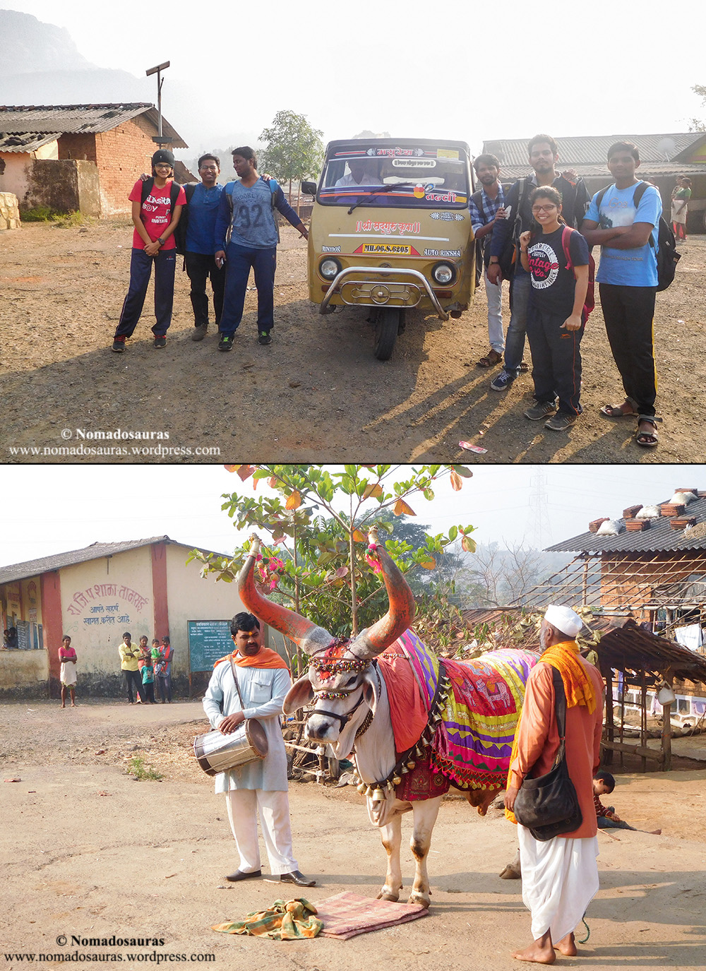
And so it was a quarter to 10 when we finally exited the village by a kuchcha road in the north and thus started the long awaited trek to Chanderi.
The Trek:
One has to
walk north from the village, along a small stream (almost dry even
though it was only December). Women from the village were doing their
chores in whatever water was left in the stream and it is sights like
these that make me think of the unfortunate gulf that’s prevalent even
today.
Anyways, back to the trek! After passing the stream, the trail climbs up along the fields and about 400 m from the village, cuts through them to turn east.
Nearly lost point #1
It is
here that one should be a little wary of the numerous trails that
criss-cross the region. Most of these are cattle trails that end up in
the bushes.
At
one such point near the fields where our trail forked out into three,
Shardul, Krunal and I fanned out to find the correct one. And bizarrely,
the correct trail turned out to be the faintest of the three! One of
the pointers to remember here is that correct trail traces a quarter
circle around the base of the unnamed hill on the left before
straightening out in Mhasmal’s* direction.
*Mhasmal is
a non-fortified cluster of pinnacles that poses an interesting
challenge to professional rock climbers. However, loose scree near the
peaks has been one of the major reasons for its waning popularity in the
rock climbing community.
Once you have safely negotiated this maze of trails, the rest of the path is pretty straightforward, except at another point which would be mentioned later in the post.
The previous week had been beautiful- Sunny weather with temperatures hovering around 25 degrees and huge, foamy white clouds racing against the stark blue sky. Unfortunately, the day of our trek turned out nothing like that.
Any hint of colour had been obscured by haze and there was no trace of a cloud for miles round the sky. Worse still, the temperatures had climbed back to over 30 degrees, necessitating a rather early hydration break barely 45 minutes into the trek. Some light banter and a couple of sips of electrolyte water later, we were back hauling our backpacks up the mountain with renewed vigour!

About half an hour later, we reached the dry bed of what must be a torrential stream in peak monsoon. A flat rock standing at the precipice of a steep fall in the stream bed looked perfectly placed for a picture and after resisting the temptation for a while, we finally gave in
With the photoshoot wrapped up, we took the clear trail on the other side of the stream. A minute later, I was staring at a dead end.
Nearly lost point # 2
I
tried scouting around for the trail ahead but thorny bushes were making
it difficult to continue. Nevertheless, I turned back with a smile,
happy that at least my calves were saved from unwanted tattoos by the
thick jeans!
Back at the stream, I cross-checked our location with the map and found that the old GPS trail I had traced, passed through what was now a dead end! For a fleeting second, I did think about forging a path through the bushes using our multi-tool but then better sense prevailed and I abandoned the foolhardy idea.

There was only one possible explanation for this anomaly- the old trail must have got blocked by landslides and subsequent wild growth during the previous monsoon. But this also meant the new trail ought to be close by!
So we started looking around and a minute later, Abhi spotted an opening in the bush wall few metres upstream. Enthused at the probable headway, we scrambled up and there it was! A red arrow painted on the wall next to a clear, steep path passing underneath a canopy of trees!
Once you have crossed the canopy, the trail gradient increases steeply and my beloved scree makes life all the more difficult 

Very soon, the brief respite from Sun ended when the trail climbed up to a spur coming down from Mhasmal with a concave wall, which transforms into a splendid waterfall during monsoon, standing on our right. The concave wall (or waterfall depending on the season) is one of the important landmarks of Tamsai trail.
Life lessons:
The trail climbed even more steeply from this point onward and the breaks became more frequent.
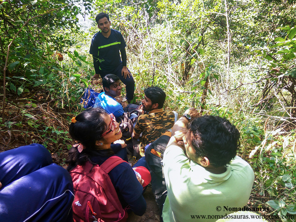
During one such break, I learnt something new.
I firmly believe that if you get along with someone on a trek, you have found a friend for life. And the fact that we have been trekking together for several years should help you gauge the close bond we share with each other. Therefore, when one of the friends unknowingly went a little overboard with his/her jokes and kind of stepped on toe of another, I wasn’t too worried because I assumed both would know there was no malice in it and banter is anyways an essential part of treks. However, I soon noticed things had turned a little frosty between the two and that is when I understood that sometimes, words can touch a nerve so raw that even years-long bonds take a hit.
Another round of climb-break-climb followed this incident before I scrambled up a very steep path carpeted with dry leaves to reach a four way junction of trails: the Mhasmal-Chanderi col.
The Sprint:
Standing on the col, the four trails are as follows:
North-east: Trail to Chinchavali; South-west: Trail to Tamsai;
North-west: Trail to Mhasmal; South-east: Trail to Chanderi.

The afternoon heat had started affecting each one of us, some more than the others and with the trail gaining elevation at a faster clip, we soon split up into two distinct groups. Manish and I were climbing at a faster pace in the first, followed by the rest of the Gang.

By this point of time, my knee had already been hurting for an hour and climbing such a steep trail with worn-out shoes was turning out even more taxing. But nothing, not even premonition could have prepared me for the wave of pain that shot through my leg when I slipped on the scree and twisted my knee once again about one-fourth way up the ridge. I looked behind. Krunal and Manish were still a few steps below and they mustn’t have heard my involuntary cry of pain. I turned around to look at the peak. It still looked far.
A crazy thought popped up in my head- What if I ran up the trail?
Not
the ‘hop-run-hop’ that trail runners do but a full-blown sprint for as
long as I could manage? The sheer effort of running up might even mask
the pain for a long time afterwards!
Foolish it might sound now, but at that point of time, nothing seemed more logical.
The next instant, I was running up the ridge with a 15 pound backpack, kicking up a cloud of dust with every slipping step.
And
I was smiling. The steps too quick to process pain from the previous
pounding and thoughts occupied by the next foothold. It was pure bliss
while it lasted.
And then pain hit me again like a wrecking train. I stopped on the spot and staggered backwards but somehow steadied myself. I wanted to sit down but the trail was too steep for that. So I bent over and braced my hands against the knees. When I opened my eyes a few seconds later, the trail was a feet from my face and seconds felt like hours.
Beads of sweat, looking impossibly big from such close quarters, dripped onto the trail accompanied by a micro splash. Muscles twitched in rhythm with the racing heartbeat and each beat sounded like a drum being pounded with sheer fury. The surge of blood in my head too much to bear, I tried standing up again but another wave of pain shot through my knee and I bent over again and closed my eyes.
And then I felt a hand on my shoulder.
“Bhava, thik aahes na?” (Bro, you alright?)
It was Manish. I clenched my teeth to muffle a groan from another wave of pain.
“Yeah.” I lied without looking up.
I asked him to go ahead and then opened my eyes again by a fraction. I could see a tiny village and a rugged peak in my peripheral vision. Chinchavali and Chanderi.
I had a decision to make.
To know what happened next, read Part II here!
NOTE TO SUBSCRIBERS!
–
995 high-resolution images (including over 75 unpublished pictures of
the Chanderi trek) from 16 escapades of ‘A Season Of Mountains’ have
been published with captions in my Flickr account. You can check them
out here!
– Useful Links post
too has been updated with new links and book recommendations that might
be helpful to anyone intending to further explore the Sahyadris. Go
check it out!
All rights reserved © 2016 – present Nomadosauras.
Content (including images) not for reproduction in any form, partial or otherwise.
Read complete disclaimer- Terms Of Use.
Cheers!
Keep Trekking
| चंदेरी (Chanderi) | किल्ल्याची ऊंची : 2300 | ||
| किल्ल्याचा प्रकार : गिरीदुर्ग | डोंगररांग: माथेरान | ||
| जिल्हा : ठाणे | श्रेणी : कठीण | ||
| मुंबई - पुणे
लोहमार्गावरून कल्याणहून कर्जतकडे जाताना उजवीकडे एक डोंगररांग दिसते, ती
म्हणजे बदलापूर डोंगररांग .नाखिंड, चंदेरी, म्हैसमाळ, नवरी, बोयी, पेब ,
माथेरान ही शिखरे याच डोंगररांगेत येतात. या डोंगररांगेत आपला भलाथोरला
माथा उंचावलेला एक प्रचंड सुळका दिसतो, त्या किल्ल्याचे नाव आहे "चंदेरी".
बदलापूर - वांगणी स्थानका दरम्यान बदलापूर - कर्जत रस्त्यावर गोरेगाव
नावाचे गाव आहे. येथूनच चंदेरीची वाट आहे. चंदेरीच्या पायथ्याशी असलेली घनदाट वृक्षराजी, गवताळ घसरडी वाट अन् मुरमाड निसरडा कातळमाथा म्हणजे सह्याद्रीतील एक बेजोड आव्हान आहे .तामसाइ गावाच्या हद्दीत असणारा असा हा दुर्ग प्रस्तरारोहण कलेची आवड असणार्या गिर्यारोहकांचे खास आकर्षण आहे. | |||
| |||
| |||
| इतिहास : | |||
| किल्ल्यावरील गुहेच्या अलीकडे
एक पडक्या अवस्थेतील शेष तटबंदी दिसते. किल्लेपणाची हीच काय ती खूण उरलेली
आहे. मे १६५६ मध्ये शिवरायांनी कल्याण ,भिवंडी ,रायरी पर्यंतचा सारा मुलूख
घेतला, तेव्हा त्यात हा गडही मराठ्यांच्या ताब्यात आला असावा. अल्प
विस्तार,पाण्याची कमी साठवणूक, बांधकामाचा अभाव, मर्यादित लोकांची
मुक्कामाची सोय, अतिशय अवघड वाट हे सारे पाहून हा किल्ला नसून, एक लष्करी
चौकी असावी असेच वाटते. काही जणांच्या मते ७ ऑक्टोबर १९५७ रोजी चंदेरी किल्ल्याच्या सुळक्यावर संघटित प्रस्तरारोहणाचा प्रारंभ झाला. | |||
| पहाण्याची ठिकाणे : | |||
| गुहेत
पूर्वी एक शिवलिंग व नंदी होता. शिवपिंडी भंगलेल्या अवस्थेत आहे. तर
नंदीचे अपहरण झाले आहे. गुहेच्या अलीकडेच एक सुमधुर पाण्याचे टाके आहे.
ऑक्टोबर शेवट पर्यंतच त्यात पाणी असते. ८ ते १० जणांच्या मुक्कामासाठी गुहा
उत्तम आहे. गुहेच्या थोडे पुढे सुळक्याच्या पायथ्याशी देखील एक टाके
आहे.कातळमाथ्याचा विस्तार फक्त लांबी पुरताच आहे. रुंदी जवळजवळ नाहीच. दरड
कोसळल्यामुळे सुळक्याचा माथा गाठणे फारच कठीण झाले आहे. सुळक्यावरून
उगवतीला माथेरान, पेब, प्रबळची डोंगररांग इ दिसते. तर मावळतीला भीमाशंकरचे
पठार ,सिध्दगड, गोरक्षगड, पेठचा किल्ला इ दिसतात. गडाच्या पायथ्याचा परिसर पावसाळ्यात फारच रमणीय व विलोभनीय असतो. धबधब्याचा आस्वाद घ्यायला अनेक पर्यटक येथे येतात. | |||
| पोहोचण्याच्या वाटा : | |||
| मुंबई - कर्जत लोहमार्गावरील
‘वांगणी’ या रेल्वे स्थानकावर उतरावे. तेथून लोहमार्गाच्या कडेकडेने
(बदलापूरच्या दिशेस) जाणार्या वाटेने गोरेगाव गाठावे. मुख्य रस्त्यावरून
डावीकडे जाणारी वाट चिंचोली या पायथ्याच्या गावी घेऊन जाते. बदलापूर
स्थानकात उतरून चिंचोलीस साधारण पाऊण तासाची पायपीट करूनही पोहचता येते.
(वांगणी स्थानकातून गोरेगाव पर्यंत जाण्यास भाड्याची वहानेही मिळतात.) चिंचोली गावास उजवीकडे ठेऊन वर जाणार्या दोन वाटा आहेत. एका लहानश्या टेकाडाच्या दोन बाजूंनी ह्या वाटा जातात. टेकडीच्या उजवीकडून जाणारी वाट दगडधोंड्यांमधून जाणारी खडकाळ आहे. तर टेकडीच्या डावीकडून जाणारी वाट घसरडया लाल मातीवरील झाडांझुडपांतून जाणारी आहे. ह्या दोन्हीही वाटा मध्यभागी असणार्या एका लहानशा पठारावर घेऊन जातात. तेथून दोन डोंगराना सामाइक असणारी, इंगजी ’T’ अक्षराच्या आकाराची खाच दिसते. त्या दिशेने चालत राहावे, ह्या खाचेच्या उजवीकडचा डोंगर म्हैसमाळचा, तर डावीकडचा उंच सुळका असणारा डोंगर चंदेरी होय. पठारावरून थोडे पुढे गेल्यावर पाण्याचे काही ओहोळ लागतात. त्याच्याचवर धबधब्याचा मार्ग आहे. धबधब्याचे पात्र ओलांडून ,धबधब्याच्या डावीकडे असणार्या पाय वाटेने गड चढण्यास सुरवात करावी. साधारणत: तासाभराच्या चढणीनंतर आपण एका चिंचोळ्या माथ्यावर पोहोचतो. त्याच्या दोन्ही बाजूस दरी आहे. तेथून डावीकडे जाणारी वाट थेट गुहेपाशी घेऊन जाते.नवीनच गिर्यारोहण करणार्यांनी सोबत वाटाड्या नेणे उत्तम. | |||
| राहाण्याची सोय : | |||
| गडावरील गुहेत ८ ते १० जणांची राहण्याची सोय होते. | |||
| जेवणाची सोय : | |||
| गडावर जेवणाची व्यवस्था नाही., आपण स्वत: करावी. | |||
| पाण्याची सोय : | |||
| ऑक्टोबरच्या शेवट पर्यंत (पावसावर अवलंबून आहे) टाक्यात पाणी असते. | |||
| जाण्यासाठी लागणारा वेळ : | |||
| चिंचोली गावातून दीड तास लागतो. | |||
| सूचना : | |||
| गडमाथा गाठण्यास अवघड असे प्रस्तरारोहण करणे आवश्यक आहे. | |||

रेणी : अत्यंत कठीण
महाराष्ट्रातील लिंगाणा,इरशाळगड यासारख्या अनेक गडकिल्ल्यांची शिखरे
दुर्गप्रेमीना व साहसवीरांना गिर्यारोहणाची आव्हान देत उभी आहेत. या
मालिकेतील असाच एक सुळका म्हणजे चंदेरी किल्ला. माथेरान-बदलापुर
डोंगररांगेत असलेल्या या किल्ल्याचा पायथा मुंबई-पुणे या दोन्ही शहरापासुन
एका दिवसात सहजपणे गाठता येतो पण पण किल्ल्याच्या माथ्यावरील सुळका
गाठण्यासाठी मात्र प्रस्तरारोहण करावे लागते. गिर्यारोहण साहित्याशिवाय
प्रस्तरारोहण करून किल्ल्याचा माथा गाठणे शक्य असले तरी अप्रिय घटना
टाळण्यासाठी गिर्यारोहण साहित्याचा वापर करावा. चंदेरी किल्ल्यावर
जाण्यासाठी दोन वाटा असुन यातील एक वाट बदलापुर जवळील चिंचवली गावातुन वर
चढते तर दुसरी वाट पनवेल जवळील तामसाई गावातील दुंदरे वाडीतून वर चढते. या
दोन्ही वाटा किल्याखाली असलेल्या खिंडीत एकत्र येतात. तामसाई गावातुन वर
जाणाऱ्या वाटेवर खडी चढण असुन मोठया प्रमाणात घसारा असल्याने चिंचवली
गावातुन गडावर जाणे जास्त सोयीचे आहे.
चिंचवली गाव मध्य लोहमार्गावरील बदलापुर स्थानकापासुन ११ कि.मी.अंतरावर तर
वांगणी स्थानकातुन ८ कि.मी. अंतरावर असुन या दोन्ही स्थानकातुन चिंचवली
गावात जाण्यासाठी रिक्षाची सोय आहे. चिंचवली गावामागे असलेल्या लहानशा
टेकडामुळे गावात गेल्यावर चंदेरी किल्ला नजरेस पडत नाही पण या टेकडावर
असलेल्या पठारावरून किल्ल्यावर जाण्यासाठी मळलेली वाट आहे. चिंचवली गावातुन
पठारावर जाण्यासाठी दोन वाटा असुन पठारावर आल्यावर उजवीकडे म्हैसमाळ डोंगर
तर डावीकडे चंदेरी किल्ला दिसतो. या दोन्ही डोंगरांना जोडणाऱ्या
सोंडेमध्ये V आकाराची खाच असुन या खाचेतुन किल्ल्यावर जाण्याचा मार्ग
असल्याने हि खाच डोळ्यासमोर ठेवुनच मार्गक्रमण करावे. किल्ल्याखालील गुहेत
स्थानिकांची देवता असल्याने त्यांचा किल्ल्यावर राबता असतो,त्यामुळे वाट
पुर्णपणे मळलेली आहे. पठारावरील अर्ध्या तासाची गवताळ वाट पार करून आपण
पायथ्याशी असलेल्या घनदाट जंगलात शिरतो. या जंगलातून वर चढत जाणारी वाट
म्हणजे पाण्याच्या प्रवाहाचा मार्ग आहे. या वाटेने साधारण अर्धा तास वर
चढल्यावर हि वाट प्रवाहाच्या उजव्या बाजुस वळते. येथुन अर्ध्या तासात आपण
चंदेरी किल्ला व म्हैसमाळ डोंगर यांना जोडणाऱ्या लहानशा खिंडीत पोहोचतो.
येथुन उजवीकडील वाट म्हैसमाळ डोंगरावर ,डावीकडील वाट चंदेरी किल्ल्यावर तर
समोर उतरत जाणारी वाट तामसाई गावातील दुंदरे वाडीत जाते. खिंडीतुन
किल्ल्यावर जाताना वाटेत एका ठिकाणी उजवीकडे कडयाच्या काठावर कातळात
खोदलेले खळगे नजरेस पडतात तर दोन ठिकाणी कातळात कोरलेल्या चार-पाच पायऱ्या
आहेत. साधारण १५ मिनिटांचा चढ पार करून आपण एका लहानशा खाचेत पोहोचतो.
किल्ल्याला जोडणारी डोंगरसोंड या खाचेने किल्ल्यापासून वेगळी करण्यात आली
आहे. सध्या गावकऱ्यांनी या खाचेत तसेच खाचेसमोरील उंचवट्यावर देवीचा तांदळा
स्थापन केलेला आहे. हि खाच चढुन आल्यावर आपण किल्ल्याच्या उद्ध्वस्त
दरवाजात पोहोचतो. किल्ल्याचा दरवाजा व त्याशेजारी असलेले बुरुज पुर्णपणे
नष्ट झाले असुन त्यांचा केवळ तळपाया शिल्लक आहे. किल्ल्याच्या बांधकामातील
हा एकमेव अवशेष आज शिल्लक आहे. दरवाजातून आत आल्यावर कातळात कोरलेल्या काही
पायऱ्या दिसतात तर मान वर करून पाहील्यावर गगनाला भिडलेला किल्ल्याचा माथा
दिसतो. या सुळक्याखाली आल्यावर उजवीकडील वाट आपल्याला सुळक्याच्या पोटात
असलेल्या प्रशस्त गुहेकडे घेऊन जाते. गुहेकडे जाताना वाटेत डावीकडे कातळात
खोदलेली दोन टाकी नजरेस पडतात. यातील पहिल्या टाक्यात पिण्यायोग्य पाणी
असुन हे पाणी साधारण फेब्रुवारीपर्यंत उपलब्ध असते. हे टाके झाकण्यासाठी
वरील बाजुस काठावर कातळात खोबणी कोरलेल्या आहेत. दुसरे टाके दगडमाती
साठल्याने कोरडे पडले आहे. चिंचवली गावातून गुहेपर्यंत येण्यासाठी अडीच तास
लागतात. गुहा चांगलीच प्रशस्त असुन नैसर्गिक असलेल्या या गुहेत काही
प्रमाणात खोदकाम केलेले आहे. पावसाळा वगळता या गुहेत ३०-४० जण सहजपणे राहु
शकतात. गुहेतील एका उंचवट्यावर संगमरवरी देव्हाऱ्यात शिवलिंग ठेवलेले आहे.
गुहेमध्ये पाण्याचे तिसरे कोरीव टाके आहे पण यातील पाणी पिण्यायोग्य नाही.
या गुहेपर्यंत सहजपणे पोहोचता येते पण येथुन पुढे किल्ल्यावर जाणारा मार्ग
धोकादायक असुन या भागासाठी दोराचा वापर करणे आवश्यक आहे. कड्याला लागुन
जाणाऱ्या या वाटेच्या पुढील भागात अजुन एक लहान नैसर्गीक गुहा आहे पण या
गुहेच्या तोंडावरच कातळ कोसळल्याने हि गुहा सहजपणे दिसुन येत नाही. येथुन
पुढे आल्यावर साधारण ३०-४० फुटांचा मुरमाड घसारा उतरावा लागतो. या
उताराच्या खालील बाजुस दरी असल्याने हा भाग सावधतेने दोराच्या मदतीने पार
करावा. पुढे कातळाला लागुन असलेल्या पायवाटेने १० मिनिटे चालत गेल्यावर आपण
किल्ल्याच्या दुसऱ्या टप्प्यात पोहोचतो. या टप्प्यावर काही प्रमाणात सपाटी
असुन बुरुजासारखा निमुळता भाग आहे. या भागाखाली कातळाच्या आतील बाजुस
खोलवर खोदलेले पाण्याचे चौथे टाके असुन या टाक्यात पिण्यायोग्य पाणी वर्षभर
असते. येथुन सुळक्याकडे पाहीले असता कातळात कोरलेल्या लहान लहान पायऱ्या
दिसतात. या पायऱ्याचा वापर व प्रस्तरारोहण करत आपण किल्ल्याच्या वरील भागात
पोहोचतो. येथुन पुढे किल्ल्याचा माथा उताराच्या खिंडीने दोन भागात
विभागलेला असुन घसाऱ्याचा हा भाग काहीसा काळजीपुर्वक चढावा लागतो. येथे
खिंडीच्या उजवीकडील कातळात अजुन एक पाण्याचे चौकोनी आकाराचे मोठे बंदीस्त
टाके कोरलेले आहे. किल्ल्याच्या या भागात असलेली हि दोन्ही टाकी पहाता हा
किल्ला शिवपुर्व काळापासूनच अस्तीत्वात असावा. येथुन पुढे काही छोटेमोठे
कातळटप्पे पार करत आपण किल्ल्याच्या सर्वोच्च भागात पोहोचतो. किल्ल्याचा
माथा म्हणजे टोकाकडे जाणारी लांबलचक वाट असुन या वाटेवर दोन ठिकाणी चौकीचे
अवशेष दिसुन येतात. किल्ल्याची उंची समुद्रसपाटीपासुन २७०० फुट असुन
किल्ल्याचा माथा म्हणजे २० जण दाटीवाटीने उभे राहू शकतील इतपत जागा आहे.
माथ्यावर सिंहासनावर आरूढ महाराजांची मुर्ती ठेवलेली असुन भगवा ध्वज
रोवलेला आहे. माथ्यावरून दक्षिणेला माथेरान, पेब, पुर्वेला प्रबळगड तर
उत्तरेला मलंगगड तसेच पश्चिमेला भीमाशंकर पठार ,सिध्दगड, गोरक्षगड, पेठचा
किल्ला इतक्या लांबचा प्रदेश व या किल्ल्याचे मध्यवर्ती स्थान लक्षात येते.
किल्ल्यावरील ठरावीक अवशेष व पाण्याची टाकी पहाता या किल्ल्याचा वापर केवळ
टेहळणीसाठी केला जात असावा. ११ व्या शतकात शिलाहारांच्या ताब्यात असलेला
हा किल्ला इ.स.१६५६ मध्ये शिवरायांनी कल्याण,भिवंडी ,रायरीपर्यंतचा सारा
मुलूख घेतला त्यात हा गडही मराठ्यांच्या ताब्यात आला असावा. संभाजी
महाराजांच्या मृत्युनंतर इ.स.१६८९ साली मातब्बर खान या मुघल सरदाराने
कल्याण,मलंगगड या किल्ल्याबरोबर चंदेरी किल्ला ताब्यात घेतला.
© Suresh Nimbalkar
Chanderi Fort Trek, Badlapur


Chanderi is an indomitable fort. This hill is notorious for making its trekkers getting lost in dense deep jungles and rivulets earlier. But frequent trekkers have marked arrows and piled rocks to indicate direction. So just follow the arrows and you will be in top in no time. Don't worry about getting lost, just follow the arrows and rock piles. I myself got lost 3 times as i climbed the wrong river, explored a bit and found out my way as there are chances to miss sign. However if one does not want to take any chance you can hire guide from village.
The climb is gradual till huge plateau with lots of rocks and boulders. After this plateau the climb is via nalichi wat or river route till the Khind mentioned earlier. The climb is tiring as one has to cross boulders in summer while it will be refreshing in monsoon.
Once you reach the Khind the other side route is to Tamsai, Panvel. The left is to Chanderi. After the Khind there is further climb to the caves.


