नागपूरपासून ५२ किमी दक्षिणेला असलेल्या रामटेक टेकडीच्या माथ्यावरून, कड्याच्या टोकावर मंदिरांचा एक समूह दिसतो. आख्यायिकेनुसार, रामायण महाकाव्याचे नायक राम, आपली पत्नी सीता आणि भाऊ लक्ष्मण यांच्यासह या टेकडीला भेट देऊन येथे आपल्या पावलांचे ठसे उमटवले होते. एकेकाळी असा विश्वास होता की, ही मंदिरे भोसले मराठ्यांनी बांधली होती, ज्यांनी इसवी सन १८ व्या शतकात हा प्रदेश ताब्यात घेतला होता. मध्ययुगीन गोंड किल्ल्याच्या अवशेषांवर बांधलेला त्यांचा खाली असलेला लाल, विटांच्या रंगाचा किल्ला, पलीकडील वनवासी जमातींपासून संरक्षण करणारा एक किल्ला असावा. वर असलेली मंदिरे ही त्यांची पवित्र स्थळे होती.
परंतु रामटेकच्या माथ्यावर आणि खाली, नगरधन गावातील किल्ल्याच्या आत आणि आजूबाजूला झालेल्या उत्खननांच्या मालिकेने, १,६०० वर्षांहून अधिक जुनी असलेली एक स्तरित कथा आणि भारतीय इतिहासातील एक महत्त्वाचा अध्याय उघडकीस आणला आहे.
येथे एका मोठ्या राजधानी शहराचे, एका शक्तिशाली विधवा राणीचे, भारताचे सर्वात प्रसिद्ध कवी कालिदास यांच्या वास्तव्याचे पुरावे, तसेच ज्यांच्यासाठी उपखंडाचे व्यवस्थापन करण्याकरिता हा भूभाग महत्त्वपूर्ण होता अशा साम्राज्य निर्मात्यांची आणि रणनीतिकारांची कथा सापडली आहे.
वाकाटक कोण होते?
हे अवशेष आणि त्यातील पुरावे आपल्याला वाकाटकांबद्दल बरीच माहिती देतात, ज्यांना भारताच्या इतिहासातील एक 'अज्ञात' राजवंश म्हणून संबोधले जाते. तरीही, ते औरंगाबादमधील प्रसिद्ध अजिंठा लेण्यांचे (वाकाटकांच्या पश्चिम शाखेने बांधलेल्या) महत्त्वपूर्ण निर्माते होते, ते पूर्वीच्या सातवाहनांचे राजकीय किंवा ऐहिक उत्तराधिकारी होते आणि त्यांनी दख्खनमध्ये गुप्त सम्राटांसाठी एक संरक्षक म्हणून काम केले.
वाकाटकांच्या दोन वेगळ्या शाखा होत्या - मूळ नंदिवर्धन शाखा, जी नगरधन येथून राज्य करत होती, आणि तिला समांतर, पण थोडी नंतरची वत्सगुल्म शाखा, जी सध्याच्या वाशिम (वाशिम जिल्हा, महाराष्ट्र) येथून राज्य करत होती.
इतिहासकार वाकाटक शासकांपैकी पहिल्या शासकाच्या नावावरून या राजवंशाचा उगम शोधतात.
पुराणांमध्ये तसेच अजिंठा लेण्यांमधील एका महत्त्वाच्या शिलालेखात उल्लेख असलेली 'विंध्यशक्ती' ही सध्याच्या बुंदेलखंडच्या आसपासच्या प्रदेशातून अवतरली असे मानले जाते. हा प्रदेश सध्याच्या उत्तर प्रदेश आणि मध्य प्रदेश या दोन राज्यांमध्ये विभागलेला आहे. त्याचा मुलगा प्रवरसेन प्रथम याने दीर्घ आणि यशस्वी राज्य केले, ज्या काळात त्याने आपले राज्य महाराष्ट्राच्या ईशान्येकडील विदर्भापर्यंत विस्तारले. प्रवरसेनाच्या मृत्यूनंतर त्याचा दुसरा मुलगा सर्वसेन याने वत्सगुल्म शाखेची सुरुवात केली.
विंध्यशक्ती आणि प्रवरसेन यांचा राज्यकाळ इसवी सन तिसऱ्या शतकाच्या अखेरीपासून सुमारे इसवी सन ३३५ पर्यंत मानला जातो. प्रवरसेनानंतर त्याचा नातू रुद्रसेन प्रथम गादीवर आला (त्याचा मुलगा गौतमीपुत्र मरण पावला होता). विशेष म्हणजे, सातवाहन काळापासून (जेव्हा शक्तिशाली गौतमीपुत्र सातकर्णी राज्य करत होता) चालत आलेल्या एका दीर्घ परंपरेत, काही प्रमुख वाकाटक शासकांच्या मातृवंशीय परंपरेचा उल्लेखही आढळतो.
Rudrasena’s mother, for instance, according to inscriptions, was the daughter of Bhavanaga, the King of the Bharasiva Nagas of Padmavati, south of present-day Gwalior. This alliance, historians believe, would have allowed the Vakatakas to cement their position and expand their kingdom.
However, by the time of the next king Prithvisena I, there seems to have been some trouble. While inscriptions referring to this ruler have been found in Baghelkhand, in the Northern part of Madhya Pradesh bordering UP, we also know that the ruler of this region was one of the many who was defeated by the Gupta King, Samudragupta, as he built his empire. Scholars like V V Mirashi and D R Bhandarkar have dated Prithvisena’s rule to about 350 CE.
It is clear that the Vakatakas were pushed and limited to the Vidarbha region as vassals of the Guptas, who ruled from Patraliputra in present-day Bihar, but the latter were also quick to realise the strategic value of a political alliance, to manage the Deccan and beyond. Towards the end of the 4th century CE, even as Chandragupta II, Samudragupta’s son, was finishing the conquest of the Western Kshatrapas, he ensured peace further south by getting his daughter Prabhavati married to Rudrasena II, the young Vakataka king of Nandivardhana (Nagardhan).
As the daughter of a powerful Emperor (Chandragupta II) and his wife, the Naga Princess Kuberanaga, Prabhavati Gupta would have been led into the Vakataka capital, Nandivardhana, with great fanfare and an entourage. We can only imagine what the city would have been like from excavations there.
Piecing Together Prabhavati’s Story
On top of Ramtek Hill, known in texts as ‘Ramagiri’, in a temple dedicated to him, sits a larger-than-life sculpture of Kevala Narasimha or the ‘Lonely’ Narasimha, without his consort. He sits like a king on a throne and overlooks the vast valley beyond. The persona of this half-lion, half-man avatar of Vishnu is impressive and it is hard to imagine that till as recently as the early 1980s, local Maharashtra state tourist guides described this image as that of the Monkey God, Hanuman.
It was easy to make this mistake. For centuries, women visiting the temple believed that if they prayed here, they would be blessed with a son. When the wish ‘came true,' they were supposed to smear vermillion on the image. By the 1980s, after hundreds of years of prayers being answered, there was a thick layer of vivid red paste, which made the idol unrecognizable. Archaeologists had to chisel their way to the actual idol.
– It was the efforts of archaeologist Dr A P Jamkhedkar, currently Chairman of the Indian Council of Historical Research (ICHR) and his team that helped identify the idol and open up the chapter on early Vakataka history in the 1980s.
Sanskrit scholar and epigraphist V V Mirashi had spent a lifetime piecing together the story of the Vakatakas, thanks to the plethora of copper-plate grants and inscriptions with references to them across Vidarbha. Later inscriptions in the famed Ajanta Caves, commissioned in large parts by the Western Vakataka King Harisena, had helped get a fair sense of the chronology of the dynasty’s rulers, backed as they were by references in the Puranas. But it was the discovery of a cluster of seven temples on Ramtek Hill, including the Kevala Narasimha temple, by Dr Jamkhedkar and team and the placing of it to Vakataka times, that lifted the veil on the early history of the Vakatakas and Queen Prabhavati.
For on the south wall of the Kevala Narasimha temple, behind layers of concrete, Jamkhedkar also found an inscription chiselled into two slabs of stone, referring to Prabhavati Gupta, her father Chandragupta II, her husband Rudrasena II and her daughter (whose name is lost), who married the queen’s step-brother.
Rudrasena II died young but he ensured his succession by having three sons and a daughter with Prabhavati. Upon his death, Prabhavati Gupta became the Dowager Empress and Regent for the next 13 years. She wielded great authority, as is evident from a series of inscriptions (in Ramtek and beyond in Pune). Tragedy struck when the eldest son passed away, and it was only with the coronation of her second son Pravarasena II that things settled.
Evidence of the kind of power she wielded has been found in the Nagardhan excavations, in the form of a clay sealing with her name on it, something rarely seen in history (that is, a Dowager Empress with her own seal!)
In fact, according to anecdotal and literary evidence, historians have been able to place the great Sanskrit poet Kalidasa in Nagardhan, during the reign of Prabhavati. They believe he was sent by Chandragupta II as part of an entourage accompanying the newlywed Prabhavati, and that he subsequently tutored her sons. His famous work the Meghaduta is said to have been composed on top of the once-forested Ramtek Hill.
Kalidasa’s training seemed to have helped the young king, Pravarasena II, because, following a long line of poet-kings in the Deccan, Pravarasena is also credited with writing a famous Prakrit Kavya Setubandha or Ravanavaha. This is considered the only extant Prakrit Mahakavya and it is believed that it was vetted by Kalidasa himself!
Many old capitals in India have been lost. Continued occupation for millennia has ensured such dense occupational layering of sites that archaeologists haven’t been able to go very deep down. Varanasi, Patna, Ujjain…the list is long. This is why excavations in the village of Nagardhan, in Ramtek taluka, south of Nagpur, are so significant.
२०१५-२०१८ मध्ये झालेल्या उत्खननातून असे दिसून आले आहे की, हे नंदिवर्धन नावाचे जुने शहर होते, जे एके काळी वाकाटकांची राजधानी होती. विशेष म्हणजे, हे स्थळ वाकाटकांच्याही आधीचे आहे आणि येथे नवपाषाण काळापासून सतत मानवी वस्ती असल्याचे दिसून येते, जेव्हा सुमारे हजारो वर्षांपूर्वी समाजांनी येथे प्रथम जमिनीची मशागत केली होती. सातवाहनांच्या काळापर्यंत, हे एक शहरी केंद्र बनले होते.
पुण्यातील डेक्कन कॉलेज ऑफ आर्किओलॉजी आणि महाराष्ट्र राज्य पुरातत्व विभाग यांनी संयुक्तपणे केलेल्या उत्खननातून, कालिदासाने भेट दिलेले आणि काही काळ वास्तव्य केलेले शहर कसे होते, याचे अधिक स्पष्ट चित्र आपल्याला मिळू शकते.
संशोधन पथकाला खोल्यांची एक रांग सापडली आहे, जी कदाचित कार्यशाळा किंवा बाजारपेठ असावी, आणि एक नागमोडी फरसबंदीही आढळली आहे, जी कोणत्यातरी सार्वजनिक जागेचे संकेत देते. प्रजनन देवी नागमेशीला समर्पित एक देवस्थान सापडले, ज्यात मोठी, उलटी ठेवलेली कलश होती, आणि वस्तीच्या परिसरात असंख्य भांडी, स्वयंपाकघरातील उपकरणे आणि दळण्याचे जाते विखुरलेले आढळले.
मागील बाजूस बैल आणि शंख असलेली वाकाटककालीन नाणी, तसेच उत्खननात सापडलेले काचेच्या बांगड्या, कानातले आणि हस्तिदंती वस्तूंसारखे दागिने, एका मोठ्या आणि गजबजलेल्या शहराचे तपशीलवार चित्र रेखाटण्यास मदत करतात.
प्रथम रामटेक आणि नंतर नगरधन येथे झालेल्या उत्खननांनी या मताला पुष्टी दिली आहे की, प्रभावती गुप्ताचा मुलगा प्रवरसेन द्वितीय याच्या राजवटीपर्यंत ही वाकाटकांची राजधानी होती; प्रवरसेन द्वितीयने आपली राजधानी काही किलोमीटर अंतरावर असलेल्या प्रवरपुरा (सध्याचे मानसर) येथे हलवली.
नागरधन, रामटेक आणि मानसर यांचा त्रिकोण हा सुरुवातीच्या वाकाटक साम्राज्याचा गाभा होता, ज्यामध्ये सुमारे ६ व्या शतकापर्यंत विदर्भाचा बहुतेक भाग समाविष्ट होता. परवरसेन प्रथमचा मुलगा सर्वसेन याच्यानंतर, वाकाटक साम्राज्याचा तळ पश्चिमेकडे सरकला आणि 'वत्सगुल्म' म्हणजेच सध्याच्या वाशिमच्या शाखेने संपूर्ण प्रदेश ताब्यात घेतला.
त्यांच्याच काळात वाकाटक खऱ्या अर्थाने अमर झाले - भारताच्या सर्वात सुंदर खजिन्यांपैकी एक असलेल्या अजिंठा लेण्यांमुळे.
हा लेख आमच्या 'भारताचा इतिहास' या मालिकेचा एक भाग आहे, ज्यामध्ये आम्ही आपल्याला आणि भारतीय उपखंडाला आकार देणाऱ्या अनेक रंजक घटना, कल्पना, व्यक्ती आणि महत्त्वाच्या टप्प्यांवर लक्ष केंद्रित करतो. पुरातत्वीय माहिती, ऐतिहासिक संशोधन आणि समकालीन साहित्यिक नोंदी यांसारख्या विविध सामग्रीचा अभ्यास करून, आम्ही आपल्याला घडवणाऱ्या अनेक स्तरांना समजून घेण्याचा प्रयत्न करतो.
ही मालिका क्रॉम्प्टन ग्रीव्हजचे माजी अध्यक्ष श्री के. के. नोहरिया यांच्या सहकार्याने सादर केली जात आहे. त्यांना इतिहासाची आवड असून, बदलत्या जगाच्या संदर्भात भारत आणि उपखंडाचा विकास कसा झाला हे समजून घेण्याच्या आमच्या प्रवासात ते सहभागी झाले आहेत.
या मालिकेतील सर्व कथा येथे वाचा.
राजेश कुमार सिंह
राजेश कुमार सिंह हे अजिंठा लेण्यांच्या विषयात विशेषज्ञ असलेले कला इतिहासकार आहेत. याच विषयावरील त्यांच्या अनेक प्रकाशनांमध्ये 'अॅन इंट्रोडक्शन टू द अजिंठा लेण्या' या पुस्तकाचा समावेश आहे.
अजिंठा गुहा, भाग १
ऐतिहासिक आणि राजकीय पार्श्वभूमीचे काही पैलू
डॉ. राजेश कुमार सिंह
बी१-२६४, सिद्धार्थ बंगलो
साम – सावली रोड, वडोदरा 390022, गुजरात, भारत
ईमेल: rksingh1970@gmail.com , +91-9429925036
अजिंठा गुहा, भाग १
ऐतिहासिक आणि राजकीय पार्श्वभूमीचे काही पैलू
सामग्री
इमारतींचा अज्ञात प्राचीन साठा. ४
अजिंठाचे स्थापत्यशास्त्रीय शब्दकोश.. ६
हरीशेणाच्या राज्याच्या सीमांविषयीचा वाद. १४
हरिशेणानंतर: वेरूळचा सर्वात सुरुवातीचा टप्पा. २३
हरिशेण काळात: अजिंठाचे पुनरुज्जीवन.. २४
तक्ता: वाकाटक कालानुक्रम - विविध आवृत्त्या. ३२
अज्ञात प्राचीन नाव
अजिंठा (Ajiṇṭhā) किंवा अजंता (Ajantā) या प्रसिद्ध जागतिक वारसा स्थळाने आणि प्राचीन बौद्ध मठाने, इसवी सन पूर्व दुसऱ्या किंवा पहिल्या शतकातील जगातील काही सर्वात जुने चित्रकलेचे नमुने जतन केले आहेत. एकोणिसाव्या शतकाच्या सुरुवातीपासून या विषयावर मोठ्या प्रमाणात साहित्य जमा झाले असले तरी, हे स्मारक निर्माण करणाऱ्या अजिंठाच्या गुंतागुंतीच्या पार्श्वभूमीबद्दल आणि काळाबद्दल फारशी स्पष्टता आलेली नाही. उदाहरणार्थ, प्राचीन काळी अजिंठा मठाला काय म्हटले जात होते हे आपल्याला माहीत आहे का? याचे उत्तर आहे, नाही. अजय मित्रा शास्त्री यांनी अजिंठाच्या प्राचीन नावाचा शोध घेण्याचा प्रयत्न केला (शास्त्री १९९१). त्यांनी हे योग्यरित्या ओळखले आहे की या स्थळाचे आधुनिक नाव देखील समस्याप्रधान आहे. सर्वसाधारणपणे असे मानले जाते—आणि या विश्वासावर शंका घेण्याचे आपल्याकडे कोणतेही कारण नाही—की या स्थळाला गुहेच्या जागेपासून सुमारे १४ किमी अंतरावर असलेल्या अजिंठा नावाच्या जवळच्या गावावरून नाव देण्यात आले आहे. तथापि, ते सर्वात जवळचे गाव नाही, कारण सर्वात जवळचे गाव खरेतर लेणापूर (म्हणजे गुहांचे गाव) आहे, जे या जागेपासून एक किमी पेक्षा कमी अंतरावर आहे. लेणापूर येथे एक उत्खनन करण्यात आले होते, ज्यात सातवाहन मातीची भांडी सापडली (घोष १९६७, १४). निःसंशयपणे, लेणापूरचा मठाशी ( संघाराम ) कोणत्या ना कोणत्या प्रकारे संबंध होता; कदाचित काही कामगार, किंवा पर्यवेक्षक, किंवा पर्यवेक्षक भिक्षू तिथे राहत असावेत. तथापि, प्राचीन मठाला नाव देण्याच्या प्रयत्नात लेणापूर कसे अयशस्वी ठरले, हा एक गूढ मुद्दा आहे. कोणत्याही परिस्थितीत, अजिंठा हे अजिंठा नाही, निदान उच्चारानुसार तरी नाही. सर्वात जुन्या अहवालांमध्ये, सरकारी दस्तऐवजांमध्ये आणि पुरातत्वीय अभ्यासांमध्ये अजिंठा हे नाव पूर्णपणे उच्चारशास्त्रावर अवलंबून होते, हे समजून घेण्यासाठी आपल्याला कल्पनाशक्तीची गरज नाही, कारण ब्रिटिश अधिकारी आणि युरोपियन विद्वान अजिंठाचा उच्चार अजंता असा करत असत. परिणामी, प्रचलित लेखन आणि उच्चार टिकून राहिले आणि चांगलेच प्रस्थापित झाले. तरीही, एक मुद्दा लक्षात घेतला पाहिजे की स्थानिक लोक, इंग्रजी न शिकलेले महाराष्ट्रीयन आणि मराठी माध्यमे व साहित्य अनेकदा अजिंठा ऐवजी अजिंठा वापरण्यास प्राधान्य देतात. प्रस्तुत लेखक स्वतःला जागतिक स्तरापेक्षा स्थानिकांशी अधिक जोडतो. म्हणून, एक प्रतिकात्मक कृती म्हणून, प्रस्तुत लेखक काही वाचकांना होणाऱ्या खेदजनक गैरसोयीचा धोका पत्करूनही, या लेखमालिकेत अजिंठा हे नाव वापरण्यास प्राधान्य देतो.
अज्ञात प्राचीन प्रांत
अजिंठा कोठे वसलेले होते, म्हणजेच कोणत्या प्राचीन प्रांतात किंवा देशात होते, हे आपल्याला माहित आहे का? याचे उत्तर नकारात्मक असेल. अजिंठा आज भारतातील महाराष्ट्र राज्यातील औरंगाबाद जिल्ह्यात वसलेले आहे. कड्याच्या मध्यभागी त्याचे स्थाननिर्देशांक अक्षांश 20°33'9.62"N, रेखांश 75°42'0.68"E आहेत (Google Inc. 2013). [1] वॉल्टर एम. स्पिंक यांच्या मते, प्राचीन काळी अजिंठा ऋषिक नावाच्या प्रांतात वसलेले होते [2] (आकृती 1).

आकृती १: 'वाकाटक स्थळांचा नकाशा' स्पिंक आणि यागुची (२०१४:xv) आणि वेनर (१९७७:११)
हा विश्वास व्ही. व्ही. मिराशी यांनी ऋषिक देशाची ओळख खांडेश म्हणून पटवण्यावर आधारित आहे (मिराशी १९६३, १२३; प्लेट पी). तथापि, त्या ओळखीमध्ये, मिराशी यांनी असे सुचवलेले नाही की अजिंठा ऋषिक देशाच्या सीमेमध्ये स्थित होता. वास्तविक पाहता, याबद्दल निश्चितपणे बोलणे कठीण आहे, कारण या गुहा सहायाद्री पर्वतरांगेच्या घाटांवर (उतारांवर) वसलेल्या आहेत, ज्याच्या वर मूलक [3] किंवा अश्मक [4] देश होता आणि खाली तथाकथित ऋषिक देश होता. अजिंठा या दोन देशांच्या/प्रांतांच्या सीमेवर होता. सीमावर्ती घाट हे ऋषिक, मूलक किंवा अश्मक देशात समाविष्ट होते की नाही, हे निश्चित करण्यासाठी कोणताही अकाट्य पुरावा उपलब्ध नाही.
इमारतींचे अज्ञात प्राचीन प्रमाण
निर्मात्यांनी एकूण किती खडकात कोरलेल्या वास्तूंची गणना केली होती, हे आपल्याला माहीत आहे का? याचे उत्तर पुन्हा नकारात्मकच असेल. हा विशिष्ट प्रश्न येथे उपस्थित केला आहे, कारण इंग्रजी शब्द ' केव्ह' (cave) कधीकधी समस्या निर्माण करू शकतो. उदाहरणार्थ, मूलभूत गोष्टींचा विचार करा (तपशिलात न जाता). [5] भारतीय पुरातत्व सर्वेक्षण ३० गुहांची गणना करते, [6] आणि हीच संख्या आणि क्रमांक पद्धती स्वाभाविकपणे या विषयावरील साहित्यात पुढे चालू आहे. तथापि, ही संख्या आणि क्रमांक पद्धती विसंगतींपासून मुक्त नाही. त्यापैकी काही आपण पाहूया.

आकृती २: अजिंठा: गुहा २६-संकुल

आकृती ३: गुहा २६-संकुल (आयसोमेट्रिक आराखडा): स्पिंक आणि अजित राव यांनी केलेली अनुमानित पुनर्रचना (कलाकृती: अजित राव आणि नितीन वेतुरकर; सौजन्य: वॉल्टर एम. स्पिंक आणि संस्कार)
भिक्षू बुद्धभद्र यांनी तयार केलेल्या वास्तूंचे उदाहरण घेऊया (आकृती ७). जरी बुद्धभद्र हे गुहा २६ चे एक सुप्रसिद्ध आश्रयदाते असले तरी [७] , आज सामान्यतः अशी धारणा आहे की त्या भिक्षूने फक्त गुहा २६ तयार केली. ही धारणा अशी आहे की शिलालेखात ' सुगतालय ' (सुगत, म्हणजेच बुद्धांचे निवासस्थान) म्हटल्या जाणाऱ्या वास्तूत एक स्तूप मंदिर आणि अंगणाच्या दोन्ही बाजूंना असलेल्या दोन खालच्या उप-संकुलांचा समावेश आहे. अलिकडच्या दशकांमध्ये, स्पिंकच्या संशोधनातून, आणि त्यानंतर प्रस्तुत लेखकाने केलेल्या संशोधनातून, असे दिसून आले आहे की मंदिराला प्रत्यक्षात दोन्ही बाजूंना चार उप-संकुल आहेत [८] (आकृती ११). या उप-संकुलांमध्ये गुहा २५, २७ आणि खालच्या दोन पंखांचा समावेश आहे (आकृती ९). पूर्वी, गुहा २५ आणि २७ यांना उप-संकुल म्हणून ओळखले जात नव्हते; त्यांना स्वतंत्र वास्तू, स्वतंत्र गुहा म्हणून ओळखले जात होते . तथापि, आश्रयदाता बुद्धभद्र आणि इतर भिक्षूंसाठी, चार संलग्न वास्तूंसह असलेले मंदिर (गुहा २६) साहजिकच एक शैलगृह म्हणून ओळखले गेले असते , तर आपण त्यांना तीन मानतो: गुहा २५, २६ आणि २७. समस्या केवळ क्रमांकाची नाही. ती आश्रयदात्याच्या 'कीर्त्ति' [9] ( kīrtti ) च्या मूळ वास्तुशास्त्रीय रचनेला समजून घेण्याची आहे; हा शब्द बुद्धभद्रांच्या दान-शिलालेखात मंदिर आणि स्मारकासाठी वापरला गेला होता, जो त्याच मंदिराच्या ओसरीमध्ये आहे.

आकृती ६: अजिंठा: गुहा २६-संकुल, इ.स. ४८० च्या सुमारास, तपशील वगळता काल्पनिक ३डी मॉडेल, (सिंग २०१२अ:६१) मधून.
चला आणखी एक उदाहरण घेऊया. दोन मजली गुहा ६ ही एकच इमारत आहे अशी एक धारणा सर्वमान्य आहे [१०] (आकृती ७). दोन्ही मजल्यांना फक्त एकच क्रमांक देण्यात आला आहे, यावरूनही हे स्वयंसिद्ध आहे. तथापि, नवीनतम संशोधनात, दोन्ही मजले दोन वेगळ्या इमारती म्हणून ओळखले गेले आहेत. त्यांच्यासाठी नवीन नामकरण स्वीकारावे लागले, म्हणजेच गुहा वरची ६ आणि गुहा खालची ६. दोन्ही मजल्यांचे आराखडे (आकृती १०), प्रतिमाशास्त्रीय योजना आणि रचना खूप भिन्न आहेत. त्यांच्यात फारसे साम्य नाही. असे प्रकर्षाने दिसून येते की, जेव्हा खालच्या मजल्याचे बांधकाम बरेच पुढे गेले होते, तेव्हा वरच्या मजल्याचे नियोजनही केले गेले नव्हते. [११]

आकृती ७: गुहा वरची ६ ( वर ) आणि खालची ६ ( खाली ), (बर्जेस १८८०, प्लेट XXXII मधून)
तिसरे उदाहरण द्यायचे झाल्यास, गुहा १८ (आकृती ४) नावाच्या एका खडकात कोरलेल्या पाण्याच्या टाकीला एक क्रमांक दिलेला आहे, पण वस्तुस्थिती अशी आहे की त्या स्थळी अशा अनेक इतर पाण्याच्या टाक्या आहेत ज्या अनामिक आहेत; त्यांना कोणताही क्रमांक दिलेला नाही; त्यांची ओळख पटवून त्यांना गुहा म्हणून गणले गेलेले नाही . समस्या इथेच आहे. समस्या 'केव्ह' (cave) या इंग्रजी शब्दात आहे . तो मूळ रचनेला दुय्यम ठरवतो. एकाच शिळेच्या संदर्भात कोरलेली कोणतीही गोष्ट सहजपणे गुहा मानली जाते . हा शब्द पाण्याची टाकी, कोठडी, सभागृह, देवस्थान, मंदिर किंवा अनेक संलग्न घटकांसह पसरलेल्या विशाल संकुलामध्ये भेद करत नाही. जर आधुनिक अभ्यासकाने अजिंठाच्या निर्मात्यांनी वापरलेले शब्दसंग्रह स्वीकारले, तर अशा समस्या उद्भवणार नाहीत. अजिंठा शिलालेखांमध्ये अनेक स्थापत्यशास्त्रीय शब्दसंग्रह आढळतात. त्यांमध्ये सामान्य ते विशिष्ट संज्ञांपर्यंत विविधता आहे.
अजिंठाचे स्थापत्यशास्त्रीय शब्दकोश
खालील अजिंठा शिलालेखांमध्ये दिसणाऱ्या काही वास्तुशास्त्रीय संज्ञांचा अपूर्ण शब्दकोष आहे [१२] : शैलगृहम् [१३] शैलगृहम् = रॉक-कट आर्किटेक्चर; कन्दरा कंदारा [१४] = नैसर्गिक किंवा खडक कापलेली गुहा; लयन [१५] लयन / एकाश्मकम् [१६] ekāśmakam = monolithic architecture; उपासय उपासय [१७] (प्राकृत) = उपाश्रय उपाश्रय (Snk.) = a monastic dwelling made of any material; वेश्म [18] veśma = dwelling; नागेन्द्रवेश्म [१९] नागेंद्रवेश्म = नागेंद्र मंदिर; उवरक [२०] उवरक (प्राकृत) = अपवरक ( Snk.) = a monk's cell; मंडप [२१] maṅḍapa = शब्दशः, एक मंडप, परंतु दिलेल्या संदर्भांमध्ये ते बुद्ध मंदिराला सूचित करते; पसादा [२२] पसादा (प्राकृत) = प्रासाद प्रासाद (Snk.) = राजवाडा, मोठे मंदिर; विहार [२३] विहार = एक मठ, पण मठांच्या निवासस्थानाशिवाय किंवा त्याशिवाय मंदिर; मुनिराजचैत्यम् [२४] मुनिराजचैत्यम् / सुगतालयम् [२५] सुगतालयम् / चैत्यमन्दिरम् [२६] चैत्यमंदिरम् / स्तूपविहार [२७] स्तुपविहार / गन्धकुटी [२८] गंधकुटी = बुद्ध मंदिर किंवा बुद्ध मंदिर किंवा दोन्ही प्रतिमा, स्तुप किंवा मंदिर; कीर्ति [२९] कीर्ति = शाब्दिक, कीर्ती, पण प्रसिद्ध स्मारक किंवा प्रसिद्धीचे स्मारक, धार्मिक संदर्भात ते मंदिराला सूचित करते; गवाक्ष [३०] गवाक्ष = पिपळाच्या पानाच्या आकाराची खिडकी (फिकस रिलिजिओसा); निर्य्यूह [३१] निर्य्यूह = गेटवे, प्रवेशद्वार, दरवाजा किंवा गावक्ष यांचे शिखर किंवा शिखर ; सुवीथी [३२] सुविथी = चित्र गॅलरी [३३] ; वेदिका [३४] वेदिका = मंडप, सभामंडप, फेरफार किंवा देवस्थान [३५] ; स्तम्भ [३६] स्तंभ = स्तंभ; विभंग [३७] vibhaṅga = सामान्यतः एक जिना, परंतु गुहा 16 च्या संदर्भात, ते सध्याच्या बोगद्याच्या पायऱ्या दर्शवितात; घरमुख [३८] घरमुख = दर्शनी भाग; भित्ति [३९] भित्ति = भिंत.
गुहांचे वय
चला आपण दुसऱ्या प्रश्नाकडे वळूया, जो पुन्हा एक मूलभूत प्रश्न आहे. गुहा कधी बनवल्या गेल्या? दुर्दैवाने, या प्रश्नावर अजूनही संशोधन आणि वादविवाद सुरू आहेत. जवळजवळ दोन शतकांच्या अभ्यासानंतरही, यावर कोणतीही अचूक स्पष्टता नाही. आपल्याकडे फक्त वेगवेगळी मते आहेत. काही प्रमुख मते येथे वस्तुनिष्ठपणे सादर केली आहेत. कोणालाही याबद्दल स्पष्ट कल्पना असल्याचे दिसत नाही. इसवी सन पूर्व तिसऱ्या शतकापासून ते इसवी सन सातव्या शतकापर्यंत पसरलेले अनेक टप्पे आणि शतके मानल्यानंतर, [40] तज्ञांनी हे मान्य करण्यास सुरुवात केली की अजिंठा दोन वेगवेगळ्या कालखंडांमधून विकसित झाला. परंपरेनुसार, या दोन कालखंडांना हीनयान आणि महायान म्हटले गेले आहे. या प्रकारचे वर्गीकरण, कालखंड आणि नामकरण आता समस्याप्रधान मानले जाते, कारण या दोन संज्ञांच्या अचूक अर्थांचे सखोल पुनरावलोकन केले जात आहे. [41] जोपर्यंत हा वाद मिटत नाही, तोपर्यंत काही विद्वानांना 'आधीचा' टप्पा आणि 'नंतरचा' टप्पा या संज्ञा वापरणे अधिक सुरक्षित वाटते. [42] या दोन टप्प्यांचा कालखंड कोणता आहे? हे देखील पूर्णपणे स्पष्ट नाही.
आधीचा टप्पा
अलीपर्यंत, आम्ही पूर्वीच्या टप्प्यासाठी सुमारे दोन ते तीन शतकांचा कालावधी मानत होतो: इ.स.पू. तिसरे शतक ते इ.स.पू. पहिले शतक. [43] तथापि, सध्याच्या संशोधनात असे मत तयार होत आहे की पूर्वीच्या गटातील पाच वास्तू, म्हणजेच गुहा ९, १०, १२, १३, आणि १५अ [44] (आकृती ५), इ.स.पू. पहिल्या शतकात ठेवल्या पाहिजेत. [45] एम. के. धवलिकर यांनी सध्या असे मत व्यक्त केले आहे की 'अजिंठा गुहांचा सुरुवातीचा गट (हीनयान) शक्यतो इ.स.पू. पहिल्या शतकाच्या उत्तरार्धात सातकर्णी द्वितीय यांच्या कारकिर्दीत कोरला गेला असावा' (धवलिकर २००३, ४). गुहा १० च्या खडकात कोरलेल्या दर्शनी भागावरील शिलालेखात 'वासिथीच्या पुत्राने' लाकडी दर्शनी भाग दान केल्याची नोंद आहे. [46] सांची येथेही त्याच नावाचा एक दाता आढळतो: 'सर्वात प्रभावी असलेल्या दक्षिण प्रवेशद्वारावरील एका शिलालेखात नोंद आहे की “हे राजा सिरी-शतकर्णीच्या कारागिरांचे (आवेषणी) प्रमुख वसिष्ठी (संस्कृत) यांचा मुलगा आनंद याने दिलेली देणगी होती ” ' (धावलिकर २००३, ४). हे दोन्ही शिलालेख एकाच व्यक्तीकडे निर्देश करतात की नाही हे आपल्याला माहीत नाही, परंतु तसे असल्यास, अजिंठाचा पूर्वीचा टप्पा आणि सांची प्रवेशद्वारांचा टप्पा हे समकालीन मानले पाहिजेत. मोनिका झिन देखील कला, शैली आणि प्रतिमाशास्त्र यांसारख्या अतिरिक्त स्रोतांच्या आधारे या कालनिर्णयाला पाठिंबा देण्यास उत्सुक आहेत (झिन २००३). डिएटर श्लिंगलॉफ यांनी दाखवून दिले आहे की इसवी सन पूर्व दुसऱ्या शतकात भारहुत, अमरावती, नागार्जुनिकोंडा [47] , सांची, मथुरा, गांधार आणि अजिंठा यांच्यामध्ये कथात्मक आणि प्रतिमाशास्त्रीय भांडाराचा एक समान साठा प्रचलित होता (श्लिंगलॉफ २०१३, खंड II, ४-१३). प्रतिमाशास्त्रीय सुसंगततेच्या आधारावर, श्लिंगलॉफ यांनी अजिंठाच्या सुरुवातीच्या टप्प्याचा काळ इसवी सन पूर्व दुसरे शतक असा निश्चित केला आहे (श्लिंगलॉफ २०१३, खंड II, ३).
यावेळी, अजिंठा प्रदेश सातवाहन शासकांच्या अधिपत्याखाली होता. त्यांची राजधानी प्रतिष्ठान (आधुनिक पैठण) येथे होती, जे अजिंठा पासून सुमारे 160 किमी अंतरावर आहे. प्राचीन महामार्गांनी बौद्ध, हिंदू आणि जैन लोकांची तीर्थक्षेत्रे जोडली होती. अजिंठा हे उत्तरापथ आणि दक्षिणापथ यांच्या संगमाच्या दरम्यान वसलेले होते. [48] त्यामुळे, व्यापारी, सैन्य आणि लोकांचे प्रवासी तांडे महामार्गांजवळील आणि नयनरम्य धबधबे असलेल्या अशा ठिकाणी थांबत असत.
सातवाहन शासक कला आणि संस्कृतीचे मोठे आश्रयदाते होते. त्यांनी हिंदू स्मारकांना जसा आश्रय दिला, तसाच बौद्ध स्मारकांनाही दिला. तथापि, अजिंठाच्या निर्मितीमध्ये सातवाहनांचा कोणताही थेट सहभाग होता, असे सुचवणारा कोणताही पुरावा नाही. शिलालेखांमधील नोंदींवरून असे दिसून येते की, अजिंठाचा पहिला टप्पा सामूहिक आश्रयाच्या जोरावर विकसित झाला. अनेक गुहांमध्ये कोरलेले आणि रंगवलेले शिलालेख अस्तित्वात आहेत, ज्यांवरून असे सूचित होते की वेगवेगळ्या देणगीदारांनी वास्तूंच्या वेगवेगळ्या भागांसाठी पैसे दिले होते. अशाप्रकारे, अजिंठाच्या पहिल्या टप्प्यात कोणताही राजेशाही आश्रय नव्हता. हे सर्व काम व्यापारी, सौदागर, सामान्य लोक, उपासक आणि स्वतः भिक्षूंनी केले होते.
राजघराण्याच्या सहभागाचा कोणताही संदर्भ आढळत नसल्यामुळे, अजिंठाच्या पहिल्या टप्प्याच्या राजकीय पार्श्वभूमीबद्दल किंवा कोणत्याही राजवंशाबद्दल बोलणे अनावश्यक ठरेल. म्हणून, आपण अजिंठाच्या दुसऱ्या टप्प्याकडे वळूया.
नंतरचा टप्पा
दुसऱ्या गटातील गुहांचे वय देखील तितकेच समस्याप्रधान आहे. आपण ढोबळमानाने असे मोजू शकतो की नंतरच्या टप्प्यात सुमारे २५ गुहा खोदण्यात आल्या. सुरुवातीला, तिसऱ्या शतकापासून ते सातव्या शतकापर्यंत अनेक शतके निश्चित करण्यात आली होती. [४९] ही कालनिश्चिती इतकी खोलवर रुजलेली आहे की युनेस्कोच्या अजिंठा गुहांवरील वेबपेजवर अजूनही जुनीच कालनिश्चिती आहे: 'अजिंठ्यातील पहिली बौद्ध गुहा स्मारके इसवी सन पूर्व दुसऱ्या आणि पहिल्या शतकातील आहेत . गुप्त काळात (इसवी सन ५ वे आणि ६ वे शतक), मूळ गटात आणखी अनेक सुशोभित गुहांची भर पडली' (युनेस्को १९९२-२०१५). भारतीय पुरातत्व सर्वेक्षण विभागाची वेबसाइट अधिक कल्पक आहे: 'या गुहा वेगवेगळ्या काळात (सुमारे इसवी सन पूर्व दुसरे शतक ते इसवी सन ६ वे शतक) खोदण्यात आल्या... ' चित्रकलेचा दुसरा टप्पा इसवी सन ५ व्या -६ व्या शतकात सुरू झाला आणि पुढील दोन शतके चालू राहिला... वाकाटक काळातील या उत्कृष्ट चित्रकलेचे नमुने गुहा क्रमांक १, २, १६ आणि १७ मध्ये पाहायला मिळतात' (भारतीय पुरातत्व सर्वेक्षण २०११). दुसऱ्या शब्दांत सांगायचे झाल्यास, भारतीय पुरातत्व सर्वेक्षणाचा असा विश्वास आहे किंवा लोकांनी असा विश्वास ठेवावा अशी त्यांची इच्छा आहे की, वाकाटकांनी इसवी सन आठव्या शतकापर्यंत राज्य केले!
आजकाल अनेक विद्वान हे वय इसवी सन पाचवे शतक किंवा पाचव्या शतकाचा उत्तरार्ध मानतात. [50] तथापि, ए. पी. जामखेडकर यांचे कालनिर्धारण अद्वितीय आहे: 'अजिंठा येथील खडकात कोरलेल्या लेण्या सुमारे ७०० वर्षांच्या काळातील निर्मिती आहेत, अंदाजे इसवी सन पूर्व २०० ते इसवी सन ५२५' (२००९). वॉल्टर एम. स्पिंक यांनी हे वय अधिक विशिष्ट शब्दांत सांगितले आहे. ते म्हणतात की नंतरच्या काळातील सर्व लेण्या अंदाजे इसवी सन ४६२ ते ४८० दरम्यान विकसित झाल्या. तथापि, ते स्पष्ट करतात की, 'सोपेपणासाठी, मी विशिष्ट तारखा वापरल्या आहेत, तरीही वाचकाने प्रत्येक कालनिर्धारणासाठी एक किंवा दोन वर्षांच्या त्रुटीची शक्यता गृहीत धरावी—कदाचित त्याहून अधिक नाही' (डब्ल्यू. एम. स्पिंक २००५, xi). पुढे, '. . . . अजिंठाच्या प्रत्येक वैशिष्ट्याला आपण लागू केलेल्या “विशिष्ट” तारखा कधीही पूर्णपणे अचूक असल्याचा दावा करू शकत नाहीत, कारण संपूर्ण कालानुक्रम हा विशिष्ट तारखांच्या अंतिम बिंदूंवर अवलंबून आहे, जे अजिंठाच्या आश्रयाच्या काळाच्या थोडे आधीचे आणि थोडे नंतरचे आहेत.' म्हणून अजिंठाच्या विकासाची मांडणी या बाह्य सीमांच्या संदर्भात केली पाहिजे' (डब्ल्यू. एम. स्पिंक २००५, २). स्पिंकचा 'संक्षिप्त कालानुक्रम' त्याच्या बहुतेक प्रकाशनांमध्ये आढळतो. त्याचा नवीनतम सुधारित कालानुक्रम तक्ता (स्पिंक आणि यागुची २०१४, xii) मध्ये आढळतो. त्याच्या कालनिर्णयावर सुरुवातीला प्रश्नचिन्ह उपस्थित केले गेले होते. [५१] तथापि, काही लेखकांनी अलीकडे त्याचा कालनिर्णय स्वीकारला आहे, ज्यात हान्स बाकर, [५२] नाओमिची यागुची (सहपीडिया.ऑर्ग २०१५), आणि प्रस्तुत लेखक [५३] यांचा समावेश आहे . स्पिंकने असे प्रतिपादन केले आहे की पाचव्या शतकातील सर्व लेण्यांचे बांधकाम एकाच राजाच्या कारकिर्दीत सुरू झाले आणि मोठ्या प्रमाणात पूर्ण झाले, ज्याच्या अधिपत्याखाली अजिंठाचे स्थळ येत होते. त्या राजाचे नाव हरिषेण होते. या राजाला भारताच्या इतिहासात केवळ एक गौण स्थान आहे. [54] परंतु स्पिंकच्या मते: 'हरिसेन, ज्याची सत्ता प्राचीन विदर्भात (पूर्व महाराष्ट्र) केंद्रित होती, तो त्या वेळी निश्चितपणे भारतातील आणि शक्यतो संपूर्ण जगातील सर्वात महान होता. त्याच्या राजवटीच्या अखेरीस, त्याचे वर्चस्व पश्चिम समुद्रापासून पूर्व समुद्रापर्यंत संपूर्ण मध्य भारतावर पसरले होते' (डब्ल्यू. एम. स्पिंक २००५, ७). स्पिंकने तयार केलेला वाकाटक साम्राज्याचा नकाशा येथे आकृती ३ मध्ये पुनर्मुद्रित केला आहे.
Two inscriptions at Ajiṇṭhā, one in the Ghaṭotkacha cave at Gulwāḍā, and the Thālner grant found in the neighbouring Dhule district, mention Hariṣeṇa’s rule. Ajiṇṭhā Cave 16 inscription, vs. 17: हरिरामहरस्मरेन्दुकान्तिर्हरिषेणो हरिविक्रमप्रतापः, harirāmharasmrendukāntirhariṣeṇo harivikkramapratāpah, ‘Then his son became king [. . .] Harisheṇa, who, in loveliness, resembled Indra, Rāma, Hara, Cupid, and the moon, and who was brave and spirited like a lion’ (Mirashi, Inscriptions of the Vākāṭakas, Corpus Inscriptionum Indicarum series 1963, 108, 110)]. Ghaṭōtkacha Cave inscription, vs. 13: अथ देवराजसूनुर्हरिषेणो […] हस्तिभोज, ‘atha devarājasūnurhariseno [. . .] hastibhoja, Then there is Harisheṇa, the son of Devarāja [...] Hastibhōja’ (Mirashi 1963, 117, 119). Cave 17 inscription, vs. 21: … वदनारविन्दचन्द्रे [।*] परिपालयति क्षितीन्द्रचन्द्रे हरिषेणे हितकारिणि प्रजानाम् [२१॥*], … vadanārvindacandre [|*] paripālayati kṣitīndracandre Hariṣeṇe hitakāriṇi prajānāṃ, ‘While that moon among the princes, Harisheṇa, whose face resembles a lotus and the moon, and who doeswhat is beneficial for (his) subjects [. . .] is protecting the earth’ (Mirashi, Inscriptions of the Vākāṭakas, Corpus Inscriptionum Indicarum series 1963, 126, 129). Concerning the reign of Hariṣeṇa, Burgess wrote: ‘Pandit Bhagwanlal is probably right in assuming that the Harisheṇa mentioned in line 21 is the Vākāṭaka prince whose name occurs in Ajanta [inscription] No. 3, and that the Vākāṭakas were the lords paramount whom these rulers [King Upendragupta II or Dharādhipa, the donor of Cave 17] obeyed’ (Burgess 1883, 128).
Mahārāja Hariṣeṇa[55]
सुमारे ४६० इसवी सनाच्या सुमारास महाराज हरिषेण (महाराज हरिषेण) पश्चिम वाकाटक साम्राज्याच्या [58] सिंहासनावर आले [57]. हरिषेण हे किमान वाकाटक राजवंशातील सर्वात महान शासक बनले असावेत (तुलनात्मक कालक्रमानुसार, तक्ता १ पहा). या राजवंशाची सुरुवात सामान्य होती. तथापि, हरिषेण महत्त्वाकांक्षी होते. सत्तेवर आल्यानंतर एक-दोन वर्षांच्या आतच, त्यांनी विविध दिशांना अनेक देशांवर हल्ले करत विजय मोहीम सुरू केली. त्यांचे वारसा हक्काने मिळालेले राज्य मध्य दख्खनच्या एका भागापुरते मर्यादित असावे, ज्याच्या नेमक्या सीमा निश्चितपणे ठरवता येत नाहीत. त्यांच्या अधिपत्याखाली, वाकाटकांच्या वत्सगुल्म शाखेने नंदीवर्धन शाखेवर आपले वर्चस्व प्रस्थापित केले. दुसऱ्या शाखेचे शासक असलेले राजा नरेंद्रसेन आणि राजा पृथ्वीसेन द्वितीय यांना संपवण्याचा कोणताही प्रयत्न केला गेला नाही, कारण ते दायाद (एकाच वंशाचे लोक) होते. महाराजा हरिषेण यांचे 'सचिव' (सचिव), ज्यांना काही लेखकांनी पंतप्रधान असे टोपणनाव दिले आहे, ते वराहदेव होते, ज्यांनी अजिंठा लेणी १६ आणि गुलवाडा येथील घटोत्कच लेणी मंदिरे विकसित केली आणि ती बौद्ध संघाला दान केली . [59] त्यांनी सुंदर लेणी मंदिरांच्या बाहेरील आणि ओसरी भिंतींवर लांबलचक शिलालेख कोरले आहेत, जे त्यांच्या देणग्यांची घोषणा करतात. [60] हे सर्व मिळून वराहदेव आणि महाराजा हरिषेण यांची वंशावळ प्रदान करतात. दानात्मक शिलालेखांमध्ये प्रथेप्रमाणे, गुहा क्रमांक १६ मध्ये हरिष्णेणाची प्रशंसा केलेली आहे. ती काव्यमय श्लोकांमध्ये रचलेली आहे.
हरीषेण महत्त्वाचा आहे कारण तो स्पष्टपणे बौद्धांचा समर्थक होता. स्पिंकच्या मते, तो अजिंठा येथील आश्रयदानाच्या कार्यात थेट सहभागी होता. तो असे प्रतिपादन करतो की 'गुहा १ ला महान वाकाटक सम्राट हरीषेण यांनी स्वतः आश्रय दिला होता' (डब्ल्यूएम स्पिंक २००७, ७).
हरीच्या रूपरेषेवरील वादविवादहरिशेणाच्या राज्याच्या
अजिंठा येथील वराहदेवाच्या दानात्मक शिलालेखाच्या १८ व्या श्लोकात अनेक प्राचीन देशांची किंवा प्रांतांची नावे दिली आहेत: 'त्याने [हरिषेणाने] (जिंकले), कुंतल, अवंती, कलिंग, कोसल, त्रिकूट, लाट, आंध्र[परंत] . . . जे, शौर्यासाठी खूप प्रसिद्ध असूनही. . . .' [61] ठिकाणांची नावे ओळखली गेली आहेत [62] (आकृती २). तथापि, गहाळ किंवा अस्पष्ट शब्दांमुळे वेगवेगळी मते निर्माण झाली आहेत. त्याचा संक्षिप्त आढावा खाली दिला आहे.
या श्लोकाचा उद्देश उल्लेखित देशांविषयी एक मुद्दा मांडणे आहे. परंतु क्रियापद गहाळ आहे. बुहलर आणि मिराशी यांनी असा तर्क केला की गहाळ क्रियापदाचा अर्थ विजय असा होतो , आणि त्यांनी असा निष्कर्ष काढला की हरीशेणाने उल्लेखित प्रांत जिंकले असावेत. नंतरच्या संशोधनात, स्पिंकने हा तर्क एक वस्तुस्थिती म्हणून स्वीकारला. ते म्हणतात की हरीशेण हा 'पाचव्या शतकाच्या मध्यातील सर्वश्रेष्ठ शासक होता; त्याच्या अल्प कारकिर्दीच्या अखेरीस ( इ.स. 460-477 CE), his domains in central India stretched from sea to sea’ [ (Spink and Yaguchi 2014, 1) (W. M. Spink 2009, fig. 1)]. For Spink, there is no scope to doubt the claim of the inscription. But, for D. C. Sircar: ‘It is a vague claim, which may indicate some sort of hostile relations of the Vākāṭaka king with those countries. It is impossible to believe that the countries were completely subjugated by Hariṣeṇa’ (Sircar 1965, n. 2). Spink does not entertain the view of A. M. Shastri, a Vākāṭaka epigraphist, who somewhat echoes Sircar’s opinion:
It is possible that he [Hariṣeṇa] carried out hurried raids in some of these territories, which the poet turned into full-fledged conquests and added to them some other regions where his relations were ruling or with which he had nothing to do militarily. It would therefore be wrong to assert merely on the basis of an otherwise unsubstantiated statement of a court-poet that ‘Hari Shena’s supremacy was recognised throughout the Deccan extending from Malwa in the north to Kuntala in the south, and from the Arabian Sea in the west to the Bay of Bengal in the east’[63] or to assert that ‘he was the greatest ruler in the world’[64] in the late fifth century AD. What we can assert more reasonably is that he brought the process initiated by his father to a logical conclusion by establishing his authority over the territory of the other branch of the Vākāṭakas either by overthrowing Prithivi Shena II, its last known member, or his successor, if any, or automatically without much resistance due to the failure of an heir. We can also conclude justifiablty that for a time, howsoever short it may have been, he was a king who commanded a very high esteem among his contemporaries due as much to his great military strength as to his human qualities. [ (Shastri 1997, 205)]
Let us also observe the opinion of Hans Bakker whose views are in line with Sircar and Shastri:
Nowhere else in the available sources concernfing Hariṣeṇa, nor in those of his supposed antagonists for that matter, do we find any confirmation of this putative extraordinary military achievement, which is most unlikely ever to have taken place in historic reality. The verse rather seems to suggest that the Vākāṭaka king was outdoing or putting to shame all the surrounding kings.[65] [ (Bakker 1997, 34-35)]
Bakker’s idea of Hariṣeṇa’s dominions is obvious in the following remarks:
Although Hariṣeṇa’s imperialist exploits thus seem to lack sufficient epigraphic basis, the verse at issue underlines his expansionist ambitions, and one of the first victims thereof might have been his eastern kinsman Narendrasena… It [the verse] does not mention those territories for which we have some positive evidence that they had came under Hariṣeṇa’s sway, viz. Aśmaka and the eastern Vākāṭaka kingdom. Hariṣeṇa, or his minister in his stead, did not mention them, first of all because the inscription probably does not refer to his conquests, as we have just argued. Morover, to specify them as such may have been thought embarrassing, as it might have cast doubt on Vatsagulma’s pretension that they formed an obvious part of the kingdom. [ (Bakker 1997, 35)]
There is no end to Spink’s opponents. Another Vākāṭaka epigraphist, Brahmanand Deshpande has rejected the core of Spink’s constructions.[66]
However, some studies corroborate Spink’s broader conclusions. To cite a few, Shobhana Gokhale has studied the evidence of Hariṣeṇa’s expansionism (Gokhale 1992). Shastri (1997), L. S. Nigam (2004), and Donald M. Stadtner (2004) believe that Hariṣeṇa or his contemporaries raided, even if briefly, the ancient country of Dakṣiṇa Kōśala (Chhattisgaḍh). If the theories of Hariṣeṇa’s conquest of Kanherī and Dakṣiṇa Kōśala are accepted then the conquests of the other regions, as claimed in the same inscription, must be accepted too. Another relevant point is argued by Bakker. He says that Hariṣeṇa had already probably inherited Aśmaka, Ṛiṣika, and Mūlaka provinces so that there was no need to mention them in the list of the raided countries. We cannot go into all the details here. Recently, Spink has made a detailed analysis of all sources and provided a comprehensive overview of a potential picture of the political background especially during the end of the Vākāṭaka era (W. M. Spink 2005, 119-162).
The Ṛiṣika and Aśmaka connection
Ajiṇṭhā inscriptions make a mention of two specific provinces: ऋषिक (Ṛiṣika) and अश्मक (Aśmaka). The king of Ṛiṣika probably donated the caves 17-20 (Figure 6) as learned from the donative inscriptions in Cave 17[67] and Cave 20[68]. The contours of the Ṛiṣika country were largely the Khāndeś region, and the site of Ajiṇṭhā lay on the border of Ṛiṣika and the neighbouring country above the ghāṭs, that is, the Aurangābād region called Mūlaka by Mirashi (Mirashi 1963, plate V) and Aśmaka by Spink. The region to the south of Godavari comprising parts of Ahamadanagar and Bhir districts is identified as Aśmaka by Mirashi (1963, 123, 124) and Shastri (1997, 48), but for Spink, it is Mūlaka. Only further research will confirm which of these identifications is valid. The name of the king of the Ṛiṣika country who donated caves 17, 18, 19, and 20, and ‘adorned the earth with stūpas and vihāras’ has been interpreted variously. Cave 17 inscription, verse 9 mentions: ‘धराधिपारख्यां प्रथमो बभार दध्रे द्वितीयो [र*]विसाम्ब संज्ञाम ॥ [९ ॥*], dharādhipārakhyām prathamo babhāra dadhre dvitīyo [ra*]visāmba sanjām || [9||*], The elder (of them) bore the title of a king, while the second bore the appellation Ravisamba’ (Mirashi 1963, 125, 128). To Mirashi (Mirashi 1963, 122), the elder’s, i.e. the donor’s name is lost. Trusting Mirashi’s name-lost theory and relating with Cave 20 inscription, Spink has conjectured that the elder brother’s name is Upendragupta (W. M. Spink 2005, 203 ff.). However, Shastri identifies the name to be Dharādhipa. He has created a separate genealogy chart of the donor (Shastri 1997, 47) with the following explanation:
Mirashi observes that the name of the elder brother of Ravisamba, the last known member of the family, has not been preserved though ‘he bore the title of a king.’ The expression Dharādhip-ākhyam employed in connection with the first prince (kumāra) appears to denote ‘one bearing the name Dharādhipa’ even as Ravisāmba-saṁjṅām used for the second son and rightly taken to mean bearing ‘the appellation Ravisāmba’. The name Dharādhipa, ‘lord of the earth’, need not be regarded as unusual as names like Narendra, ‘lord of men’, and Bhūpati or Avanindra, ‘lord of the earth’ are known to have been borne by individuals. Utterly grieved at the untimely decease of Ravisāmba, [the] elder brother Dharādhipa developed an utter distaste for worldly pleasures and riches and pursued a pious life dedicated to Buddhism. He covered his kingdom with stūpas and vihāras and made charities to the suppliants. [ (Shastri 1997, 47-48)]
Bakker (Bakker 1997, 36) too calls him Dharādhipa: ‘The “name” of the elder brother is odd: Dharādhipa (i.e. “Lord of the Earth,” or “King”).’ Bakker rejects Spink’s reading on the following grounds:
In his treatment of the inscription in Cave XVII, Spink goes one step further than Mirashi when he identifies the elder brother called ‘King’ with the donor of Cave XX. In the latter cave a very fragmentary donative inscription is found [ (Chhabra 1952, 113)] which seems to feature the name Upendra, who, possibly, is the son of a man whose name might have begun with Kṛ. One of the ancestors (the great-great-great-great grandfather) in the pedigree of Ravisāmba and his anonymous brother is called Upendragupta; hence Spink conjectures that the elder brother might have been named after him, in which case the name of the father in the inscription of Cave XX, whose name might have begun with ‘Kṛi,’ should be read as ‘Kṛiṣṇadāsa.’ However, the inscription in Cave XX is in such a bad condition that hardly any reliable information can be derived from it; moreover, Cave XX is not Cave XVII or Cave XIX. It is difficult therefore to consider Spink’s theory as any more than ingenious speculation. [ (Bakker 1997, 38)]
Ancient highways connected Ṛiṣika, Aśmaka, and Mūlaka with the rest of India. The name of the Aśmaka province is mentioned in the donative inscription of Cave 26 donated by Monk Buddhabhadra. The donor, in fact, erected the monument in the honour of Bhavvirāj who was the minister of the Aśmakarājā, as we are told in verses 9-13:
अनेकजन्मान्तरबद्धसौहृदम् स्थिरम् कृतज्ञं सुधियम् विपश्चितम [|*] सुरासुराचार्यमतेषु कोविदम् महानुभावाश्मकराजामन्त्रिणं || [९ ||*] . . . तम भव्विराजम उद्दिश्य मातापितरमेव च [|*] भिक्षुणा बुद्धभद्रेण कारितः सुगतालयम् [१३ ।।*][69]
‘Aneka-janm-ātta(nta)ra-baddha-sauhṛidaṁ sthiraṁ kṛitajṅaṁ sudhiyaṁ vipaśchitam [|*] sur-āsur-āchāryyā(ryya)-mateshu kovidaṁ mahānubhāv-Āśmaka-rāja-mantriṇam || [9 ||*] . . . Taṁ Bhavvirājam uddiśya mātā-pitaram-eva cha [|*] bhikṣuṇā Buddhabhadreṇa kāritaḥ Sugat-ā[layaṁ] [13 ||*]
The monk Buddhabhadra has caused (this) temple of Sugata to be made in honour of his parents as well as (that) Bhavvirāja who served the mighty king of Aśmaka as the latter’s minister, who was attached to him (the monk) in friendship through many successive births…’ [ (Chhabra 1952, 115-116, 118)]
As seen above, Monk Buddhabhadra goes on to record that he was attached to the minister through many successive births. Maybe, Buddhabhadra belonged to or hailed from the Aśmaka country. Thus, there is a direct evidence that the Ṛiṣika and Aśmaka provinces had a role to play at Ajiṇṭhā.
About the involvement of other provinces, or the people from other provinces, there is no such direct evidence. This is because the names of other principle donors are not known. However, we get the name of one माथुर (Māthur) in the pedestal of the shrine Buddha image of Cave 4[70], but it is uncertain whether he donated just the shrine part or the whole edifice. The doubt is there because of the unusual location and unusually short length for a donative inscription. Māthur is quite a popular surname in India, but here it is the first name. Frequently, many people’s names in India are still associated with the places of origin. We wonder whether Māthur hailed from Mathurā. For the rest of the caves, we can only conjecture based on stylistic, iconographic, and pilgrimage routes that other donors might have hailed from regions as far and wide as Āryāvarta[71], Greater Magadha[72], Anūpa, Kōśala, Avantī, Lāṭa, Mūlaka, Vidarbha, Kuntala, Aparānta, Āndhra, and Kalinga.
The ‘golden age’
It has not been possible to map the true extent and diversity of the patronage activity of the fifth-century India. The story of the Gupta patronage to art and culture is relatively well known. However, the sotry of the Vākāṭaka patronage remains a work in progress. It is now well understood to the Vākāṭaka historians that the ‘golden age’ of India stretched much beyond the dominions of the Guptas. Especially during the time of the fifth-century Ajiṇṭhā, the Guptas were confined to north India, and a large swathe of their erstwhile dominions in central India and the Deccan were in control of the two branches of the Vākāṭakas. Particularly, during the Hariṣeṇa-period, the Vākāṭakas had great expansionism that lasted only briefly, less than two decades. Altogether, the Vākāṭakas in the fifth-century were able to create or allowed for an impressive bulk of patronage activity. Ajiṇṭhā is only a tip of the iceberg. The extant archaeological, epigraphic, numismatic,[73] and art historical corpus are enough to suggest that patronage under both the branches of the Vākāṭakas was quite prolific and consistent. The consistency is equal in the Buddhist as well as the brāhmaṇical[74] patronage. It is only a distortion of history that Ajiṇṭhā and Hariṣeṇa have taken all the limelight, even in the current scholarship.
It is outside the scope here to cast an account of the various known patronage activities of the two branches of the Vākāṭakas. But, an assessment of Ajiṇṭhā must not be made without comparing with the art historical and archaeological corpus of the patronage by the Nandivardhana branch. Hans Bakker has made an extensive survey of the comparatively lesser known art history of Mansar, Rāmagirī, Nagardhan, Mandhal, and Pravarapura.[75] Bakker has highlighted brāhmaṇical heritage of the Vākāṭakas. The students of art and archaeology must keep in mind that what we have today is never the complete picture, for the greater, the larger part, is perished or some may still be waiting to come to light in the future. Another certainty is with regard to the medium and material. The greater part of the extant and known art historical and archaeological corpus has come down to us by the virtue of the material: the stone, or rock, as the case may be. But, these were not the only media. In fact, it can be reasonably argued that these were never the most prevalent media, for a work in stone or rock is often more expensive and demanding than in other media and materials. Perhaps, the larger corpus in wood, brick, and other perishable media is irretrievably lost. The art historical map, therefore, is doomed to remain inadequate, incomplete, and imperfect. The available corpus, therefore, must be treated only as indicative of a larger, much wider scenario. Take, for example, the epigraph in Cave 17, Ajiṇṭhā, verse 22, which says: ‘He [the donor] . . . adorned the earth with stūpas and vihāras . . . .’[76] Judging by the contents of the whole inscription, it does not seem to be a false claim, even if it is obviously an exaggeration. We wonder, therefore, where those stūpas are.[77] The monasteries that were of the rock-cut type have been called ‘ekāśma,’ ‘layana’, or ‘śailagṛha’ in the Ajiṇṭhā inscriptions.
Before Hariṣeṇa
As noted earlier, there was a resurgence of patronage to the Buddhists in the Hariṣeṇa period. The sites included, among others, Ajiṇṭhā, Ghaṭōtkacha, Aurangābād, Banōṭī, Bāgh, and Kanherī. What was the scenario in the pre-Hariṣeṇa period? Advancement in research indicates that Hariṣeṇa was a Vākāṭaka different from the rest in his clan. Prior to his reign (c. 460-477 CE), there prevailed a lull with regard to major Buddhist patronage. In the period of the lull, a brāhmaṇical wave likely prevailed through the southern and middle kingdoms of India. The lull indicates that the Buddhists had taken a backseat in the cultural and theological map of the regions in context. Indeed, Buddhist archaeology of the Deccan, eastern, and western India does not show any major initiative of the establishment of new and large monasteries during the third to early fifth century CE. In this period, little signs of usage, worship, or habitation are noticed in the existing Buddhist sites. However, some older monasteries must have continued somehow to remain in function but fresh and elaborate developments are barely seen during the period in question. M. K. Dhavalikar in Late Hīnayāna Caves of Western India (1984) has documented many lesser-known and newly rediscovered sites of wesern India that he attributes to a ‘hiatus period’ from the third to mid-fifth centuries CE. The sites are Pītalkhōrā, Nāsik, Junnar, Karāḍ, Pohaḷe, Wāi, Nadsur, Nenāvaḷī, Shirwaḷ, Kuḍā, Mahāḍ, Shelārwāḍī, Khéḍ, and Kanherī. None of these sites is comparable to the scale and grandeur of Ajiṇṭhā, Ellora, Sānchī, Amarāvatī, Nālandā, etc. Apparantly, Dhavalikar’s late Hīnayāna caves were rather for the individual monastics or small groups of monastics. There is little, if any scope of the existence of the Buddhist sangha having been situated at these sites.
After Hariṣeṇa: Ellora’s earliest phase
In the post Hariṣeṇa period, the picture is rather worse. We do not see any substantial activity in the sixth century Buddhist India. The problem is compounded by the fact that the period of the earliest caves of Ellora is still far from settled. Especially, the period of the Buddhist caves of Ellora has been a tough nut to crack. Various dates have been ascribed ranging from the fifth to the eighth centuries CE.[78] On art, architectural, and iconographic grounds, the age of Ellora’s Buddhist temples cannot be placed at par with the Hariṣeṇa-period caves of Ajiṇṭhā. Evidently, Ellora picks up the threads of the art and architectural legacy of Ajiṇṭhā, and takes it to the next level; they are not contemporaneous, for nothing of Ellora is yet visible at Ajiṇṭhā. Obviously, Ellora started after the collapse of Ajiṇṭhā and the Vākāṭakas. Not only the art, architectural, and iconographic grounds give rise to such a conclusion, but the political and sociological geography also point to the same. Some observations on Ellora may be in context.
The first Buddhist phase of Ellora cannot be dated prior to the mid-sixth century CE. They could never have begun until several decades had elapsed after the death of Hariṣeṇa in c. 477 CE. We know of only one successor of Hariṣeṇa, his son Sarvasena III who did not rule for long (Table 1). After him, we do not hear anything of the Western Vākāṭakas.[79] The same is the case of Sarvasena III’s contemporary, Prithivisena II of the Eastern Vākāṭaka kingdom. That kingdom too is lost in oblivion around the close of the fifth century CE. A number of regional powers take control of the Vākāṭaka domains. The Early Kalacūris of Mahiṣmatī take control of the Ellora region in the sixth century CE. It is not clear what role the Early Kalacūris played at Ellora. There is no epigraphic record to guide us. It will be too much to expect that soon after taking control of the region they started sponsoring the Buddhist caves of Ellora. If a likely brāhmaṇical agitation and sociological upheaval were among the larger factors of the collapse of Hariṣeṇa’s kingdom—a point that is discussed elsewhere[80]—one cannot expect the smaller immediate successors to commit the same heresy that Hariṣeṇa in a way committed. What the Early Kalacūris did was to support the brāhmaṇical patronage. Spink believes that the rock-cut caves in the Mumbai region like Elephanta and Jogeshwari were excavated during this time (mid-sixth century CE). In addition, some brāhmaṇical caves were also begun at Ellora that was already a tīrtha due to the Ghṛiṣṇeṣvara jyōtirlinga. The first cave temples were from caves 27 to 17 near the waterfall, all brāhmaṇical.[81]
At the end of nearly half a century of their rule, the Early Kalacūris are supplanted by the Early Cālukyas of Bādāmī. This dynasty is already known to have patronised the rock-cut caves of Bādāmī. Art historically, many caves of Ellora have well demonstrated the stylistic and iconographic relationship with Early Cālukyan art and architecture. Thus, it appears more reasonable that the Early Cālukyas inaugurated the series of the Buddhist caves of Ellora.[82]
During Hariṣeṇa: Revival of Ajiṇṭhā
Fresh or renewed patronage activities at several rock-cut monasteries (and presumably several others in the perishable media of wood or brick) within the dominions of Hariṣeṇa happened shortly after he came to the throne. This fact, based on current research, implores us to gauge the scenario. In the lack of required proof to shed light on how this happened the reasoning and inference are the only options. How was the prolonged ‘hiatus’ of nearly three centuries broken no sooner than Hariṣeṇa’s enthronement? How would anyone have known Hariṣeṇa’s policies, unless it was announced in some way by Hariṣeṇa himself? How did so many patrons come together for sponsoring the establishment of new monasteries, or planning the renaissance of the older monastery of Ajiṇṭhā? How did the communication among patrons take place, especially when the patrons came from different spheres of society and administration, with some from the royal courts, others being high priests with friendship with ministers, the kings themselves, and wealthy merchants? As is known, not all the patrons were monks, not at least as wealthy or resourceful monks as Buddhabhadra was. In fact, a majority of the donors were from the non-monastic community. The Buddhist world had two broad sections. One, that of the monastics, and the other that of the laity. The laity served for the larger pool of patrons; it was true also of the Hariṣeṇa period.
The coming together of the various representatives or adherents of some larger or smaller sanghas, mainly belonging to the Mūlasarvāstivāda nikāya, would have added to the strength or the renewed formation of the sanghārāma at Ajiṇṭhā. This could not have happened without the overt or covert support from the Maharaja Hariṣeṇa. Monks travelled from one monastery to another that permitted the traffic of ideas. Such possibilities are corroborated by the varieties of idioms and styles of the art, architecture, and iconography of Ajiṇṭhā. Painting has not survived at other sites. So necessary comparisions cannot be made. But there is enough archaeological, sculptural, architectural, epigraphic, and iconographic material to show that the ideas at Ajiṇṭhā came from various regions. Technical expertise took time to develop as the excavations progressed year by year. There are numerous examples to show that the work in the initial years was less than perfect. Some serious errors were also committed. Senior and expert monks would have been adept to the principles and methods of art and architecture, but a majority of the workforce evidently comprised of such people who were less than experienced; there must also have been those who had never carved a cliff before. This is mainly because we do not find major rock-cut excavations in the preceding decades or centuries. As to how the work was organised, a picture drawn by Romila Thapar for c. 200 B.C. – A.D. 300 may hold good even for the case of Ajiṇṭhā in the Hariṣeṇa period:
Buddhism hovered in the background of most activities at this time [c. 200 B.C. – A.D. 300], also supported by the rich and the powerful. Buddhist texts such as the Milindapanha, Mahavastu, and Saddharma-pundarika were supportive of the ethos created by the mercantile community. It is therefore not suprising that monasteries were well endowed, with huge stupas being built or small ones renovated, and that the Buddhist Sangha became affluent and respected. Some monasteries had large endowments, employing slaves and hired labourers to work the land and labour on other enterprises. The excavating of these structures into hillsides, or the building of free standing ones, would have required the monks to be proficient in various kinds of management skills, collecting donations, gauging technical expertise, controlling labour, maintaining accounts, supervising construction, to say the least. Some were given special designations to carry out this work, but most, being untrained, would have merely supervised the labour. They would doubtless have been assisted by lay followers in these professions. The days when the Buddhist monks lived entirely on alms collected in the morning hours became a distant memory for those in the bigger and richer monasteries who ate regular meals in monastic refectories. [ (Thapar 2003, 270)]
Some nikāyas
As noted, the Hariṣeṇa-period Ajiṇṭhā was synchronically orchestrated by noted people of the times including high priests, wealthy merchants, rājās, ministers, and even the secretary (‘saciva’) of the Mahārāja Hariṣeṇa. The most outstanding monk known to us was Monk Buddhabhadra who had so much of money and political influence that he was able to donate a series of ambitious edifices the likes of which were unprecedented. To his credit, we owe the Caves 21, 23, 24, 25, and 27 (Figure 7). Monk Buddhabhadra has left a donative inscription on the porch wall of Cave 26. No such dedicatory inscriptions are found in the neighbouring caves. Spink’s detailed study of the caves’ sequential developments and structural interrelationships (W. M. Spink 2007) demonstrates that the neighbouring caves (with the exception of Cave 22) were patronised by the same patron who patronised Cave 26. Hence, Monk Buddhabhadra patronised not only Cave 26 but also the adjacent caves 21, 23, 24, 25, 27, and also possibly the highly incomplete Cave 28 on the farthest western end of the cliff. A careful reading of his donative inscription indicates that he might have been the head priest of a sanghārāma somewere in the Aśmaka country. Burgess had first deduced the point:
Buddhabhadra seems to have been no common monk (vs. 7)… the epithet ‘abhijānopapanna’ (vs. 16), which seems to mean that he was of noble family, indicate, too that he was more than a common begging friar. Perhaps, we shall not err, if we assume that he occupied a position analogous to that of a Jaina Sripuj and was the spiritual head of some Bauddha sect. The fact that he mentions ‘his striving for the welfare of the people’ (vs. 16), and ‘his having taken upon himself the care of the people,’ may be adduced in support of this view. [ (Burgess 1883, 133)]
Monk Buddhabhadra had an esoteric yet materially powerful connection with the Aśmaka country. His friendship with Bhavvirāja, the minister of Aśmakarājā, had continued from many previous existences, as we are told in his donative inscription in Cave 26, verses 9-10:
The monk Buddhabhadra has caused (this) temple of Sugata to be made in honour of his parents as well as in honour of (that) Bhavvirāja who served the mighty king of Aśmaka as the latter’s minister, who was attached to him (the monk) in friendship through many successive births…’ [ (Yazdani 1952, 118)]
Buddhabhadra might even have been the regional head of one of the Buddhist nikāyas. Was he a Bahuśrutiya[83] or a Mūlasarvāstivādīn? The recent updates on the efforts of identifying the themes of the painted murals indicate that a majority of the painted themes at Ajiṇṭhā relate most closely to the extant sources of the Mūlasarvāstivāda Vinaya.[84] On the paintings of the fifth-century CE, Schlingloff writes:
The majority of the narrative paintings are based on the vinaya of the Mūlasarvāstivādin[85], and on the poems of Āryaśūra[86], and Aśvaghoṣa[87]. All the works of literature connected with the paintings belong to the Hinayana and accordingly, and accordingly themes that are particularly Mahayanistic were not portrayed, with the possible exception of the Avalokitesvara devotional pictures (Schlingloff 1987, 175-80). The term ‘Mahayana-Caves’ for the later caves, which originates from the time when the literary background of the paintings was still unknown, can therefore only be used as a label; it would be a mistake to form conclusions about the ideology behind the paintings on the basis of this term. [ (Schlingloff, Ajanta: Handbook of the Paintings 2013, vol. I, 75) ]
However, in the saptamāṇuṣībuddha mural of Cave 22, a painted inscription records that the donor was either a follower of the Aparaśaila or Mahāyāna. Cohen’s edition is ‘Success! This is the religious donation of the Śākyabhikṣu Aparaśaila…’[88] (2006, 331). In note 3, the editor observes, ‘perhaps, it read sākyabhikṣo m aparaśailanikāyasya.’[89] However, N. P. Chakravarti’s edition had the last hemistich as ‘Success! This is the meritorious gift of the Śākya monk, a follower of the Great Vehicle…’[90] (1952, 112). Of the two editions, Cohen’s suggested reading probably holds the key. But, an inscription in the interior of Cave 10 suggests the presence of another nikāya at the site, that of the Chetika: ‘Vipaśvin, the Complete and Perfect Buddha. Belonging to Cetika ?rika’[91] (Cohen 2006, 304). Cohen elaborates in the subjoined notes:
The inclusion of the word cetika, in this record has been widely read as an indication that the present donor was a member of the Cetika nikāya, a sub-sect of the Mahāsaṅghika. According to Vasumitra, this sect’s name derives from the fact that its founder lived on Caitya-hill near Amarāvatī, and does not indicate anything about the sect’s doctrinal stand (Jiryo Masudo. “Origin and Doctrines of Early Buddhist Schools: A Translation of the Hsüan-Chwang Version of Vasumitra’s Treatise,” Asia Major. 2 [1925]: 15). In fact, Vasumitra stipulates that one of the Cetika nikāya’s characteristic tenets is, “Even if one makes offerings to a stūpa one cannot acquire great fruits” (Masuda: 38). Assuming this inscription referes to the Cetika nikāya, it is worth noting that the only other nikāya mentioned at Ajanta, the Aparaśaila of inscription #90, was also a sub-sect of the Mahāsāṅghika, also originally from the Amarāvatī region. [ (Cohen 2006, 304)]
From the above it cannot, however, be concluded that the main patrons of Ajiṇṭhā came from diverse nikāyas, for the timing of the aforementioned inscriptions ought not be missed. In both the instances, the murals and the inscriptions are datable to the Period of Disruption, c. 478-480 CE. It was a period when the original patrons had abandoned the site and many ordinary monks and upāsakas made use of the empty spaces for donating some painted and carved Buddhas and stūpas of their own. These were placed on the empty and prominent locations of the abandoned caves. Spink calls them ‘intrusive’ images because they intrude upon and violate the original layout and scheme of things.[92] Thus, in the two instances, it were the new donors—who were not the owners or original patrons of the edifices—that belonged to the Mahāyāna or Aparaśaila and Chetika nikāyas. Thus, even the above evidence does not help us to find out which schools the original patrons belong to. When epigraphy and the murals in question are of no help, we may profitably rely on the sources exposed by Schlingloff (2013) and Zin (2003). Their research on the precise identification of the painted themes reveals unambiguously that a majority of the iconographic sources were drawn from the Mūlasarvāstivāda Vinaya.
The abandonment
Spink has proposed that the history of the later phase of Ajiṇṭhā and that of the Vākāṭakas, particularly Hariṣeṇa, are inextricably linked. The death of Hariṣeṇa cast the death of the monastery. The last quarter of the fifth century proved to be fatal for the two branches of the Vākāṭakas as well as Ajiṇṭhā. Not only for Ajiṇṭhā, but also for the other Buddhist monasteries where patronage activities were going on. How did both the Eastern and the Western Vākāṭakas collapse together? The dominions of the Vākāṭakas are seen in the control of the successive rulers from the early sixth century CE onwards: the Kadambas, Early Kalacūris, Viṣṇukuṇḍīns, Nalas, Mūṇḍaputras, and Kumbhakarṇas.[93] What were the factors that wiped them out? There is no clarity. To add to the mystery is the archaeological, art historical, and epigraphic evidence preserved at Ajiṇṭhā, Banōṭī, Bāgh, Aurangābād, and Ghaṭōtkacha that collectively indicate that the developments in all of these monasteries that were situated in different provinces across the dominions of Hariṣeṇa abruptly ended. The on-site evidence of the rushed as well as immediate abandonment of the work is incontrovertible but so detailed that several volumes will be required simply to document them.[94] They consistently suggest that the work by the original patrons had discontinued unexpectedly and rapidly. At places, the works seem to have been abandoned overnight, which could never be resumed. There are signs as if a catastrophe had suddenly befell on a particular date. Spink has proposed the year to a conjectural c. 477 CE (Spink and Yaguchi 2014, fig. xii). Spink says that the date is not absolute but reconstructed to understand and explain the synchronous and intermittent development of the majority of the caves. He concedes that the proposed time bracket of Ajiṇṭhā’s development could be shifted a few years forward or backward based on further research. A detailed examination of the on-site evidence will indicate that Spink’s formulations are quite deductive. It will also become clear that fixing a conjectural or approximate date is helpful in understanding the chronological sequence of excavation and painting activities. It helps in learning how Ajiṇṭhā is closely related to Aurangābād, Banōṭī, Ghaṭōtkacha, Bāgh, and Kanherī, and how some of the ideas also came from larger monastic establishments, such as Sānchī, Sārnāth, Kanherī, Nāsik, Mathurā, Nālandā, and others in northern India, Pakistan, Afghanistan, and Central Asia.
हरिशेण काळातील तब्बल पाच मठांचा अनपेक्षित आणि एकाच वेळी झालेला त्याग स्पष्टीकरणास पात्र आहे. हे मठ हरिशेण राज्याच्या हद्दीतच वेगवेगळ्या भौगोलिक ठिकाणी पसरलेले असल्यामुळे, या त्यागामागे एक मोठे आणि सामायिक कारण असावे लागेल; असे दिसते की हरिशेण राज्यावर अचानक एखादे संकट किंवा महासंकट कोसळले होते. याहूनही अधिक धक्कादायक बाब म्हणजे, या परिस्थितीने पूर्व वाकाटकांच्या राज्यालाही ग्रासले होते असे दिसते, कारण पाचव्या शतकाच्या अखेरीस त्यांचाही तितक्याच वेगाने ऱ्हास झाला. त्यामुळे, हे कारण एखाद्या विशिष्ट आश्रयदात्याच्या वास्तूपेक्षा मोठे होते; ते एखाद्या विशिष्ट मठाच्या आस्थापनेपेक्षा मोठे होते; ते ऋषिक किंवा अश्मक यांच्या राज्यापेक्षा मोठे होते; ते हरिशेण राज्यापेक्षाही मोठे होते. काही दशकांतच, संपूर्ण वाकाटक राजवंशाचा अंत झाल्याचे दिसते. यामागे काय कारण होते? याचे एक संभाव्य उत्तर समाजशास्त्राशी संबंधित असू शकते. परंतु, दंडीनच्या ' दशकुमारचरित' या ग्रंथाच्या आठव्या अध्यायातील काही विशिष्ट मजकुराच्या तसेच इतर संबंधित मुद्द्यांच्या आधारे, स्पिंक असे प्रतिपादन करतात की वाकाटकांचे पतन हे अश्मकांचेच कृत्य होते, ज्यांनी काही असंतुष्ट राजांचे संघटन करून साम्राज्य बळकावण्याचा प्रयत्न केला होता. स्पिंक यांचा पहिला खंड पूर्णपणे याच विषयाला वाहिलेला आहे (डब्ल्यू. एम. स्पिंक २००५). त्यांच्या सिद्धांतानुसार, अशांतता आणि बंडाचे नाट्य केवळ राजकीय क्षेत्रातच घडते. याउलट, प्रस्तुत लेखकाच्या मते, संभाव्य वांशिक संघर्षाचे नाट्य प्रामुख्याने समाजशास्त्रीय क्षेत्रातच घडते, ज्यामुळे राजकीय अस्थिरता आणि अराजकता निर्माण झाली.
तर मग आपण विचारूया का: काही सामाजिक अशांतता होती का? अजिंठा आणि घटोत्कच शिलालेखांमध्ये हरिशेणाची स्तुती केली गेली असल्याने, [95] हे स्पष्ट आहे की तो बौद्धांचा समर्थक होता. [96] कदाचित त्याच कारणास्तव त्याची हत्या झाली असावी का? व्यापक सामाजिक उलथापालथीमुळे बौद्धांना हाकलून लावले गेले होते का? या प्रश्नांची उत्तरे केवळ भविष्यातील संशोधनच देऊ शकेल.
तक्ता: व आकाटक कालानुक्रम - विविध आवृत्त्या
शास्त्री (१९९७, २१२) |
बॅकर (१९९७, १६९-७१) |
स्पिंक (2005, 166) |
|
अविभाजित राजवंश |
|||
विंध्यशक्ती I |
२५०-२७५ इ.स. |
- |
- |
प्रविरा उर्फ प्रवरसेना I |
२७५–३३५ इ.स. |
२७५–३३५ इ.स. |
- |
नंदीवर्धना शाखा |
|||
गौतमीपुत्र I |
- |
- |
- |
रुद्रसेन १ |
३३५-३५५ इ.स. |
३३५-३६० सीई |
- |
पृथ्वीविसेन I |
३५५-३८५ इ.स. |
३६०-३९५ सीई |
- |
रुद्रसेन दुसरा |
३८५-३९५ इ.स. |
३९५-४०५ सीई |
३८५-३९०, पाचव्या वर्षाच्या नोंदणीस परवानगी देते. |
कार्यवाहक सम्राट प्रभावतीगुप्ता |
४०५-४१९ इ.स. |
३९०-४०५, अंदाजे १५ वर्षांचा राजप्रतिनिधीचा काळ |
|
युवराज दिवाकरसेन |
३९५–४१० इ.स. |
- |
|
दामोदरसेना |
४१०-४२० इ.स. |
४१९-४२२ इ.स. |
४०५-४१०, भावाचे राज्य दीर्घकाळ चालले. |
प्रवरसेन दुसरा |
४२०-४५५ इ.स. |
४२२-४५७ सीई |
४१०-४४५, वर्ष ३२ च्या नोंदणीस परवानगी देते. |
नरेंद्रसेना |
४५५-४८० इ.स. |
४५७-४६१ इ.स. |
४४५-४५५, लांबीबद्दल कोणताही पुरावा नाही |
पृथ्वीसेन दुसरा |
४८०–५००/५०५ सीई |
४७५-४७७ इ.स., वत्सगुलमाच्या अधिपत्याखाली |
४५५-४७५, वर्ष १७ च्या नोंदणीस परवानगी देते. |
४७८-४९५, स्वतंत्र |
|||
वत्सगुलमा शाखा |
|||
सर्वसेना पहिला |
३२५-३५५ इ.स. |
- |
- |
विंध्यशक्ती दुसरा उर्फ विंध्यसेन |
३५५-४०० इ.स. |
३६०-४०० सीई |
- |
प्रवरसेन दुसरा |
४००-४२५ इ.स. |
400-450 CE, नंदीवर्धनाच्या अधीनस्थ |
- |
सर्वसेन दुसरा |
४२५-४५५ इ.स. |
- |
|
देवसेना |
४५५-४८० इ.स. |
४५०-४६० सीई |
- |
हरिसेना |
४८०-५१० सीई |
४६०-४७८ सीई |
४६०-४७७, देवसेनाचा निकाल ४५८ |
सर्वसेना तिसरा |
- |
- |
४७८-४८३, ४८६ पूर्वी निधन झाले. |
संकलन: आर. के. सिंग. तारखा अंदाजित आहेत.
आकृत्यांसाठी मथळे
आकृती १ 'वाकाटक स्थळांचा नकाशा' (स्पिंक आणि यागुची २०१४, xv) आणि (वेनर १९७७, ११) मधून घेतला आहे.
आकृती २ 'वाकाटक शिलालेख आणि नाण्यांचे वितरण' (शास्त्री १९९७, नकाशा)
आकृती ३ 'गुप्त आणि वाकाटकांच्या काळातील भारत', (डब्ल्यू. एम. स्पिंक २००९, आकृती १) मधून, (श्वार्ट्झबर्ग १९९२, प्लेट III.D.1) वरून रूपांतरित.
आकृती ४ अजिंठा: गुहा १८, समोरून दिसणारे दृश्य
आकृती 5 अजिंठा: श्रावकायन लेणी
आकृती ६ अजिंठा: गुहा १७-२०
आकृती ७ अजिंठा: गुहा २६-संकुल
आकृती ८ अजिंठा: गुहा २६अ ( गुहा २६ च्या खाली ), २०१२ मध्ये पुनर्शोधित
आकृती ९ अजिंठा: गुहा २६-संकुल इ.स. ४८० च्या सुमारास, तपशील वगळता काल्पनिक ३डी मॉडेल, (सिंग २०१२अ, ६१)
आकृती १० गुहा वरची ६ ( वर ) आणि खालची ६ ( खाली ), (बर्जेस १८८०, प्लेट XXXII मधून)
आकृती ११ गुहा २६-संकुल (आयसोमेट्रिक प्रतल): स्पिंक आणि अजित राव यांनी केलेली अनुमानित पुनर्रचना (कलाकृती: अजित राव आणि नितीन वेतुरकर; सौजन्य: वॉल्टर एम. स्पिंक आणि संस्कार)
संदर्भित साहित्य
भारतीय पुरातत्व सर्वेक्षण. २०११. “जागतिक वारसा स्थळे - अजिंठा लेणी.” भारतीय पुरातत्व सर्वेक्षण. ९ नोव्हेंबर, २०१५ रोजी पाहिले. http://asi.nic.in/asi_monu_whs_ajanta.asp.
बेकर, हंस टी., एड. 2004. वाकाटक हेरिटेज: क्रॉसरोड्सवर भारतीय संस्कृती. ग्रोनिंगेन: एग्बर्ट फोर्स्टन.
—. 1997. द वाकाटक: हिंदू आयकॉनॉलॉजीमधील निबंध. ग्रोनिंगेन: एग्बर्ट फोर्स्टन.
ब्रॉन्कहॉर्स्ट, योहान्स. २००७. ग्रेटर मगधा: प्राचीन भारतीय संस्कृतीचा अभ्यास, एचडीओ मालिका. लीडेन आणि बॉस्टन: ब्रिल.
बर्जेस, जेम्स. १८८३. बौद्ध गुहा मंदिरे आणि त्यांचे शिलालेख, पश्चिम भारतीय पुरातत्व सर्वेक्षण मालिका. खंड ४. लंडन: ट्रुबनर अँड कंपनी.
बर्जेस, जेम्स. १८८०. “पश्चिम भारतातील गुहा मंदिरे.” द केव्ह टेम्पल्स ऑफ इंडिया , जेम्स फर्ग्युसन आणि जेम्स बर्जेस, १६५-५२४. लंडन: डब्ल्यू एच ॲलन.
बर्जेस, जेम्स, आणि पंडित भगवानलाल इंद्रजी. १८८१. पश्चिम भारतातील गुहा मंदिरांमधील शिलालेख, पश्चिम भारतीय पुरातत्व सर्वेक्षण मालिका. मुंबई: शासकीय मध्यवर्ती मुद्रणालय.
चक्रवर्ती, एनपी १९५२. रंगीत शिलालेख. खंड ४, अजंता: फोटोग्राफीवर आधारित अजंता भित्तिचित्रांच्या एकरंगी प्रतिकृती , जी. याझदानी, १११-११२. लंडन: ऑक्सफर्ड युनिव्हर्सिटी प्रेस.
छबरा, बी. च. १९५२. कोरलेले शिलालेख. खंड ४, अजंता: छायाचित्रणावर आधारित अजंता भित्तिचित्रांच्या एकरंगी प्रतिकृती , गुलाम यझदानी संपादित, ११४-११८. लंडन: ऑक्सफर्ड युनिव्हर्सिटी प्रेस.
कोहेन, रिचर्ड स्कॉट. २००६. परिशिष्ट: अजिंठाचे शिलालेख. खंड II, ' अजिंठ्याबद्दलचे युक्तिवाद: अजिंठा, इतिहास आणि विकास -- हँडबुक डेर ओरिएंटलिस्टिक (HDO) मालिका' , वॉल्टर एम. स्पिंक लिखित, जे. ब्रॉन्कहॉर्स्ट संपादित, २७३-३३९. लीडेन: ब्रिल.
कॉलिन्स, मार्क. १९०७. “रघुवंश आणि दशकुमारचरितातील भौगोलिक माहिती.” अप्रकाशित डॉक्टरेट प्रबंध, तत्त्वज्ञान विद्याशाखा, लाइपझिग विद्यापीठ, लाइपझिग.
डेकारोली, रॉबर्ट. १९९५. “दंडिनच्या दशकुमारचरिताचे विश्लेषण आणि वाकाटक व पल्लव दरबारांसाठी त्याचे परिणाम.” जर्नल ऑफ द अमेरिकन ओरिएंटल सोसायटी , ६७१-६७८.
देशपांडे, ब्रह्मानंद. 2002c. दशकुमारचरित आणि अजिंठा लेण्यांची तारीख. खंड. मी, ब्रह्मानंद देशपांडे लिखित एपिग्राफीच्या अभ्यासात , ८०-९१. औरंगाबाद : कैलास पब्लिकेशन्स.
—. १९९२. “वाकाटक ऱ्हासाच्या संदर्भात अजिंठा लेण्यांचे कालनिर्धारण.” महाराष्ट्र पथिक , जुलै: ८-१४.
देशपांडे, ब्रह्मानंद. 2002 ब. खानदेशातील वाकाटक राजवट. खंड. मी, ब्रह्मानंद देशपांडे लिखित एपिग्राफीच्या अभ्यासात , ६५-७९. औरंगाबाद : कैलास पब्लिकेशन्स.
देशपांडे, ब्रह्मानंद. 2002a. वाकाटक-त्रैकुटक संबंध. खंड. मी, ब्रह्मानंद देशपांडे लिखित एपिग्राफीच्या अभ्यासात , 54-64. औरंगाबाद : कैलास पब्लिकेशन्स.
देशपांडे, ब्रह्मानंद. 1996. वाकाटक नृपती हरिसेना: एक पुनर्मुल्यांकना. खंड. II, शोधमुद्रा मध्ये , ब्रह्मानंद देशपांडे, 29-41. औरंगाबाद : कैलास पब्लिकेशन्स.
धवलिकर, एम. के. १९८४. पश्चिम भारतातील उत्तर हीनयान लेणी. पुणे: डेक्कन कॉलेज पदव्युत्तर आणि संशोधन संस्था.
—. २००३. सांची, मॉन्युमेंटल लेगसी सिरीज. नवी दिल्ली: ऑक्सफर्ड युनिव्हर्सिटी प्रेस.
दत्त, एन., संपा. १९४७-५०. [मूलसर्वास्तिवाद-विनय] गिलगिट हस्तलिखिते, काश्मीर ग्रंथ आणि अभ्यास मालिका, ७१. संस्कृत आवृत्ती. खंड ३. ४ खंड. श्रीनगर.
फर्ग्युसन, जेम्स, आणि जेम्स बर्जेस. १८८०. भारतातील गुहा मंदिरे. लंडन: डब्ल्यू. एच. ॲलन.
घोष, ए. १९६७. अजिंठा भित्तिचित्रे: रंगीत पंच्याऐंशी प्रतिकृतींचा संग्रह. पुनर्मुद्रण १९८७, २००४. संपादन: ए. घोष. नवी दिल्ली: भारतीय पुरातत्व सर्वेक्षण.
ग्नोली, रानिएरो, संपा. १९७७-७८. [मूलसर्वास्तिवाद-विनय] संघभेदवस्तूची गिलगिट हस्तलिखिते, मूलसर्वास्तिवादिनच्या विनयचा १७वा आणि शेवटचा विभाग, सेरी ओरिएंटेल ४९. दोन खंड. रोमा: ISIAO.
Gokhale, Shobhana. 1992. “Epigraphical Evidence on Harishena's Conquest from Kanheri.” In The Age of the Vakatakas, by Ajay Mitra Shastri, 269-278. New Delhi: Harman Publishing House.
Google Inc. 2013. Latitude 20°33'9.62"N, longitude 75°42'0.68"E. Vers. 7.1.2.2041. 7 October. Accessed November 13, 2015.
Goyal, Shankar. 2012. “An Investigation into the Feudal Nature of the Vakataka Economy: A Study of the Epigraphic Evidence.” Presidential Address: XXXVII Annual Congress of the Epigraphical Society of India (24-26 Feb 2012). Baroda: Epigraphical Society of India and Dept of Archaeology and Ancient History, M. S. University of Baroda. 1-31.
Indraji, Pandit Bhagwanlal. 1881. Inscriptions from the Cave-Temples of Western India with Descriptive Notes, &c. Repr. Indian India, Delhi, 1976. Bombay: Archaeological Survey of Western India, printed at Government Central Press.
Jamkhedkar, A. P. 2009. Ajanta: Monumental Legacy series. New Delhi: Oxford University Press.
—. 1991. “Some Reflections on Professor Spink’s Chronology at Ajanta.” Maharashtra Pathik, April.
Johnston, E. H., ed. 1928. The Saundarananda of Asvaghosa, Punjab University Oriental Publications series. Translated by E. H. Johnston. Vol. XIV. Lahore: The University of the Panjab. Repr. Tokyo 1972, Motilal Banarasidass 1975.
Kannal, Deepak H. 1996. Ellora: An Enigma in Sculptural Styles. New Delhi: Books & Books.
Kern, Hendrick J., ed. 1891. The Jātaka-Mālā, Harvard Oriental series. Repr. Cambridge, Mass. 1914. Vol. I. Boston: Harvard University Press.
Khandalavala, Karl. 1990. “The History and Dating of the Mahayana Caves of Ajanta.” Maharashtra Pathik, September: 18-21.
Khandalavala, Karl. 1991. The Chronology of Caves 16, 17, 19, 26, 1 and 2 at Ajanta and the Ghatotkacha Cave. Vol. I, in The Art of Ajanta: New Perspectives, edited by Ratan Parimoo, Deepak Kannal, Shivaji Panikkar and Jayaram Poduval, 105-129. Delhi: Books & Books.
Khoroche, Peter, trans. 1989. Once the Buddha was a Monkey: Aryasura's Jatakamala. Chicago-London: The University of Chicago Press.
Kulke, Harmann. 2004. “Some Thoughts on State and State Formation under the Eastern Vakatakas.” In The Vakataka Heritage: Indian Culture at the Crossroads, by Hans T. Bakker, 1-9. Groningen: Egbert Forsten.
Malandra, Geri H. 1993. Unfolding a Mandala: The Buddhist Cave Temples at Ellora. New York: State University of New York.
Mirashi, V. V. 1960. Historical Data in Dandin's Dasakumaracarita. Vol. I, in Studies in Indology, edited by V. V. Mirashi, 165-177. Nagpur: Vidarbha Samshodhan Mandal.
Mirashi, V. V., ed. 1963. Inscriptions of the Vākāṭakas, Corpus Inscriptionum Indicarum series. Vol. V. Ootacamund: Government Epigraphist for India.
Mitra, Debala. 1996. Ajanta. 11th. New Delhi: Archaeological Survey of India.
Nagaraju, S. 1981. S. Buddhist Architecture of Western India, c. 250 B.C. — c. A.D. 300. Delhi: Agam Kala Prakashan.
Nigam, L S. 2004. “Impact and Extension of Vakataka Art in Chhattisgarh (Daksina Kosala).” In The Vakataka Heritage: Indian Culture at the Crossroads, by Hans T Bakker, 143-156. Groningen: Egbert Forsten.
Raven, Ellen M. 2004. “Kings in Copper.” In The Vakataka Heritage: Indian Culutre at the Crossroads, by Hans T Bakker, 19-31. Groningen: Egbert Forsten.
Ruegg, David Seyfort. 2004. “Aspects of the Investigation of the (earlier) Indian Mahayana.” Journal of the International Association of Buddhist Studies XXVII (1): 3-62.
Sahapedia.org. 2015. Ajanta Caves: Dr. Rajesh Kumar Singh in Conversation with Prof. Naomichi Yaguchi. Video. Edited by Phani Damara. Sahapedia.org. Pune, 25 September. Forthcoming.
Schiefner, Anton. 1876-1878. “[Mūlasarvāstivāda-Vinaya] Indische Erzählungen.” Bulletin de l'Académie impériale des sciences de St.-Pétersbourg. Vols. XXI-XXIV. XXI: 433-93; XXII: 123-38; XXIII: 1-70, 529-65; XXIV: 449-508. Repr. Übersetzungen aus dem tibetischen Kanjur, Sinologica Coloniensia series, XXV, Otto Harrassowitz Verlag, Weisbaden, 2007.
—. 1882. [Mūlasarvāstivāda-Vinaya] Tibetan Tales Derived from Indian Sources, of the Kahgyur by A. Schiefner, Trübner's Oriental series. Translated by W. Ralston. Boston: James R. Osgood & Co. Repr. 1925, 1990.
Schlingloff, Dieter. 2013. Ajanta: Handbook of the Paintings. III vols. New Delhi: IGNCA and Aryan Books International.
—. 1987. Studies in the Ajanta paintings: Identifications and interpretations. Delhi: Ajanta Publications.
Schwartzberg, Joseph E., ed. 1992. A Historical Atlas of South Asia. 2nd. Oxford: Oxford University Press.
Shastri, Ajay Mitra. 1991. Names of Ajanta: Modern and Ancient--A Re-appraisal. Vol. I, in The Art of Ajanta: New Perspectives, edited by Ratan Parimoo, Deepak Kannal, Shivaji Panikkar, Jayaram Poduval and Indramohan Sharma, 67-70. New Delhi: Books & Books.
—. १९९७. वाकाटक: स्रोत आणि इतिहास, भारतीय इतिहासाची महान युगे मालिका. नवी दिल्ली: आर्यन बुक्स इंटरनॅशनल.
सिंग, राजेश कुमार. २०१४. “अजिंठ्याची प्राचीनता: इतिहास, शिलालेख आणि सुरुवातीच्या कालानुक्रमिक घडामोडींशी संबंधित स्रोत आणि समस्या.” पीएचडी प्रबंध, कला इतिहास आणि सौंदर्यशास्त्र विभाग, ललित कला विद्याशाखा, एम.एस. बडोदा विद्यापीठ, बडोदा.
—. २०१२ब. अजिंठा लेण्यांचा परिचय: सहा लेण्यांच्या उदाहरणांसह. पहिली आवृत्ती, पेपरबॅक. बडोदा: हरी सेना प्रेस.
—. २००९. “अजिंठा येथील शैलागृहांची गणना.” जर्नल ऑफ द एशियाटिक सोसायटी ऑफ मुंबई , १२२-१२६.
सिंग, राजेश कुमार. २००९. “अजिंठा लेण्यांच्या वाकाटक टप्प्याची तारीख निश्चित करण्यातील काही संदिग्धता.” आर. डी. चौधरी संपादित. कला: द जर्नल ऑफ द इंडियन आर्ट हिस्ट्री काँग्रेस, २००८-२००९ (इंडियन आर्ट हिस्ट्री काँग्रेस आणि शारदा पब्लिशिंग हाऊस) XIV: ६९-८५.
—. २०१२अ. “अजिंठा येथील लेणी २६-संकुलाचा प्रारंभिक विकास.” दक्षिण आशियाई अभ्यास , ३७-६८.
—. २०१५c. “अजिंथाचा काळ - मानववंशशास्त्रीय आणि समाजशास्त्रीय पार्श्वभूमीचे पैलू.” सहपीडिया.ऑर्ग. लवकरच प्रकाशित होणार.
सिरकार, डी.सी. १९६५. क्र. ६३--हरिषेनाच्या काळातील अजिंठा लेणी शिलालेख. खंड १, डी.सी. सिरकार यांच्या 'सिलेक्ट इन्स्क्रिप्शन्स' या पुस्तकात , ४४९-४५५. कलकत्ता: कलकत्ता विद्यापीठ.
स्पायर, जे. १८९५. जातकमाला: बुद्धांच्या जन्मकथांची माळ, बौद्ध धर्माच्या पवित्र ग्रंथांची मालिका. खंड १. लंडन: हेन्री फ्रोडे. पुनर्मुद्रण दिल्ली १९७१, १९९०.
स्पिंक, वॉल्टर एम. २००५-२०१४. अजंता: इतिहास आणि विकास मालिका. जे. ब्रॉन्कहॉर्स्ट संपादित. सातवे खंड. लीडेन: ब्रिल.
स्पिंक, वॉल्टर एम. २००६. अजिंठ्याबद्दलचे युक्तिवाद, अजिंठा: इतिहास आणि विकास मालिका – हँडबुक डेर ओरिएंटलिस्टिक (HDO) मालिका. जे. ब्रॉन्कहॉर्स्ट द्वारा संपादित. खंड II. VIII खंड. लायडन: ब्रिल.
—. 2007. गुहा बाय केव्ह: अजंता, इतिहास आणि विकास मालिका - हँडबच डेर ओरिएंटलिस्टिक (एचडीओ) मालिका. J. Bronkhorst द्वारे संपादित. खंड. V. आठवा खंड. लीडेन: ब्रिल.
—. २००९. चित्रकला, शिल्पकला, वास्तुकला वर्षानुवर्षे: अजंता, इतिहास आणि विकास मालिका – हँडबुक डेर ओरिएंटलिस्टिक (HDO) मालिका. जे. ब्रॉन्कहॉर्स्ट द्वारा संपादित. खंड ५. आठवे खंड. लायडन: ब्रिल.
स्पिंक, वॉल्टर एम. १९९२. “अजिंठ्याची उपलब्धी.” द एज ऑफ द वाकाटक , अजय मित्रा शास्त्री संपादित, १७७-२०२. दिल्ली: हरमन.
—. २००५. सुवर्णयुगाचा अंत: अजंता, इतिहास आणि विकास — हँडबुक डेर ओरिएंटलिस्टिक (HDO) मालिका. जे. ब्रॉन्कहॉर्स्ट संपादित. खंड १. आठवे खंड. लायडन: ब्रिल.
स्पिंक, वॉल्टर एम. आणि नाओमी यागुची. 2014. परिभाषित वैशिष्ट्ये, अजंता: इतिहास आणि विकास मालिका. J. Bronkhorst द्वारे संपादित. खंड. सहावा. आठवा खंड. लिडेन: ब्रिल.
स्टॅडनर, डोनाल्ड एम. २००४. “विदर्भ आणि कोसल.” द वाकाटक हेरिटेज: इंडियन कल्चर ॲट द क्रॉसरोड्स , लेखक हान्स टी बाकर, १५७-१६५. ग्रोनिंगेन: एगबर्ट फोर्स्टन.
स्टीटेनक्रॉन, हेनरिक वॉन. 2004. "वॉल्टर स्पिंकला संबोधित केलेले प्रश्न." चॅप. द वाकाटक हेरिटेज: इंडियन कल्चर ॲट द क्रॉसरोड्स मधील 8 , हॅन्स टी. बाकर, 107-108 संपादित. ग्रोनिंगेन: एग्बर्ट फोर्स्टन.
सुझुकी, टी., संपा. १९५५-६१. [मूलसर्वास्तिवाद-विनय] तिबेटी त्रिपिटक, पेकिंग आवृत्ती. तिबेटी अनुवाद. खंड ४१-४४. तोक्यो-क्योतो.
थापर, रोमिला. २००३. द पेंग्विन हिस्ट्री ऑफ अर्ली इंडिया फ्रॉम द ओरिजिन्स टू एडी १३००. नवी दिल्ली: पेंग्विन बुक्स इंडिया.
युनेस्को. १९९२-२०१५. “अजिंठा लेणी.” युनेस्को: जागतिक वारसा करार. ९ नोव्हेंबर २०१५ रोजी पाहिले. http://whc.unesco.org/en/list/242.
वैद्य, PL 1959. बौद्ध संस्कृत ग्रंथ. दुसरी आवृत्ती. 1999. खंड. XXI. दरभंगा: मिथिला इन्स्टिट्यूट.
वेनर, शीला एल. १९७७. अजिंठा: बौद्ध कलेतील तिचे स्थान. बर्कले: युनिव्हर्सिटी ऑफ कॅलिफोर्निया प्रेस.
यझदानी, गुलाम. १९५२. अजिंठा: छायाचित्रणावर आधारित अजिंठा भित्तिचित्रांच्या एकरंगी प्रतिकृती, जी. यझदानी यांच्या स्पष्टीकरणात्मक मजकुरासह आणि एन. पी. चक्रवर्ती व बी. सी. छाबरा यांच्या रंगीत व कोरलेल्या शिलालेखांवरील परिशिष्टांसह. खंड ४. ४ खंड. लंडन: ऑक्सफर्ड युनिव्हर्सिटी प्रेस.
झिन, मोनिका. २००३. अजिंठा चित्रकलेचा मार्गदर्शक: भक्तीपर आणि अलंकारिक चित्रे. खंड २. २ खंड. दिल्ली: मुंशीराम मनोहरलाल प्रा. लि.
—. 2003. अजंता: हँडबुक डेर मालेरेयन - भक्ती आणि सजावटीच्या मलेरीयन. खंड. I. II खंड. Wiesbaden: Harrassowitz Verlag.
झिन, मोनिका आणि डायटर श्लिंगलॉफ. 2007. संसारचक्र: दास रॅड डेर विडर्जेबर्टन इन डर इंडिचेन उबेरलीफेरुंग. डसेलडॉर्फ: लुडिशिअम वेर्लाग.
नोंदी
[1] भारतीय पुरातत्व सर्वेक्षण विभागाचे अधिकृत मार्गदर्शक पुस्तिकेतील निर्देशांक थोडेसे चुकीचे आहेत, “अक्षांश 20°32'N आणि रेखांश 75°45'E” (मित्रा 1996, 1), आणि “75°40'N; 20°30'E” (भारतीय पुरातत्व सर्वेक्षण 2011) देणाऱ्या अधिकृत वेबपेजवर ते पूर्णपणे चुकीचे आहेत.
[2] स्पिंक लिहितात, '. . . दक्षिणेकडील प्राचीन अस्मक प्रांत आणि उत्तरेकडील अनुप प्रांताप्रमाणे, प्राचीन ऋषिक, ज्यामध्ये अजिंठाचा समावेश होता, हा हरिसेनाला सत्तेवर आल्यावर वारसा हक्काने मिळालेल्या विस्तृत राज्यांचा आधीच भाग होता' (डब्ल्यूएम स्पिंक २००५, ७).
[३] मिराशी औरंगाबाद प्रदेशाला मुळका (मिराशी १९६३, १२४) म्हणून ओळखतात.
[४] मिराशीसाठी, 'मुलकाच्या दक्षिणेस अस्माका (आधुनिक अहमदनगर आणि भीर जिल्हे)' (मिराशी १९६३, १२४).
[5] तपशिलांसाठी, (सिंग २००९) पहा.
[6] उदाहरणार्थ, (मित्रा 1996, 5) पहा.
[७] भिक्षु बुद्धभद्र यांच्या दानशिलालेखासाठी पहा (छाबरा १९५२, ११४-१८).
[8] स्पिंकच्या काल्पनिक रेखीय रेखाचित्रासाठी, (सिंग 2012a, आकृती 26) पहा आणि सिंगच्या 3D स्केचसाठी, (सिंग 2012a, आकृत्या 35-37) पहा.
[9] गुहा 26 शिलालेख, श्लोक 7-8 (छबरा 1952, 115).
[10] मित्रा लिहितात: 'हे [गुहा 6] एक दुमजली मठ आहे' (मित्रा 1996, 36). तिरपे अक्षर प्रस्तुत लेखकाने पुरवले आहे.
[11] सविस्तर अभ्यासासाठी, (डब्ल्यूएम स्पिंक 2007, 83-113) आणि (सिंग 2014, खंड I, 330-48) पहा.
[12] इंग्रजी भाषांतर हे दिलेल्या संदर्भांमध्ये वापरल्याप्रमाणे प्रस्तुत लेखकाचे शब्दकोशांबद्दलचे आकलन दर्शवतात.
[13] गुहा 26 शिलालेख, श्लोक 6 (छबरा 1952, 115).
[१४] गुहा १६ शिलालेख, वि. २७ (मिराशी १९६३, १०९).
[१५] गुहा 16 शिलालेख, श्लोक 29, 32 (मिराशी 1963, 109).
[१६] गुहा १७ शिलालेख, वि. २४ (मिराशी १९६३, १२७).
[17] लेणी क्रमांक १२ मधील शिलालेख, ओळ ३ (इंद्रजी १८८१, ६८) आणि (बर्जेस १८८३, ११६). फक्त 'उपा….' जतन झाले आहे आणि शेवटची अक्षरे वाचता येत नाहीत. इंद्रजींनी केलेला 'उपाशय' (संस्कृत: upāśraya ) हा अर्थ नंतरच्या संपादकांनी स्वीकारला आहे.
[18] गुहा 16, श्लोक 22 (मिराशी 1963, 109) आणि गुहा 26, श्लोक 14, 19 (छबरा 1952, 116) मधील शिलालेख.
[१९] गुहा 16 शिलालेख, वि. 25 (मिराशी 1963, 109).
[20] गुहा 12 शिलालेख, ओळ 3 (बर्जेस 1883, 116).
[२१] गुहा 17, श्लोक 24, 29 (मिराशी 1963, 127) आणि गुहा 16, वि. 31 (मिराशी 1963, 109) मधील शिलालेख.
[२२] गुहा 10 शिलालेख, ओळ 2. पूर्ण शिलालेख: धमदेवस . . . नस [।१] पसादा द[हा]नम् पवजितस [॥२], ' धमदेवसा . . . नस . . त्याग करणाऱ्यांसाठी' (कोहेन 2006, 296). लेखकाने पसादा पसादा असे शब्दलेखन केले आहे, जी संस्कृतमध्ये प्रासादची प्राकृत आहे . कोहेन यांनी जोडलेल्या नोट्समध्ये दाता धमदेवाच्या दाव्यातील अडचण ओळखली आहे की त्याने पसादा दान केला आहे . हा दावा खरा असू शकत नाही, कारण त्याच मंदिरात इतर दात्यांचे दानाचे शिलालेख आहेत ज्यांनी मंदिराचे काही भाग दान केले होते. त्यामुळे, धामदेवाने संपूर्ण पसाद दान केला हे अकल्पनीय आहे .
[२३] गुहा 4, ओळ 1 (कोहेन 2006, 284) आणि गुहा 17, वि. 1 (मिराशी 1963, 124) मधील शिलालेख.
[२४] गुहा 17 शिलालेख, वि. 24 (मिराशी 1963, 127).
[25] गुहा 26 शिलालेख, श्लोक 13 (छबरा 1952, 116).
[२६] लेणी १६ शिलालेख, श्लोक २४ (इंद्रजी १८८१, ७१) आणि (मिराशी १९६३, १०९). त्याच पानाच्या टीप ९ मध्ये, बर्जेसने पुढे म्हटले आहे: 'हे [चैत्य-मंदिरा] आता आढळत नाही: ते कदाचित संरचनात्मक आणि बाहेरील असावे.' ही टिप्पणी आधुनिक इतिहासकाराच्या या गैरसमजाचे प्रतिनिधित्व करते की चैत्य किंवा स्तूप या शब्दाचा अर्थ केवळ बुद्धाचे प्रतीकात्मक प्रतिनिधित्व आहे, मानवरूपी नाही. लेणी १७ च्या शिलालेखातही, ' मुनिराजचैत्यम्' आणि ' स्तूपविहार' या शब्दांचा वापर स्पष्टपणे तेथे असलेल्या मूर्तीमंदिराचा संदर्भ देतो. हे स्पष्ट आहे की अजिंठाच्या लेखकांसाठी आणि निर्मात्यांसाठी प्रतीक (म्हणजे, तथाकथित स्तूप) आणि मूर्ती यांच्यात कोणताही भेद, ध्रुवीयता किंवा विरोधाभास नव्हता. प्रतिमाशास्त्रीय दृष्ट्याही या वस्तुस्थितीला सर्वात स्पष्टपणे दुजोरा मिळतो, कारण गुंफा क्रमांक १९ आणि २६ मध्ये स्तूप आणि मूर्ती एका संश्लेषित एकतेमध्ये एकत्र उभे आहेत.
[२७] गुहा 17 शिलालेख, वि. 22 (मिराशी 1963, 126).
[२८] गुहा 17 शिलालेख, वि. 27 (मिराशी 1963, 127).
[29] लेणी 26 शिलालेख, श्लोक 7-8 (छबरा 1952, 115, 117 n.7).
[३०] गुहा 16 शिलालेख, ओळ 19, वि. 24 (मिराशी 1963, 109).
[३१] गुहा 16 शिलालेख, ओळ 19, वि. 24 (मिराशी 1963, 109).
[३२] गुहा 16 शिलालेख, ओळ 19, वि. 24 (मिराशी 1963, 109).
[33] सुवीथी या शब्दाचा अर्थ लांब ओसरी किंवा रस्ता असाही होतो. दिलेल्या संदर्भात, वर दिलेले मिराशी यांचे भाषांतर सर्वात योग्य आहे.
[३४] गुहा 16 शिलालेख, ओळ 19, वि. 24 (मिराशी 1963, 109).
[35] संदर्भानुसार वेदिका या शब्दाचे अनेक अर्थ आहेत: पवित्र वेदी, मंदिराच्या आवारातील चौकोनी जागा, इमारतीचा भिंतींनी झाकलेला भाग, रेलिंग, कठडा, कमान इत्यादी. मिराशी याचा अनुवाद 'कमान' असा करतात (१९६३, १११). गुहा १६ मध्ये कोणतीही कमान, रेलिंग किंवा कठडा दिसत नाही. अगदी ओसरीबाहेरील छपराच्या कडेचा अर्थही कमान किंवा वेदिका असा लावता येत नाही . म्हणून, संदर्भानुसार त्याचा अर्थ वर दिल्याप्रमाणेच असावा.
[३६] गुहा 16 शिलालेख, ओळ 19, वि. 24 (मिराशी 1963, 109).
[३७] गुहा 16 शिलालेख, ओळ 19, वि. 24 (मिराशी 1963, 109).
[38] गुहा 10 शिलालेख (बर्जेस 1883, 116).
[39] गुहा 10 शिलालेख (कोहेन 2006, 296-97).
[40] आधारासाठी फारसे पूर्वीचे संशोधन उपलब्ध नसल्यामुळे, जेम्स बर्जेस यांना गुहांचे कालनिर्धारण करताना होणारी वेदना लपवणे कठीण झाले, हे कालनिर्धारण अनेक दशके टिकून राहिले: 'जर आपण गुहा क्रमांक १, २, १६, १७, इत्यादींमधील बहुतेक चित्रांना सहाव्या शतकातील मानले, तर आपण कदाचित फारसे चुकत नाही; काही रंगवलेल्या शिलालेखांमध्ये आणि आकृत्यांच्या नावांमध्ये वापरलेल्या अक्षरांच्या शैलीवरून आपण असा निष्कर्ष काढू शकतो की ही त्या चित्रांची तारीख आहे. नंतरची चित्रे सातव्या शतकातील मानली जाऊ शकतात आणि गुहा क्रमांक ९ आणि १० मधील पूर्वीची चित्रे शक्यतो दुसऱ्या शतकापर्यंतची असू शकतात—म्हणजे आपल्या युगाच्या पहिल्या तीन शतकांतील बौद्ध धर्माचे महान आश्रयदाते असलेल्या आंध्रभृत्य राजांच्या काळातील' (बर्जेस १८८०, २८५).
[41] अलीकडील आढाव्यासाठी, (Ruegg 2004, 5-18, 28-31) पहा.
[42] गेल्या काही दशकांतील अनेक प्रकाशने अशा कालनिर्णय पद्धतीचे अनुसरण करतात. त्यांची संख्या इतकी जास्त आहे की त्यांचा उल्लेख करणे शक्य नाही.
[43] नागराजू यांनी सुरुवातीच्या टप्प्याचा काळ अंदाजे इ.स.पूर्व २२० ते इ.स.पूर्व १०० असा निश्चित केला आहे (नागराजू १९८१, तक्ता ५). यझदानी यांनी सर्वात सुरुवातीच्या घडामोडींचे वर्गीकरण इ.स.पूर्व दुसऱ्या शतकात केले आहे: 'अजिंठा येथील लेणी क्रमांक १० मध्ये शिलालेखांसह चित्रकलेचे नमुने आहेत, जे तज्ञ शिलालेखशास्त्रज्ञांच्या मते एकमताने इ.स.पूर्व दुसऱ्या शतकाच्या मध्यातील मानले जातात. या सुरुवातीच्या उदाहरणांमध्येही चित्रकलेची कला बऱ्यापैकी विकसित आहे आणि ती शेकडो वर्षांपासून चालत आलेला सराव आणि परंपरेतील सातत्य दर्शवते.' [(यझदानी १९५२, २)] धवलिकर यांनी एकदा म्हटले होते, 'वॉल्टर एम. स्पिंक यांनी अजिंठा येथील लेण्यांच्या नंतरच्या गटासाठी मांडलेला कालानुक्रम स्वीकारल्यास, साधारणपणे असे मानले जाते की पश्चिम भारतातील हीनयान चळवळ इ.स. दुसऱ्या शतकाच्या अखेरीस पूर्णपणे थांबली आणि ५ व्या शतकाच्या उत्तरार्धात महायानांनी ती पुन्हा सुरू केली. सुमारे तीन शतकांच्या या खंडकाळात काय घडले हे अज्ञात आहे.' [ (धावलिकर १९८४, १)] श्लिंगलॉफच्या अजिंठ्यावरील महान ग्रंथाच्या दोन विभागांच्या शीर्षकांवरून त्याचे कालनिर्धारण स्पष्ट होते : '१. इसवी सन पूर्व दुसऱ्या शतकातील चित्रे. २. इसवी सन पाचव्या शतकातील चित्रे' [ (श्लिंगलॉफ २०१३, ३-४)]
[44] यापैकी काही पूर्वीच्या गुहांमध्ये पाचव्या शतकाच्या टप्प्यात तथाकथित 'घुसखोर' चित्रे, शिल्पे, शिलालेख इत्यादींसह पुनर्बांधणी करण्यात आली. याबद्दल तपशीलांसाठी, पहा (डब्ल्यूएम स्पिंक 2006, 199-271).
[45] यांपैकी, गुहा क्रमांक ९ आणि १० मंदिरे आहेत, आणि बाकीच्या (गुहा क्रमांक १२, १३, आणि १५अ) मठातील निवासस्थाने आहेत. २०१२ मध्ये आणखी एक गुहा अलीकडेच उजेडात आली आहे. ही एक साधी गुहा असून, त्यात कोणतेही चित्र, शिलालेख किंवा कोरीवकाम नाही. ही एक खोली आहे जी गुहा क्रमांक २६ च्या खाली नदीपात्राजवळच्या ढिगाऱ्याखाली गाडली गेली होती (आकृती ९). तिचा समावेश प्रथम एका पीएचडी प्रबंधात (सिंग २०१४, खंड २, आकृत्या २१२-१३) करण्यात आला होता, आणि तोच येथे प्रथमच प्रकाशित होत आहे. ती कोणत्या टप्प्यातील आहे हे आम्हाला माहीत नाही. प्रथमदर्शनी, ती आधीच्या टप्प्यातील असल्याचे दिसते.
[४६] 'वासिठिपुतस कट हादिनो घरमुख दानम्' (बर्गेस १८८३, ११६); लाकडी दर्शनी भाग हे वशिथीच्या मुलाचे दान आहे (लेखकाचे भाषांतर).
[47] अमरावती आणि नागार्जुनिकोंडा व्यतिरिक्त, प्राचीन आंध्रदेशात वेगवेगळ्या काळातील इतर अनेक कमी ज्ञात किंवा नव्याने शोधलेली बौद्ध स्थळे आहेत. अपुऱ्या अभ्यासांमुळे, या स्थळांशी अजिंठाच्या संबंधाबद्दल बोलणे कठीण आहे. त्यापैकी काही आहेत अल्लुरु, अलुगुडू, बाविकोंडा, भाटीप्रौडू, चिन्नागंजम, चंदावरम, डौपडू, दहुडकाटा, वारिकामटा, गरिकामटा. Neḷakōṇḍapaḷḷī, Gudīvāḍā, Gajurabanda, Fanigiri, Uppuguṇḍuru, Pedoganjam, Rama Tirtham, Sankram, Salihundam, and Ṭhoṭlākōṇḍā.
[48] उत्तर भारत आणि उत्तरेकडील महामार्ग उत्तरापथ म्हणून ओळखले जात होते. दक्षिण भारत आणि दक्षिणेकडील महामार्ग दक्षिणापथ म्हणून ओळखले जात होते.
[49] यझदानी यांना वाटले की अजिंठा येथील विकास ही एक अखंड प्रक्रिया होती: 'नवव्या आणि दहाव्या लेण्यांमध्ये असे नमुने आहेत जे इसवी सन पूर्व दुसऱ्या शतकापासून ते इसवी सन पाचव्या शतकापर्यंतच्या तंत्राच्या विकासाची अखंड कथा सांगतात…. निळ्या रंगाचा पूर्ण अभाव आहे, जो अजिंठ्यात इसवी सन चौथ्या किंवा पाचव्या शतकापर्यंत दिसत नाही' [ (यझदानी १९५२, २)] '.... हे चित्र [दहावी लेणी, षडदंत जातक] बहुधा इसवी सन तिसऱ्या शतकातील असावे…. [श्याम जातक] हे इसवी सन तिसऱ्या शतकाच्या शेवटच्या तिमाहीपासून ते चौथ्या शतकाच्या पहिल्या तिमाहीपर्यंतच्या काळातील, म्हणजेच वाकाटकांच्या सार्वभौमत्वाच्या अगदी आधीच्या काळातील मानले जाऊ शकते…' [ (यझदानी १९५२, ३)] ही कालनिर्णय पद्धत पुन्हा पृ. वर आढळते. १, 'इ.स. चौथ्या आणि पाचव्या शतकात वाकाटक राजांच्या प्रबुद्ध आश्रयाखाली अजिंठा बौद्ध धर्म आणि कलेचे एक महत्त्वाचे केंद्र बनले...' [(यझदानी १९५२, १)] पृ. २ वर, यझदानी सहाव्या शतकातील विकासाबद्दल बोलतात, परंतु सातव्या शतकातील कोणताही विकास नाकारतात: 'राजकीय आश्रयाच्या अभावामुळे, इ.स. सहाव्या शतकाच्या उत्तरार्धात अजिंठ्यातील कलेचा झपाट्याने ऱ्हास होऊ लागला, आणि अजिंठ्यात असा कोणताही विहार किंवा चैत्य नाही , ज्याला निश्चितपणे इ.स. सातव्या शतकातील मानले जाऊ शकते' [(यझदानी १९५२, २)]
[50] उदाहरणार्थ, (श्लिंगलॉफ 2013, 3-4) पहा. मोनिका झिन लिहितात, 'इ.स.पूर्व 1 ल्या शतकात आणि इ.स. 5 व्या शतकात बांधलेला अजिंठा येथील मठांचा समूह आज आपल्याला खूपच अद्वितीय वाटतो…' (झिन 2003, 1).
[51] स्पिंकच्या कल्पनांवरील प्रश्न आणि टीकांसाठी, खंडालवाला [ (1990), (1991)], देशपांडे [ (1992), (1996), (2002a), (2002b), (2002c)], जामखेडकर (1991), शास्त्री (1997, xii, 209), बाकर (1997, 37 n. 127), आणि स्टिएटेंक्रॉन (2004) पहा. त्यापैकी बरेचसे (डब्ल्यूएम स्पिंक 2005) मध्ये स्पिंकच्या उत्तरांसह पुनर्मुद्रित केले आहेत.
[52] पहा (बॅकर 1997, 34).
[53] पहा, सिंग [ (2009), (2012a, 37), (2012b, 28), (2014, 25)].
[54] प्राचीन भारतीय इतिहासावरील एका प्रमुख पुस्तकात (थापर २००३) हरीशेणाचा उल्लेख नाही.
[55] प्रस्तुत लेख हा अजिंठाच्या पाचव्या शतकातील काळातील राजकीय परिस्थितीचा केवळ एक आराखडा आहे. यातील मजकूर हा सध्याच्या संशोधनावर आधारित आहे, ज्यामध्ये शिलालेखांचा नवीनतम संग्रह, प्रत्यक्ष स्थळावरील पुरातत्वीय पुरावे, नाणकशास्त्र, मूर्तिकला, साहित्यिक आणि लिखित स्रोत, इतिहासलेखन आणि संबंधित ऐतिहासिक सामग्रीचे निगमनात्मक अन्वेषण यांचा समावेश आहे. लेखकाच्या निदर्शनास कोणतीही महत्त्वपूर्ण चूक आणल्यास, तो त्या चुकीची पुनर्तपासणी करून, जिथे शक्य असेल तिथे ती दुरुस्त करण्यास तयार आहे.
[56] हरीषेणाच्या थालनेर अनुदानानुसार, राजा 'महाराज' ही पदवी धारण करत असे (शास्त्री १९९७, ११२). विशेष म्हणजे, वंध्यशक्ती प्रथम हा सम्राट आणि धर्म-महाराज या पदव्या धारण करत असे; प्रवरषेण प्रथम हा धर्म-महाराज आणि हारितीपुत्र या पदव्या धारण करत असे. हरीषेणासह बाकीच्या राजांना फक्त महाराज म्हणून संबोधले जाते.
[57] वॉल्टर एम. स्पिंक यांच्या मते, हरीशेणाने अंदाजे ४६० ते अंदाजे ४७७ इसवी सन पर्यंत राज्य केले ( (डब्ल्यूएम स्पिंक २००६); (डब्ल्यूएम स्पिंक २००५-२०१४)). हान्स टी. बाकर यांनी याला दुजोरा दिला आहे: 'आम्ही स्पिंक यांच्याप्रमाणेच असे मानतो की देवसेनाचा मुलगा हरीशेण अंदाजे ४६० इसवी सन मध्ये वत्सगुल्माच्या सिंहासनावर बसला' (बाकर १९९७, ३४). यझदानी आणि मिराशी यांनी किंचित वेगळी कालमर्यादा सुचवली होती: 'प्रख्यात इतिहासकारांनुसार (व्हीव्ही मिराशी, हैदराबाद आर्किओलॉजिकल सिरीज , क्र. १५, पृ. ३), राजा हरीशेण अंदाजे ४७५-५०० इसवी सन या काळात राज्य करत होता' (यझदानी १९५२, १).
[58] वाकाटकांवरील ग्रोनिंगन प्राच्यविद्या अभ्यास परिसंवादात (ग्रोनिंगन ६-८ जून २००२), असा समन्वय साधण्यात आला की वाकाटकांच्या दोन शाखांना सोयीस्करपणे पूर्व वाकाटक आणि पश्चिम वाकाटक म्हटले जाऊ शकते, जिथे पहिल्याची राजधानी नंदीवर्धन (नागर्दन, तालुका रामटेक , जिल्हा नागपूर) येथे होती आणि दुसऱ्याची राजधानी वत्सगुल्म (जिल्हा वाशिम) येथे होती. पहा (कुलके २००४, ३).
[59] अजिंठा येथील काही दान-शिलालेखांमध्ये स्पष्टपणे उल्लेख आहे की ही दाने संघासाठी होती . परंतु बहुतेक दान-शिलालेखांमध्ये 'देय धर्म्मो देय धर्म्मो ' (धर्माला दान) हा वाक्प्रचार वापरला जातो . संघ आणि धर्म हे त्रिरत्न , म्हणजेच बौद्ध त्रिमूर्तीचे भाग आहेत: बुद्ध, धर्म आणि संघ. बौद्ध कला आणि पुरातत्वशास्त्रामध्ये त्रिरत्नाची प्रतिमा पद्धतशीरपणे चित्रित केली गेली आहे, आणि अजिंठा याला अपवाद नाही. शिलालेखी आणि प्रतिमाशास्त्रीय चित्रणांवरून असे सूचित होते की अजिंठा येथे कोणत्या ना कोणत्या स्वरूपात संघाचे अस्तित्व असलेच पाहिजे, हा एक मुद्दा आहे ज्याकडे अभ्यासपूर्ण संशोधनात दुर्लक्ष केले जाते. या मुद्द्यामुळे एक प्रश्न निर्माण होतो. जर तिथे संघ होता, तर मठाच्या विकासात आणि कार्यप्रणालीत त्याने कोणती भूमिका बजावली?
[६०] वराहदेवाच्या शिलालेखांसाठी पहा (मिराशी १९६३, १०३-११९).
[६१] कुन्तलावन्तिकलिङ्गकोसलत्रिकूटलाटान्ध्र[परान्त] जानिमान [।] उ - उ - - उउ शौर्यविश्रुतानपि स्वनिर्देशगुणाति - उ - [१८ ||]; सा कुंतलावंतिकालिंगकोसलत्रिकुटलाटांध्र[परांत] जानीमान [|] उ – उ – उ – उ शौर्यविश्रुतानापि स्वानिर्देसगुणाति – उ – [१८||] [ (मिराशी १९६३]) सरकार शौर्यविश्रुतान्ला –उ नैरधृतान् (१९६५, ४५३) असे वाचतात ; गोखले (गोखले 1992) यांनी परान्त परंताचा पुरवठा केला आहे.
[62] कुंतल = कन्नड प्रदेश, बनवासीच्या आसपासचा जिल्हा. अवंती = पश्चिम मालवा, राजधानी उज्जैन. कलिंग = महानदी आणि गोदावरी यांच्यामधील प्रदेश; संकुचित अर्थाने = ओरिसाचा पुरी-गंजम प्रदेश. कोसल = दक्षिण कोसल = आधुनिक छत्तीसगड आणि ओरिसाचा लगतचा भाग, ज्यात राजपूर-संबलपूर-बिलासपूर प्रदेशाचा समावेश आहे. त्रिकूट = नाशिकच्या पश्चिमेकडील प्रदेश. लाट = मध्य आणि दक्षिण गुजरात, माही आणि तापी यांच्या दरम्यान; नौसारी-भरूच प्रदेश. आंध्र = गोदावरीच्या दक्षिणेकडील तेलगू भाषिक प्रदेश. अपरांत = उत्तर कोकण. [(सरकार 1965, 453, एन. 2) आणि (मिराशी 1963, 107)]
[६३] व्हीव्ही मिराशी मधील CHI , III, भाग I, p. 144. CII , V, p हे देखील पहा. xxx काहीशा अतिशयोक्तीपूर्ण खात्यासाठी पहा , वाकटका नृपति आनि त्यांचा काला , पृ. 59. [मूळ टीप.]
[64] वॉल्टर एम. स्पिंक, “अजिंठ्याची उपलब्धी”, एव्ही, पृ. ११७. [= (डब्ल्यूएम स्पिंक १९९२, ११७); मूळमधील टीप.]
[65] वराहदेवाच्या दानशिलालेखातील वादग्रस्त श्लोक १८ च्या विषयावर, बक्कर गहाळ शब्दांचा अर्थ पुरवण्यासाठी एक पुनर्रचित किंवा अनुमानित वाचन सादर करतात: 'तो [म्हणजे हरीषेण], कुंतल, अवंती, कलिंग, कोशल, त्रिकूट, लाट आणि आंध्रच्या या परदेशी राजांपेक्षा [श्रेष्ठ आहे], जे त्यांच्या शौर्य आणि धैर्यासाठी, त्यांच्या स्वतःच्या नावांसाठी प्रसिद्ध आहेत […]' . [ (बक्कर १९९७, ३५)]
[66] देशपांडे पहा [ (देशपांडे १९९२), (देशपांडे १९९६), (देशपांडे २००२c), आणि (देशपांडे २००२b)].
[67] गुहा 17 च्या दानशिल्पासाठी, पहा (मिराशी 1963, 120-129).
[६८] लेणी 20 च्या देणगी शिलालेखासाठी, पहा [ (इंद्रजी 1881, 76-77), (बर्गेस 1883, 132)].
[69] लेखकाचे देवनागरीमध्ये लिप्यंतरण.
[70] गुहा 4 च्या शिलालेखासाठी, पहा (कोहेन 2006, 284).
[71] आर्यावर्त आणि बृहत्तर मगधच्या बदलत्या सीमांसाठी, (ब्रॉन्कहॉर्स्ट 2007) पहा.
[72] बृहत्तर मगधच्या सीमांसाठी, पहा (ब्रॉन्कहॉर्स्ट 2007, 1-9).
[73] वाकाटकांनी नाणी पाडली की नाही यावर वाद आहे. १९९७ मध्ये, शास्त्रींनी नाण्यांचा एक साठा (१९९७, १३६-१४६) प्रकाशित केला, जो त्यांच्या मते वाकाटकांचा होता. या साठ्याचा पुढे एलेन एम. रेव्हन (२००४) यांनी अभ्यास केला. तथापि, शंकर गोयल यांचा विश्वास आहे की हा साठा बनावट आहे (२०१२, ४, ७-१४). गोयल असा युक्तिवाद करतात की वाकाटकांची सामाजिक रचना सरंजामशाही होती आणि त्यात मोठे शहरीकरण नव्हते. ते त्यांच्या पूर्वसुरी आणि समकालीनांची कवडी किंवा स्वस्त धातूची नाणी वापरत होते.
[74] 'ब्राह्मणवाद' ही संज्ञा 'हिंदू धर्म' इतकीच समस्याप्रधान आहे. पहिली संज्ञा संकुचित दृष्टिकोनातून उगम पावते; ती पारंपरिक वर्ण -आधारित भारतीय समाजशास्त्राचा भाग असलेल्या चार वर्णांपैकी एका वर्णाचा 'वाद' दर्शवते ; ती इतर तीन वर्णांना अनिर्दिष्ट ठेवते. तर दुसरी संज्ञा कालबाह्य आहे. रोमिला थापर हे अधिक चांगल्या प्रकारे मांडतात: 'या टप्प्यावर [प्राचीन भारतात] 'हिंदू धर्म' ही सामान्य संज्ञा वापरणे हे ऐतिहासिकदृष्ट्या काहीसे कालबाह्य आहे. इसवी सनाच्या पहिल्या सहस्रकाच्या सुरुवातीला “हिंदू” ही संज्ञा वापरात नव्हती, आणि ज्यांना आज आपण 'हिंदू' पंथ म्हणतो, त्यांचे समर्थक आपला धर्म ओळखण्यासाठी त्यांच्या पंथीय नावांचा वापर करत असत. त्यामुळे, ते स्वतःला वैष्णव आणि शैव या व्यापक नावांनी किंवा यांमध्येच भागवत, पशुपत इत्यादी संकुचित नावांनी ओळखत असत. धार्मिक ओळखीची जाणीव ही पंथाची होती, सर्व पंथांना सामावून घेणाऱ्या सर्वसमावेशक धर्माची नव्हती.' [ (थापर २००३, २७५)]
[७५] पहा (बेकर १९९७) आणि (बेकर २००४).
[७६] पूर्ण श्लोक असा आहे: '. . . . नत्यद्भुतपुण्यराशिः [|*] चक्रे भुव स्तूपविहारभूषां दानोदयैश्चार्थिजनप्रमोदम् || [२२||*]; . . . natyadbhutapuṇyarāsih [|*] चक्रे भुव स्तुपविहारभूषाम दानोदयेशाचाार्थिजनप्रमोदम् || [२२||*]; . . . ज्याच्याकडे गुणवत्तेचे अद्भूत भांडार आहे. . . . स्तूप आणि विहारांनी पृथ्वी सुशोभित केली आणि (त्यावर) भेटवस्तू देऊन विनवणी करणाऱ्यांचा आनंद दिला.' [(मिराशी १९६३, १२६, १२९)]
[77] नदीच्या पलीकडे, अजिंठा येथेच एक विटांचा मठ होता. २०१२ मध्ये, प्रस्तुत लेखकाने अजिंठा गुहांपासून काही किलोमीटर अंतरावर, फरदापूरला लागून असलेल्या ठाणा गावात एका प्राचीन विटांच्या वास्तूचा पाया शोधून काढला. ही सूचना आम्हाला गुंफा १२ च्या शिलालेखाशी ठणा गावाचा संबंध जोडण्यास सक्षम करते: 'थानको देयधम्मम घनामदस वणिजस सौवरको सौपा [सथो], ठणको देयधामम घनामददमदम, सौव्रसौप्य [सौव] सौवांची भेट . घनामदडा [ टहानाचा ] व्यापारी [ (बर्गेस आणि इंद्रजी 1881, 68) ; (बर्गेस 1883, 116)]. घाटकच येथे मला पाचव्या शतकातील विटा घाटाच्या वरच्या शेतात विखुरलेल्या आढळल्या आहेत . तिथे विटांचा एक मठही असला पाहिजे, जो आता नष्ट झाला आहे. एलोरा येथे विटांच्या वास्तू होत्या; त्यापैकी काही आजही पाहता येतात. त्या वेगाने नष्ट होण्याच्या मार्गावर आहेत. अशाप्रकारे, लाकूड, दगड आणि विटांनी बनवलेले अनेक मठ होते, जे आता नष्ट झाले आहेत. केवळ खडकात कोरलेले मठ हाच एकमेव प्रकार होता, असे मानता येणार नाही. फा-हिएन आणि शुआनझांग यांनी भेट दिलेल्या प्रत्येक प्रदेशात अनेक मठांचा उल्लेख केला आहे.
[78] 1880 मध्ये, जेम्स बर्जेसने एलोरा येथील बौद्ध लेण्यांचा काळ 350-550 CE असा निश्चित केला (फर्ग्युसन आणि बर्जेस 1880, 368). 1883 मध्ये, त्यांनी त्यांचा काळ 450-700 CE असा निश्चित केला (बर्जेस 1883, 4). यझदानीने त्यांचा काळ सातव्या शतकातील असल्याचे सांगितले: 'सातव्या शतकात उत्खनन केलेल्या वेरूळच्या बौद्ध मंदिरांवर दक्षिण भारतातील ब्राह्मणी वास्तुकलेचा स्पष्ट प्रभाव दिसतो...' [(यझदानी १९५२, २)] गेरी एच. मालंद्रा यांनी यझदानीच्या कालनिर्णयाचे तंतोतंत अनुसरण केले आहे: 'हे स्थळ [वेरूळ] तीन प्रमुख टप्प्यांत विकसित झाले, एक सुरुवातीचा ब्राह्मणी टप्पा ( सुमारे ५५० ते ६००), एक बौद्ध टप्पा ( सुमारे ६०० ते ७३०), आणि शेवटचा टप्पा ( सुमारे ७३० ते ९५०), ज्यामध्ये वेरूळचे एकमेव ज्ञात प्राचीन आश्रयदाते असलेल्या राष्ट्रकूट राजवंशाने पुरस्कृत केलेल्या ब्राह्मणी आणि जैन या दोन्ही उत्खननांचा समावेश होता.' [ (मालंद्रा १९९३, ५)] तथापि, दीपक कन्नाल यांनी त्यांचा काळ इसवी सन सहावे शतक असल्याचे सांगितले आहे (कन्नल १९९६, १३०). एलोरा येथील बौद्ध लेण्यांचा काळ इसवी सन सातवे शतक असल्याचे सांगताना स्पिंक हे बर्जेस, याझदानी आणि मालंद्रा यांच्या मताच्या जवळ आहेत (स्पिंक, वैयक्तिक संवाद).
[७९] दंडीनच्या दशकुमारचरितातील आठव्या अध्यायाला विश्रुतचरित म्हटले जाते. दंडीनच्या इतर ग्रंथांप्रमाणेच हा अध्यायही काल्पनिक शैलीत लिहिलेला आहे. तथापि, या कथेचे कथानक काही प्रमाणात खऱ्या ऐतिहासिक घटनांवर आधारित असल्याचे दिसते. त्या घटना म्हणजे वाकाटक वंशाचा हळूहळू झालेला ऱ्हास. दंडीनने ऐतिहासिक व्यक्तींची नावे बदलली आहेत आणि चरिताच्या ( अलंकृत चरित्राच्या) उद्दिष्टांना अनुरूप असे अनेक नाट्यमय आणि काल्पनिक घटक त्यात समाविष्ट केले आहेत असे दिसते. तरीही, पारखी नजरेला, विशेषतः अजिंठाच्या पुरातत्वीय पुराव्यांसह आणि वाकाटकांशी संबंधित इतर ऐतिहासिक स्रोतांसह अभ्यास केल्यास, त्यात संबंधित ऐतिहासिक आणि भौगोलिक माहिती आढळू शकते. या मताच्या बाजूने असलेले इतिहासकार कॉलिन्स (1907), मिराशी [ (1960), (1963)], (डब्ल्यू. एम. स्पिंक 2005, 119-162, 169-178, 393-411), आणि (डीकारोली 1995) आहेत. हा विषय विवादास्पद आहे. या वादाच्या आढाव्यासाठी, (सिंग 2009, 72-76) पहा.
[80] पहा (सिंग 2015c).
[81] (स्पिंक, वैयक्तिक संवाद) आणि (मालंद्रा १९९३, १२३) यांनी सुचवले.
[82] यझदानी यांनी असे निरीक्षण नोंदवले की 'इ.स. सहाव्या शतकाच्या पूर्वार्धात वाकाटकांनंतर दख्खनच्या सार्वभौमत्वात आलेले चालुक्य कदाचित त्यांच्या पूर्वजांइतके बौद्ध धर्माला अनुकूल नव्हते, जरी चालुक्यांनी त्यांची राजधानी बदामी येथे बांधलेली मंदिरे मोठ्या प्रमाणात बौद्ध विहारांवरून घेतलेली आहेत. ' [(यझदानी १९५२, २)]
[८३] बहुश्रुतः हा शब्द बुद्धभद्राच्या समर्पित शिलालेखात आढळतो. आम्हाला आश्चर्य वाटते की ते मुख्य प्रवाहातील बौद्ध धर्मातील अठरा निकायांपैकी एकाशी संबंधित आहे का . छाबरा यांनी त्यांच्या श्लोकाच्या भाषांतरातून हा शब्द सोडला आहे असे दिसते: 'यो बुद्धशासनिम् समबुद्ध्य) भिक्षुर्व्ययसभिनवेभिजनोपपन्नः [। [१६ ॥*], 'Y o Buddhaśāsanagatiṁ samabuddhya jātō bhikṣurvya(rvva)yasyābhinavebhijanōpapanna[ḥ |*] bahuśrutaḥ ś(ī)laviśuddhachetā (lōkasya mokṣāya kṛi)tādhikāraḥ || (16 ||*), जो कुलीन कुळात जन्मलेला, महान विद्येने संपन्न, सत्कर्माने मन शुद्ध केलेला ( लोकांना मुक्तीच्या मार्गावर नेण्यास समर्थ ), बुद्धांच्या शिकवणींचा संपूर्ण अभ्यास करून तरुण वयात भिक्षू झाला.' [ (छबर १९५२, ११६, ११८, वि. १६)]
[८४] पहा (श्लिंगलॉफ 2013) आणि (झिन आणि श्लिंगलॉफ 2007).
[८५] मूलसर्वास्तिवाद-विनयासाठी , श्लिंगलॉफ यांनी जर्मन आवृत्ती उद्धृत केली. (Schiefner 1876-1878) = इंजि. ट्रान्स. (Schiefner 1882), Snk. एड (दत्त 1947-50), टिब. एड (सुझुकी 1955-61), इंजि. एड (ग्नोली 1977-78).
[८६] आर्याशुराच्या जातकमालासाठी , श्लिंगलॉफ इतर गोष्टींसह (केर्न १८९१), (स्पेयर १८९५), (वैद्य १९५९), (खोरोचे १९८९) उद्धृत करतात.
[८७] अश्वघोषाच्या सौंदरानंदसाठी , श्लिंगलॉफ इतर गोष्टींबरोबर (जॉन्स्टन १९२८) उद्धृत करतात.
[८८] 'सिद्धम् देयधर्ममो यम शाक्यभिक्षो म अपरशैल… नियस्य मातापितृ…, सिद्धम देयधर्ममो-यम शाक्यभिक्षो म अपारशैला.i… न्यास्य मातापित्रि...' [३६]
[८९] 'शाक्यभिक्षो म अपरशैलनिकायस्य' [(कोहेन २००६, ३३१)]
[९०] 'शाक्यभिक्षो[र]-म[हा]यान… [नियस्य मातापितृ]…, शाक्यभिक्षो[आर*]-मा[हा]यान [नियास्य माता-पितृ]… ' [ (चक्रवर्ती १९५२, ११२)]
[९१] 'विपश्वी सम्यकसम्बुद्ध चेतिक[…]रिकस्य [|*], vi(pa)śv(i) samya(k)saṁbu(ddhaḥ) cetika.rikasya. ' [(कोहेन 2006, 304)]
[92] अजिंठा येथील तथाकथित 'घुसखोर' प्रतिमांच्या सविस्तर अभ्यासासाठी, पहा (डब्ल्यूएम स्पिंक 2006, 116 ff.).
[93] शास्त्री (1997, 209-210).
[94] स्पिंकचे खंड पहा (डब्ल्यूएम स्पिंक 2005-2014). गुहा 1, 2, 16 आणि 17 शी संबंधित काही अतिरिक्त पुराव्यांसाठी, (सिंग 2012b) पहा; गुहा 26 साठी, (सिंग 2012a) पहा.
[९५] अजिंठा गुहा १६ शिलालेख, वि. १७, पहा (मिराशी १९६३, १०८, ११०)]. घटोत्कच गुंफा शिलालेख, वि. १३, पहा (मिराशी १९६३, ११७, ११९). अजिंठा लेणी 17 शिलालेख, विरुद्ध 21, पहा (मिराशी 1963, 126, 129). तसेच, पहा (बर्गेस 1883, 128).
[96] यझदानीला देखील वाटत होते की वाकाटक बौद्धांना पाठिंबा देत होते; त्याला तेव्हा हे माहित नव्हते की संपूर्ण वाकाटक घराण्याने नव्हे तर फक्त हरिशेणनेच बौद्धांना आश्रय दिला होता. यझदानींच्या शब्दांत: 'वाकाटक राजांनी बौद्ध धर्म आणि कलेच्या प्रसाराला दिलेला पाठिंबा, या वंशातील शेवटचे दोन राजे, देवसेन आणि हरिशेन, ज्यांनी वरवर पाहता बौद्ध धर्म स्वीकारला होता, त्यांचे मंत्री हस्तिभोज आणि त्याचा मुलगा वराहदेव यांच्या धार्मिक उत्साहामुळे मिळाला असावा. त्यांची नावे अजिंठा येथील सोळाव्या लेणीतील आणि जवळच्या घटोत्कच येथील विहारातील शिलालेखांमध्ये जतन केलेली आहेत (टीप ३: व्ही. व्ही. मिराशी, हैदराबाद पुरातत्व मालिका, क्र. १४, पृ. २, आणि घटोत्कच शिलालेख , पृ. ८-१७).' [(यझदानी १९५२, १)]
सहपीडियाकडून अधिक


अकोला
सांस्कृतिक स्थळे
शेवटचे अद्यतन १८ जुलै २०२५ रोजी. 'संपादन सुचवा' वर क्लिक करून किंवा आम्हाला लिहून या पृष्ठावरील माहिती सुधारण्यास मदत करा .
असदगड किल्ला
![अकोला येथील असदगडाचे अवशेष[1]](https://indiandistricts.in/media/culture/images/maharashtra/akola/cultural-sites/ruins-of-asadgad-in-akola1-d224ad0e.jpg)
असदगड अकोला शहरात वसलेला आहे. अकोला गॅझेटियर (१९७७) मध्ये नोंद आहे की, औरंगजेबाच्या काळाच्या अखेरीस , अकोला हे त्याचे पंतप्रधान असद खान यांच्या जहागिरीखाली होते . असद खान यांचे स्थानिक प्रतिनिधी, ख्वाजा अब्दुल वतीफ, हे शहराचे प्रभारी होते. या अधिकाऱ्याने अकोळ्याच्या भिंती बांधल्या आणि असद खान यांच्या सन्मानार्थ शहराला 'असदगड' असे नाव दिले . त्यांनी येथे एक छोटा किल्ला बांधला , जो पुढे 'असदगड' म्हणून ओळखला जाऊ लागला. हा किल्ला इ.स. १६९७ मध्ये बांधण्यात आला असे म्हटले जाते. असद खान यांनी किल्ला बांधण्यापूर्वी , त्याच ठिकाणी अकोलसिंह (अकोला शहराचे कथित संस्थापक) यांनी बांधलेली एक मातीची गढी (हल्ल्यापासून बचाव करण्यासाठी बांधलेले किल्ल्यासारखे घर किंवा राजवाडा) होती. असे म्हटले जाते की, एक ससा कुत्र्याचा पाठलाग करत त्या जागेवरून जात असल्याचे अद्भुत दृश्य पाहून अकोलसिंह यांना ती जागा दाखवण्यात आली होती. ( कुत्रे आणि सशांच्या अशा कथा विजयनगर (आधुनिक हंपी) आणि श्रीलंकेतील कॅंडी शहराबद्दलही सांगितल्या जातात . )
हा किल्ला सध्या जुन्या शहरात वसलेला असून तो मोरना नदीच्या काठावर आहे . फक्त एक भिंत, काही प्रवेशद्वारे आणि बुरुज शिल्लक आहेत. किल्ल्यावर अनेक शिलालेख आढळले आहेत, ज्यात असद खान आणि आलमगीर औरंगजेब यांच्या नावांचा स्पष्टपणे उल्लेख आहे . किल्ल्यावर सापडलेल्या एका मराठी शिलालेखात असे नमूद आहे की, गोविंद आप्पाजी नावाच्या व्यक्तीने इ.स. १८४३ मध्ये हा किल्ला बांधला. राजराजेश्वर (अकोला शहराचे पूजनीय देवता) यांचे मंदिर किल्ल्यापासून चालत जाण्याच्या अंतरावर आहे. अलीकडेच , किल्ल्यावर एक शहीद स्मारक आणि एक बाग बांधण्यात आली आहे.
बार्शी टाकळी किल्ला
बार्शी टाकळी गावातील कलंका देवी मंदिराच्या आजूबाजूचा परिसर, पूर्वीच्या काळी एका मोठ्या किल्ल्याचा भाग असावा अशा वास्तूच्या अवशेषांनी भरलेला आहे. बेसॉल्ट आणि चुनखडीपासून बनवलेली कमानीची प्रवेशद्वारे पाहता येतात. या वास्तूचे इतर भाग अत्यंत जीर्ण झाले आहेत.
![बार्शी टाकळी किल्ल्याचे अवशेष[2]](https://indiandistricts.in/media/culture/images/maharashtra/akola/cultural-sites/the-remnants-of-the-barshi-takli-fort2-54bc605f.jpg)
बालापूर छत्री
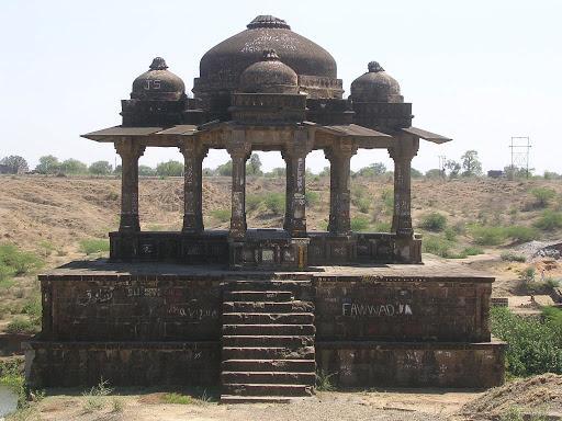
बालापूरमध्ये मान नदीच्या काठावर राजा जयसिंग यांची बालापूर छत्री (मंडप) उभी आहे, जी एका उंच चौथऱ्यावर बांधलेली आहे. हा मुळात एक छत्रीच्या आकाराचा मंडप आहे, जो १७ व्या शतकातील मुघल सेनापती मिर्झा राजा जयसिंग यांनी बांधला होता, ज्यांना शिवाजी महाराजांचा सामना करण्यासाठी दख्खनमध्ये पाठवण्यात आले होते .
या मंडपात वीस खांब असून त्यांच्यावर पाच घुमट आहेत: एक मोठा मध्यवर्ती घुमट आणि त्याच्याभोवती चार लहान घुमट. सजावटीमध्ये प्रामुख्याने पाने आणि बाणांच्या नक्षीसोबतच कमळाच्या फुलांची रचना आढळते, आणि घुमटांचे आतील भाग उत्कृष्ट कलाकुसरीने घडवलेले आहेत.
मूळतः, मंडपाला नदीशी जोडणारी एक पायऱ्यांची मालिका होती, पण आता ती नाहीशी झाली आहे. राजपुताना स्थापत्यशैलीत बांधलेल्या या वास्तूला पुराच्या वेळी मोठे नुकसान झाले. दुर्दैवाने, काही समाजकंटकांनी त्याच्या पृष्ठभागांवर कोरीवकाम करून आणि लिहून त्याची नासधूसही केली आहे.
बालापूर किल्ला
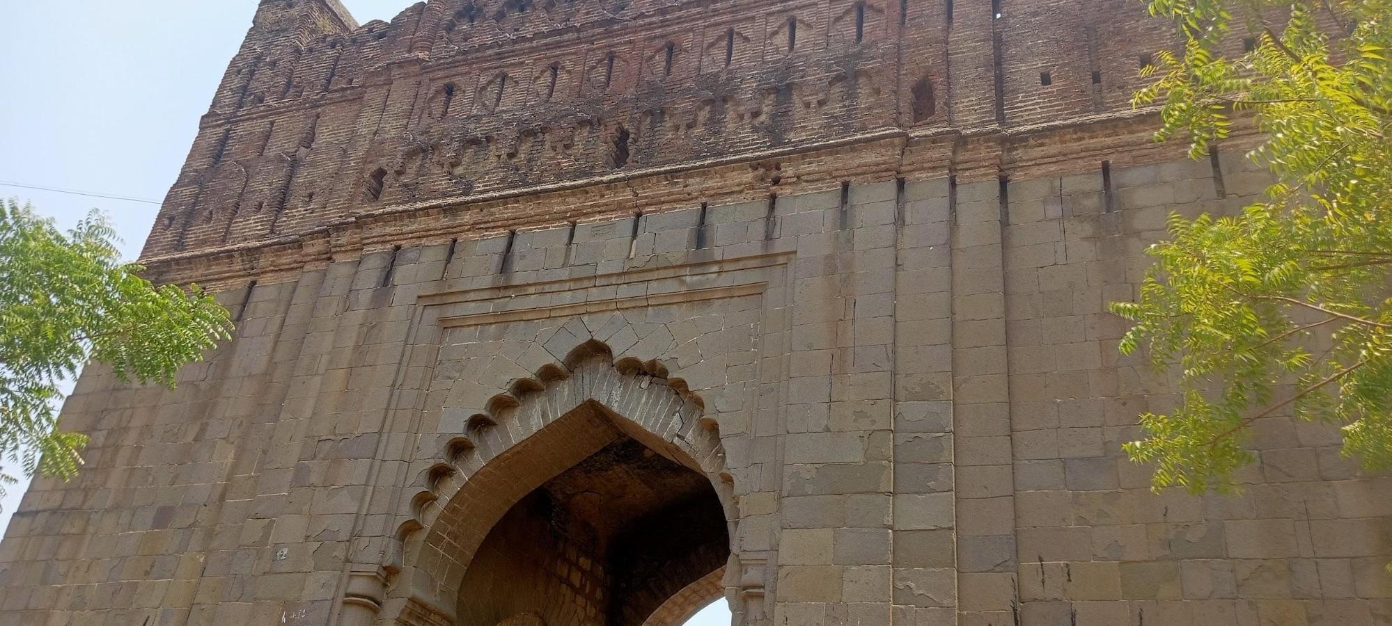
नावाप्रमाणेच, बालापूर किल्ला बालापूर शहरात वसलेला आहे. अकोला गॅझेटियर (१९७७) मध्ये मान आणि भैंस नद्यांच्या पाण्याने तयार झालेल्या द्वीपकल्पावर वसलेल्या, उत्तर मुघल काळातील बालापूर किल्ल्याची नोंद आहे. हा किल्ला नदीच्या दोन शाखांमधील उंच जमिनीवर वसलेला आहे आणि त्याच्या अत्यंत उंच असलेल्या भिंती व बुरुज, संपूर्णपणे किल्ल्याच्या काळातील विटांनी बांधलेले आहेत. बाहेरील किंवा खालचा किल्ला दशकोनी असून, त्याच्या प्रत्येक कोपऱ्यावर एक बुरुज आहे, आणि त्याच्या वर, त्याच्या भिंतींच्या संपूर्ण उंचीइतका, आतील किल्ला आहे, जो पंचकोनी असून त्याच्या प्रत्येक कोपऱ्याच्या शेवटी एक बुरुज आहे. बाहेरील आणि आतील किल्ल्यांमध्ये सुंदर मुघल प्रवेशद्वारांमधून प्रवेश केला जातो, त्यापैकी बाहेरील किल्ल्याच्या प्रवेशद्वारावर एक शिलालेख (बहुतेक पर्शियन भाषेत) आहे, जो आता वाचता येत नाही, ज्यात पूर्वी किल्ल्याच्या बांधकामाची नोंद होती.
किल्ल्याचे बांधकाम १७१७ साली सुरू झाले आणि एलिचपूरचे (अचलपूर, अमरावती) नवाब इस्माईल खान यांनी १७५७ साली ते पूर्ण केले. दोन्ही नद्यांना आलेल्या पुरामुळे तटबंदीचा काही भाग वाहून गेला आणि किल्ल्याचेही नुकसान झाले. आता या किल्ल्यात तहसील कार्यालय आणि इतर सरकारी कार्यालये आहेत. त्यांच्या राजवटीत या इमारती बांधण्याचे श्रेय ब्रिटिशांना दिले जाते.
![बालापूर किल्ल्यावरील तहसील कार्यालय ब्रिटिश काळात बांधण्यात आले होते [4]](https://indiandistricts.in/media/culture/images/maharashtra/akola/cultural-sites/tehsil-office-at-the-balapur-fort-was-bu_t0E6rpz.jpg)
बुद्ध भूमी
![शिरला येथील बुद्ध भूमी एनपी संघपा [5] यांनी बांधली होती](https://indiandistricts.in/media/culture/images/maharashtra/akola/cultural-sites/buddha-bhumi-at-shirla-was-built-by-np-s_Q9drrzS.jpg)
लोकमत (२०१४) नुसार, शिरला (पातुर तालुका) येथील बुद्धभूमी हे महाराष्ट्रातील नव्यन बौद्धांसाठी एक महत्त्वाचे स्थळ आहे. आज आपण जो स्तूप पाहतो, तो २००७-०८ मध्ये दादर येथील चैत्यभूमीचे (जिथे बी. आर. आंबेडकरांवर अंत्यसंस्कार झाले होते) संस्थापक/पालक एन. पी. संघपाल यांनी बांधला. यापूर्वी येथे एक छोटी धम्मकुटी उभारण्यात आली होती आणि काही काळानंतर, काही समाजकंटकांनी या जागेचा गैरवापर करण्यास सुरुवात केली. हे कळताच एन. पी. संघपाल यांनी त्या समाजकंटकांना हुसकावून लावले आणि सध्याची रचना बांधली. स्तूपाच्या अगदी बाहेर डॉ . बी. आर. आंबेडकरांचा एक सुंदर पुतळाही पाहायला मिळतो.
चक्रधर स्वामी मंदिर
बार्शी टाकळी गावाच्या पूर्वेकडील टोकावर १२ व्या शतकातील संत आणि तत्त्वज्ञ चक्रधर स्वामी यांचे एक छोटे मंदिर आहे. असे मानले जाते की, संभाजीनगर (औरंगाबाद) येथील पैठणहून अमरावतीतील रिधपूरला जाताना चक्रधर स्वामी येथे एका रात्रीसाठी थांबले होते. अकोला आणि आसपासच्या इतर अनेक जुन्या मंदिरांप्रमाणेच, हे मंदिरही हेमाडपंथी शैलीत बांधलेले असून ते १२ व्या आणि १३ व्या शतकात बांधले गेले असावे असे मानले जाते. महानुभाव पंथाचे लोक येथे आरती आणि पूजा करतात.
चौबारी बारव
![कलंका देवी मंदिराचा प्रवेशद्वार[7]](https://indiandistricts.in/media/culture/images/maharashtra/akola/cultural-sites/the-entrance-of-the-kalanka-devi-mandir7_js4a7WQ.jpg)
पिंजर गावात (बारशी टाकळी तालुका) चौबारी बारव नावाची १२व्या शतकातील हेमाडपंथी शैलीतील पायऱ्यांची विहीर आहे. या विहिरीत वर्षभर पाणी असते आणि असे मानले जाते की, पूर्वीच्या काळी भक्त, विशेषतः राजघराण्यातील लोक, मंदिरात प्रवेश करण्यापूर्वी येथे स्नान करत असत. या पायऱ्यांच्या विहिरीत दोन छोटी मंदिरे आहेत, एक शिवाचे आणि दुसरे शक्यतो गणपतीचे. हे स्थळ भारतीय पुरातत्व सर्वेक्षण (ASI) द्वारे संरक्षित नाही, त्यामुळे ते दुर्लक्षित राहिले आहे.
कलंका देवी मंदिर
![कलंका देवी मंदिराचा प्रवेशद्वार[7]](https://indiandistricts.in/media/culture/images/maharashtra/akola/cultural-sites/the-entrance-of-the-kalanka-devi-mandir7_RoWXBgU.jpg)
बारशीतकली शहराच्या बाहेरील बाजूस असलेले कलंक मंदिर हे माता कलंक देवीचे १२ व्या शतकातील मंदिर आहे. सौरभ सक्सेना (२०२४) यांच्या 'पुरत्तत्व'वरील लेखानुसार, मंदिराचे तोंड उत्तरेकडे आहे आणि पूर्वेला क्रॉसच्या आकाराच्या दोन लहान खिडक्या आहेत, ज्यातून सूर्याची पहिली किरणे कलंक देवीच्या मस्तकावर पडतात. हे मंदिर काळ्या दगडात बांधलेले असून त्यात एक गर्भगृह आणि एक मंडप किंवा सभागृह आहे. या दोन्हींच्या बाहेरील बाजूस नक्षीकाम आणि आकृत्यांच्या पट्ट्यांनी भरपूर सजावट केलेली आहे. अकोला गॅझेट (१९७७) मध्ये नोंद आहे की, सभागृहाच्या मध्यवर्ती छताला चार सुशोभित खांब आधार देतात. गणपती वगळता, मंदिराच्या बाहेरील बाजूस असलेल्या प्रमुख आकृत्या महाकाली आणि महिषासुरमर्दिनी या स्त्रियांच्या असून त्या महत्त्वाच्या स्थानांवर आहेत; छत विशेषतः सुशोभित आहे. मंदिराच्या आत एक संस्कृत शिलालेख आहे, जो दुर्दैवाने खराब अवस्थेत आहे. हे शके १०९८ सालातील, म्हणजेच इसवी सन ११७७ मधील असल्याचे मानले जाते. त्या काळात, राजा हेमाद्रीदेव टेक्कली (आधुनिक बार्शी टाकळी) येथून राज्य करत होता. नंतर, यादव राजा सिंघनाच्या खोलेश्वर नावाच्या सेनापतीने त्याचा पराभव केला .
असे म्हटले जाते की, जुन्या मूर्तीची नासधूस झाल्यानंतर देवीची सध्याची मूर्ती माहूरमधून येथे प्रकट झाली. दुसरी एक कथा सांगते की, एका असुरासोबतच्या युद्धानंतर देवी येथे विश्रांतीसाठी थांबली आणि नंतर तिची येथेच स्थापना करण्यात आली. नवरात्रीच्या काळात येथे मोठ्या संख्येने भाविक येतात .
खोलेश्वर मंदिर
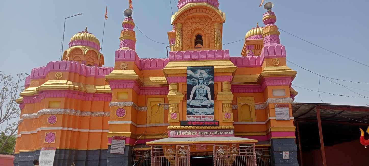
बार्शी टाकळी शहराच्या बाहेरच्या बाजूला, विद्रुप नदीच्या काठावर, हेमाडपंथी शैलीतील खोलेश्वरचे शिवमंदिर आहे. या मंदिराला 'खोलेश्वर' असे नाव पडले आहे, कारण येथील शिवलिंग अशा ठिकाणी आहे जिथे एका पोकळीतून खाली उतरणाऱ्या पायऱ्यांच्या मार्गानेच पोहोचता येते, कारण मराठीत 'खोल' म्हणजे खोल. (खोलेश्वर हे यादव राजा सिंघानाच्या एका सेनापतीचे नाव देखील होते , ज्याने बार्शी टाकळीचा प्रदेश यादवांच्या अधिपत्याखाली आणला.)

मंदिराच्या मध्यभागी नंदी मंडप आहे, ज्यात बेसॉल्टचा नंदी विराजमान आहे. स्तंभांवर यक्षांची दोन भित्तिचित्रेही आहेत. यांना भरवहक म्हटले जाते (जणू काही ते मंदिराला आधार देत आहेत अशा प्रकारे त्यांचे चित्रण केले आहे).
महादेव मंदिर
![पिंजर येथील महादेव मंदिर[८]](https://indiandistricts.in/media/culture/images/maharashtra/akola/cultural-sites/the-mahadev-mandir-at-pinjar8-99b4d3f2.jpg)
दीपक वानखेडे यांना त्यांच्या बार्शी टाकळीच्या सफरीवरील एका व्हिडिओमध्ये पिंजर गावातील (बार्शी टाकळी तालुका) प्राचीन महादेव मंदिराचा शोध लागला. हेमाडपंती शैलीतील हे मंदिर यादव काळात (१२ व्या शतकात) बांधले गेले असल्याचे म्हटले जाते. हे मंदिर काळ्या दगडाने बांधलेले असून त्याला प्रेमाने कपिलेश्वर महादेव मंदिर म्हटले जाते. स्थानिक समाजाने पिढ्यानपिढ्या या मंदिराचे जतन आणि संरक्षण केले आहे. मंदिराच्या आवारात एक शाळा देखील आहे. नंदी मंडपामध्ये, जिथे नंदीची काळ्या दगडाची मूर्ती ठेवलेली आहे, तिथे एक संस्कृत शिलालेख पाहायला मिळतो. हा शिलालेख खूपच पुसट झाल्यामुळे संशोधकांना फक्त 'वदीप्तिप्रशस्ती' हा शब्दच वाचता आला आहे. दरवर्षी महाशिवरात्रीच्या वेळी येथे सुमारे १०-१२ दिवसांचा उत्सव साजरा केला जातो, ज्या दरम्यान विविध अभिषेक आणि पूजा केल्या जातात.
![मंदिरातील शिलालेख[9]](https://indiandistricts.in/media/culture/images/maharashtra/akola/cultural-sites/inscription-at-the-mandir9-32b299df.jpg)
मोरेश्वर मंदिर
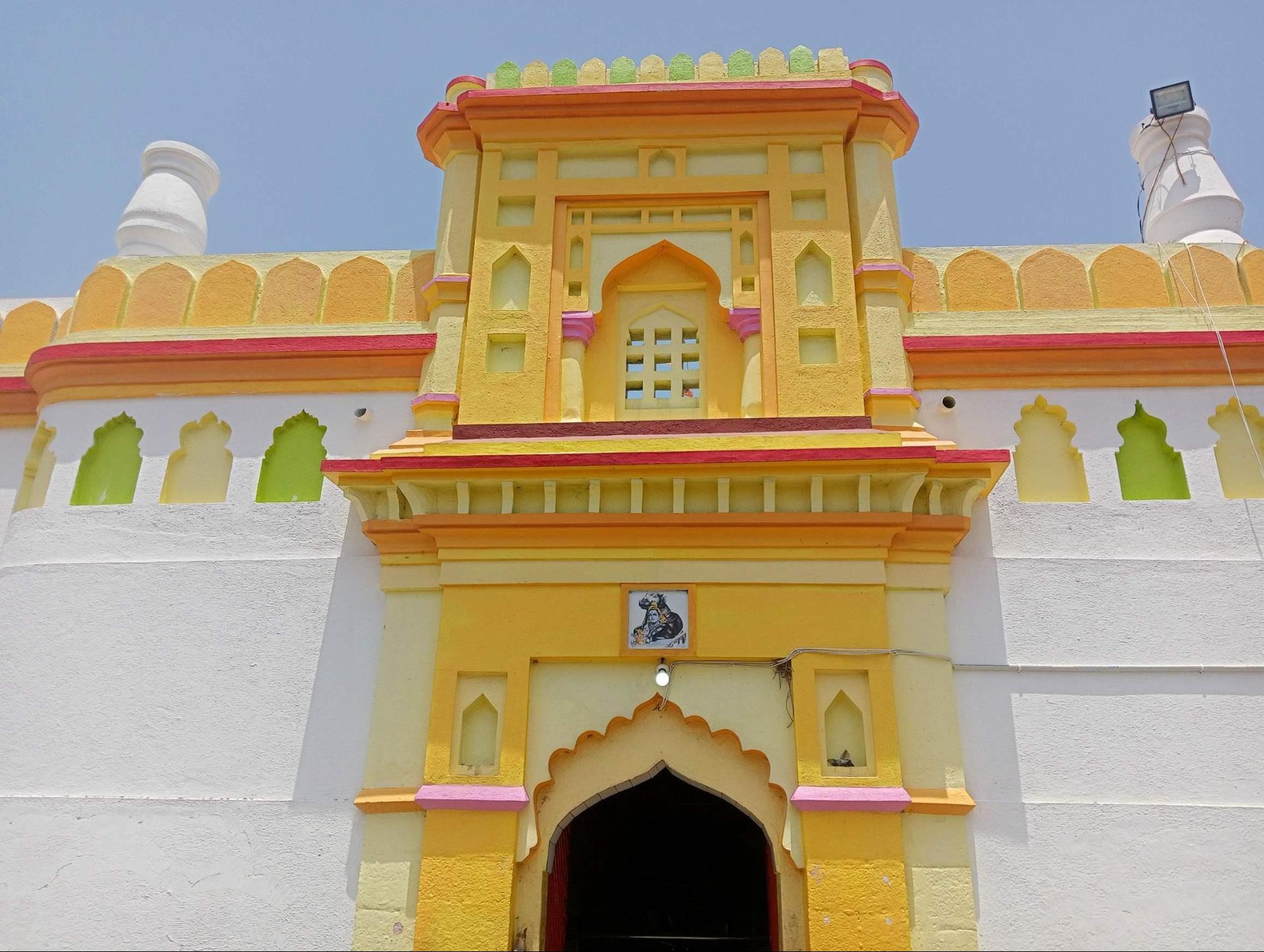
सिंधखेड जिल्ह्यातील बार्शी टाकळी येथील मोरेश्वर मंदिर हे हेमाडपंथी शैलीत बांधलेले एक शिवमंदिर आहे , जे शक्यतो उत्तरकालीन यादवांच्या कारकिर्दीत बांधले गेले असावे . मुख्य प्रवेशद्वाराच्या अगदी बाहेर दोन खोल माळा आहेत. मंदिरात प्रवेश केल्यावर, गर्भगृहाकडे तोंड करून असलेला पारंपरिक नंदी सहज दिसतो.
ज्ञानबतुकरम नावाच्या वेबसाइटवरील एका लेखात उल्लेखलेली एक स्थानिक आख्यायिका, मंदिराच्या 'मशिदीसारख्या' स्वरूपाचे स्पष्टीकरण देते. या कथेनुसार, औरंगजेबाच्या एका सरदाराला मंदिर पाडायचे होते, स्थानिकांनी याला विरोध केला आणि काही दैवी चमत्कार अनुभवल्यानंतर, त्या सरदाराने आपली पाडण्याची योजना रद्द केली. त्याऐवजी, त्याने मंदिराचा जीर्णोद्धार करून त्याला सध्याचे मशिदीसारखे स्वरूप दिले. स्थानिक असेही सांगतात की, मंदिराच्या तळघरात औरंगजेबाने जारी केलेला एक शिलालेख आहे, ज्यावर "या मंडीला कोणीही स्पर्श करू नये किंवा इजा पोहोचवू नये" असे लिहिलेले आहे.
दरवर्षी श्रावण महिन्यातील सोमवारी भक्तगण मंदिरात गर्दी करतात . याव्यतिरिक्त, चैत्र महिन्याच्या शुद्ध पक्षातील १२ व्या दिवशी, म्हणजेच चैत्र -शुद्ध द्वादशीला, एक विशेष यात्रा देखील आयोजित केली जाते .
![चैत्र-शुध्द द्वादशी यात्रा (मार्च-एप्रिल दरम्यान आयोजित)[10]](https://indiandistricts.in/media/culture/images/maharashtra/akola/cultural-sites/chaitra-shudh-dwadashi-yatra-held-betwee_qZhxgtT.jpg)
मोथे श्रीराम मंदिर

अकोला शहरातील सर्वात वर्दळीच्या रस्त्यांपैकी एकावर सुमारे १२० वर्षे जुने मोठे श्रीराम मंदिर वसलेले आहे. असे म्हटले जाते की, संत श्री गजानन महाराज (१९व्या-२०व्या शतकातील संत) यांनी या स्थळाला भेट दिली होती आणि त्यांनी त्यांचे भक्त बाचूलाल यांना याच ठिकाणी मंदिर बांधण्यास सांगितले होते. बाचूलाल यांनी जमीन खरेदी करून १९०३ मध्ये बांधकाम सुरू केले, १९०६ पर्यंत ते पूर्ण केले आणि मार्च १९०७ मध्ये ते जनतेसाठी खुले केले. तेव्हापासून, हे मंदिर एक महत्त्वाचे पूजास्थान बनले आहे. १९०८ मध्ये, जेव्हा लोकमान्य टिळक (भारतीय स्वातंत्र्यसैनिक) अकोल्या दौऱ्यावर होते, तेव्हा त्यांनीही या नव्याने बांधलेल्या मंदिराला भेट दिली होती.
नानासाहेबांचे मंदिर (वडा)
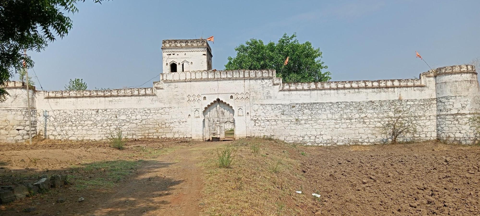
नानासाहेबांचे मंदिर/ वाडा जिल्ह्यातील पातूर तालुक्यात आहे. हे मंदिर १८ व्या शतकातील संत नानासाहेब यांना समर्पित आहे. त्यांचा जन्म सुमारे १७०० साली झाला आणि १७४० मध्ये त्यांनी समाधी घेतली असे मानले जाते . अकोला गॅझेटियर (१९७७) मध्ये नोंद आहे की, ते पातूर येथील एका श्रीमंत यजुर्वेदी ब्राह्मणाचे पुत्र होते, ज्यांचे मूळ नाव नारायण कान्होजी आमले होते. अगदी तरुणपणीही त्यांनी ब्राह्मण आणि गरिबांना दानधर्म करण्यासाठी मोठा खर्च केला. असे मानले जाते की, नानासाहेबांच्या एका नातवाने नागपूरच्या भोसले दरबारातील एका उच्चपदस्थ अधिकाऱ्याच्या मुलाला पुन्हा जिवंत केले होते. कृतज्ञता म्हणून, त्या अधिकाऱ्याने सध्याचे मंदिर बांधले.
सुमारे ३०० ते ३५० वर्षे जुने असलेले हे मंदिर एका किल्ल्यासारखे दिसते, कारण त्याच्या रचनेत बाहेरील तटबंदी आणि चार दिशांना असलेले चार बुरुज यांसारख्या घटकांचा समावेश आहे. बांधकामासाठी विटा, दगड आणि चुना मिसळलेली माती यांसारख्या साहित्याचा वापर केला गेला असे म्हटले जाते. नानासाहेब येथे राहिले आणि त्यांनी येथे समाधी घेतली असे मानले जाते . या मंदिरात नानासाहेबांच्या पत्नी, त्यांचे दोन शिष्य सोनाजी आणि होनाजी यांच्या समाधी, एक जुने हनुमान मंदिर, सुमारे ५ विहिरी, काही खोल माळा आणि एक नगरखाना देखील आहे. या वास्तूच्या मध्यभागी नानासाहेबांची समाधी /मंदिर आहे, जिथे त्यांच्या पादुका आणि कासवाची (कुर्म) दगडी मूर्ती आहे. हे मंदिर दुसऱ्या एका प्रसिद्ध मंदिराच्या, म्हणजेच रेणुका माता मंदिराच्या जवळ आहे. स्थानिकांचा असा विश्वास आहे की या मंदिराला एक तळघर देखील होते, जे नंतर नष्ट झाले. १८१२ साली आगीमुळे मंदिराचे मोठे नुकसान झाले.
पूर्वी भक्त या मंदिरात पंधरा दिवसांची यात्रा करत असत, पण आता या ठिकाणाचे आणि यात्रेचे महत्त्व खूपच कमी झाले आहे. माघ शुद्ध दशमीला (जानेवारी-फेब्रुवारीमध्ये) येथे एक जत्रा भरते; पूर्वी या जत्रेला प्रचंड गर्दी होत असे आणि स्थानिकांच्या मते, या कार्यक्रमात रोग बरे करण्याचे चमत्कार घडत असत.
नरनाला किल्ला
अकोला शहरापासून सुमारे ७५ किमी आणि अकोट शहरापासून ३० किमी अंतरावर असलेला नारनाला किल्ला, सातपुडा पर्वतरांगेत वसलेल्या अनेक महत्त्वाच्या किल्ल्यांपैकी एक आहे, जो पूर्णपणे काळ्या बेसॉल्ट खडकापासून बांधलेला आहे . अकोला गॅझेटियर (१९७७) मध्ये असे नमूद आहे की, पांडवांचे वंशज आणि तत्कालीन हस्तिनापूर (दिल्ली) चे सम्राट नरेंद्रपूर यांनी पहिली तटबंदी बांधली असे मानले जाते. फिरिश्ता त्यांच्या 'तारीख-ए- फिरिश्ता' (१८२९ मध्ये अनुवादित) मध्ये उल्लेख करतात की, अहमद शाह बहामनीने आपल्या राज्याच्या उत्तर सीमेवरील आक्रमकांना रोखण्यासाठी अमरावतीमध्ये गविलगड बांधताना, सुमारे १४२५ मध्ये या किल्ल्याची दुरुस्ती करून घेतली.
अकोला गॅझेटियर (१९७७) मध्ये पुढे असे म्हटले आहे की, किल्ल्यावरील जवळजवळ प्रत्येक इमारत इस्लामी काळातील असल्याचे दिसते. सम्राट अकबर आणि त्यांच्या काही सेनापतींनी नारनाला आणि गविलगड जिंकण्यासाठी दख्खनच्या शहांशी (बहमनी साम्राज्याचे तुकडे) विविध लढाया केल्या, जे अखेरीस मुघलांनी जिंकले. त्यानंतर, हा किल्ला मराठ्यांकडे, विशेषतः नागपूरच्या भोसलेंकडे आणि नंतर अखेरीस ब्रिटिशांकडे गेला.
किल्ल्याच्या पूर्वेकडील उंच ठिकाणी एक क्रॉस उभा आहे, जो अडगावच्या लढाईनंतर येथेच प्रभारी म्हणून ठेवलेल्या आणि मरण पावलेल्या एका युरोपीय अधिकाऱ्याची कबर दर्शवतो , परंतु त्याच्या नावाचा कोणताही मागमूस शिल्लक राहिलेला नाही.
![नारनाला किल्ल्याच्या प्रवेशद्वाराचे आंशिक दृश्य[11]](https://indiandistricts.in/media/culture/images/maharashtra/akola/cultural-sites/partial-view-of-the-entrance-gate-of-the_ezWBpoK.jpg)
किल्ल्यावरील एक महत्त्वाचे आकर्षण म्हणजे नौगज तोफ, एक नऊ यार्डांची तोफ. असे म्हटले जाते की ही तोफ १६७० मध्ये औरंगजेबाच्या कारकिर्दीत तिथे ठेवण्यात आली होती आणि त्यावर फारसी भाषेत एक शिलालेख आहे. ६ फूट व्यास आणि १८ फूट लांबीच्या या तोफेची मारक क्षमता सात मैल होती. पूर्वी, 'कडक बिजली' (भयानक वीज) नावाची तिची दुसरी तोफ होती, परंतु ती कशीतरी कड्यावरून खाली चंदनाच्या खोऱ्यात, म्हणजेच चंदनाच्या खोऱ्यात पडली आणि रहस्यमयरीत्या नाहीशी झाली असे म्हटले जाते.
![नारनाला किल्ल्यावरील नौगाज तोफ [12]](https://indiandistricts.in/media/culture/images/maharashtra/akola/cultural-sites/naugaj-toph-on-the-narnala-fort12-6ac97dd2.jpg)
पतुर गुहा
![वाकाटकांनी कोरल्या असे म्हटले जाणारे पातुर लेणी [13]](https://indiandistricts.in/media/culture/images/maharashtra/akola/cultural-sites/patur-caves-that-are-said-to-have-been-c_xATd2Ch.jpg)
नावाप्रमाणेच, पातुर लेणी जिल्ह्यातील पातुर तालुक्यात वसलेल्या आहेत. ए. जामखेडकर (२०११) त्यांच्या 'कोण होते वाकाटक ?' नावाच्या पुस्तकात सांगतात की, ह्या तीन बौद्ध लेण्या आहेत, ज्या वाकाटकांनी बांधल्या असे मानले जाते. त्यांचे खोदकाम कदाचित सातवाहन राजवंशाच्या काळात, म्हणजे इसवी सन पूर्व दुसऱ्या शतकापासून ते इसवी सन तिसऱ्या शतकापर्यंत सुरू झाले असावे. तथापि, त्या कदाचित हरिसन नावाच्या वत्सगुळम वाकाटक राजाच्या आणि त्याचा मंत्री वराहदेव यांच्या कारकिर्दीत (इसवी सन ४८० - ५१०) पूर्ण झाल्या.
या गुहा प्रामुख्याने बेसॉल्ट खडकापासून बनलेल्या आहेत , जो दख्खनच्या पठारात सामान्यपणे आढळतो. त्यांचा शोध १७३० मध्ये इंग्रज पुरातत्वशास्त्रज्ञ एडमंड लायन आणि रॉबर्ट गिल यांनी लावला . कझिन्स हेन्री नावाच्या दुसऱ्या एका पुरातत्वशास्त्रज्ञाच्या अहवालानुसार, या बौद्ध गुहा आहेत. तथापि, १९२३ मध्ये प्रसिद्ध इतिहासकार वाय. एम. काळे यांनी प्रकाशित केलेल्या एका अहवालानुसार, यापैकी एका गुहेत संस्कृत शिलालेखही होता, जो नंतर खराब झाला आणि आता सापडत नाही.
या गुहा शैव पंथाच्या असाव्यात अशी अटकळ आहे. या अटकळीला पुष्टी देणाऱ्या पुराव्यांमध्ये गुहा क्रमांक २ मध्ये सापडलेली पार्वतीची मूर्ती (जी नागपूरच्या मध्यवर्ती संग्रहालयात ठेवलेली आहे) आणि मुख्य गुहेतील चौरसाकृती गर्भगृहाचा (जे शिवलिंगाच्या अस्तित्वाकडे सूचित करते) समावेश आहे. गुहेच्या बाहेर पेटिकाशीर्ष ब्राह्मी लिपीत लिहिलेले दोन शिलालेखही सापडले आहेत, जे वाकाटक काळातील असल्याचे मानले जाते .
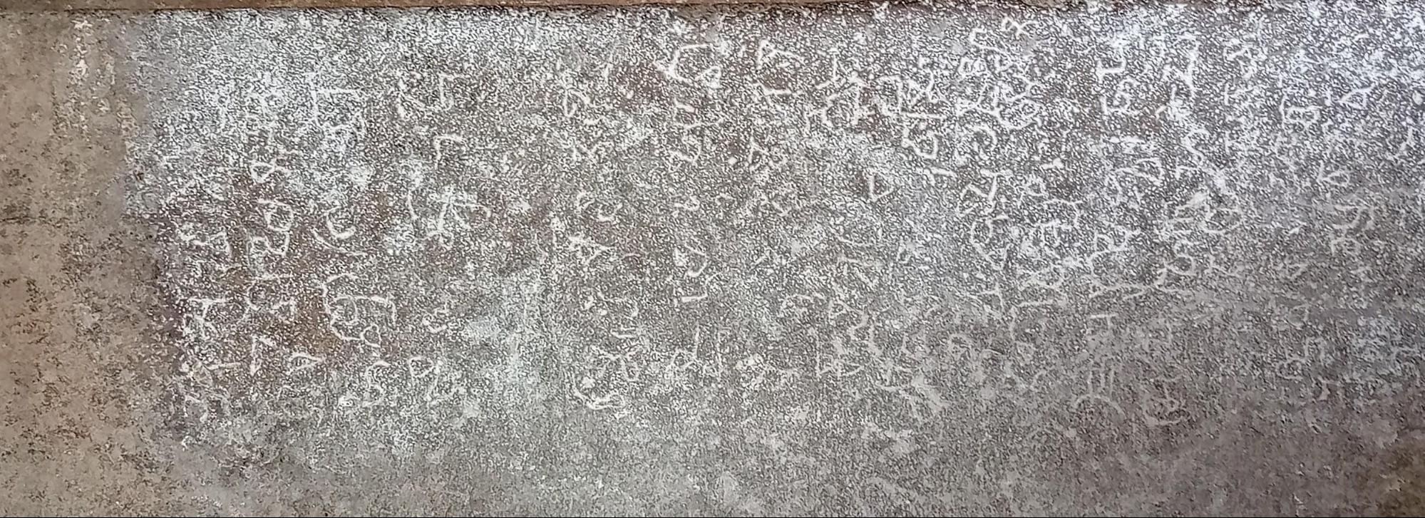
विवेक चंदुरकर (२०२०) यांच्या मते, या गुहांबद्दल स्थानिकांमध्ये अनेक कथा प्रचलित आहेत. अशीच एक कथा म्हणजे, शिवाने अमरत्वाचे वरदान दिलेल्या कल्यावन नावाच्या असुराला पराभूत करण्यासाठी भगवान कृष्णाने या गुहांचा कसा उपयोग केला. असे म्हटले जाते की, शिवाकडून वरदान मिळाल्यानंतर, तो असुर स्थानिक समुदाय आणि साधूंवर अन्याय करून धुमाकूळ घालू लागला. लोक कृष्णाकडे मदतीसाठी धाव घेऊ लागले. कृष्णाला माहित होते की उघड युद्धात असुराला हरवणे अशक्य आहे, म्हणून त्याने या गुहांमध्ये लपून त्याला जाळ्यात ओढण्याचा निर्णय घेतला. अपेक्षेप्रमाणे, कल्यावन त्या जाळ्यात अडकला. त्यावेळी त्या गुहांमध्ये ऋषी पराशर तपश्चर्येत मग्न होते. गुहेत आल्यावर त्या असुराने ऋषींना त्रास दिला, ज्यामुळे त्यांनी डोळे उघडले आणि ऋषी पराशरांनी आपली शक्तिशाली नजर कल्यावनावर टाकताच, तो जळून राख झाला.
सिद्धेश्वर मंदिर
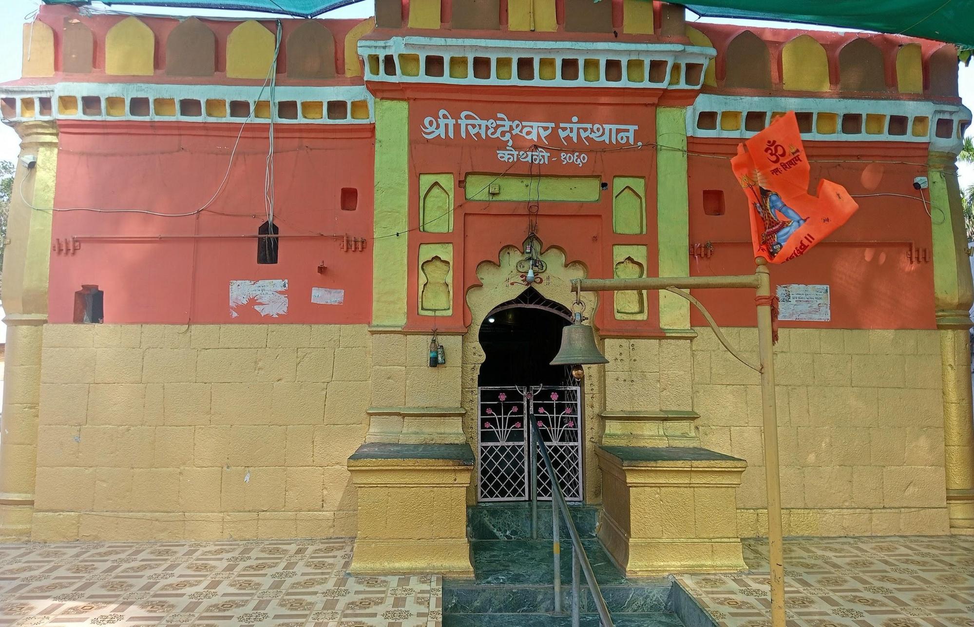
कोठाळी (बारशी टाकळी तालुका) येथील सिद्धेश्वर मंदिर हे स्थानिकांसाठी एक महत्त्वाचे देवस्थान आहे. लोकांचा असा विश्वास आहे की, हे मंदिर १०६० मध्ये सरदार महादेव जाधव (बहुधा एक स्थानिक सरदार) यांनी बांधले होते. ही वास्तू काळ्या दगडांनी बनलेली असून ती हेमाडपंथी शैलीत बांधलेली दिसते (जरी ही शैली १३ व्या शतकात उदयास आली असली तरी). मंदिराच्या आत एक पारंपरिक नंदी (काळ्या दगडाचा) आहे. आता या वास्तूला रंग दिला गेला आहे. महाशिवरात्री मोठ्या थाटामाटात साजरी केली जाते.
सुंदरबाई खंडेलवाल टॉवर
या प्रसिद्ध घड्याळ टॉवरला सुंदरबाई खंडेलवाल टॉवर म्हणतात, हा टॉवर शहराच्या आत स्थित आहे. १२ फेब्रुवारी १९६२ रोजी, तत्कालीन पंतप्रधान, दिवंगत पंडित जवाहरलाल नेहरू यांच्या उपस्थितीत याचे उद्घाटन करण्यात आले. घड्याळ टॉवरच्या सभोवतालचा परिसर टॉवर चौक म्हणून ओळखला जातो.
वारी भैरवगड
![भैरवगड किल्ल्यावरील एक प्रवेशद्वार[14]](https://indiandistricts.in/media/culture/images/maharashtra/akola/cultural-sites/a-gateway-on-the-bhairavgad-fort14-c966b3d8.jpg)
भैरवगड किल्ला वारी गावात (तेलहारा तालुका) वान नदीच्या काठावर वसलेला आहे. 'माय फोर्ट एक्सप्लोरेशन्स'साठी गुंजन देशमुख (२०१९) यांनी केलेल्या अभ्यासानुसार, मुख्य दरवाजात दिसणाऱ्या साहित्यावरून असे सूचित होते की, हा किल्ला विटांनी बांधलेला होता. १८५३ मध्ये त्यांचा पाडाव होईपर्यंत हा किल्ला काही काळ नागपूरच्या भोसले घराण्याच्या ताब्यात होता, अशी शक्यता आहे. किल्ल्याला चार पांढऱ्या मातीचे बुरुज होते आणि मध्यभागी एक भैरवनाथ मंदिर होते. आज, किल्ल्याच्या आत फक्त एक जीर्ण झालेला मुख्य दरवाजा, एक नगरखाना आणि नव्याने बांधलेले भैरवनाथ मंदिर शिल्लक आहे.
![भैरवगड किल्ल्यावरील एक भिंत[15]](https://indiandistricts.in/media/culture/images/maharashtra/akola/cultural-sites/a-wall-on-the-bhairavgad-fort15-e5899a6f.jpg)
![किल्ल्यावरील भिंत, विटांच्या भिंती लक्षात येतात [16]](https://indiandistricts.in/media/culture/images/maharashtra/akola/cultural-sites/a-wall-at-the-fort-one-can-notice-the-br_JGwuzc8.jpg)
स्रोत
A. जामखेडकर. 2011. कोन होते वाकाटक? अपरांत प्रकाशन.
ज्ञानबा तुकाराम टीम. 2021. मोरेश्वर यात्रा, सिंदखेड.
गुंजन देशमुख. २०१९. वारी भैरागड किल्ला – वान नदीच्या काठावर. माझे किल्लेभ्रमण.
लोकमत कर्मचारी. 2014. शिर्ला बुद्ध भूमीचे केंद्र प्रसार. लोकमत.
महंमद कासिम फरिश्ता; जॉन ब्रिग्स यांनी फारसीमधून अनुवादित. १८२९. भारतातील महंमदी सत्तेच्या उदयाचा इतिहास.
आरजे दिपक वानखडे. 2018. बार्शी टाकळी किल्ला | बार्शी टाकळी | अकोला | विदर्भ पर्यटन. YouTube.
आरजे दिपक वानखडे. 2021. चौबरी बारव पिंजर | चौबारी बारव | पिंजर. YouTube.
आरजे दिपक वानखडे. 2021. श्री कपिलेश्वर महादेव संस्थान पिंजर | कपिलेश्वर महादेव. YouTube.
विवेक ज्ञानेश्वर चांदूरकर. 2020. पातूरच्या ऐतिहासिक लेण्या. लोकसंवाद.
शेवटचे अद्यतन १८ जुलै २०२५ रोजी. 'संपादन सुचवा' वर क्लिक करून किंवा आम्हाला लिहून या पृष्ठावरील माहिती सुधारण्यास मदत करा .
शतकांपूर्वी, एक दयाळू राजा होता जो आपल्या शहाण्या पंतप्रधानाच्या मदतीने एका विशाल राज्यावर राज्य करत होता. पण त्याचा अचानक मृत्यू झाला आणि त्याचा अशक्त मुलगा गादीवर आला. एका विश्वासघातकी राज्यपालाने मुलाची हत्या करून राज्य बळकावले. काही वर्षांच्या संघर्षानंतर, एका निष्ठावान राज्यपालाने त्या विश्वासघातक्याचा पराभव करून त्याला हद्दपार केले.
विशेष म्हणजे, या मध्ययुगीन नाटकातील चारही प्रमुख पात्रांनी – राजा, पंतप्रधान, विश्वासघातकी राज्यपाल आणि निष्ठावान राज्यपाल – धार्मिक पुण्य मिळवण्यासाठी बौद्ध लेण्यांच्या मालिकेचे दान केले होते. आणि, हे ऐकायला कितीही अविश्वसनीय वाटले तरी, हे एखाद्या चित्रपटाचे कथानक नसून अजिंठा लेण्यांच्या बांधकामामागील कहाणी आहे!
महाराष्ट्रातील औरंगाबाद जिल्ह्यात वसलेल्या, उत्कृष्ट चित्रे आणि भित्तिचित्रे असलेल्या ३० बौद्ध शैलकोष्ठ लेण्यांची ही जगप्रसिद्ध मालिका आहे. प्राचीन भारतीय कलेची ही कदाचित सर्वोत्तम टिकून राहिलेली चित्रसंग्रहालय असून, तिचा इतिहास १,५०० वर्षांहूनही जुना आहे. परंतु, जरी नेहमीच अजिंठ्याच्या अद्भुत चित्रांवर आणि लोकप्रिय संस्कृतीवरील त्यांच्या प्रभावावर प्रकाशझोत टाकला गेला असला तरी, या लेण्यांच्या बांधकामाभोवती आणि त्यांच्या अचानक झालेल्या परित्यागाभोवती असलेल्या नाट्यमय घडामोडी व गूढतेबद्दल फार कमी लोकांनी लिहिले आहे.
प्रख्यात इतिहासकार डॉ. वॉल्टर एम. स्पिंक यांनी ५० वर्षांहून अधिक काळ अजिंठा लेण्यांचा अभ्यास केला आणि त्यावर एक भव्य सात-खंडांची ग्रंथमाला प्रकाशित केली. हा महान ग्रंथ लिहिताना, डॉ. स्पिंक यांनी उपलब्ध पुराव्यांचा वापर करून १,५०० वर्षांपूर्वी घडलेल्या घटनांची काळजीपूर्वक पुनर्रचना केली.
डॉ. स्पिंक आपल्याला आठवण करून देतात की, अजिंठ्याचा इतिहास लाखो वर्षांपूर्वी सुरू झाला, जेव्हा पावसाळ्याच्या पाण्याने हळूहळू एक खोल दरी तयार करण्यास सुरुवात केली, ज्यात या गुहा वसलेल्या आहेत. या दरीतून वाघोरा (वाघ) नदी पलीकडच्या मैदानी प्रदेशाकडे वाहते. सुमारे इसवी सन पूर्व पहिल्या शतकात, सातवाहन राजवंशाच्या (इसवी सन पूर्व दुसरे शतक - इसवी सन तिसरे शतक) काळात, स्थानिक व्यापारी आणि सौदागरांच्या आश्रयामुळे येथे बौद्ध धर्माचा प्रसार झाला. याच काळात अजिंठ्यातील सर्वात जुन्या गुहा (गुहा क्रमांक १० आणि १२) खोदण्यात आल्या. या गुहा अद्वितीय नव्हत्या, तर महाराष्ट्रातील कार्ले, भाजा, कान्हेरी आणि नाशिक यांसारख्या पश्चिम भारतातील इतर गुहा संकुलांसारख्याच होत्या.
हरिसेना आणि वाकाटक साम्राज्य
इसवी सन तिसऱ्या शतकापासून, सातवाहनांचे उत्तराधिकारी म्हणून दख्खनमध्ये वाकाटक घराण्याचा (इसवी सन तिसरे ते पाचवे शतक) उदय झाला. ते उत्तर भारतातील गुप्त साम्राज्याचे समकालीन होते आणि त्यांना खंडणीही देत असत. त्यांच्या प्रदेशातून जाणाऱ्या व्यापारी मार्गांमुळे, त्यांनी आपली राजधानी वत्सगुल्म (सध्याचे महाराष्ट्रातील वाशिम शहर) येथून एका समृद्ध राज्यावर राज्य केले. अजिंठा लेण्यांमधील परदेशी व्यापाऱ्यांचे चित्रण करणाऱ्या चित्रांवरून आपल्याला याची माहिती मिळते.
सुमारे ४६० इसवी मध्ये, सम्राट देवसेन यांच्यानंतर त्यांचा मुलगा हरिसेन गादीवर आला. वाकाटक शासक हिंदू (शैव) असले तरी, त्यांचे मंत्री, मांडलिक आणि लोकसंख्येचा मोठा भाग बौद्ध होता. डॉ. स्पिंक यांचा असा विश्वास आहे की, हरिसेनच्या बौद्ध मंत्र्यांनीच अजिंठा गावाजवळील दऱ्यांमध्ये एक विशाल आणि आधुनिक बौद्ध मठ बांधण्याच्या महत्त्वाकांक्षी उपक्रमाला प्रायोजित करण्यासाठी हरिसेनला राजी केले होते. पश्चिम भारतातील इतर लेणी संकुलांप्रमाणे, जिथे सामान्य लोकांनी लेण्यांना देणग्या दिल्या होत्या, त्याउलट अजिंठा हा पूर्णपणे एक 'खाजगी' उपक्रम होता, ज्याला केवळ वाकाटक साम्राज्याच्या सत्ताधारी वर्गानेच प्रायोजित केले होते. यामुळेच काही दशकांतच तो मठ नाट्यमयरीत्या ओसाड पडला.
इ.स. ४६६ मध्ये, अजिंठा येथील अनेक लेण्यांच्या बांधकामास सुरुवात झाली, त्यांपैकी हरिसेनाने दान केलेली लेणी क्रमांक १ आणि त्याचा पंतप्रधान वराहदेवाने दान केलेली लेणी क्रमांक १६ या विशेष उल्लेखनीय आहेत. या दोन्ही लेण्या या संकुलातील सर्वात भव्य आणि सर्वाधिक सुशोभित लेण्या आहेत.
साम्राज्यातील समस्या
लेण्यांचे बांधकाम वेगाने चालू असताना, राजा हरिसेनाच्या राज्यात मात्र सर्व काही आलबेल नव्हते. तो दोन मांडलिक राजा, मराठवाड्याच्या काही भागांवर राज्य करणारा अस्मकांचा राजा (नाव अज्ञात), आणि उत्तर महाराष्ट्रातील खानदेशवर राज्य करणारा ऋषिकांचा राजा (उपेंद्रगुप्त), यांचा अधिपती होता. त्या दोघांनीही अजिंठा येथे स्वतःच्या लेण्यांना दान दिले होते.
इ.स. ४७१ ते ४७४ च्या दरम्यान, अस्मक आणि ऋषिकांनी लेणी संकुलाच्या आसपासच्या प्रदेशावर वारंवार हल्ले केले आणि एकमेकांच्या लेण्यांच्या कामात अडथळा आणण्याचा प्रयत्न केला. अस्मक हे अत्यंत त्रासदायक मांडलिक होते आणि ते वाकाटक सत्तेविरुद्ध सतत बंड करत राहिले. हे युद्ध तीन वर्षे चालले आणि अजिंठा येथील काम थांबले. या काळात, बहुतेक स्थानिक कामगार धार येथे स्थलांतरित झाले, जिथे त्यांनी मध्य प्रदेशातील धारजवळ असलेल्या भव्य बाग लेण्यांवर काम केले. दुर्दैवाने, तेथील खडकांच्या निकृष्ट दर्जामुळे, बाग येथील फारच कमी चित्रे टिकून राहिली आहेत.
अजिंठा येथील काम इ.स. ४७५ मध्ये पुन्हा सुरू झाले, परंतु दोन वर्षांनंतर इ.स. ४७७ मध्ये राजा हरिसेनाच्या आकस्मिक मृत्यूमुळे ते थांबले. सातव्या शतकातील प्रसिद्ध संस्कृत व्याकरणकार, दंडीण यांनी त्यांच्या ' विश्रुतचरित' या ग्रंथात, या ग्रंथात वाकाटक साम्राज्याच्या अखेरच्या दिवसांचे सविस्तर वर्णन केले आहे. त्यांनी असे सूचित केले आहे की हरिसेनाचा मृत्यू अगदी अचानक झाला आणि कदाचित अस्मकांनी त्याची हत्या केली असावी किंवा त्याला विष दिले असावे. डॉ. स्पिंक यांचा असा विश्वास आहे की याच कारणामुळे अजिंठा लेण्यांचे कधीही 'अधिकृत उद्घाटन' झाले नाही.
हरिसेनाच्या मृत्यूनंतर, त्याच्या अशक्त मुलावरही अस्मकांनी कपटाने हल्ला करून त्याला ठार मारले. हरिसेनाच्या नातवंडांनी महिष्मती (मध्य प्रदेशातील महेश्वर) येथे आश्रय घेतला आणि वाकाटक राजवंशाचा अंत झाला. साम्राज्यात अराजकता माजली आणि अजिंठाच्या आसपासचा प्रदेश अस्मकांनी ताब्यात घेतला.
वाकाटक साम्राज्यात झालेल्या राजकीय बदलांचे प्रतिबिंब अजिंठा लेण्यांच्या बांधकामात दिसून येते. जेव्हा अस्मकांनी सत्ता ताब्यात घेतली, तेव्हा त्यांच्या लेण्यांचे (लेणी २१-२६) काम सुरू झाले आणि इतर लेण्यांचे काम थांबले. जेव्हा त्यांना हद्दपार करण्यात आले, तेव्हा इतर लेण्यांचे काम पुन्हा सुरू झाले आणि अस्मक लेण्यांचे काम थांबले. कोणत्याही वेळी, सत्ताधारी कामगारांना केवळ त्याच लेण्यांवर काम करायला लावत, ज्या त्यांनी दान केल्या होत्या.
राजा हरिसेनाने गुहा क्रमांक १ ला आश्रय दिला होता; त्याचा प्रसिद्ध मंत्री वराहदेवाने “सर्वश्रेष्ठ तपस्व्यांसाठी” गुहा क्रमांक १६ दान केली होती; ऋषिकांच्या राजाने (उपेंद्रगुप्ताने) गुहा क्रमांक १७-२० आणि २९ वर प्रचंड रक्कम खर्च केली होती; आणि बंडखोर अस्मकांनी संपूर्ण पश्चिम टोकावर गुहा बांधल्या होत्या. परंतु इसवी सन ४७८ च्या अखेरीस, राजकीय गोंधळामुळे हा सर्व आश्रय अचानक संपुष्टात आला.
या काळात, येथे राहणाऱ्या भिक्षूंव्यतिरिक्त, शेकडो कामगार आणि कारागीर त्या ठिकाणी काम करत होते. आता, चिंताग्रस्त, अजूनही तिथेच राहणाऱ्या भिक्षूंनी आणि स्थानिक भक्तांनी त्या गुहांचा ताबा घेतला आणि त्या चालू ठेवण्याचा प्रयत्न केला. आपल्या कोसळणाऱ्या जगात जे काही पुण्य मिळवता येईल या आशेने, त्यांनी अडकलेल्या कलाकारांना बुद्धांच्या विविध प्रतिमा कोरण्यासाठी आणि रंगवण्यासाठी तुटपुंजे मानधन दिले. मग, युद्धाचा धोका वाढत गेल्याने, हे टप्प्याटप्प्याने होणारे कामही थांबले. आश्रय गमावल्यामुळे, कामगार तसेच भिक्षू इतर भागांमध्ये स्थलांतर करू लागले. इसवी सन ४८० च्या दशकाच्या सुरुवातीपर्यंत, अजिंठा वेगाने विस्मृतीत जात होती.
अजिंठ्याचा पुनर्शोध
पुढील १,३०० वर्षे अजिंठा लेणी पूर्णपणे विस्मृतीत गेली आणि त्या जागेवर जंगलाने कब्जा केला. साम्राज्ये आली आणि गेली, पण अजिंठा अबाधित राहिली. २८ एप्रिल १८१९ रोजी, ब्रिटिश ईस्ट इंडिया कंपनीचे लष्करी अधिकारी कॅप्टन जॉन स्मिथ, अजिंठाजवळील जंगलात शिकार करत असताना त्यांना या विस्मृत लेण्या सापडल्या. पुढे त्यांनी लेणी क्रमांक १० मध्ये आपले नाव कोरले – 'जॉन स्मिथ , २८ वी कॅव्हलरी, २८ एप्रिल, १८१९', जे अजिंठाच्या लोककथेचा एक भाग बनले.
कालांतराने, तेथील चित्रांच्या सौंदर्यामुळे अजिंठ्याची लोकप्रियता भारतभर आणि जगभरात वाढली. अजिंठा हैदराबादच्या निजामाच्या प्रदेशात असल्याने, 'निजामाच्या पुरातत्व विभागाने' या गुहांमध्ये अद्भुत संवर्धनाचे काम केले. निजामाच्या निर्देशानुसार, येथे रस्ते आणि पूल बांधण्यात आले आणि पर्यटकांसाठी एक विश्रामगृहही बांधण्यात आले. अजिंठ्यावर असंख्य पुस्तके आणि लेख लिहिले गेले आहेत आणि त्यांत प्रामुख्याने तेथील चित्रांविषयी आणि तिच्या पुनर्शोधाच्या कथेविषयी सांगितले आहे. परंतु, त्या चित्रांच्या निर्मितीस कारणीभूत ठरलेल्या १,५०० वर्षांपूर्वीच्या घटनांची गुंफण फार कमी जण करतात. आज, अजिंठ्याला भेट देणारे पर्यटक गुहा क्रमांक १ ते २६ ची प्रचंड संख्या आणि त्यातील चित्रांचे तपशील पाहून भारावून जाऊ शकतात. पर्यटकांसाठी या गुहा सोप्या करण्यासाठी आणि त्यांच्या निर्मितीमागील नाट्यमय घडामोडींशी त्यांना जोडण्यासाठी, आम्ही या गुहांना पाच भागांमध्ये विभागले आहे...
सर्वात प्राचीन गुहा – गुहा १०, १२, १३, १५अ
सातवाहन आश्रयाखाली अजिंठा येथे खोदण्यात आलेल्या ह्या सर्वात जुन्या लेण्या असून, त्या इसवी सन पूर्व पहिल्या शतकातील आहेत. त्यांपैकी सर्वात प्रभावी लेणी म्हणजे लेणी क्रमांक १०. हे एक मोठे चैत्यगृह किंवा प्रार्थना सभागृह असून, त्याच्या मध्यभागी एक स्तूप आहे आणि स्तंभांवर बोधिसत्वांची चित्रे रंगवलेली आहेत. १८१९ मध्ये कॅप्टन जॉन स्मिथ यांनी याच लेणीचा शोध लावला आणि त्यांचा शिलालेख आजही एका स्तंभावर पाहता येतो. लेणी क्रमांक १२ सारख्या इतर लेण्या साध्या चैत्यगृहे आहेत आणि वाकाटककालीन लेण्यांमध्ये दिसणारी चित्रे त्यांच्यात आढळत नाहीत.
राजा हरिसेनाची गुहा – गुहा १
संपूर्ण अजिंठा संकुलातील सर्वात भव्य गुहा म्हणजे राजा हरिसेनाने बांधायला लावलेली गुहा क्रमांक १ (मुखपृष्ठावरील छायाचित्र). हरिसेनाचा अचानक मृत्यू झाल्यामुळे, ही गुहा ना पूर्ण झाली, ना सक्रिय पूजेसाठी 'समर्पित' केली गेली. गुहेच्या भिंती आणि छत बुद्धांच्या जीवनातील प्रसंग दर्शवणाऱ्या चित्रांनी आच्छादलेले आहेत. अजिंठ्यातील दोन सर्वात प्रसिद्ध चित्रे याच गुहेत आहेत – मुख्य बुद्ध मंदिराच्या प्रवेशद्वाराच्या दोन्ही बाजूंना असलेल्या बोधिसत्व पद्मपाणी आणि वज्रपाणी यांच्या मानवाकृतीपेक्षा मोठ्या दोन मूर्ती.
गुहा क्रमांक १ च्या शेजारी गुहा क्रमांक २ आहे, जिच्यामध्येही बुद्धांच्या जीवनातील थोर आणि शक्तिशाली स्त्रियांचे चित्रण करणारी अतिशय सुंदर चित्रे आहेत. ही गुहा कोणी बांधली हे कोणालाही निश्चितपणे माहीत नसले तरी, राजा हरिसेनाच्या गुहेच्या सान्निध्यामुळे डॉ. स्पिंक आणि डॉ. जामखेडकर यांसारख्या इतिहासकारांना असे वाटते की, ही गुहा वाकाटक राजघराण्यातील स्त्रियांनी दान केली असावी.
पंतप्रधान वराहदेवांच्या लेण्या – लेणी क्रमांक १६
गुहा क्रमांक १५ अ (एक जुनी गुहा) जवळ हरिसेनाचा पंतप्रधान वराहदेव याने बांधलेले 'हत्तीद्वार' आहे, ज्याच्या दोन्ही बाजूंना दोन मोठे हत्ती कोरलेले आहेत. एकेकाळी खालच्या नदीमार्गे थेट येथे पोहोचता येत असल्यामुळे, प्राचीन काळी हे गुहा संकुलाचे मुख्य प्रवेशद्वार म्हणून ओळखले जात असे. आतमध्ये, नागराजाचा एक राजा आहे . ), खालच्या दरीवर नजर ठेवून असतो.
गुहा क्रमांक १६ ही पंतप्रधानांची गुहा आहे. प्रवेशद्वारावरच, सर्वांना दिसावे म्हणून मुद्दामहून ठेवलेला एक शिलालेख आहे, ज्यावर असे लिहिले आहे की, ' देशावर न्यायाने राज्य करणाऱ्या' वराहदेवांची अशी इच्छा आहे की, " संपूर्ण जगाने... दुःख आणि रोगांपासून मुक्त असलेल्या त्या शांत आणि उदात्त अवस्थेत प्रवेश करावा ". या गुहेत जातक कथांमधील अनेक सुंदर चित्रे आहेत . त्यापैकी सर्वात नेत्रदीपक चित्र 'हस्ती जातक' कथेचे आहे. यात एका बोधिसत्व हत्तीची कथा सांगितली आहे, ज्याला लोकांचा एक मोठा गट उपाशी असल्याचे कळते, मग तो त्यांना अन्नासाठी एका कड्याखाली जाण्यास सांगतो आणि नंतर स्वतः कड्यावरून उडी मारतो, जेणेकरून ते त्याला खाऊ शकतील.
ऋषिकांचा राजा (उपेंद्रगुप्त) यांच्या लेण्या – लेणी क्रमांक १७ ते २० आणि २९
लेणी क्रमांक १७ ते २० तसेच २९ या वाकाटकांचा निष्ठावान मांडलिक आणि अश्मकांचा शत्रू असलेल्या ऋषिकांचा राजा उपेंद्रगुप्त याने दान केल्या होत्या. लेणी क्रमांक १७ मध्ये उपेंद्रगुप्ताचा एक मोठा शिलालेख आहे, ज्यात त्याने स्पष्ट केले आहे की, त्याने हा विहार बांधण्यासाठी " अफाट संपत्ती खर्च केली " असून , त्यामुळे भक्तांना मोठे समाधान मिळाले आहे.
या गुहेत ३० भित्तिचित्रे आहेत, ज्यात बुद्धांची विविध रूपे तसेच दैनंदिन जीवनातील दृश्ये चित्रित केली आहेत. गुहा क्रमांक १७ च्या शेजारी वराहदेवाने बांधलेली एक पाण्याची टाकी आहे, जिच्याबद्दल जवळच्याच एका शिलालेखात त्याने दावा केला आहे की ती नेहमीच “ गोड, हलक्या, स्वच्छ, थंड आणि मुबलक पाण्याने भरलेली ” होती.
लेणी क्रमांक १९ आणि २० या उपेंद्रगुप्ताने दान केलेल्या भव्य प्रार्थनास्थळे आहेत. या लेण्यांमध्ये बुद्ध, नाग आणि इतर देवतांच्या मूर्ती आहेत. उपेंद्रगुप्ताने अजिंठा येथील आपल्या लेण्यांसाठी एक भव्य आणि महत्त्वाकांक्षी योजना आखली होती, परंतु अस्मकांच्या वारंवार होणाऱ्या आक्रमणांमुळे त्याच्या योजनांना खीळ बसली. त्याच्या बहुतेक लेण्या अपूर्णच राहिल्या.
अस्मकाच्या लेण्यांमधील लेणी २१ ते २६
अजिंठाच्या कथेत अस्मक हे 'खलनायक' आहेत. त्यांची कारस्थाने आणि बंडाळी हेच मुख्य कारण होते ज्यामुळे अजिंठ्यातील भव्य लेणी कधीच पूर्ण होऊ शकली नाहीत. पण आश्चर्याची गोष्ट म्हणजे, त्यांनीही अजिंठ्यात अनेक लेण्या दान केल्या. यापैकी सर्वात महत्त्वाची म्हणजे लेणी क्रमांक २६, जी एक मोठे चैत्य किंवा प्रार्थना सभागृह आहे, जे अस्मकांच्या राजाने (नाव अज्ञात) दान केले होते. डॉ. स्पिंक यांचा असा विश्वास आहे की, त्यांच्या द्वेषपूर्ण प्रतिस्पर्ध्यांच्या चैत्य सभागृहांना झाकोळून टाकण्यासाठी ते मुद्दामहून मोठे बांधले गेले होते. इतर लेणी या मठवासी वास्तू असून त्यांचा उपयोग भिक्षूंच्या निवासस्थानांसाठी केला जातो.
अशा प्रकारे, गुहांच्या प्रचंड संख्येने भारावून जाण्याऐवजी, अजिंठा संकुलाला भेट देणारे पर्यटक त्यांना या पाच गटांमध्ये पाहू शकतात. तरच तुम्ही गुहांचे आणि त्यांच्या निर्मितीमागील नाट्यमयतेचे खऱ्या अर्थाने कौतुक करू शकता.
History - Akola, Maharashtra | The Districts Project
अकोला जिल्हा महाराष्ट्राच्या उत्तर-मध्य भागात वसलेला असून तो अमरावती विभागातील विदर्भ प्रदेशाचा एक भाग आहे. आपल्या इतिहासात, अकोला विविध राजकीय सत्तांच्या अधिपत्याखाली आला असून, त्याचे अवशेष या प्रदेशात विखुरलेले आढळतात.
मुघल राजवटीत , जिल्ह्यात असलेले बालापूर शहर, थोड्या काळासाठी एक अत्यंत महत्त्वाचे तटबंदीयुक्त लष्करी ठाणे होते. इ.स. १६९७ मध्ये, अकोला शहर औरंगजेबाच्या दरबारातील एक सरदार असद खान याला देण्यात आले, ज्याने असदगड नावाचा किल्ला बांधला . १९व्या शतकाच्या उत्तरार्धात, बेरार प्रांतातील व्यापक प्रशासकीय सुधारणांचा भाग म्हणून अकोला प्रदेशाचे काही भाग शेजारील जिल्ह्यांमध्ये पुनर्रचित करण्यात आले . १९५६ मध्ये, राज्य पुनर्रचना कायद्यानुसार, वाशिम आणि मंगरूळपीर हे तालुके अकोला जिल्ह्यात विलीन करण्यात आले. हे १९९८ पर्यंत जिल्ह्याचा भाग होते, जेव्हा वाशिमची स्वतंत्र जिल्हा म्हणून स्थापना झाली, ज्यामुळे अकोला जिल्ह्याला त्याचे सध्याचे स्वरूप प्राप्त झाले.
व्युत्पत्तिशास्त्र
अकोला नावाच्या उगमाबद्दल अनेक स्थानिक परंपरांमधून माहिती दिली जाते. त्यापैकी एका परंपरेनुसार, हे नाव अकोल सिंग नावाच्या एका स्थानिक व्यक्तीशी जोडले जाते. असे म्हटले जाते की, एका सशाने कुत्र्याचा पाठलाग केल्याचे पाहिल्यानंतर त्यांनी गावाला मातीच्या भिंती बांधून तटबंदी केली; ही घटना एक शुभशकुन मानली जाते. या कथनानुसार, या वस्तीला त्यांचे नाव देण्यात आले.
पर्यायी व्युत्पत्तीदेखील मांडण्यात आल्या आहेत. एका सिद्धांतानुसार, हे नाव ' अडका ' या शब्दापासून आले आहे , ज्याचा अर्थ बाजारपेठ आहे . यावरून असे सूचित होते की, हे शहर एकेकाळी व्यापारी केंद्र असावे. दुसरे स्पष्टीकरण या नावाचा संबंध 'अकोल' या मराठी शब्दाशी जोडते , ज्याचा अर्थ शेवट किंवा सीमा आहे . हे कदाचित पूर्वीच्या प्रादेशिक व्यवस्थेतील शहराच्या स्थानाचा संदर्भ देत असावे.
प्राचीन काळ
सध्याचा अकोला जिल्हा असलेला प्रदेश वेगवेगळ्या काळात विविध राज्यांच्या अधिपत्याखाली आला आहे. माहितीच्या कमतरतेमुळे त्याचा सुरुवातीचा इतिहास पूर्णपणे उलगडणे अवघड आहे. तथापि, उपलब्ध पुरातत्वीय निष्कर्ष आणि काही साहित्यिक संदर्भ, विशेषतः विदर्भ आणि बेरारच्या (ज्या सांस्कृतिक आणि राजकीय क्षेत्रांमध्ये अकोला ऐतिहासिकदृष्ट्या समाविष्ट होता) व्यापक इतिहासाच्या संदर्भात पाहिल्यास, एक सामान्य रूपरेषा मांडता येते.
सातवाहन प्रभाव आणि तर्हाळा नाण्यांचा संग्रह
अकोला प्रदेशावर आपला कायमस्वरूपी ठसा उमटवणाऱ्या सुरुवातीच्या राजवंशांपैकी एक म्हणजे सातवाहन राजवंश होता , ज्यांनी इसवी सन पूर्व पहिल्या शतकापासून ते इसवी सन तिसऱ्या शतकापर्यंत दख्खनच्या मोठ्या भागावर राज्य केले . या प्रदेशातील त्यांच्या उपस्थितीचा पुरावा १९३९ मध्ये तरहाळा येथे सापडलेल्या पोटिन नाण्यांच्या साठ्यावरून मिळतो. हे गाव त्यावेळी अकोळ्याचा भाग होते, पण आता ते वाशिम जिल्ह्यात आहे. विशेष म्हणजे, या साठ्यात १,२०० हून अधिक पोटिन नाणी होती, ज्यापैकी बऱ्याच नाण्यांच्या दर्शनी भागावर सोंड वर उचललेला हत्ती आणि मागील भागावर उज्जयिनी चिन्ह होते. विशेष म्हणजे, ही दोन्ही चिन्हे सातवाहन नाण्यांच्या अभ्यासात सामान्य मानली जातात .
नाण्यांवर गौतमीपुत्र सातकर्णी , पुलुमवी, वसिष्ठिपुत्र सातकर्णी आणि स्कंद सातकर्णी यांसारख्या शासकांची नावे आहेत . तथापि, अधिक लक्षणीय बाब ही आहे की, नाण्यांवर आढळणारी कुंभ आणि शाक सातकर्णी यांसारखी काही नावे सातवाहन शासकांच्या पारंपरिक पौराणिक यादीत आढळत नाहीत. यामुळे अनेक इतिहासकारांनी विदर्भ प्रदेशापुरते मर्यादित असलेल्या प्रादेशिक सातवाहन शासकांच्या अस्तित्वाची शक्यता वर्तवली आहे . या प्रदेशातील अकोलाचे स्थान आणि वाशिमशी असलेली जवळीक, अनेक प्रकारे असे सूचित करते की प्राचीन काळी येथे एका विकेंद्रित सातवाहन शासनप्रणालीद्वारे राज्य केले गेले असावे.
बौद्ध धर्माचा प्रसार आणि पतूर लेणी
अकोळ्यावरील सातवाहनांचा प्रभाव केवळ नाण्यांपुरता मर्यादित नाही. हा काळ दख्खनभर बौद्ध धर्माला प्रोत्साहन आणि त्याचा प्रसार करण्यासाठीही ओळखला जातो , आणि जिल्ह्यातील वास्तुकलेचे पुरावे या व्यापक सांस्कृतिक चळवळीतील त्याचे स्थान अधोरेखित करतात. जिल्ह्यातील असेच एक स्थळ म्हणजे पातुर-बालापूर रस्त्यालगत, रेणुका माता मंदिराच्या जवळ असलेली पातुर लेणी.
दख्खनच्या पठारावरील बेसॉल्ट खडकात कोरलेल्या या शैलगुहा , साध्या विहारांच्या स्वरूपात आहेत, ज्या मठातील रहिवाशांची निवासस्थाने म्हणून वापरल्या जात असाव्यात असे मानले जाते. त्यांची स्थापत्य वैशिष्ट्ये, जसे की चौरस खांब असलेली व्हरांडा आणि आता खराब झालेली बसलेली मूर्ती, ही महाराष्ट्रातील इतर ठिकाणच्या सुरुवातीच्या बौद्ध लेणी परंपरांशी सुसंगत आहेत. विशेष म्हणजे, १७३० मध्ये इंग्रज पुरातत्वज्ञ एडमंड लायन आणि रॉबर्ट गिल यांनी हे स्थळ व्यापक शैक्षणिक जगाच्या निदर्शनास आणले , ज्या दोघांनीही दख्खनभर शोधमोहीम राबवली होती . नंतर, हेन्री कौसेन्स यांनी एकोणिसाव्या शतकाच्या उत्तरार्धात केलेल्या पद्धतशीर क्षेत्रीय अभ्यासात, या लेण्यांचे स्वरूप बौद्ध असल्याचे वर्गीकरण केले. येथील त्यांचे अस्तित्व अनेक प्रकारे, त्या काळातील व्यापक बौद्ध धार्मिक आणि व्यापारी जाळ्यांमध्ये अकोल्याच्या सहभागाची साक्ष देते. यावरून असेही सूचित होते की, इसवी सनाच्या सुरुवातीच्या शतकांमध्ये या जिल्ह्यात बौद्ध समुदाय सक्रिय होते.
वाकाटक आणि त्यांचा पातूरशी संबंध
दख्खनमध्ये सातवाहन सत्तेचा ऱ्हास झाल्यामुळे , विदर्भ प्रदेशातील राजकीय सत्ता हळूहळू वाकाटकांच्या हाती गेली. या राजवंशाच्या अनेक शाखांपैकी, वत्सगुल्म वंश सध्याच्या अकोला जिल्ह्यासाठी विशेष महत्त्वाचा आहे. त्यांची राजधानी, वत्सगुल्म , आता आधुनिक वाशिम म्हणून ओळखली जाते, जे अकोलाच्या पूर्व सीमेपासून फार दूर नव्हते. यावरून असे सूचित होते की हा जिल्हा त्यांच्या थेट प्रभावक्षेत्रात येत असावा. या प्रभावक्षेत्राचे संकेत देणाऱ्या खुणांपैकी, विशेषतः जिल्ह्यातील पातुर लेण्यांचा अलीकडील विद्वानांनी पुनर्विचार केला आहे, आणि त्यांच्या मते विकासाच्या नंतरच्या टप्प्यात या लेण्यांमध्ये वाकाटकांच्या आश्रयाची चिन्हे होती.
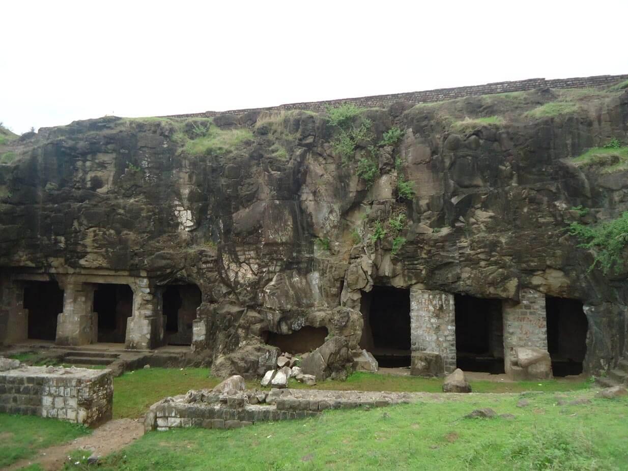
जरी या लेण्यांचे बांधकाम साधारणपणे सातवाहन काळात सुरू झाले असे मानले जात असले तरी , ए. जामखेडकर (२०११) यांनी त्यांच्या 'कोण होते वाकाटक ?' या मराठी ग्रंथात असा युक्तिवाद केला आहे की, त्यांचे बांधकाम वाकाटक राजा हरिशेन (इ.स. ४८०-५१०) आणि त्याचा मंत्री वराहदेव यांच्या कारकिर्दीत पूर्ण झाले . या दोन्ही व्यक्तींचा संबंध सामान्यतः सध्याच्या संभाजी नगरमधील अजिंठा लेण्यांशी जोडला जातो, ज्यांना त्यांच्या राजवटीत मोठा आश्रय मिळाला होता. जर हे मत स्वीकारले गेले, तर पातुर लेण्यांचा समावेश इ.स. ५ व्या शतकातील वाकाटकांच्या शैल-वास्तुकलेच्या पुनरुज्जीवनाशी संबंधित स्थळांमध्ये होईल .
अलिकडच्या वर्षांत, अधिक पुराव्यांमुळे असा प्रस्ताव मांडण्यात आला आहे की या गुहांचा शैवांशी संबंध असावा. गुहा क्रमांक २ मधून सापडलेली, अंदाजे इसवी सन ४५० च्या काळातील पार्वतीची मूर्ती आता नागपूरच्या मध्यवर्ती संग्रहालयात ठेवण्यात आली आहे. मुख्य गुहेत एक चौरसाकृती गर्भगृह आहे, जिथे लोकांच्या मते शिवलिंगासारखी रचना आहे . या रचनेचा, तसेच गुहांच्या बाहेर सापडलेल्या पेटिकाशीर्ष ब्राह्मी लिपीतील दोन शिलालेखांचा, तात्पुरता वाकाटक काळातील मानला जातो .
इसवी सन ६ व्या शतकाच्या मध्यापर्यंत वाकाटकांचे वर्चस्व क्षीण झाले होते आणि हा प्रदेश बदामीच्या सुरुवातीच्या चालुक्यांच्या अधिपत्याखाली आला , ज्यांनी उत्तर कर्नाटकात आपली राजधानी स्थापन केली होती. त्यांचा प्रभाव विदर्भ प्रदेशापर्यंत पसरला होता आणि त्यात सध्याच्या अकोळ्याच्या काही भागांचाही समावेश असण्याची शक्यता आहे.
आठव्या शतकाच्या मध्यास, राष्ट्रकूट राजवंशाचा संस्थापक दंतिदुर्ग याने बदामी चालुक्यांना पदच्युत करून दख्खनभर सत्ता प्रस्थापित केली . दहाव्या शतकाच्या अखेरीस त्यांचा ऱ्हास होईपर्यंत, राष्ट्रकूटांनी सुमारे दोन शतके विदर्भ आणि बेरारवर आपले नियंत्रण कायम ठेवले .
इ.स. ९७३ च्या सुमारास राष्ट्रकूटांचा पाडाव झाला आणि कल्याणीचे चालुक्य म्हणून ओळखल्या जाणाऱ्या पश्चिम चालुक्यांनी त्या प्रदेशात आपले वर्चस्व प्रस्थापित करण्याचा प्रयत्न केला. तथापि, सुरुवातीला विदर्भ माळव्याच्या परमारांच्या प्रभावाखाली आला . अखेरीस इ.स. ९९५ मध्ये पश्चिम चालुक्यांनी विदर्भ पुन्हा जिंकून आपले अधिपत्य पुन्हा स्थापित केले.
यादव राजवट आणि अकोल्यातील हेमाडपंथी मंदिरे
By the 12th century CE, the region came under the rule of the Yadava dynasty, whose capital was Devagiri (modern Daulatabad). Originally vassals of the Western Chalukyas of Kalyani, the Yādavas declared independence under Bhillama V and further consolidated their rule under his successor, Singhana II (r. c.1200–1247 CE). Interestingly, epigraphic and local accounts suggest that parts of Akola were integrated into this administrative apparatus during this phase of regional conquest and stabilisation.
Their advance into the region is locally remembered through figures such as General Kholeshwar, who, according to tradition, subdued Tekkali (modern Barshi Takli) on behalf of King Singhana II. An inscription found inside the Kalanka Devi Mandir, built in 1177 CE (Śaka 1098), refers to the rule of Hemadrideva, a local chief later defeated by Kholeshwar. While Hemadrideva’s precise political status remains debated, his defeat is taken to signify the firm establishment of Yadava authority in the region.
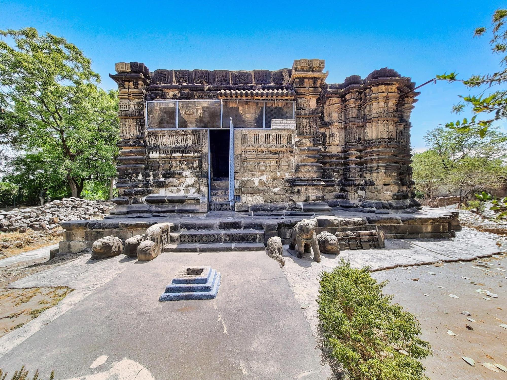
Fascinatingly, to this day, the figure of Kholeshwar remains etched in the landscape of Barshi Takli, most notably through a Mandir that bears his name.
Situated on the outskirts of the town, on the banks of the Vidrup River, stands the Kholeshwar Mandir, a structure of considerable antiquity and distinct character. It is important to note, however, that the origin of the Mandir’s name is subject to multiple interpretations. The garbhagriha of the Mandir notably can be accessed by descending a steep flight of steps into a narrow cavity which has led some to suggest that the name derives from khol, the Marathi word for depth. Whether the nomenclature refers directly to a Yadava general or is merely coincidental, it nonetheless evokes the memory of the dynasty’s northern campaigns in this region.
However, what can be said with certainty is that the Mandir, built from locally quarried black stone and constructed without mortar, adheres to the stylistic conventions popularised under the Yadava regime. Notably, beyond their political role, the Yadavas left a lasting architectural legacy in Maharashtra through their minister Hemadri, also known as Hemadpant. He is widely credited with popularising a distinctive style of temple construction that later came to be known as Hemadpanthi architecture.
Characterised by the use of locally available black stone and lime without mortar, Hemadpanthi Mandirs are found across present-day Maharashtra and often attributed to Yadava patronage, either directly or through local chieftains under their suzerainty. In Akola district, several mandirs built in this style, especially in areas like Balapur and Akot, attest to Yadava influence.
Among the enduring remains attributed to this era is the Choubari Barav, a stepped well located in the village of Pinjar (Barshi Takli taluka). Believed to have been constructed in the 12th century in Hemadpanthi style, the well retains water through the year and is said to have served ritual purposes. Notably, Devotees and local royalty are believed to have bathed here prior to entering the Mandir.
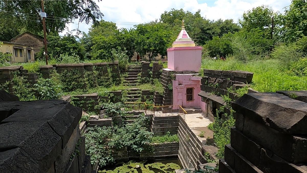
At Pinjar, in Barshi Takli taluka, stands the Mahadev Mandir, also referred to as the Kapileshwar Mandir, constructed in the Hemadpanthi style with black stone. According to local accounts documented by RJ Dipak Wankhede, a partially legible inscription inside the nandi mandapa preserves the word Vdiptiprashasti, though the rest remains too weathered to interpret.
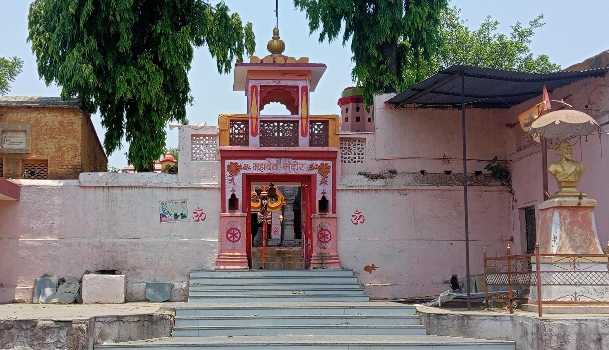
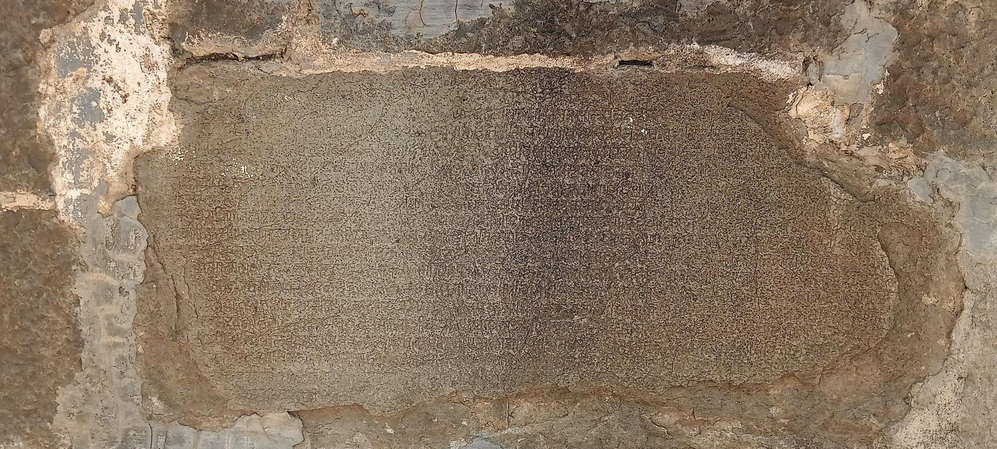
Akola Town and Akol Singh
It is likely that Akola town had already begun to take shape, perhaps even as a fortified settlement, during or slightly before the Yadava period. While the Yadavas left behind a clear architectural legacy in the region, the early history of Akola town remains uncertain, owing to the absence of archaeological or textual evidence.
What is known, however, is that a ruler (about whom little is known) is believed to have fortified the town in its early days. He is credited with constructing the first protective wall around the village. Interestingly, there is a rather peculiar story behind this. According to local tradition, Akol Singh witnessed a hare chasing a dog, an unusual and auspicious sign, and took it as a divine indication to fortify the area with an earthen wall. He is believed to have been a Rajput ruler, though little historical evidence survives to confirm his identity or the period in which he lived. The town’s very name, Akola, is often associated with him, though whether this is rooted in fact or folklore remains open to interpretation.
Medieval Period
Delhi Sultanate
Following the decline of the Yadava dynasty, Akola, along with the rest of Berar region, was annexed by the Delhi Sultanate under the Tughlaq dynasty. In 1298 CE, Alauddin Khilji, son-in-law of the Sultan of Delhi, launched a successful military campaign into the Deccan against King Ramachandra of the Yadavas. This invasion was part of a broader effort by the Delhi Sultanate to extend its control southward.
By around 1311 CE, the Yadava territories were fully annexed into the Delhi Sultanate, and governance of the Deccan was entrusted to imperial officers stationed at Devagiri (modern Daulatabad). It is likely that parts of present-day Akola were brought under the administrative and military influence of these northern rulers during this period of expansion and consolidation.
Bahmani Rule and Narnala Fort
The authority of the Delhi Sultanate began to wane by the mid-14th century, and the wider Deccan region witnessed the rise of new regional powers. Among them, the Bahmani Sultanate, established in 1347 by Ala-ud-Din Bahman Shah, rapidly expanded its influence across large parts of the plateau. The area that now forms Akola district, then part of a loosely held frontier zone, gradually came under Bahmani control in the decades that followed.
To bring order and stability to their growing dominion, the Bahmani rulers undertook a major administrative reorganisation. They divided their territories into five provinces, one of which (Berar) was newly carved out to administer the northern reaches. This new province included the Akola region and was strategically important due to its fertile land, frontier location, and access to trade routes leading towards Khandesh and Malwa.
Though distant from the Sultanate's early capitals at Gulbarga and later Bidar (both of which lie in Karnataka), Berar's fertile plains and frontier position between northern and southern India rendered it strategically valuable. To secure their northern approaches, the Bahmani rulers established a regional headquarters at Ellichpur (now Achalpur in Amravati district) and fortified key passes and hilltops along the Satpura ranges. It was during this period that Narnala, a rugged hill fort near present-day Akot taluka, assumed heightened importance. Its location, in many ways, made it an ideal watchpoint over the plains of eastern Berar and a stronghold against incursions from the east (a feature which perhaps contributed to its sustained prominence under successive dynasties in the centuries that followed, as will be seen in the ensuing sections).
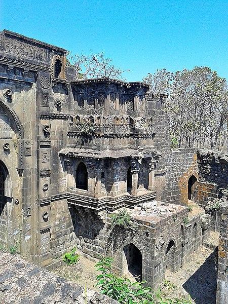
By the early 15th century, as threats from Gond rulers grew more frequent, Sultan Ahmad Shah I Wali of the Bahmani dynasty took personal interest in the region. In 1425, following an expedition to quell disturbances in eastern Berar, he temporarily established his camp at Ellichpur. Recognising the vulnerability of the province’s open terrain, he ordered the strengthening of nearby forts, among them Narnala. Contemporary accounts suggest that extensive fortification works were undertaken here under his direction. In time, it would become the base for further developments under the Imad Shahi dynasty, but its political emergence began firmly under Bahmani authority.
Imad Shahi Rule and the Berar Sultanate
As the Bahmani Sultanate weakened in the late 15th century, its provincial governors began asserting independence. In 1490, Fatehullah Imad-ul-Mulk, governor of Berar, declared himself sovereign and established the Imad Shahi dynasty, ruling from Ellichpur. Akola and its surrounding forts, including Narnala, continued to serve as important military and administrative centres under his dominion.
The dynasty maintained its independence precariously amidst growing pressure from neighbouring states. The later years of its rule were marked by internal dissension and declining authority. In the mid-16th century, Burhan Imad Shah, the last ruler of the line, faced open rebellion from his minister Tufail Khan, who laid siege to Narnala Fort. The betrayal proved fatal to the dynasty, and Berar was soon annexed by the Ahmadnagar Sultanate.
Siege at Naranala and the Campaigns Under Murtaza Nizam Shah I
With the weakening of the Imad Shahi dynasty, which had until then governed Berar from its regional seats of power such as Ellichpur and Narnala, the sultans of Ahmadnagar turned their attention northward. What followed was a prolonged and calculated campaign by Murtaza Nizam Shah I of Ahmadnagar, which culminated in the absorption of Berar, Akola included, into the Ahmadnagar Sultanate.
In 1572, according to the Maharashtra State Gazetteers (The Imadshahi of Berar, Chapter XI), Murtaza entered into a treaty with Ali Adil Shah of Bijapur, whereby Ahmadnagar would annex the territories of Berar and Bidar, while Bijapur would expand into the present-day Karnataka region. Though this alliance served to partition the Deccan between the two major powers, it also unleashed a wave of ambition and rivalry. Ahmadnagar’s claim over Berar rested on the pretext of restoring authority to the young Burhan Imad Shah, then under the regency of his minister Tufail Khan.
An envoy was dispatched from Ahmadnagar to demand that Tufail return power to Burhan. Tufail, however, rightly suspected a veiled threat of invasion. His son, Samser-ul-Mulk, advised against compliance, and the envoy was turned away. Even as the diplomatic exchange unfolded, Murtaza I had already begun his military advance. Berar was overrun and its lands distributed among Ahmadnagar’s nobles, marking the beginning of the end for the Imad Shahis.
The confrontation quickly reached Akola’s and the fort of Narnala became the last major seat of contention. After failed negotiations and minor engagements near Bidar and Mahur, Tufail Khan withdrew to Narnala, while Samser-ul-Mulk retreated to Gavilgad. Murtaza launched an aggressive siege of Narnala under his vizier Asad Khan.
The siege extended for more than a year, from 1573 into early 1574. Despite heavy bombardment, the garrison resisted fiercely. An attempted betrayal from within was thwarted by the defenders. Eventually, in April 1574, Ahmadnagar’s troops breached the gates, and Tufail Khan fled, only to be captured shortly thereafter. With Narnala lost, the remaining defenders at Gavilgad lost heart. Samser-ul-Mulk was arrested by his own men and handed over to Murtaza.
Thus, the rule of the Imad Shahis in Akola came to a close. Tufail Khan, his sons, Burhan Imad Shah, and other members of the dynasty were imprisoned in Lohagad Fort (in Pune district, Maharashtra), where they passed away soon after, it is said, by poisoning. Akola, along with the rest of Berar, was now brought firmly under Ahmadnagar control, where it would remain until the Mughal invasion of 1596.
Mughal Advance and Establishment of Rule
The closing years of the sixteenth century witnessed a marked decline in the authority of the Ahmadnagar rulers in Berar. This circumstance was not long unexploited. Khan-i-Azam, the foster-brother of Emperor Akbar and then governor of Malwa, led a northern force into Berar, sacking Achalpur and advancing through what is now the Akola district. In 1595, the province was annexed to the Mughal Empire. The following year, Prince Murad, Akbar’s fourth son, assumed governorship of the region and established his headquarters at Balapur, which henceforth grew into a seat of administration and military control.
It is notably recorded in the Mughal record Ain-i-Akbari that many parts of the present-day district during this time fell under the sarkar of Narnala, with Balapur and Shahpur marked as principal towns. Abul Fazl makes mention of streams near Balapur said to yield small precious stones, which were collected and preserved as curiosities. Near the vicinity of Balapur, arose the settlement of Shahpur, where Prince Murad was also known to have resided.
Turbulence and the Campaigns of Malik Ambar
Despite nominal control, Mughal possession of Berar remained far from secure. Resistance to Mughal authority persisted under the leadership of Malik Ambar, a capable and restless general of the Nizam Shahi dynasty of Ahmadnagar. Throughout the early seventeenth century, Malik Ambar conducted a series of incursions into Berar, at times occupying it in its entirety, Akola included, and establishing his own administrative arrangements.
Emperor Jahangir, upon ascending the throne in 1605, endeavoured to stabilise the region by appointing Prince Parvez as viceroy in 1609. The prince’s administration, however, lacked vigour, and Berar continued to be a theatre of contest between Mughal officers and the forces of the Ahmadnagar Sultanate. The instability rendered Akola a frequent frontier in this prolonged conflict.
The Treachery of Khan Jahan Lodi
The political climate worsened during the years of Shah Jahan’s rebellion against his father. Though Mughal control over Balapur and Akola was not entirely lost, it grew precarious. Khan Jahan Lodi, a noble of Afghan descent who had been entrusted with the governorship of Berar, entered into secret negotiations with the Nizam Shahi court. He sold the Balaghat region, including Akola and its dependencies, for a consideration of lakhs of rupees to Murtaza Nizam Shah II. Consequently, the Mughal garrisons withdrew, and the Ahmadnagar Sultanate’s influence expanded over the district.
Upon accession to the throne in 1628, Shah Jahan repudiated the sale and issued a firm demand for the restoration of all military outposts. When the Nizam refused to surrender Lodi, who had sought refuge in his court, the emperor initiated a campaign, marching from Burhanpur to reassert dominion over Berar. Akola was brought once again under firm Mughal control following this expedition.
It is important to note that under Mughal administration, Berar was divided into Balaghat (the southern upland) and Payanghat (the northern plain), with the two separated by the natural edge of the Deccan plateau. Within this framework, Akola, Balapur, Akot, and Murtizapur fell within Payanghat, while Basim (Washim) and Mangrul belonged to Balaghat. Balapur emerged as the chief centre of Mughal authority in the region, and a permanent garrison was maintained there.
By the latter part of the seventeenth century, the town of Akola itself was held as a jagir by Asad Khan, the prime minister of Emperor Aurangzeb. His local representative, Khwaja Abdul Watif, is credited with the construction of the fortification walls, thereafter known as Asadgarh, a structure which, though now largely in ruins, long served to protect the town and assert Mughal presence in the district.
The Great Famine of 1630
This phase of Mughal administration was, however, soon overshadowed by natural calamity. In the year 1630, Akola and the greater part of Berar suffered the effects of a devastating famine, which was brought on by the failure of the monsoon and exacerbated by military operations. Contemporary accounts record unspeakable misery, people bartered their lives for a morsel of food, and in their desperation, turned to the flesh of dead animals and, at times, of one another. Cannibalism, though unspeakable, is repeatedly mentioned in records later compiled in the district Gazetteer. Even the bones of the deceased were said to have been ground into flour. Depopulation followed, and the effects of the calamity lingered long after the rains returned.
Maratha Expansion and the Rise of Raghuji Bhosale I
Following the death of Aurangzeb in 1707, the Mughal Empire’s authority over the Deccan steadily waned. In 1724, Chin Qilich Khan, the Mughal Subahdar of the Deccan, declared independence and founded the Hyderabad State under the title Asaf Jah I. While Berar, including Akola, nominally passed into the Nizam’s dominion, the ground reality was more complex. The Marathas were asserting increasing influence over the region.
As early as 1719, Emperor Farrukhsiyar had formally conferred upon the Marathas the rights of chauth and sardeshmukhi over Berar. The recognition forced the Nizam to tolerate Maratha fiscal claims even while he continued to claim administrative control. In practice, Akola and the surrounding parganas were subjected to overlapping revenue claims by both the Nizam’s jagirdars and the Maratha revenue officers.
It is noted in the district Gazetteer that during this period, peasants were often forced to make dual payments, leading to widespread discontent. Numerous villages in Akola taluka were abandoned, reflecting the economic strain of this contested sovereignty.
The principal Maratha figure to assert control over Berar during this period was Raghuji Bhosale I, originally raised in the household of Kanhoji, a military officer of some standing in Gondwana. Though Kanhoji treated Raghuji as an adopted heir for a time, the birth of his own son Rayaji created tensions, eventually prompting Raghuji to seek the support of Chhatrapati Shahu I. With Shahu’s backing, Raghuji overthrew his former guardian and consolidated his hold over Nagpur, Berar, and Gondwana by the 1740s.
As Raja of Nagpur, Raghuji Bhosale I firmly established Maratha sovereignty over Berar, and Akola became part of this expanding eastern domain. His authority was later recognised even in the Treaty of Deogaon (1803), where the British referred to the Nagpur Bhosales as the ruling house of Berar.
Battle of Kumbhari, 1773
By the latter half of the 18th century, the Akola district became a site of military and political consequence in the succession dispute within the Nagpur branch of the Bhosale dynasty. The death of Raja Janoji Bhosale in 1772 left the question of succession unresolved. His brother, Sabaji Bhosale, supported by Peshwa Madhavrao I of Pune, advanced his claim to the Nagpur gadi. In opposition stood Mudhoji Bhosale, father of the minor Raghuji Bhosale II, who had previously been adopted by Janoji. Mudhoji, though initially operating from a position of relative weakness, secured the covert support of the Nizam of Hyderabad.
The conflict culminated in the Battle of Kumbhari, fought in January 1773 near the village of Kumbhari, situated within the present-day Akola district. Owing to its proximity to the boundary between Maratha-held Berar and areas influenced by the Hyderabad State, the location bore strategic significance.
Contemporary records suggest the engagement was prolonged and hard-fought. Despite setbacks in the early stages of the battle, Mudhoji Bhosale ultimately prevailed, securing control over Nagpur and its dependencies, including Berar. His assumption of power was followed by a realignment in the region’s political relations, particularly with the Hyderabad State.
The Battle of Argaon (1803) and the Second Anglo-Maratha War
Following the succession conflict at Kumbhari in 1773, which secured Mudhoji Bhosale’s control over the Nagpur State, the region around Akola remained under Maratha rule for several decades. However, internal divisions among the Maratha Confederacy, particularly between the Bhosales of Nagpur, the Scindias of Gwalior, and the Peshwas of Pune, grew more pronounced over time. Meanwhile, the British East India Company, backed by its longstanding alliance with the Nizam of Hyderabad, was steadily expanding its presence across the Berar region.
It was in this atmosphere that the Second Anglo-Maratha War (1803–1805) broke out. The district of Akola became the site of one of its key engagements. On 28 November 1803, British forces under Major-General Arthur Wellesley (later Duke of Wellington) marched into the area near Argaon (now Adgaon village in Telhara taluka). Facing them was a joint army of the Bhosales of Nagpur, under Raghuji Bhosale II, and the Scindias of Gwalior, under Daulat Rao Scindia. The two factions had formed an alliance in a last attempt to resist British expansion.
The next day, 29 November, a major battle unfolded near Sirsoli, a village about three miles south of Argaon. Early in the encounter, part of the British line gave way under heavy cannon fire, raising fears of a defeat. However, Wellesley quickly reorganised his troops and launched a counterattack. The Maratha forces were soon overwhelmed. Their artillery and baggage were seized, and the defeat marked a turning point in the campaign.
The outcome of the battle effectively ended Maratha resistance in Berar, and soon after, Raghuji Bhosale II signed the Treaty of Deogaon (December 1803). Under the treaty, he ceded large territories such as Cuttack (present-day Cuttack, Odisha) and Balasore (present-day Balasore, Odisha), and agreed to limit diplomatic engagement with other powers. Though the Nagpur State remained under Bhosale rule, it now operated under British supervision, with diminished sovereignty.
The Battle of Argaon, thus fought within the bounds of the present-day Akola district, was, in many ways, a significant moment in the district's political history. It marked the final collapse of Maratha power in the region and the formal commencement of British political influence in the region.
Sant Gajanan Maharaj
Sant Gajanan Maharaj made a profound contribution to the spiritual heritage of Maharashtra, revitalising faith through his enigmatic presence as a perfect Avadhuta (a saint beyond all worldly conventions). His origins are a celebrated mystery, as he was first seen as a young man on February 23, 1878, in Shegaon. This town, then a part of Akola district (and now in Buldhana district), became his karmabhoomi and a major pilgrimage centre. He was discovered picking leftover food grains, a sign of his complete detachment from ego and social norms.
Unlike saints with known lineages, Gajanan Maharaj had no known birth name, family, or external Guru; he was widely regarded as a self-realised Paramahansa and an incarnation of Lord Ganesha. He spent his entire life in and around Shegaon, guiding devotees through his simple, often cryptic, actions rather than long discourses. He performed countless miracles to bolster the faith of the common people, teaching the unity of God and the importance of selfless service, summed up in his famous mantra "Gan Gan Ganat Bote." His legacy continues through the massive charitable, educational, and spiritual work of the Shegaon Sansthan.
Colonial Period
The formal involvement of the British in the administration of Akola began in 1853, when the Nizam of Hyderabad, under pressure from mounting debts, consented to cede the Berar province to the East India Company for its management. While nominal ownership remained with the Nizam, real authority was exercised by British officials appointed under the Resident at Hyderabad.
Berar, until then governed as a frontier zone under the dominion of the Hyderabad State, was now subject to reorganisation. The British divided the territory into East Berar, with its headquarters at Amravati, and West Berar, which included the area now constituting Akola district.
As part of the ensuing administrative restructuring, the district of Akola was formally established in 1864, along with Amravati district. In the same year, the region of Wun (now Yavatmal district) was also constituted as a separate administrative unit. Additional changes followed: the sub-divisions of Malkapur, Chikhli, and Mehkar, earlier part of West Berar, were separated and grouped into a new district called South-West Berar. This unit was renamed Mehkar district in 1865. Subsequently, in 1867, Buldhana was selected as the district headquarters for the reorganised tract.
The following year, in 1868, further reorganisation led to the creation of Bashim district (present-day Washim district as it was called then), while the earlier districts of Achalpur and Mehkar, both of which had functioned briefly, were dissolved. Throughout these developments, the British maintained oversight through the office of the Agent of the Resident, stationed at Amravati, who was tasked with supervising the administration of Berar, including Akola. By the late nineteenth century, the Berar region was merged with the adjoining Central Provinces, giving rise to the larger political entity known as the Central Provinces and Berar. Akola thus came to be incorporated within this expanded colonial framework.

Some further changes came in 1905, when the district was comprehensively reconstituted. Of the original talukas, Akola, Balapur, and Akot were retained. In contrast, Khamgaon and Jalgaon were transferred to other units. In their place, the talukas of Murtizapur, Basim (Washim), and Mangrul were brought under Akola's jurisdiction.
The 1901 Census recorded the total population of Akola district at 7,54,804, across an area of 4,110 square miles. In comparison to other districts in the Central Provinces and Berar, Akola ranked 10th in area and 4th in population, with a population density of 184 persons per square mile, exceeding the regional average of 120.
Local Dissent and the Warhad Samachar
In parallel with these developments, Akola also witnessed the emergence of regional journalism as a channel for civil expression. Among the earliest such publications was the Warhad Samachar, an Anglo-Marathi weekly published from Akola between 1865 and 1918. It served as a forum for articulating public grievances and reporting on matters of local concern.
An edition dated 6 May 1877 notably criticised the conduct of British officials, drawing attention to the alleged murder of Ramdayal, a municipal peon from Akola, and the arrest of a local resident by Chief Commissioner Mr. Morris for accessing a public well. Such reports marked the growing presence of a local print culture that engaged critically with colonial administration and reflected the stirrings of political awareness in the district.
The Forest Satyagraha at Dahihanda
By the early 20th century, discontent against colonial forest policies began to take organised shape in parts of Akola district. One of the earliest expressions of this discontent occurred in the village of Dahihanda, where locals resisted the restrictions imposed under British forest laws that curtailed access to grazing, firewood, and minor forest produce.
The Forest Satyagraha, as it came to be known, emerged as part of a larger campaign in the Vidarbha region, led by Bapuji Ane and other Gandhian activists. In Dahihanda, villagers defied the colonial regulations, asserting traditional rights over forest use. Although non-violent in method, the protest marked a visible challenge to British authority and contributed to the broader civil disobedience movement that was gathering momentum across the country.
Brijlal Biyani and the Freedom Struggle in Akola
Among the leading figures in Akola’s nationalist activity was Brijlal Biyani (1896–1968), often referred to as Vidarbha Kesari for his contributions to public life and the freedom struggle. Born in Akola, Biyani was educated at Morris College, Nagpur, where he came under the influence of Gandhian ideals.
He played an active role in the Non-Cooperation Movement (1920) and was imprisoned for participating in protests against British-imposed salt laws and forest regulations. His leadership in movements such as the Dahihanda Salt Satyagraha and the Jungle Satyagraha cemented his reputation as a key regional figure in Vidarbha’s resistance to colonial rule.
Biyani’s influence extended beyond activism. He served in the Central Provinces and Berar Legislative Council (1927–1930), later becoming Finance Minister of the erstwhile Madhya Pradesh State after independence. His contributions were memorialised through the founding of the Shri Brijlal Biyani Shiksha Samiti (1969) and the naming of educational institutions, including the Brijlal Biyani Science College in Amravati.
The Akola Pact and the Demand for Regional Autonomy
In the final years of British rule, questions concerning the future organisation of provinces and the representation of diverse linguistic communities came to occupy the attention of political leaders across India. In regions such as Berar, which had long been administratively tied to the Central Provinces but was culturally and linguistically aligned with Marathi-speaking Maharashtra, this issue became particularly significant.
It was during this time that the town of Akola acquired prominence as the venue for a political agreement that sought to reconcile these regional aspirations. On 8 August 1947, a meeting was held in Akola between representatives of Western Maharashtra and those of Vidarbha, then still part of the Central Provinces and Berar. The outcome was the Akola Pact, an understanding aimed at ensuring equitable political and administrative treatment for Marathi-speaking regions after independence.
The pact proposed the formation of two distinct sub-provinces within a unified administrative framework—Mahavidarbha in the east and Western Maharashtra in the west—each with its own executive, legislature, and judiciary. Among the key figures associated with the pact was Barrister Ramrao Deshmukh, a senior leader from the Berar region.
The roots of this proposal lay in earlier demands dating back to the Montagu–Chelmsford Reforms (1918), during which Marathi leaders had petitioned for a unified Marathi linguistic province. These demands were carried forward by organisations such as the Mahavidarbha Samiti, formed under the leadership of M. S. Aney, which actively campaigned for a state comprising Marathi-speaking areas from Berar, Nagpur Division, and parts of Bombay Presidency. Although the Akola Pact did not result in immediate administrative changes, it in some ways laid the foundation for future debates on linguistic state formation.
Post-Independence
After India attained Independence in 1947, the Central Provinces and Berar, which included Akola district, were integrated into the newly formed Indian Union. In the initial phase of reorganisation, this region became part of the state of Madhya Pradesh. However, Among the Marathi-speaking districts of the former Berar, including Akola, the idea of a Marathi linguistic state began to gather force in the years that followed.
In response to such demands growing across the country, a States Reorganisation Commission was organized and appointed by the Government of India in 1953 under the chairmanship of Justice Fazal Ali; they undertook a comprehensive review of state boundaries across the country. In its report submitted in 1955, the Commission recommended the formation of a separate Vidarbha State, comprising the districts of Akola, Amravati, Buldhana, Yavatmal, Wardha, Nagpur, Bhandara, and Chandrapur. However, the recommendation did not find favour with the Union Government of the time, which feared that the creation of multiple new states on linguistic lines, so soon after Partition, might endanger national cohesion.
In lieu of the Commission’s recommendation, the Berar regions were, in 1956, transferred from Madhya Pradesh to the Bombay State, as part of the broader reorganisation of state boundaries enacted that year. This administrative arrangement placed Akola district within a larger Marathi-speaking unit, though not as a separate state. A few years later, in 1960, the Bombay State was divided along linguistic lines, resulting in the formation of the modern states of Maharashtra and Gujarat. Akola remained within Maharashtra, where it continues to form a significant part of the Vidarbha region.
In the later decades of the 20th century, the administrative map of Akola underwent further reorganization. On 1 July 1998, the district of Washim was constituted as a separate administrative unit. This reorganisation involved the transfer of several talukas from the erstwhile Akola’s eastern portion, notably Washim, Mangrulpir, and Malegaon, to the newly formed district. Following the bifurcation, Akola district comprised seven talukas: Akola, Balapur, Patur, Barshitakli, Murtizapur, Akot, and Telhara.
Sources
Bipan Chandra, Mridula Mukherjee, and Aditya Mukherjee. 1999. India After Independence 1947-2000. Penguin Books, New Delhi.
C. Brown, A.E. Nelson ed. 1910. Central Provinces and Berar District Gazetteers Akola District. Vol. A - Descriptive. Baptist Mission Press, Calcutta.
Government of India. 1955. Lok Sabha Debates: Part I - Questions and Answers. Vol. 7. No. 1-26, Session 11. Lok Sabha Secretariat, New Delhi.
Government of Maharashtra. 1977. Maharashtra State Gazetteer: Akola District. Gazetteers Department, Government of Maharashtra, Mumbai.
Gunakar Muley. 2015. Forts of Maharashtra. Centre for Cultural Resources and Training (CCRT).
Jadunath Sarkar. 1949. Ain-i-Akbari Of Abul Fazl - I - Allami. Vol. 2. Ed. 2. Royal Asiatic Society of Bengal, Calcutta.
Kishori Saran Lal. 1950. History of the Khaljis (1290-1320). Asia Pub. House.
Krishna Mohan Ganguly, tr. 1883-96. The Mahabharata: Vana Parva. Book 3, Section XCVI-VII.
Maharashtra State Gazetteer. History, Part II, Chapter 6: The Imadshahi of Berar. Directorate of Government Printing, Mumbai.https://gazetteers.maharashtra.gov.in/cultur…
Meadows Taylor. 1863. Sketch of the Topography of East and West Berar, in Reference to the Production of Cotton. Vol. 20. The Journal of the Royal Asiatic Society of Great Britain and Ireland.https://www.jstor.org/stable/pdf/25581242.pd…
Pranab Kumar Bhattacharya. 2010. Historical Geography of Madhya Pradesh: from Early Records. Motilal Banarsidass Publishers, Delhi.
Ramachandra Guha. 2008. India after Gandhi. Macmillan Publication, London.
The Economic Weekly. 1955. Reorganization of States: The Approach and Arrangements.https://www.epw.in/system/files/pdf/1955_7/4…
डब्ल्यू डब्ल्यू हंटर. १८८६. द इम्पीरियल गॅझेटियर ऑफ इंडिया. खंड ६. आवृत्ती २. मॉरिसन अँड गिब, एडिनबर्ग.
विकिपीडिया, अकोला जिल्हा संकेतस्थळ, नरनाळा.


No comments:
Post a Comment