

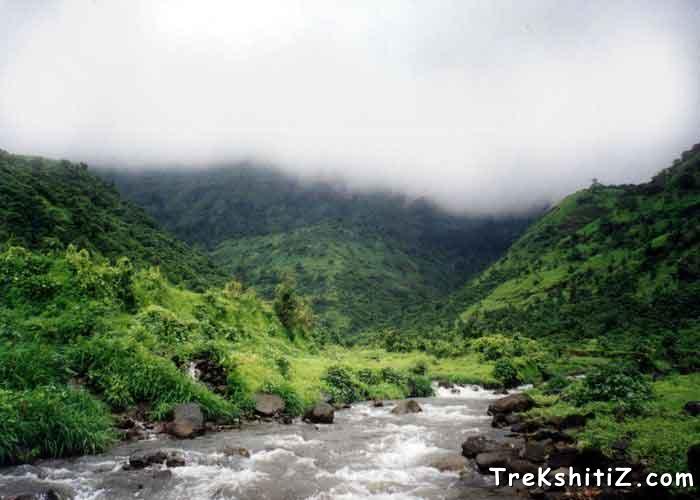
माथेरानची डोंगररांग कल्याणच्या मलंगगडापासून सुरू होते. याच रांगेत ताहुली शिखर आहे. पुढे बदलापूरची डोंगररांग आहे. नवरानवरीची डोंगररांग, चंदेरीचा उभा सुळका, म्हैसमाळ, नाखिंद खिंड अन् पेब ( विकटगड ) याच रांगेत आहे. भिवगड, सोंडाई किल्ला, इर्शाळवाडी, प्रबळगड हेदेखील आजूबाजूच्या परिसरात पहुडलेले आहेत. त्यामुळे दर पावसाळ्यात ट्रेकिंगसाठी मुंबई, ठाणे अन् पुणेकरांची पावले उल्हास अथवा कर्जत व्हॅलीकडे वळतात. पनवेलच्या ईशान्येला, मुंबई - पुणे मार्गावरील नेरळपासून पश्चिमेला तीन - चार किलोमीटर अंतरावर पेबचा किल्ला (विकटगड) आहे. गडाखालच्या पेबी देवी वरून या किल्ल्याचे नाव पेब ठेवण्यात आलेले असावे. माथेरान सारख्या सुंदर थंड हवेच्या ठिकाणा जवळ, पण माणसांच्या गर्दीपासून दूर असलेला पेबचा किल्ला एका दिवसाच्या ट्रेकसाठी आदर्श जागा आहे. किल्ला चढण्यासाठी लागणारा वेळ ,चढण्याची वाट, वरील गुहेची रचना, गुहेसमोरील निसर्गरम्य दृश्य अशा अनेक बाबतीत हा गड अजोड आहे. पेबच्या किल्ल्याचे विकटगड असे देखील नाव आहे. किल्ल्यावर जाण्यासाठी नेरळ, माथेरान, पनवेल या तिनही ठिकाणांहून वाटा आहेत.
किल्ल्यावरील गुहेचा शिवाजी महाराजांनी धान्य कोठारांसाठी उपयोग केला होता, असा स्पष्ट ऐतिहासिक संदर्भ पेबच्या किल्ल्याबाबत आढळतो. या गडाचा बाकी इतिहास ज्ञात नसला तरी इथे असलेली पाण्याची कोरीव टाकी बघता हा गड निश्चितच प्राचीन असावा.



१) नेरळ मार्गे :-
पेबला जाण्यासाठी मध्य रेल्वेवरील नेरळ स्टेशनला उतरावे. नेरळ स्टेशनवर उतरल्यावर, समोरच माथेरान आणि त्याच्या बाजूस पेबच्या किल्ल्याचे दर्शन होते. स्टेशनच्या बाहेर आल्यावर माथेरानच्या दिशेला न जाता उजवीकडची (मुंबईच्या दिशेची ) वाट पकडावी. या वाटेने डोंगराच्या दिशेने जाताना प्रथम ओढ्यावरील पुल, मग शिवाजी मैदान आणि जिजामाता तलाव ,



१) धबधब्याला लागून असलेली वाट
२) मधून गेलेली मुख्य वाट
३) टॉवर्सला लागून असलेली वाट
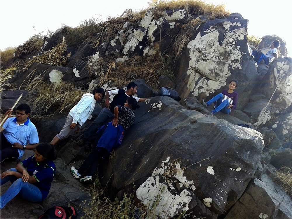
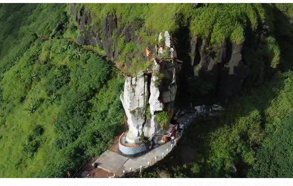
या तीन वाटांपैकी मधली मुख्य वाट हीच किल्ल्याच्या गुहेपर्यंत नेणारी खरी वाट आहे. पहिल्या वाटेने पुढे गेल्यास जंगल लागते पण पुढे या वाटेने जाणे अशक्य आहे. तिसरी वाट म्हणजे मानेला वळसा घालून घास घेण्यासारखा प्रकार होय. तसेच या वाटेला पनवेलकडे जाणारे फाटे फुटत असल्याने वाट चुकण्याची शक्यता जास्त आहे. मधून जाणारी वाट पकडावी या वाटेने गणपतीचे चित्र काढलेला दगड येतो या दगडाच्या उजव्या बाजूने वर चढावे. हीच वाट पुढे झर्या,ची होत असली तरी, ही वाट न सोडता याच वाटेने खिंडीच्या दिशेने वाटचाल करावी. या खिंडीत पनवेलहून येणारी वाट येउन मिळते. खिंडीत पोहोचल्यावर तेथून डाव्या हाताला वळून पुढे जावे.


माथेरान-नेरळ रस्त्यावर आणि रेल्वे मार्गावर वाटर पाईप स्टेशननंतर रेल्वे लाईन रस्त्याला आडवी जाते तिथे "पेब/प्रती गिरनार" जाण्याचा मार्ग असा बोर्ड लावलेला आहे. येथवर एसटी किंवा खाजगी वाहनाने पोहोचता येते. या ठिकाणाहून रेल्वे मार्गाने चालायला सूरुवात करावी. पुढे वळसा घेऊन रेल्वे लाईन एका खिंडीत पोहोचते. या खिंडीतून समोरच्या डोंगरावर गेलेल्या तारा दिसतात. तारा समोर ज्या डोंगरावर गेल्या आहेत तो डोंगर म्हणजेच विकटगड. अर्थात पेबला जाण्यासाठी या नालाकृती खिंडीतून वाट नाही हे लक्षात ठेवावे.


३) अमन लॉजमार्गे :-








या ठिकाणी आपली गडफेरी पूर्ण होते. येथून आल्या मार्गाने किल्ला उतरुन नेरळ किंवा पनवेलला जाता येते किंवा बुरुजा खालच्या वाटेने माथेरान - नेरळ रस्त्यावर पोहोचून नेरळला जाता येते.
१ ) साद सह्याद्रीची ! भटकंती किल्ल्यांची !!- प्र.के. घाणेकर
२ ) www.trekshitiz.com हि वेबसाईट
३ ) रायगड जिल्हा गॅझेटियर
4 ) सांगाती सह्याद्रीचा- यंग झिंगारो ट्रेकर्स
५ ) डोंगरयात्रा - आनंद पाळंदे
६ ) www.nomadosauros.com हा ब्लॉग
Trek to Vikatgad aka Peb fort-I
#06
When: January ‘15
Where: Vikatgad aka Peb fort
Range: Matheran
Route: Neral-Komalwadi-Nakhind pass route-Vikatgad-Dasturi Naka
Nearest railway station:
Aman Lodge (Neral-Matheran Narrow Gauge railway): 3 kms from NM 156
marker & Neral (Central Railway): 5 kms from Vikatgad Caves.
Base Village: Anandwadi/Dhaswadi/Komalwadi (All three are in close proximity)
Height: 621 m (approx. 2050 ft) as per Google Maps & 606 m as per GPS.
Total Distance: 12 km (Neral-Komalwadi-Join Nakhind Pass route on col-Vikatgad-Dasturi Naka)
Time: 9 to 12 hours for this route
Approx. expenses: Less than 200 excluding lunch
Best Time: All year (Avoid day treks during October & March-May)
Map:
Difficulty: Medium
Endurance: 3
Risk Factor: HIGH during Monsoon (A Mumbai teen unfortunately lost his life during monsoon ’16).
Medium during the rest of the year. (What do these grading indicate? Find out here!)
Other Routes:
One Day:
1. Neral- Anandwadi/Komalwadi-Vikatgad-Matheran. (Normal route).
2. Neral-Dilkap college-Vikatgad-Matheran. (Normal route)
3. NM 134 (Last road & railway intersection before Dasturi naka)- NM 156- Vikatgad-Matheran.
Two Day Range trek:
- Vangani- Vaghachi wadi-Nakhind-Vikatgad-Matheran (Dasturi Naka)
- Karjat-Varose-Hashyachi Patti-Malang point-Aman lodge-Vikatgad Dilkap college/ Komalwadi-Neral.

For GPS trail of this and other such treks, visit my Wikiloc page!
Important!
This blog describes a winter trek through one of the rarely used,
longer routes to Vikatgad. A word of caution before you head elsewhere
looking for the more often used, shorter route: Consider visiting
Vikatgad only if you have done 10+ moderately difficult treks even if
you are going with a commercial trekking group. A lot of unfortunate
accidents have happened on the fort in the last couple of years and it
is best avoided during heavy rains when the exposed trails become
dangerously slippery. Read this news article for one such incident. Check out the following forts for easier monsoon treks-
Mumbai: Karnala, One tree hill route to Matheran.
Lonavla: Lohgad, Korigad, Tikona & Tung.
Pune: Sinhagad, Raigad.
Account of the Trek:
Vikatgad (Jan ‘15) was my first actual trek
(Advise: Don’t follow our footsteps and head to Vikatgad for your first
trek. We were incredibly lucky to come back unscathed. Get experience
on easier treks and then head here). This post is the longest that you ‘ll come across on this blog
one of the longest and therefore divided into two parts. My objective
behind a very detailed account is to take the reader through all the
emotions that we, as first timers went through and hence, to experienced
trekkers, may seem to exaggerate the difficulty. Indeed, my later
visits to Vikatgad have been fairly easy and my blog posts reflect the
same. Notes have been added to help the reader avoid the mistakes we
committed.
The Gang: Akshita, Aparna, Mansi, Omkar G, Persis, Ruchit, Shruti, Yogesh & Me
PART I
It was 3 pm
and we were at the 15 feet rock patch. What should have been an easy
trek based on some blogs, was testing us to the limits. We had been
climbing for 7 hours and reached a height of 1500 feet but the summit
was still 500 vertical feet away.
Me: Have we bitten off more than we can chew?
Persis: I think so too.
This conversation is etched in my memory as
if it was yesterday. We should have been at the peak by noon according
to the schedule we had made and panic had begun to set in slowly. What
if we couldn’t make it to safe ground before dark? There was barely any
network in that region. Mental exhaustion has a way of making things
seem direr than they actually are.
But we ‘ll come to that later. Let’s start from how it all began!
The initial plan was to go for a hike along the lines of what I had done in the preceding December.
Omkar, then came up with this suggestion of a proper trek instead of a hike.
“How about Vikatgad?” he asked.
Vikatgad, also known as Peb Killa, is a fort in the Matheran range and may have derived its name Peb from the ‘Goddess Pebi’ at the base of the fort. Historical references indicate that Shivaji Maharaj used the caves on the fort for grain storage.
Omkar had attempted this trek earlier with his friends but aborted it midway after they lost the way without a map to help them out. I asked my classmates about changing the plan to a trek and they were more than eager. So I read some trekking blogs to collect information about the route and even found a traced path on Wikimapia! woohoo! THE TREK WAS ON! (Here is a list of some excellent links to get information about prospective treks)
As has become the norm now, a plan isn’t a plan unless a new WhatsApp group is made for it
So the group was made and members were
added, a high-res map was made (whatever I could manage with my crude
Photoshop skills back then), a list of stuff that we’ ll require was
compiled and a restless night later, the day of the Trek was here!
Trek Day!
Some people backed out the previous day and Yogesh (without whom I don’t think we would have made it back in time) jumped on the trek bandwagon at the last moment (Literally! He was about to miss the train from Kurla!) and the party reached Neral by 8 am.
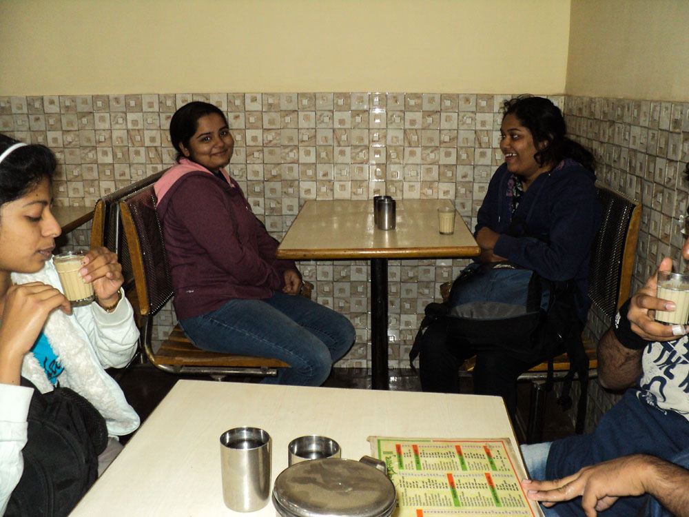
We took a right turn from Neral (east) ticket counter (Left goes to Matheran via Dasturi Naka) and a quick breakfast followed in one of the many restaurants that line up the station road. Cross a bridge and the second left takes you towards the Neral-Badlapur road.

There are two routes to the base hills of Vikatgad- One goes through Anandwadi and the other goes through Dilkap college boundary. You can see the Dilkap college across the road and a bridge on the left.
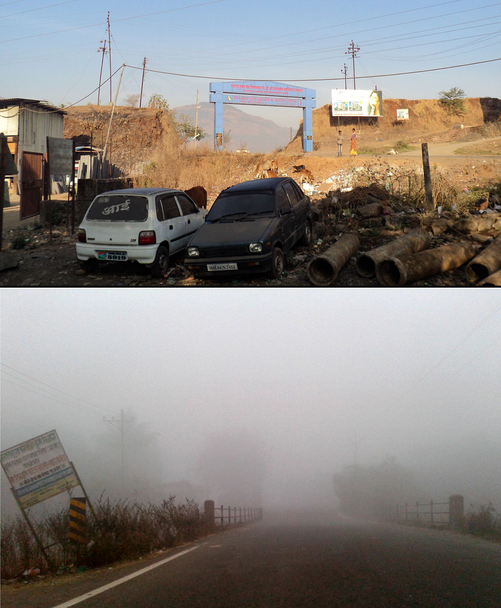
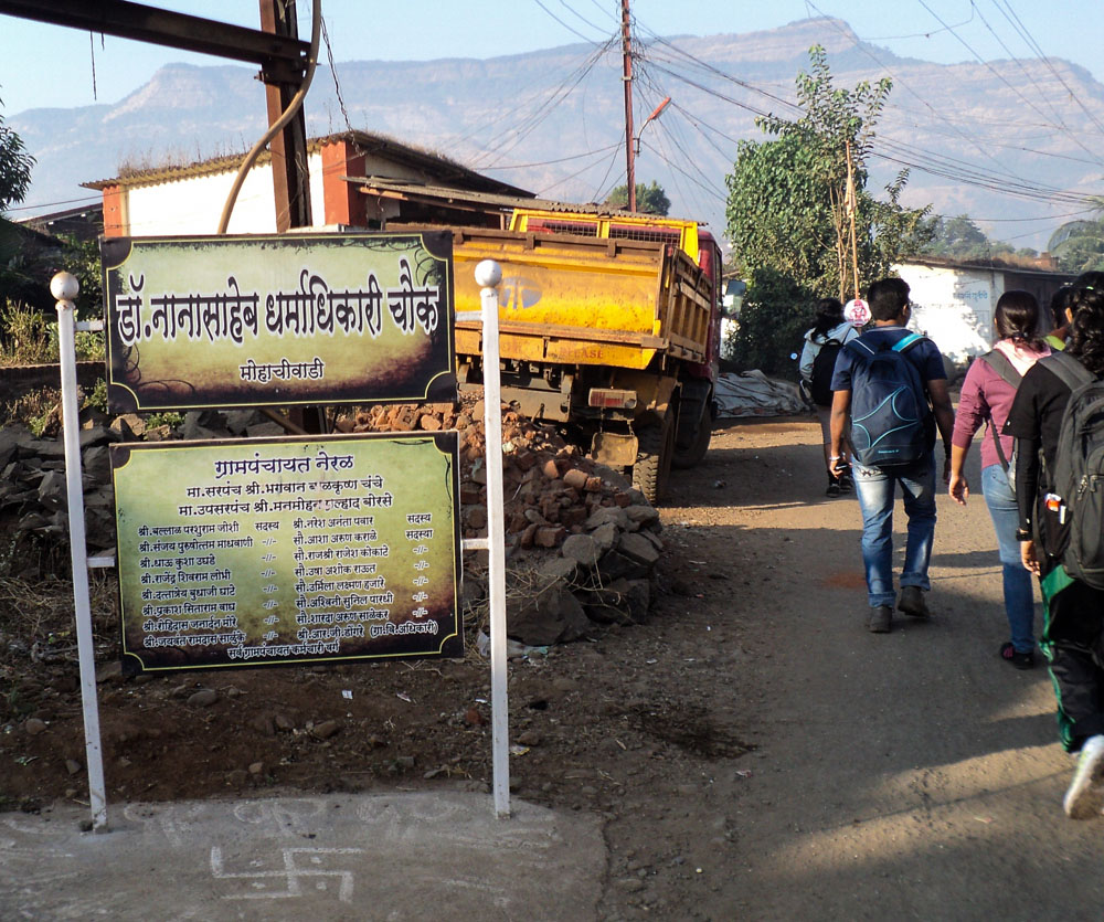
We turned left upon reaching the road and then took the first right after the bridge. Our first landmark was Mohachiwadi-
Base village for Vikatgad is Anandwadi, the way to which is through a broad tarred road from Mohachiwadi. People wanting to cut down the walking distance can take an auto directly till the base village for less than 100 bucks. But we were a cash-strapped lot and besides, what’s the fun in breezing through the roads cocooned in a vehicle when you could as well enjoy the scenic walk? It takes less than an hour to reach and is a pleasure, especially during foggy Monsoon mornings!
The map we were using indicated a right after reaching Anandwadi. About a km before the base village, we saw a small hamlet which is known as Komalwadi.
Taking the right towards the wadi, we reached a dry river bed in 10 mins and criss-crossing through the numerous fields that dot the landscape on the other side of the bed, we made our way to the foothills of Vikatgad.
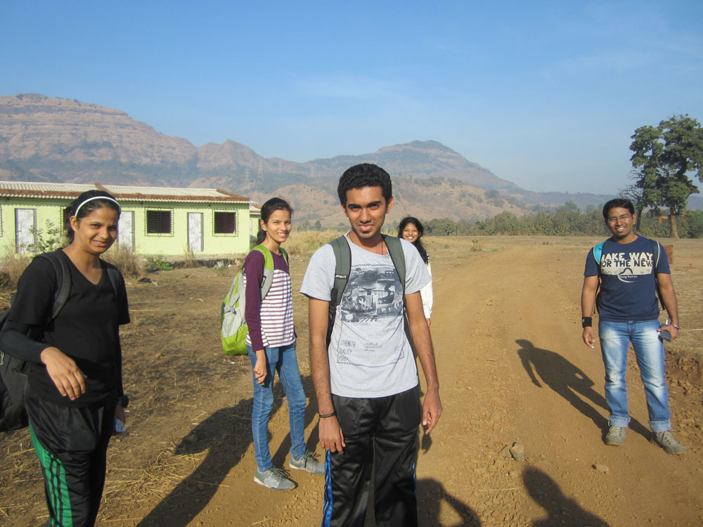
Just as were
approaching the foothills, we walked into the boundary of some
villager’s cow-shed. Unable to find a way out and looking around like
headless chickens brought a good Samaritan out of some nearby hut and he
promptly showed us a detour around a field which was the way to
climbing the base hill and onward to the electric tower with a big
cement base. (If you are going in monsoon, the overgrown grass can make
it tough to find the path- remember this, you climb the hill to the
right of the first elevated tower)
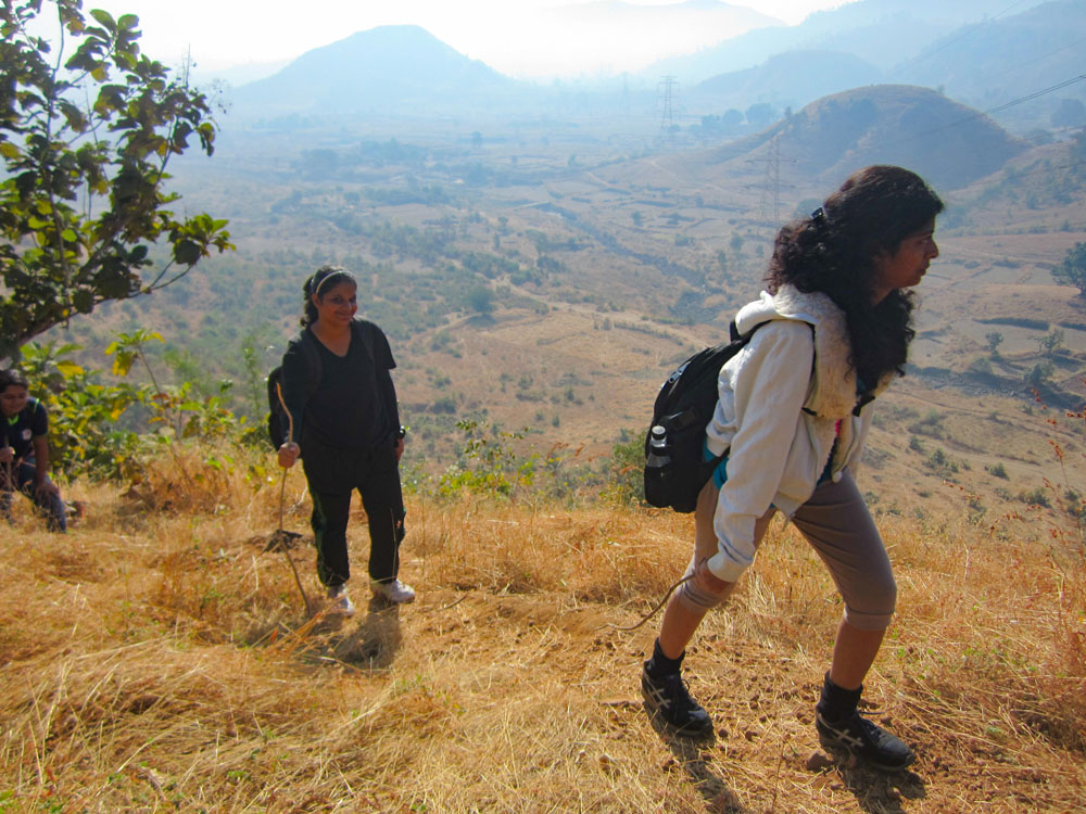
Slowly we started climbing the hill and two key differences between my December rail hike and this trek struck me:
ONE- The short steep climbs can leave us couch potatoes breathless.
TWO- You have to find your way unlike the
hike where you just blindly follow the tracks to Matheran, so this is a
little tough mentally as well.
Since none of us had ever trekked before, save for Mansi and Yogesh, we were struggling and it was Mansi who came up with the idea of picking up a stick to assist in climbing.
Soon we
reached a tower with a huge cement base and climbed a little further
onto a thinly forested plateau where we came across some villagers on
their way back after collecting firewood. It’s a good practise to always
confirm whether you are on the right route with villagers whenever you
get the chance coz here in Sahyadri, the localites are your google maps!
Doing the same, we marched ahead not
knowing that this was going to be our last brush with a fellow human
being for a good 7 hours. Crossing the forest, we reached a clearing
from where one can clearly see the Vikatgad.
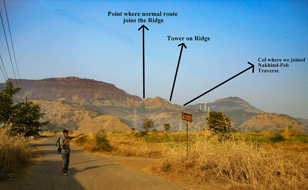
For the Normal route, cross three elevated towers and then you take the path ahead that goes straight from the clearing towards the point shown in the earlier pic. On this route, a prominent landmark is a hollow tree you come across after some distance from the clearing before entering the forest and climbing up a dry waterfall to the left-most col on the ridge.
This is where missed our path for the first time. A lot of blogs advised following the tower route and we did so quite ‘literally’. It’s always prudent to use your instinct and not take a bloggers version to be the last word. (The irony! I know )
NOTE: Sahyadri is home to a dynamic culture and the people in the villages use different paths to reach a certain place, sometimes out of convenience and sometimes out of necessity (e.g. wildfires). So you may come across some new paths that weren’t there when someone else visited a particular place.
We took the path on the right side at the bifurcation since the 4TH tower was on the right of the clearing. Even though it did seem like we had lost the way completely, I came to know later that the route we ended up on, is actually a longer route to Vikatgad that people take when coming from Nakhind towards Vikatgad. Here is a post about my later trek traversing the Nakhind-Vikatgad-Matheran.

(This route of ours will henceforth be referred to as the summer route in this post)
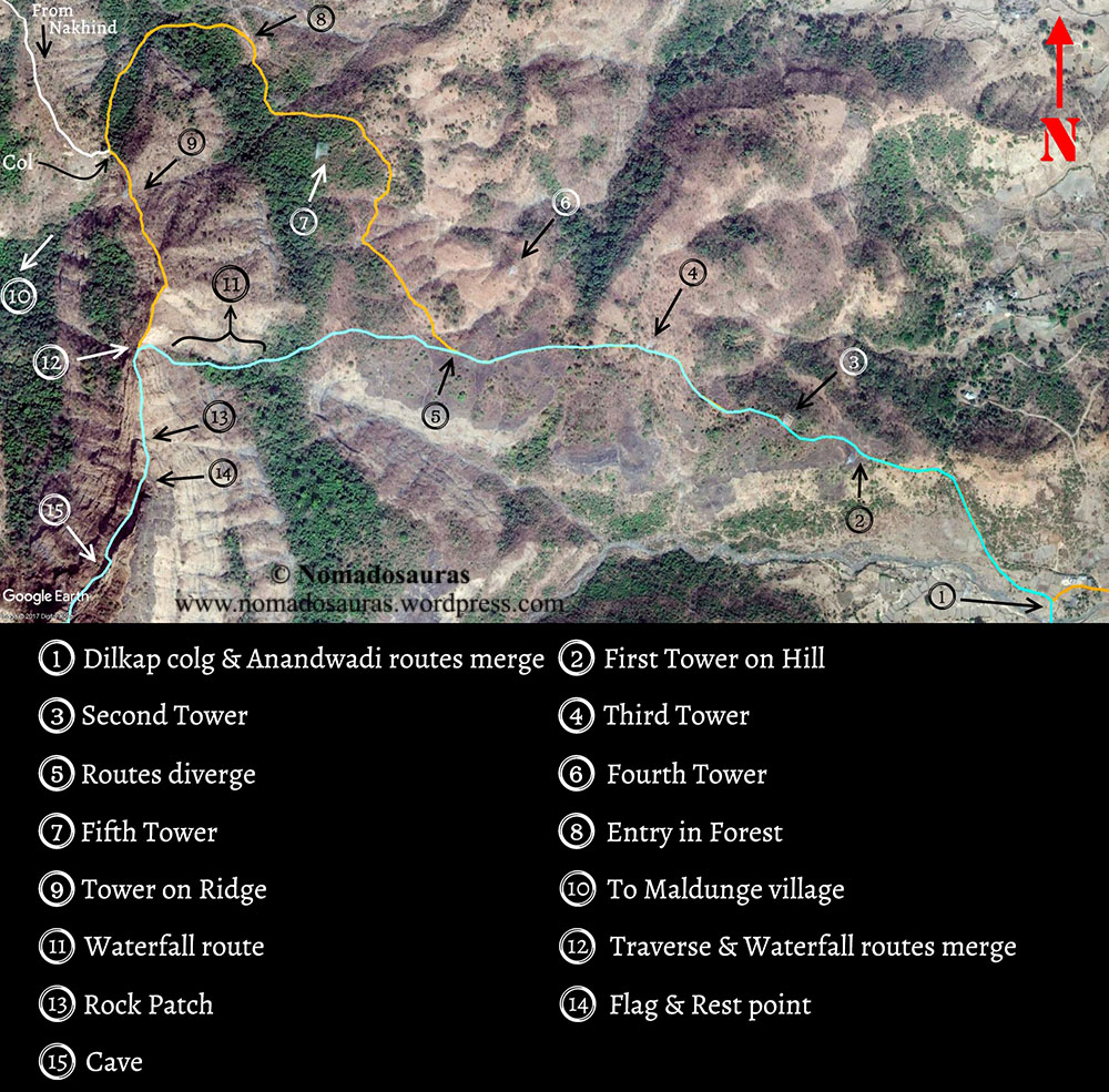
About half hour after crossing the tower lines such that they now lay on our left, we found an opening in the forest on our left that seemed to lead to the col (a depression between two mountains) before the tower on the ridge (landmark 2).

THIS IS WHERE OUR ADVENTURE STARTED!
Taking the forest route which steadily climbed up, we managed to take a lesser used passage and ended up in a path parallel to the correct one.
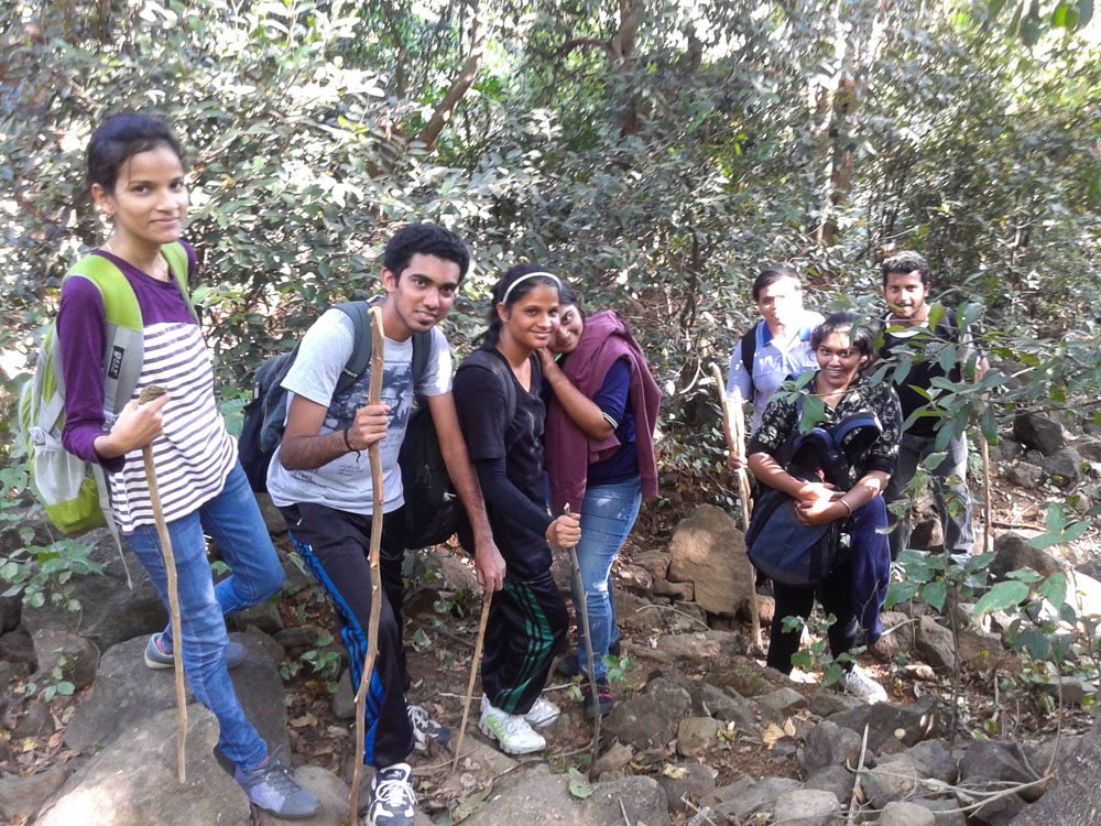
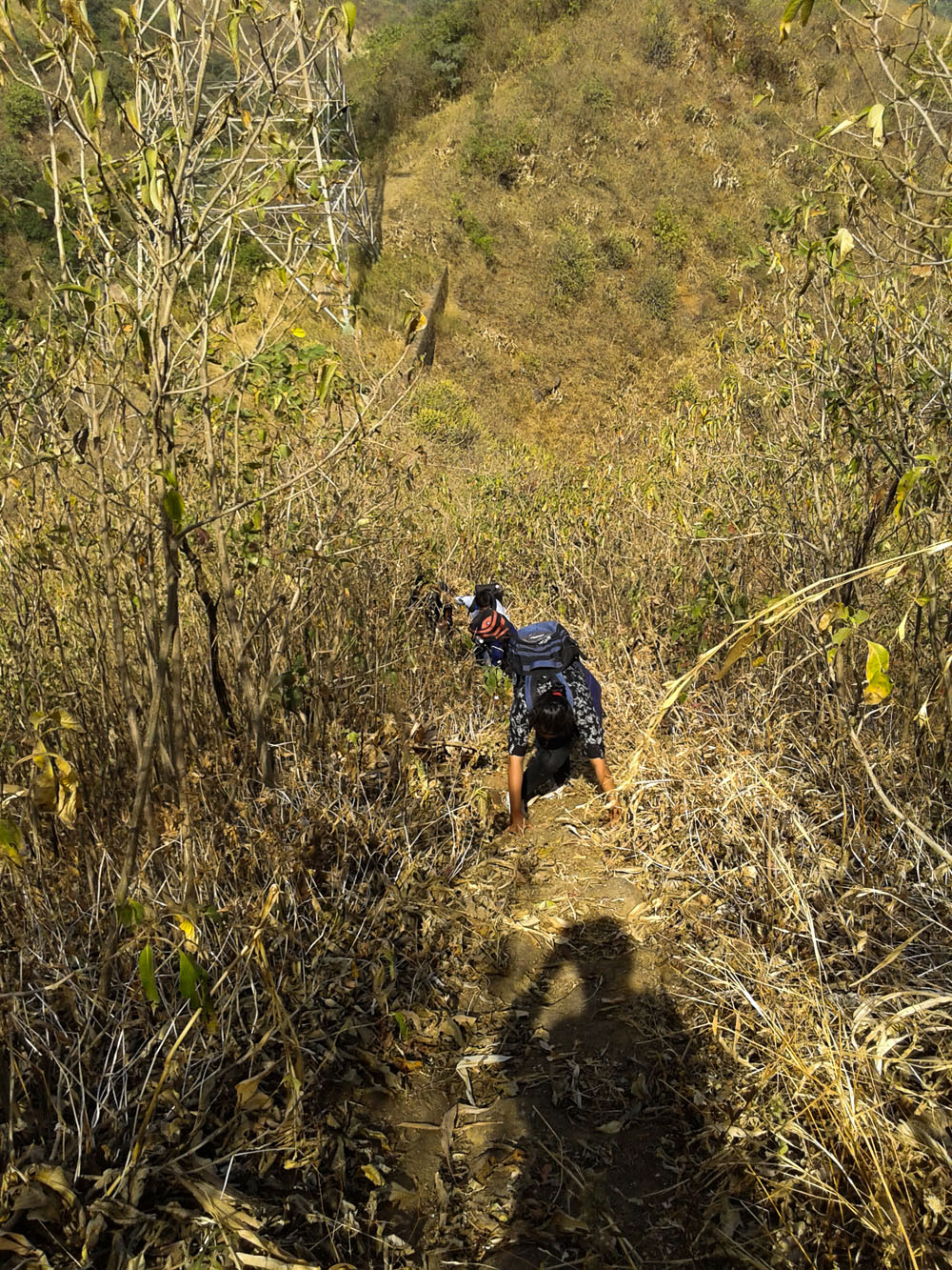
Making our way through thorns, shrubs and cobwebs (which is enough indication to know you have lost the way), we reached a point where you could see the light seeping through the forest but the path ahead was blocked with wild growth. Not wanting to head back with the col so close, I tried to find a way through to the correct path and after looking around for a couple of minutes found a narrow steep way through trees. It wasn’t easy but everybody found their inner COMMANDO and crouched their way through to the correct path in a manner that would have made Indian Army proud!
The Col was barely 5 minutes from this point and we slumped down to take a breather.

My trusty Samsung Core entered ZEN MODE and summoned network out of the blue to start pinging with messages from our classmates. Ironically, the first msg I read was ‘Have a safe trek’ on the class whatsapp group that made me smile recounting the ordeal we had just been through in the last hour. But then it’s the intention that matters after all and it remains a sweet memory!
After getting some Glucon-D (courtesy Aparna who can be seen busy making it in the col picture) in our system, we started towards the tower on the ridge. There are two ways from col. The path that goes down into the valley heads to Dodhani (Base village for the Sunset Point trek to Matheran) and the other one on the left side goes towards Vikatgad. It’s a narrow path and leads you to the tower in 10 mins. The Tower on the ridge, as we had christened it, was our third landmark and its sight barely an hour after thinking we were lost for good felt like a small victory in itself! The grand plans of roaming Matheran after climbing Vikatgad long forgotten, we were enjoying the moments one at a time.
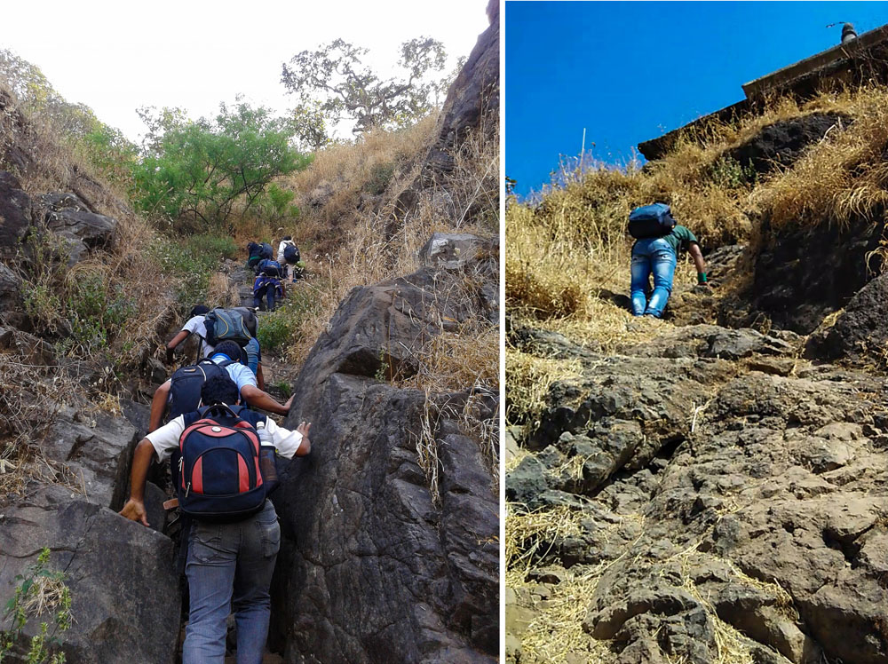
Passing the tower, you see a 25m high 30-degree steep climb up a hill. Ruchit, Mansi, Shruti and me climbed up followed by Akshita, Persis, Aparna, Omkar with Yogesh bringing up the latter part (climbing with his and Aparna’s bag as well). Halfway up the hill, I heard my name. I looked back and told Akshita to go up ahead as I slid down on my haunches towards Persis who was about 6 meters up from the base.
I asked her what’s the matter, and she replied that she couldn’t do it. To be truthful, it wasn’t easy to climb this patch, especially in the first trek. You could see the valley on either side of the ridge with dried plants providing the only cover between you and a 200 feet drop. I told her that going back wasn’t an option. We were closer to Matheran than Neral and I hadn’t been tracking our route on any app so finding our way down the forest was another question I didn’t want to face. The ridge had holds at alternating steps, though only one person could climb at a time.
So I told her that I can’t help her. “Nobody can. Only you can help yourself and You can do it. You have to! There’s no other option”. She looked at the path ahead and said she ‘ll do it. And boy! did she do it! Steadily made her way up like a seasoned trekker. I came down a couple of steps to the place where Aparna was. She was scared of the valley as well. Thankfully, a couple of words of encouragement was all that was needed and she made her way up as well without any help.
Omkar had frozen some feet from where I stood and said he’s scared of heights.
My jaw dropped. I was like you had said you don’t know if you are scared of heights when I had asked before the trek and pat came the reply which is one of the best-remembered lines from the trek: “EVEN I FOUND OUT JUST NOW!”
I had dealt with acrophobia for the better part of my teenage years until my maiden trip to Matheran back in ’11 made me overcome it bit by bit. So I knew what he was going through. Yogesh said he ‘ll help him and told me to go ahead. I made my way ahead and upon reaching the top of the first hill did the enormity of the task in front of us dawn upon me.
Vikatgad stood in front of us in all its majestic glory. If mountains could be given human qualities, Vikatgad had to have plenty of stubbornness- it won’t bend to help you, you had to climb it on its own terms and you ‘ll be duly rewarded. The path ahead was clear till the flag post. A steep descent down the hill followed and we came to a small rock patch with a 5 feet gap in between. Circumventing the rock, you climb and then traverse a couple of small hills (where we had an impossible lunch on a 30’ slope)

A small climb from the last hill brings you to the toughest part of the trek-
The approach
path itself is at an incline and is flanked on both sides by deep
valleys. Couple this with half holds, a narrow ledge between the two
levels and the rock stands like a gate whose purpose is to make sure
that only the ones willing to risk life and limb can gain entry to the
hallowed fort that lies behind it.
Find out how we went past this shortcut to hell/heaven, read the Second part!
NOTE:
- All the pictures used in this post have been clicked by me or my friends, unless stated otherwise.
- The information provided in this post is for informational purposes only. Any reliance you place on such information is therefore, strictly at your own risk. For full Disclaimer and Content (including Images) Policy, click here -> Terms of Use.
All rights reserved © 2016 – present Nomadosauras.
Content (including images) not for reproduction in any form, partial or otherwise.
Read complete disclaimer- Terms Of Use.
Cheers!
Keep Trekking
Trek to Vikatgad aka Peb fort-II

This is part II of the Vikatgad trek series. Read Part 1.
The rock
patch has two levels, one is about 8 feet high and the second is another
7 feet but with a wedge between two rocks at 5 feet from the ledge.
There’s a half foothold to plant your feet while climbing the first
level and then you have pull yourself up the second level on the
strength of your shoulders.
NOTE: Carrying a chord/rope would be a good idea if you are attempting the rock patch during monsoons when the rocks are slippery.
Mansi & Ruchit had scaled the rock without much problem and soon Shruti followed them. Later on we came to know that the people who were waiting for others to come up the rock patch made constructive use of their time by calling 911 from INDIA to call for help!! 100 dial kiya to samajh ata hai but 911?!? Indian help par bharosa hi nahi!
A little help with the feet placement and Persis was up the rock patch. I climbed up the second level after handing over the bags to Ruchit who went on ahead to find the route to the caves along with others. Aparna followed me up the rock with a helping hand and then started the most epic portion of the trek- helping Omkar up the rock!
NOTE: I have noticed it quote often the people scale high rocks by pushing against the surface with one knee. Not only does this make you vulnerable to slipping but can be damaging to your joint in the long term. Whenever you are unable to reach the surface with your feet, look around for footholds at a lower height. Trekkers and Villagers have carved out rocks at intervals at most of the difficult sections on fort trails to make it easier for first timers and kids
Omkar’s running shoes weren’t helping him much on this scree filled terrain. The half holds weren’t confidence inspiring as it is, and it took some convincing to make him trust his feet placement but he somehow made it on to the ledge. Yogesh climbed up behind him and tried to help me help Omkar (HELP-CEPTION! )
So Yogesh was on the ledge and giving Omkar an additional foothold with his hands who was in the wedge now while I was sitting over it and trying to give him a hand hold. Some jostling and amazing contortions later, Omkar was up over the rock! Phew!
Then Yogesh threw his sandals up the rock (yes, he wore sandals and did this trek! Kudos to that guy) so that he could climb the wedge with his feet, giving him more flexibility than sandals. Though the force with which he threw them over a 5 feet distance towards me still makes me doubt his intention!
After negotiating the rock patch, you climb up a sharp inclined ridge for a few metres and come across another a bifurcation. One way goes to the right and another goes straight up to a flagpost.
We initially took the right path but soon came to a place where a tiny exposed patch was there. I decided that it wasn’t a necessary risk and asked Yogesh to go check out the upper route before proceeding on this patch.
It was at this point that Ruchit got a call from home and had a conversation that has become the standard template on ‘HOW TO FREAK OUT YOUR PARENTS WHILE ON A TREK!’
I ‘ll prefer to keep that convo a group secret though!
Meanwhile Yogesh replied in the affirmative about a possible route and we promptly set out for that one.
NOTE: The exposed patch on the lower path
is perfectly safe since there are footholds carved in the rock above it
but the overgrown grass had hidden it from our view. We took the lower
path to the caves on my visit to the fort this year.

The flagpost gave us a 200-degree panoramic view of the surroundings and we traced our path in the landscape below while some took care of their sprains with help of our pooled in medical kit
Beyond the Flagpost is a narrow traverse overlooking a 20 feet pit on the way to the caves. The ledge has a small gap in between and lies beneath a protruding rock.
Everyone completed the traverse with utmost care as a fall, though not fatal, would severely affect mobility due to injuries. A 5 min walk from the traverse brings you to the famed Vikatgad cave big enough to comfortably house 20-30 people for an overnight stay.
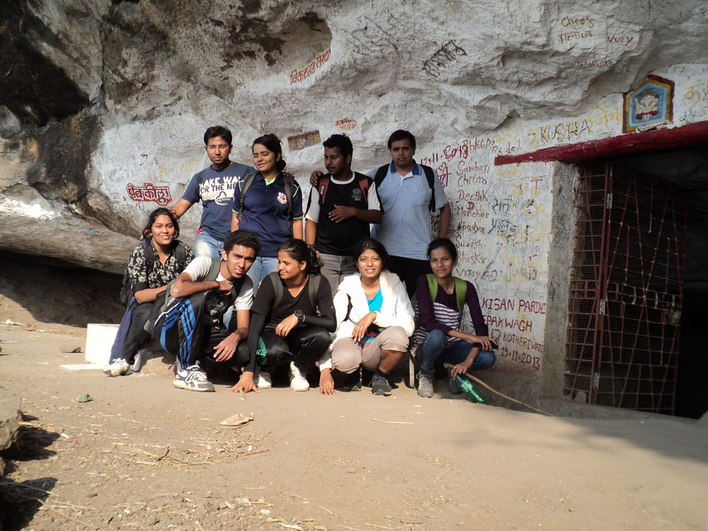
I couldn’t have asked for anything better than the tiled platform outside the cave and slumped there while others caught up. A quick photo session along with a Shivgarjana by Yogesh followed. Just as we were leaving the cave, we heard some noises from people far away in the valley and we tried communicating but to no avail.
Take a left from the cave to arrive upon a ladder fixed on the fort wall. This is one of the few remnants of the fortification. (The ladder is a recent addition to the fort. People used to climb up into the fort with the help of rods inserted in the rock patch beside the wall but I wouldn’t advise anyone to attempt it now as the rods are no longer present making the rock almost a straight slab)
Once you climb up the ladder, there is a flight of stairs. A few feet to its right is a water cistern and a Hanuman Idol.

There is an easy rock patch of about 10 m after the stairs that leads you to a clearing just below the temple.
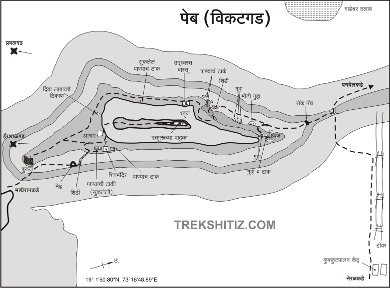
Two routes lead you to the temple from the clearing. if you stand facing the temple, the proper route goes through the bushes on the right and takes you around the edge of the fort onto the small plateau above the bastion as seen in this map made by Sanket Sangwikar & Trekshitiz group.
We tried to take this route but the impending darkness and the narrow path made us turn back mid-way. We took the shorter route straight upto the temple. Most of the blogs I read don’t recommend this route ‘cos of the steepness but we had little choice & after 10 mins, we emerged out of the thin forest and stood within 10 m of the temple. A tricky but easy rock patch separated us from the temple and there stood a Sadhu (Priest) who was looking down upon the nutheads scrambling out of the forest at this unusual hour.

I reached the temple and dumped my bag to watch others follow in quick succession. If you haven’t been to Vikatgad temple, it’s to tough explain in words the awe that the sight inspires in you.
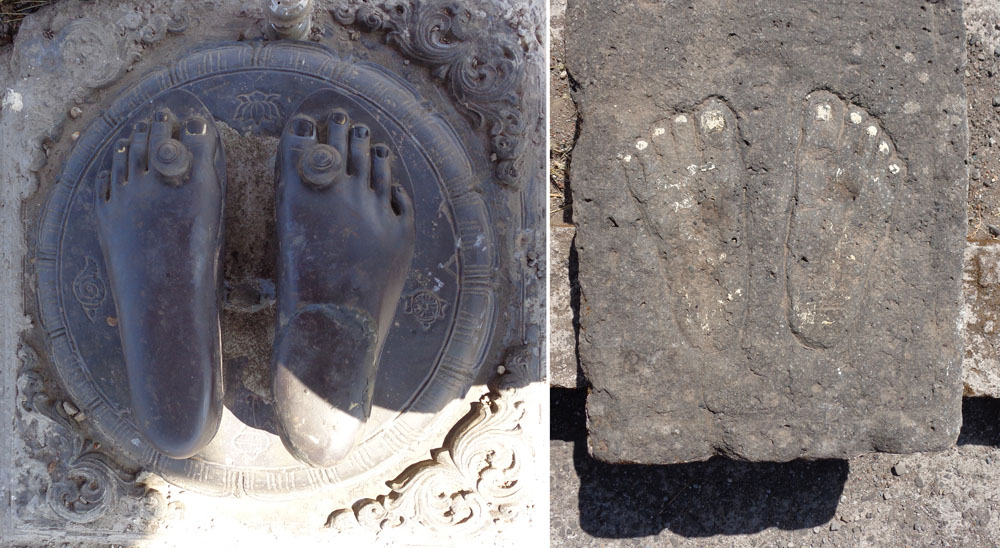
The temple is built to shelter the footprints of swami samarth on the topmost point of the mountain and commands the best view of the entire range. We could see the Central Railway line running through the flatlands far away as well as other mountains of the Matheran range like Prabalgad, Kalavantin Durg, Chanderi, Mhasmal & Nakhind.

It was 5.40 by the time we reached the temple and the sun had started setting. The Temple priest told us that the railway tracks of Matheran were still a good hour away and it ‘ll be pitch dark by 7. I enquired if he was planning to go towards Matheran but he said he lives in the ashram on the fort halfway towards the bastion. Not wanting to spend the night on the fort without any provisions for the same and faced with the prospect of finding our way through the wilderness in the dark, we wasted no time in starting towards Matheran.

Any exposed peak has its set of unique challenges and the Prati Girnar (as the peak of Vikatgad is called for its similarity to the Girnar mountain of Gujarat) is no different. The path ahead of the temple is unique in the sense that it isn’t that narrow but it does taper as you move towards the ladder.

These factors coupled with the sheer drop on either side gives you a sense of walking on a tightrope with no support. The wind had picked up by now and it struck fear in my heart. I somehow held my nerve to negotiate the rickety ladder perched precariously atop two rocks and had just went some distance when Aparna called.
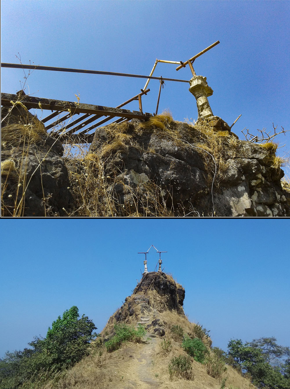
I looked back and to my horror, the sole iron rail pegged there in the name of a handhold decided to play truant and came off its support and she was right in the middle of it! Despite wanting to, my feet refused to budge and thankfully Ruchit, who was standing near me, went back and helped Aparna come down and I heaved a sigh of relief. This incident left me a little shaken and I decided that I wouldn’t let such a situation arise ever again and I would like to believe I have succeeded in that endeavour. (Going over the temple ladder again to overcome my fear was part of the reason I went back to Vikatgad with Rohit a month later).

Once everyone was done with the ladder, we literally started running towards Matheran. We skipped the bastion and instead made way for the path on the left side of the mountain that goes to the double ladder after passing the Ashram mentioned earlier. You can see a Shiv temple on the left of the path just before you reach the Ashram. A narrow path goes to the temple over the edge of several water tanks with the valley on the other side.
A narrow but easy path then leads you to the V shape that is visible even from Anandwadi.
Akshita, Shruti, Ruchit & Persis went
ahead while Mansi helped Aparna and Yogesh helped Omkar over the path
safely. I took a moment to look back and it was here that I got one of
my favourite clicks-

A solitary narrow, tilted path leads to Matheran from the col.

Soon enough, we came across the last ladder of the route.

And then came the time for the tactic which I have had to resort to quite a few times since then- False assurances about the proximity of our next landmark so as to keep the enquirer moving!
This is why the answer to the classic “AUR KITNA DUR?” remains a standard “5 MIN AUR” even an hour after the first time its asked!
Numerous such queries later, we finally reached the stairs I had descended till during my December hike about a fortnight back. The sun had set half hour back and It was almost pitch dark. Despite the meticulous planning, we had overlooked the possibility of getting stuck in darkness before reaching our destination and consequently, did not have a single torch amongst us! (To make sure you don’t end up in a similar predicament, check out this list)
Our cell phones came to the rescue at this point and with the help of their flashes, we passed a small place where some idols are housed and reached the bench near NM 158 at exact 7 pm.
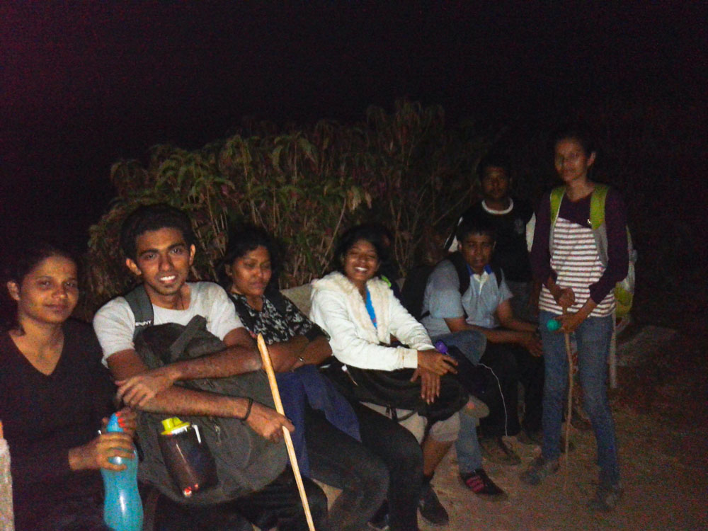
Aman lodge lies about three km from NM 158 marker and somehow everyone willed themselves onto their feet.
Someone asked me if the toy train comes around this time and I promptly said No.
BUT! Indian Railways has a knack of proving
you wrong and within minutes we heard a horn in the distance.
Confirming our suspicions, the gentle engine made it’s not so gentle
entry and while we waited for it to pass, to my shock, my friends
started shouting ‘HELP! Help!’ to the passing train! The driver, clearly
not moved by my friend’s pleas went ahead without even bothering to
slow down and we continued our lonely march to Dasturi Naka
NOTE: If you plan on taking a cab to Neral from Vikatgad and don’t want to visit Matheran, make your way straight to the car park as soon as you see the cars parked alongside the tracks. The ticket collectors at Aman Lodge will otherwise charge you 50 rs entry fee to Matheran even if you don’t cross Aman lodge station.
A kind soul enlightened us about this shortcut and we reached Dasturi car park around 7.45pm and took two cabs to Neral.
Just when I had thought the day had no more drama in store, the 8.01 train left the station as my cab reached Neral. Next train being at 8.56 and the rest of the gang yet to reach in the trailing cab, we decided to go to the same restaurant we had breakfast in the morning to take care of our empty tummies & wait for the others to catch up. As luck would have it, someone from the other cab rang us up and urged us to move our asses into the station asap ‘cos the 8.01 was the next train on the indicator! Omkar gave me a perplexed look and without a second thought, both of us along with Yogesh broke into a run towards the station leaving the bemused Restaurant owner to cancel our yet to arrive order.
It’s funny how your legs get a new life at the prospect of reaching home an hour early but alas! our sprint went in vain as the people at the platform confirmed the train indicator that showed 8.01 as the next train, in fact, referred to the very train I had seen pass earlier and was due to be changed to 8.56 pm.
With nothing to do while we waited for
the train, tiffins were opened and the famished souls that we had
become, squatted on the platform and ate like there’s no tomorrow!
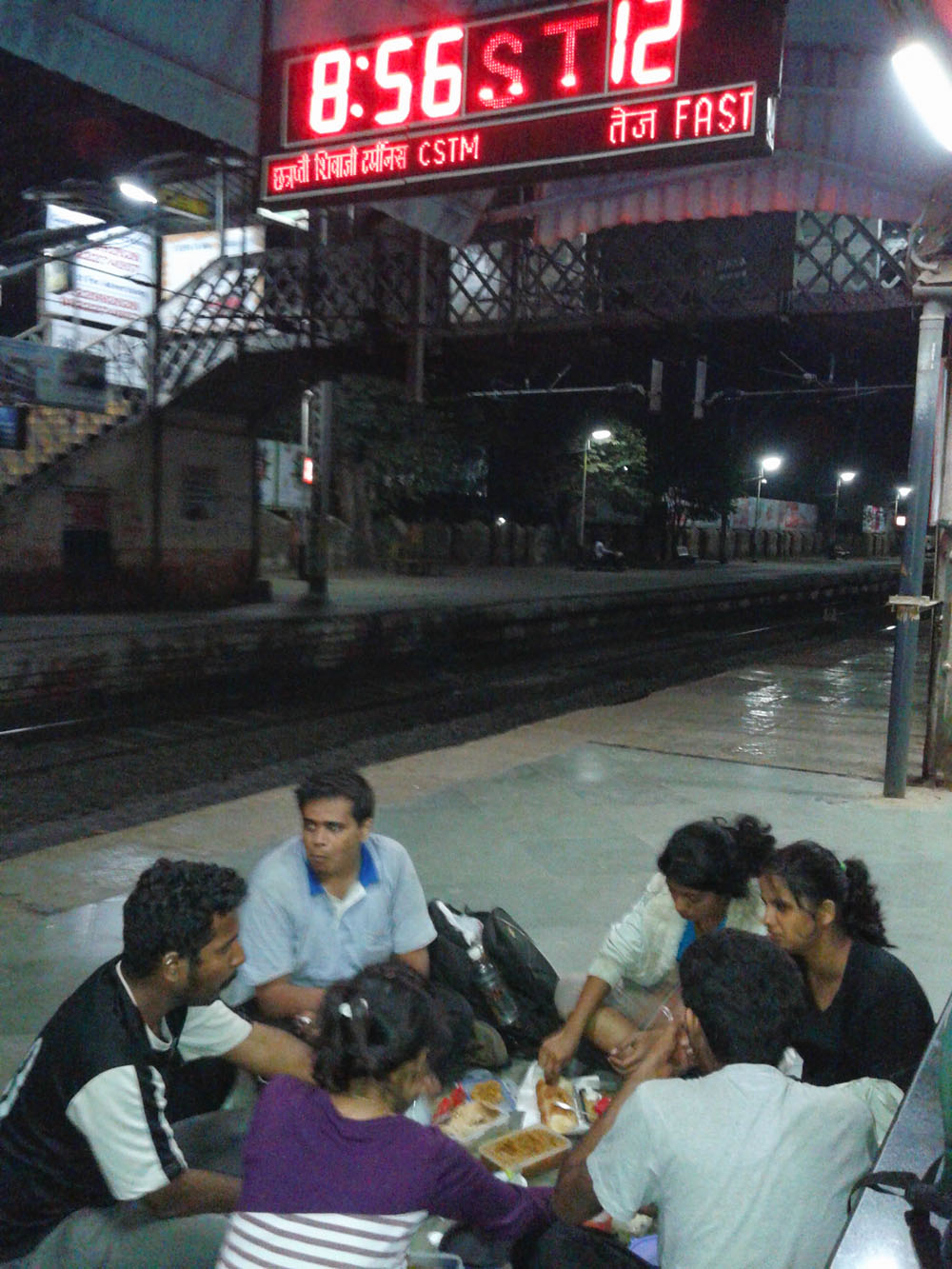
The rest of the journey to our respective
homes was nothing out of ordinary, which seemed like an anti-climax to
the roller coaster day we just had been through!
We were classmates till the morning of the trek, knew each other and spoke a bit (yeah okay, spoke a lot ) but something in those 12 hours made us friends- in the true sense of the word. We looked out for each other, made up for each other’s shortcomings, laughed & winced together. Hell! We even bled a bit on the trek! (Chill, no slasher movie this. I am referring to thorns that pricked us ) So you can even say we forged bonds of blood! I know, a bit OTT but you get what I am trying to say, right? These are moments which are hard to rival. You could spend 2-3 years together and still not bond like we did in those 12 hours. That is the beauty of Sahyadri. Of Mountains. And Of Friendship as well.
Vikatgad was, and remains, one of my favourite one day treks near Mumbai. If you are thinking about visiting it, and have persevered through my extra-long blog post(s), I hope it would have helped you make up your mind either way.
NOTE:
- All the pictures used in this post have been clicked by me or my friends, unless stated otherwise.
- The information provided in this post is for informational purposes only. Any reliance you place on such information is therefore, strictly at your own risk. For full Disclaimer and Content (including Images) Policy, click here -> Terms of Use.
All rights reserved © 2016 – present Nomadosauras.
Content (including images) not for reproduction in any form, partial or otherwise.
Read complete disclaimer- Terms Of Use.
Cheers!
Keep Trekking
(Peb) |
किल्ल्याची ऊंची : 2100 | ||||
| किल्ल्याचा प्रकार : गिरीदुर्ग | डोंगररांग: माथेरान | ||||
| जिल्हा : रायगड | श्रेणी : मध्यम | ||||
पनवेलच्या ईशान्येला,
मुंबई - पुणे मार्गावरील नेरळपासून पश्चिमेला तीन - चार किलोमीटर अंतरावर
पेबचा किल्ला (विकटगड) आहे. गडाखालच्या पेबी देवी वरून या किल्ल्याचे नाव
पेब ठेवण्यात आलेले असावे. माथेरान सारख्या सुंदर थंड हवेच्या ठिकाणा जवळ,
पण माणसांच्या गर्दीपासून दूर असलेला पेबचा किल्ला एका दिवसाच्या ट्रेकसाठी
आदर्श जागा आहे. किल्ला चढण्यासाठी लागणारा वेळ ,चढण्याची वाट, वरील
गुहेची रचना, गुहेसमोरील निसर्गरम्य दृश्य अशा अनेक बाबतीत हा गड अजोड आहे.
पेबच्या किल्ल्याचे विकटगड असे देखील नाव आहे. किल्ल्यावर जाण्यासाठी
नेरळ, माथेरान, पनवेल या तिनही ठिकाणांहून वाटा आहेत.
|
|||||
|
|||||
| इतिहास : | |||||
| या किल्ल्याचे मूळ नाव "पेब" हे
नाव पेबी देवीवरून पडले असावे. किल्ल्यावरील गुहेचा शिवाजी महाराजांनी
धान्य कोठारांसाठी उपयोग केला होता, असा स्पष्ट ऐतिहासिक संदर्भ पेबच्या
किल्ल्याबाबत आढळतो. |
|||||
| पहाण्याची ठिकाणे : | |||||
|
पेबचा किल्ला नेरळ किंवा पनवेल मार्गे चढून आल्यावर आपल्याला डाव्या
बाजूला एक प्रचंड गुहा दिसते. या गुहेत साधारणत: १०० जण राहु शकतात. या
गुहेच्या बाजूला चौकोनी तोंड असलेल्या गुहा आहेत. या गुहांमध्ये रांगत जाता
येते. यातील एका गुहेत खालच्या बाजूला एक माणूस बसू शकेल इतकी छोटी खोली
आहे. मोठ्या गुहेच्या वरच्या बाजूस सुध्दा अशाच प्रकारच्या गुहा आहेत.
त्यापैकी शेवटच्या गुहेच्या आत टोकाला पाण्याच टाक आहे. ( मोती गुहा सोडून
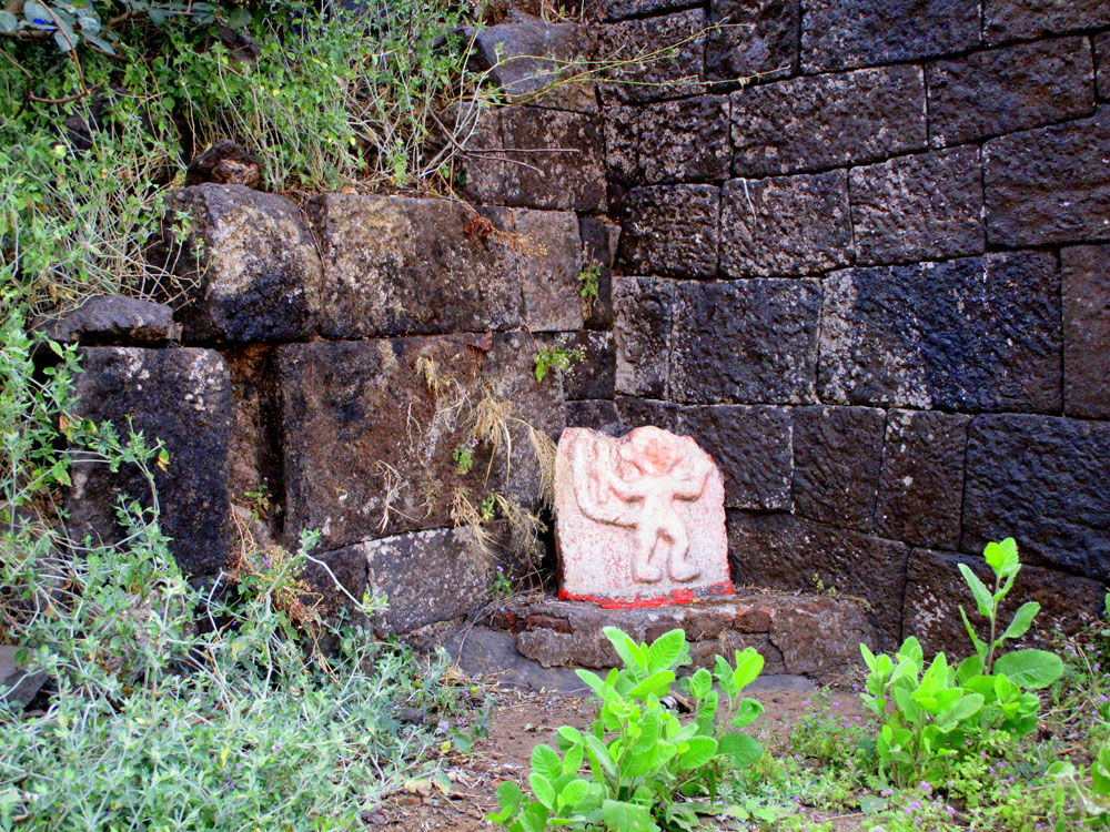
इतर सर्व गुहांमध्ये जाण्यासाठी विजेरी आवश्यकता आहे.) या गुहा पाहून पुढे गेल्यावर तटबंदीच्या भिंतीचे अवशेष दिसतात. त्यावर चढून जाण्यासाठी एक शिडी आहे. या शिडीवर न चढता खालच्या बाजूस गेल्यावर कातळात खोदलेली २ पाण्याची टाक पाहायला मिळतात.पुन्हा शिडीजवळ येऊन शिडी चढून गेल्यावर उजव्या हाताला पाण्याचे कातळात खोदलेले टाक आहे. त्याच्या बाजूलाच हनुमानाची मुर्ती आहे. येथून वर चढून उजव्या हाताला वळल्यावर वास्तुंचे अवशेष आहेत. तिथून पुढे गेल्यावर आपण दत्तमंदिरा/ आश्रमा जवळ पोहोचतो. या मंदिराच्या बाजूने किल्ल्याच्या सर्वोच्च टोकावर जाण्याची वाट आहे. या वाटेवर एक शिडी आहे. ही शिडी चढून गेल्यावर आपण किल्ल्याच्या सर्वोच्च टोकावर पोहोचतो. येथे दत्ताच्या पादुका आहेत. येथून पूर्वेकडे नेरळ व उल्हास नदी , पश्चिमेकडे गाडेश्वर तलाव, पनवेल, उरण, उत्तरेकडे म्हैसमाळ ,चंदेरी, ताहूली ही डोंगररांग व दूरवर मलंगगडाचे सुळके दिसतात. दक्षिणेकडे माथेरनचा डोंगर व प्रबळगड दिसतो. पादुकांचे दर्शन घेऊन परत दत्तमंदिरा जवळ येऊन गडाच्या दक्षिण टोकाकडे जावे. येथे गडावरील एकमेव बुरुज आहे. माथेरान मार्गे गडावर येतांना आपण या बुरुजा खालून येते. बुरुज पाहून परत दत्तमंदिरा जवळ येउन खालच्या बाजूला गेल्यावर कड्याजवळ २ पाण्याच्या कोरडी टाकं आहेत. या टाक्र्यांच्या पुढे महादेवाचे मंदिर आहे. मंदिराच्या भिंतीवर पेबी देवीची मुर्ती कोरलेली आहे. मंदिराच्या बाजूला थंडगार पाण्याचे टाक आहे. या टाक्याच्या भिंतीवर यक्ष प्रतिमा कोरलेली आहे. या ठिकाणी आपली गडफेरी पूर्ण होते. येथून आल्या मार्गाने किल्ला उतरुन नेरळ किंवा पनवेलला जाता येते किंवा बुरुजा खालच्या वाटेने माथेरान - नेरळ रस्त्यावर पोहोचून नेरळला जाता येते. | |||||
| पोहोचण्याच्या वाटा : | |||||
| १) नेरळ मार्गे :- पेबला जाण्यासाठी मध्य रेल्वेवरील नेरळ स्टेशनला उतरावे. नेरळ स्टेशनवर उतरल्यावर, समोरच माथेरान आणि त्याच्या बाजूस पेबच्या किल्ल्याचे दर्शन होते. स्टेशनच्या बाहेर आल्यावर माथेरानच्या दिशेला न जाता उजवीकडची (मुंबईच्या दिशेची ) वाट पकडावी. या वाटेने डोंगराच्या दिशेने जाताना प्रथम ओढ्यावरील पुल, मग मैदान, पोल्ट्रीफार्म या मार्गे आपण १५ मिनीटात कातकरवाडीत पोहोचतो. येथे मुख्य रस्ता सोडून समोर दिसणार्या इलेक्ट्रीकच्या टॉवरच्या दिशेने मार्गक्रमण करावे. सिमेंटचा एक मोठा पाया असलेला टॉवर आल्यावर तेथून थोडे पुढे गेल्यावर एक मोठा धबधबा लागतो. या धबधब्याजवळ आपल्याला ३ वाटा लागतात. १) धबधब्याला लागून असलेली वाट २) मधून गेलेली मुख्य वाट ३) टॉवर्सला लागून असलेली वाट या तीन वाटांपैकी मधली मुख्य वाट हीच किल्ल्याच्या गुहेपर्यंत नेणारी खरी वाट आहे. पहिल्या वाटेने पुढे गेल्यास जंगल लागते पण पुढे या वाटेने जाणे अशक्य आहे. तिसरी वाट म्हणजे मानेला वळसा घालून घास घेण्यासारखा प्रकार होय. तसेच या वाटेला पनवेलकडे जाणारे फाटे फुटत असल्याने वाट चुकण्याची शक्यता जास्त आहे. मधून जाणारी वाट पकडावी या वाटेने गणपतीचे चित्र काढलेला दगड येतो या दगडाच्या उजव्या बाजूने वर चढावे. हीच वाट पुढे झर्या,ची होत असली तरी, ही वाट न सोडता याच वाटेने खिंडीच्या दिशेने वाटचाल करावी. या खिंडीत पनवेलहून येणारी वाट येउन मिळते. खिंडीत पोहोचल्यावर तेथून डाव्या हाताला वळून पुढे जावे. तेथून पुढे पांढरा दगड लागतो. पांढरा दगड चढण्यास कठीण असून तो पार केल्यानंतर मात्र पुढे थोड्याच अंतरावर गुहा लागते. प्रथमच जाणार्र्यांनी वाटाडया घेणे हितकारक आहे. किल्ला चढण्यास दोन ते तीन तास लागतात. २) माथेरान - नेरळ रस्ता मार्गे :- माथेरान - नेरळ रस्त्यावर आणि रेल्वे मार्गावर " वाटर पाईप " स्टेशन आहे. या स्टेशन नंतर रेल्वे लाईन रस्त्याला जिथे आडवी जाते, तिथे " पेब (विकटगड) / प्रती गिरनार " ला जाण्याचा मार्ग असा बोर्ड लावलेला आहे. येथ पर्यंत एसटी किंवा खाजगी वाहनाने पोहोचता येते. या ठिकाणाहून रेल्वे मार्गाने चालायला सूरुवात केल्यावर थोड्याच वेळात डाव्या हाताला वरच्या बाजूस " माथेरानचा पॆनोरमा पाँईंट" दिसायला लागतो. पुढे वळसा घेऊन रेल्वे लाईन एका खिंडीत पोहोचते. ही खिंड पार केल्यावर उजव्या बाजूस पेब किल्ला दिसतो.थोडे अंतर चालल्यावर उजव्या बाजूला लोखंडाची भगव्या रंगाची कमान दिसते. रस्त्यापासून कमानी पर्यंत पोहोचण्यास पाऊण तास लागतो. कमानीतून खाली उतरण्याकरीता पायर्या आहेत. या पायर्या उतरल्यावर पहीली शिडी लागते. शिडी उतरल्यावर वाट डोंगराच्या कडेकडेने पेब व माथेरानचा डोंगर र्यांच्या मधील खिंडीत येते. येथून समोर गडावरील एकमेव बुरुज दिसतो. पुढे दुसर्या शिडी जवळ कातळभिंतीत एक नेढ आहे. ही शिडी चढल्यावर आपण महादेवाचे मंदिराजवळील पाण्याच्या टाक्र्यांपाशी पोहोचतो. या मार्गाने किल्ल्यावर पोहोचण्यास १.३० ते २ तास लागतात. | |||||
| राहाण्याची सोय : | |||||
| किल्ल्यावर गुहेमध्ये ५० जणांच्या राहाण्याची सोय होते. पण रात्री येथे उंदरांचा फार त्रास होतो. | |||||
| जेवणाची सोय : | |||||
| जेवणाची सोय आपण स्वत: करावी | |||||
| पाण्याची सोय : | |||||
| १) मोठ्या गुहेजवळील शिडी जवळ असलेले पाण्याच्या टाक्यातील पाणी पिण्या योग्य आहे. २) महादेव मंदिराच्या बाजूला थंडगार पाण्याचे टाक आहे. | |||||
| जाण्यासाठी लागणारा वेळ : | |||||
| १) नेरळ मार्गे, पायथ्यापासून ३ तास लागतात. २) माथेरान - नेरळ रस्ता मार्गे १.३० ते २ तास लागतात. | |||||
| जाण्यासाठी उत्तम कालावधी : | |||||
| या गडावर कोणत्याही ऋतूत जाता येते. | |||||
विकटगड
प्रकार : गिरीदुर्ग
जिल्हा : रायगड
उंची : २१५० फुट
श्रेणी : मध्यम
चकवणारा ‘विकटगड’
विवेक जाधव - Jadhavkalpana45@gmail.com
कोकण म्हटलं की, आपल्या नजरेसमोर येतो अथांग निळाशार समुद्र. कोकणच्या चिंचोळ्या प्रदेशाच्या पश्चिमेला अरबी समुद्र तर पूर्वेला सह्याद्री पर्वताचा वेढा आहे. त्यामुळे कोकण हा प्रदेश जैवविविधता, निसर्गसंपन्नतेने समृद्ध असा प्रदेश आहे. अरबी समुद्र अन् सह्याद्री पर्वत याच्या मधोमध असलेल्या ४० ते ६० किलोमीटरच्या प्रदेशात अनेक नद्या वाहतात. त्यातील महत्त्वाची नदी म्हणजे उल्हास नदी होय. उल्हास नदीचा उगम राजमाची टेकड्यांवर होतो. पुढे ती वाहत जाऊन वसईच्या खाडीला मिळते. याच नदीला भातसा, काळू, मुरबाडी, पेज, पोशीर, शिलार, भिवपुरी आदी उपनद्या येऊन मिळतात. त्यामुळे उल्हास नदीच्या खोऱ्याला भौगोलिक विशेष महत्त्व प्राप्त होते. उल्हास नदीच्या खोऱ्याला लागूनच कर्जत, बदलापूरसारखी ऐतिहासिक महत्त्व असलेली शहरे आहेत. त्याचबरोबर उल्हास नदीच्या खोऱ्यात सह्याद्रीचाच भाग असलेली माथेरान डोंगररांग आहे.
माथेरानची डोंगररांग कल्याणच्या मलंगगडापासून सुरू होते. याच रांगेत ताहुली पीक आहे. पुढे बदलापूरची डोंगररांग आहे. नवरानवरीची डोंगररांग, चंदेरीचा उभा सुळका, म्हैसमाळ, नाखिंद खिंड अन् पेब विकटगड याच रांगेत आहे. भिवगड, सोंडाई किल्ला, इर्शाळवाडी, प्रबळगड हेदेखील आजूबाजूच्या परिसरात पहुडलेले आहेत. त्यामुळे दर पावसाळ्यात ट्रेकिंगसाठी मुंबई, ठाणे अन् पुणेकरांची पावले उल्हास अथवा कर्जत व्हॅलीकडे वळतात.
मी २०१८ मध्ये घाटकोपरहून बदलापूरला राहायला आलो. त्यानंतर दोन वर्षांनंतर कोरोनामुळे टाळेबंदी लागली. या टाळेबंदीच्या काळात अनेक गोष्टींवर निर्बंध होते. जगभरातील सर्व व्यवहार ठप्प होते. त्यानंतर काही महिन्यांनी निर्बंधांमध्ये शिथिलता आणली. याच गोष्टीचा फायदा घेत, मी वर्क फ्रॉम होमची कामे आटोपून माथेरानच्या डोंगररांगांमध्ये भटकंतीला जात असे. लॉकडाऊनच्या काही दिवस आधीच दादा ओमानहून भारतात आला होता. टाळेबंदी लागल्याने त्याला पुन्हा ओमानला जाणे अशक्य होते. तोही भारतात अडकून पडला होता.
त्यामुळे टाळेबंदीच्या काळात दर शनिवार-रविवारी आम्ही दोघेच माथेरानच्या डोंगररांगांमध्ये भटकंतीला जात असू. त्या काळात आम्ही बदलापूरच्या आजूबाजूचा परिसर अक्षरश: पिंजून काढला होता. अनेक नवी ठिकाणेही शोधून काढली होती. बदलापूर परिसरात अनेक अज्ञात पर्यटनस्थळे आहेत. छोटे-मोठे धबधबे, ओढे, धरणे, बंधारे आहेत.
ताहुली पीकच्या पाठीमागचा भाग घनदाट जंगलाने वेढलेला आहे. बदलापूर स्टेशनहून पूर्वेला आलात, की बदलापूर-पनवेल हायवेला, जुन्या पेट्रोलपंपापासूनच काहीच अंतरावर एक छोटीशी टेकडी चढल्यावर एक छोटंसं मंदिर लागतं. त्याच्या पाठीमागे जंगल आहे. मलंगगडापासून सुरू झालेली हीच ती डोंगररांग पुढे नेरळजवळील माथेरानला मिळते. याच डोंगररांगेत एक अतिशय महत्त्वाचा पण सुरुवातीच्या काळात दुर्लक्षित राहिलेला विकटगड आहे. याला पेब किंवा प्रतिगिरनार असेही म्हणतात.
नेरळ स्थानकापासून दोन ते तीन किलोमीटर अंतरावर विकटगडाकडे जायचा बेस कॅम्प आहे. आम्ही नेरळला बाइकने आल्यावर छत्रपती शिवाजी महाराजांच्या पुतळ्याच्या इथे आलो. तिथून उजवीकडे गेल्यावर शिवाजी मैदान आणि जिजामाता तलाव दिसतो. तिथून मुख्य रस्त्यावर आलो, की समोरच गणेश घाट आहे. गणेश घाट ओलांडल्यावर सरळ पायवाट दिसते. तिथे पुढे गेल्यावर मंदिर आहे. मंदिराच्या डाव्या बाजूने जायला पायवाट आहे. या पायवाटेच्या पुढे डांबरी रस्ता लागतो. तिथून डावीकडे वळल्यावर एक टॉवर आहे. पुढे याच टॉवरच्या बाजूने जाण्यासाठी पायवाट आहे. पुढे काही अंतरावरच नदीवरचा पूल लागतो. पुढे थोडीशी चढण चढल्यावर पठार लागतं; मात्र अनेकदा विकटगडावर जायला रस्ता सापडत नाही.
अनेक जण भरकटतात. वाट चुकलेल्यांचे अपघातही झाले आहेत. त्यामुळे सोबत गाईड किंवा अनुभवी ट्रेकर नसेल तर इथे जाणं टाळा. विकटगडाच्या वाटेवर दगडांवर बाण दाखवलेल्या खुणा आहेत. त्यामुळे नवखे असाल तर अशा खाणाखुणा सापडतील त्या वाटेवरून पुढे जावं. तसं नाही केलं तर रस्ता चुकण्याची दाट शक्यता असते. असे रस्ता चुकलेले वाटसरू आपल्याला विकटगडावर सापडतातच. एकदा रस्ता चुकल्यावर पुन्हा खाली उतरून चढायला सुरुवात करावी लागते. पावसाळ्यात तुम्ही ट्रेकिंगला गेला असाल तर चुकूनही ओढा पार करून जायचं नाही. तो चकवा आहे. त्याउलट आहेच त्याच वाटेने सरळ जावं.
पुढे काही अंतरावर गेल्यावर रस्त्यावरून इंग्रजी व्ही आकार दिसतो. तिथवर पोहोचता येतं. उजव्या बाजूला खोल दरी आहे, तर डाव्या बाजूला चढण आहे. पुढे दगड चढून गेल्यावर १५ ते २० मिनिटांच्या अंतरावर गुहा दिसतात. या गुहेत स्वामी समर्थांचे मोठे चित्र आहे. तसेच छत्रपती शिवाजी महाराजांचा अर्धाकृती पुतळा आहे. भिंतीवर स्तोत्र आणि आरत्या लिहिलेल्या आहेत. एका वेळी ५० पेक्षा अधिक लोक या ठिकाणी मावतील इतकी जागा या गुहेत आहे. पुढे काही अंतरावरच तटबंदी चढण्यासाठी एक शिडी लागते. तटबंदीच्या उजवीकडे पाण्याची टाकी आहे; मात्र ते पिण्यायोग्य नाही. त्याच्या उजव्या बाजूला हनुमानाची मूर्ती आहे.
येथून वर चढल्यावर उजव्या हाताला वास्तूंचे पडके व जीर्ण अवशेष दिसतात. तिथून पुढे गेल्यावर आश्रमाजवळ पोहोचता येते. याच मंदिराच्या बाजूने विकटगडावर जाण्यासाठी वाट आहे. याच वाटेवर पुन्हा एक शिडी लागते. ती चढून गेल्यावर किल्ल्याच्या सर्वोच्च टोकावर पोहोचतो. याच ठिकाणी दत्तांच्या पादुका आहेत. त्यामुळेच विकटगडाला प्रतिगिरनार असेही म्हणतात.
मी जेव्हा जेव्हा पावसाळ्यात विकटगडावर जातो, तेव्हा येथील निसर्गसौंदर्य अन् धो-धो कोसळणारा पाऊस पाहून ना. धों. महानोर यांच्या
‘येता पावसाळी झड
न्हाली गुलालात माती
पंखपिवळ्या पानांत
थेंब थेंब झाले मोती’
या ओळी आवर्जून आठवतात.
विकटगडावरून उल्हास नदीचे निसर्गसंपन्नतेने नटलेले विलोभनीय खोरे दिसते. तर पश्चिमेला गाडेश्वर, पनवेल, उरणचा प्रदेश दिसतो. उत्तरेला म्हैसमाळ, चंदेरी, ताहुलीची डोंगररांग अन् दूरवर मलंगगडाचे सुळके दिसतात. माथेरानची डोंगररांग, प्रबळगडही नजरेस पडतो.
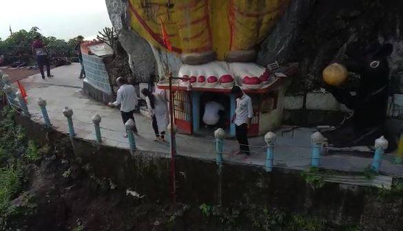
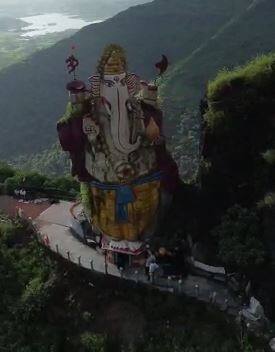
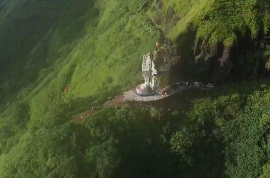
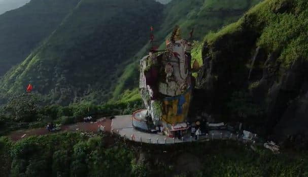
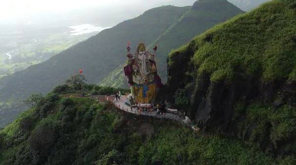
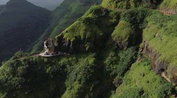
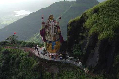
तुम्ही माथेरानमार्गे गडावर येत असाल तर दत्तमंदिराजवळ खालच्या बाजूस गेल्यावर दोन पाण्याच्या टाक्या दिसतात. या टाक्यांच्या पुढे महादेवाचे मंदिर आहे. मंदिराच्या भिंतीवर पेब देवीची मूर्ती कोरलेली आहे. याच देवीच्या नावावरून याला पेब किल्ला असेही म्हणतात. पेबला जाताना कड्यावरच्या गणपतीचे दर्शनही घेता येते. अशाप्रकारे तुमची गडप्रदक्षिणा पूर्ण होते.
नेरळ-माथेरान मार्गावर भव्य निसर्गराजा गणपती साकारणारे 'पायलट' खडे काका काळाच्या पडद्याआड




No comments:
Post a Comment