
तसेच या आकृत्या कोरण्यामागे काय कारण होते, त्या कशासाठी कोरल्या, कशा पद्धतीने कोरल्या, इत्यादी अनेक प्रश्न आजच्या तारखेला अज्ञात आहेत.
कोकणातील कातळ खोदचित्रामध्ये प्राणी, पक्षी, मासे, इत्यादी आकृत्या प्रामुख्याने चित्रित केल्या आहेत. त्यामुळे शिकारी आणि मासेमारी करून उपजीविका करण्याच्या काळातील ही कला असावी, असा कयास करता येतो.
कोकणातील ही कातळशिल्पे अरबी समुद्र आणि लगतचा सह्याद्री या भूभागातील रत्नागिरी ते सिंधुदुर्ग परिसरातील जवळपास १७० किमी लांब आणि २५ किमी रुंद पट्ट्यात आढळली आहेत. पुढे गोवा आणि कर्नाटकामध्येही कातळशिल्पे आहेत.


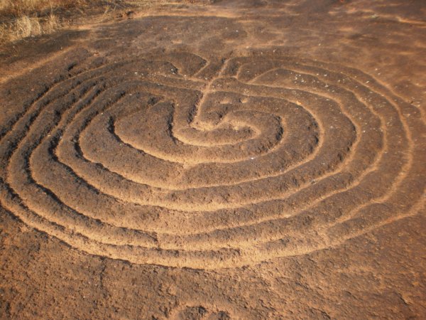
प्राण्यांचे आकार हे जिवंत प्राण्याच्या आकाराएवढे खोदलेले दिसतात. काही ठिकाणी हत्ती आणि वाघ यांचे केलेले अंकन अचंबित करते. त्याचा अर्थ ज्या काळात ही चित्रे खोदली गेली त्याकाळात त्या परिसरात हत्ती आणि वाघ हे असणार! मगर, कासव आणि मासे यांची चित्रेसुद्धा आढळतात. स्थानिक लोकांच्या समजुतीनुसार ती खोदचित्रे पांडवांनी वनवासात असताना खोदलेली आहेत. किंवा ती चित्रे तत्कालीन शेतकरी व मेंढपाळ यांनी त्यांच्या पशुधनाच्या रक्षणासाठी खोदली असावीत.अनेक ठिकाणी आश्चर्यकारक अशा प्रमाणबद्ध भौमितिक अमूर्त रचना सापडल्या आहेत. अशा रचना कोरणारा मानव प्रगल्भ असला पाहिजे. बऱ्याचशा रचनांमध्ये चौकोन किंवा आयतांमध्ये आणखी काही चौकोन आखून त्यात नागमोडी रेषा खोदलेले शिल्पपट्ट आढळतात. गूढ नकाशांप्रमाणे या रचना भासतात. काही ठिकाणी वर्तुळे (circles), चक्री वर्तुळे (spirals), चक्रव्युह ( labirynths ) आढळून येतात. यांचा संबंध आकाशातील ग्रहतारे यांच्याशी किंवा खगोलांशी असावा का, हासुद्धा विचार करण्यासारखा प्रश्न आहे.


मात्र त्याचं नेमकं उत्तर अद्याप पुरातत्वशास्त्रज्ञांकडे नाही. कारण त्यासाठी ज्या दगडी हत्यारांनी ही चित्रं खोदली गेली, ती सापडावी लागतील आणि मग कार्बन डेटिंगनं त्यांचं नेमकं वय समजू शकेल. काही मोजक्या ठिकाणी ही हत्यारं सापडायला सुरुवात झाली आहेत, पण त्यांचा प्रगत अभ्यास नुकताच सुरू झाला आहे. पण या कातळशिल्पांच्या दर्शनी अभ्यासावरून आणि आजवर जगभरात इतर झालेल्या अभ्यासाच्या आधारे कोकणातल्या चित्रांच्या कालखंडाचा कयास करता येतो.
भविष्य आणि संरक्षण :-
रत्नागिरी जिल्ह्यामधील रत्नागिरी, राजापूर आणि लांजा या तीन तालुक्यांत जवळजवळ दोनशेऐंशीपेक्षा जास्त खोदचित्रे सापडली आहेत. त्यांच्या सोबतच काही देवता, जसे की गोपद्म आणि लज्जागौरी यांचे केलेले अंकन हे आश्चर्यचकित करते.प्राण्यांचे आकार हे जिवंत प्राण्याच्या आकाराएवढे खोदलेले दिसतात. काही ठिकाणी हत्ती आणि वाघ यांचे केलेले अंकन अचंबित करते. त्याचा अर्थ ज्या काळात ही चित्रे खोदली गेली त्याकाळात त्या परिसरात हत्ती आणि वाघ हे असणार! मगर, कासव आणि मासे यांची चित्रेसुद्धा आढळतात. स्थानिक लोकांच्या समजुतीनुसार ती खोदचित्रे पांडवांनी वनवासात असताना खोदलेली आहेत. किंवा ती चित्रे तत्कालीन शेतकरी व मेंढपाळ यांनी त्यांच्या पशुधनाच्या रक्षणासाठी खोदली असावीत.

विविध चित्रे आणि अगम्य अशा आकृत्या व नकाशांनी ही शिल्प समृद्ध आहेत . अनेक ठिकाणी रस्ता रुंदीकरणात किंवा नवीन इमारतींच्या बांधकामामुळे अशी दुर्मिळ शिल्पे गायब झाली आहेत . ही चित्रे , नकाशे आणि आकृत्या कोणी आणि कधी काढल्या असाव्यात याची नेमकी कालगणना आज तरी उपलब्ध नाही .


कातळ खोदचित्रांची ठिकाणे :-
रत्नागिरी जिल्ह्यातील ५२ गावांमध्ये कातळखोदचित्र सापडली आहेत. रत्नागिरी जिल्ह्यातील रत्नागिरी, लांजा, राजापूर परिसरातएक हजारपेक्षा अधिक कातळखोदचित्रे असून, या प्रत्येक रचना भिन्न आहेत.मंडणगड व गुहागर तालुक्यातही कातळखोदचित्र सापडली आहेत. सिंधुदुर्ग जिल्ह्यातील देवगड तालुक्यातही काही रचना सापडल्या आहेत. गेल्या काही वर्षात काही हजारपेक्षा अधिक पर्यटकांनी या कातळशिल्पांना भेटी दिल्या आहेत. त्यामध्ये विदेशी पर्यटकांचाही समावेश आहे. ऑस्ट्रेलिया, फ्रान्स, इंग्लंड, अमेरिकेतील पर्यटक याठिकाणी भेट देत आहेत.रत्नागिरी तालुका -
जयगड, चवे, रामरोड, करबुडे, मासेबाव, निवळी, गोळप, निवळी - गावडेवाडी, कापडगाव, उमरे, कुरतडे, कोळंबे, गणेशगुळे, मेर्वी, गावखडी, डोर्ले.
राजापूर तालुका - देवाचे गोठणे, सोगमवाडी, गोवळ, उपळे, साखरे कोंब, विखारे गोठणे, बारसू, पन्हाळे, शेंडे, कोतापूर, खानवली, देवीहतोळ, नाचण इत्यादी. राजापूर तालुक्यात 290 हून अधिक कातळ-शिल्पे आढळतात.
लांजा तालुका - भडे, हर्चे, रूण, खानावली, रावारी, लावगण
देवरुख: देवरुखमध्येही काही कातळशिल्पे आढळतात.वाघोटन, बापर्डे.
सिंधुदुर्ग जिल्हा:
फोंडाघाट: फोंडाघाट येथे अनेक दुर्मिळ कातळशिल्पे आहेत.
कुडोपी: कुडोपीमध्येही काही सुंदर कातळशिल्पे आहेत.
बारसू :-
रत्नागिरी जिल्ह्याच्या राजापूर तालुक्यात एकेकाळी बंदर असलेले बारसू हे गाव तसे छोटे पण नारळ, पोफळी, आंब्याच्या झाडांनी वेढलेले. काजूची अनेक मळे, हिरवागार निसर्ग, पक्ष्यांचा किलबिलाट आणि नीरव शांतता अनुभवायला येते. बारसू या गावातील मोठ्या डोंगरावर असलेली खोदीव चित्रे ऐतिहासिक अभ्यासकांना व संशोधकांना आजवर एक आव्हान ठरली आहेत . ही चित्रे प्रत्यक्ष पाहतानाती कोणत्या तरी धार्मिक कारणासाठी काढलेली असावीत असेच वाटते . मात्र ती चित्रे कोणी आणि कधी कोरली यासंदर्भातील शोध अद्यापही लागलेला नाही
कोल्हापूरपासून साडे तीन तासांचा प्रवास करत बारसूला पोहोचता येतं. जाताना बारसू नावाचे फलक दिसते. पण, त्या गावात न जाता, अलिकडेच डाव्या बाजूला कच्चा रस्ता गेला आहे. दोन किलोमीटर आतमध्ये हा रस्ता असून याठिकाणी चारचाकी आणि दुचाकीने कातळशिल्पांपर्यंत जाता येते. पण आजूबाजूला बऱ्याच किलोमीटर अंतरावर कोणत्याही सुविधा नसल्याने सोबतचं पाणी आणि खाऊ घेऊन जाणे सोयीचे ठरते.
बारसूच्या एका विस्तीर्ण पठारावर तीन ते चार ठिकाणी विविध आकृत्या कोरलेल्या आहेत. जांभ्या दगडांवर प्राण्यांची चित्रे, वाघ, ससा, छोटे-मोठे मासे, मानवी आकृती, समुद्र असे अनेक शिल्पे आहेत. अशी काही चित्रे आहेत, जी समजण्यापलिकडे आहेत. ही चित्रे आकाराने मोठी आहेत. तर काही आकृत्या आकाराने छोट्या आहेत. त्यातील काही चित्रांचा अर्थ किंवा त्या आकृत्या नेमक्या कशाचा आहेत? हे पटकन लक्षात येत नाहीत. कातळ खोदचित्रांचा अभ्यास करणारे अनेक अभ्यासक, तज्ज्ञ, इतिहासकार यावर संशोधन करताना दिसतात.

सर्व कातळशिल्पांमध्ये अत्यंत देखणे शिल्प हे राजापूरजवळ बारसू गावी असलेल्या तारव्याचा सडा येथे पाहण्यास मिळते. राजापूरपासून देवाचे गोठणेला जाऊ लागले, की दहा किलोमीटरवर बारसू/बारसव गाव लागते. तेथून डावीकडे जाणारा रस्ता आहे. त्या रस्त्याने अंदाजे दीड किलोमीटर गेले, की अंदाजे पन्नास फूट लांब आणि वीस फूट रुंद अशी काळ्या खडकावर खोदचित्र चौकट दिसते. तेथे खडकात दोन वाघ एकमेकांसमोर उभे आहेत आणि त्यांच्या मध्येच एक मानवी आकृती त्या दोन वाघांना थोपवून धरत आहे असे चित्र खोदलेले आहे.माणसाच्या छातीवर योनी सदृश्य आकृती दिसून येते. माणसाच्या शेजारी मासा, ससा आणि मोरसुद्धा आहेत.
(1).jpg)

.jpg)
पण खरे आश्चर्य पुढेच आहे. तेच चित्र जर विरुद्ध बाजूने समोर जाऊन पाहिले तर एक मोठे गलबत समुद्रातून चाललेले दिसते. त्याला शिडे आहेत आणि खाली पाण्याच्या लाटा हलत आहेत, पाण्यात विविध मासे पोहत आहेत असे सर्व दाखवले आहे. दोन वाघांच्या मध्ये जी मानवी आकृती कोरलेली दिसते तिच्या छातीवर लज्जागौरीचे चिन्ह अगदी ठसठशीतपणे जाणवते. ते धार्मिक विधीचे शिल्पांकन असेल का? किंवा ते ठिकाण कोठल्या देवतेचे स्थान असेल का? सगळा तर्काचा भाग, परंतु इतके सुंदर, इतके अद्भुत आणि आखीवरेखीव चित्र पाहून प्रेक्षक थक्क होतो. रत्नागिरीनजिकच्या नाचणे या गावीही अशाच प्रकारचे जांभादगडावर कोरलेले नौकेचे चित्र पहावयाला मिळते .ज्या चित्रपाशी आता आपण उभे आहोत त्याकडे बघतांना आपल्याला वाघासारखे दोन मोठे महाकाय प्राणी दिसतात आणि मधे तुम्हाला एक मानवी आकृती दिसते. त्यात जी सिमेट्री आहे ती त्यांनी विलक्षण साधलेली आहे. हे करणं जिकीरीचं काम आहे. त्यांनी आऊटलाईनवरुन तो एक उठाव दिलेला आहे. एम्बॉस केलेला आहे. आत वेगवेगळे भौमितिक आकार दिसतात. जो मूळचा वाघ आहे त्यामध्ये वेगळेपण आणण्याचाही त्यांनी प्रयत्न केलेला आहे. यात माणसांचं आणि पशूंचा एक संबंध आपल्याला दिसतो आहे


बारसूला कसे जाल?
कोल्हापूरपासून बारसूला जाण्यासाठी साडेतीन तासांचा कालावधी लागतो. कोल्हापूर-गगनबावडा-अणुस्कुरा घाट-पाचाल रोड-रायपाटण-मुंबई गोवा हायवे-हार्डी ब्रीज-बारसू कातळशिल्प
देवाचे गोठणे :-
कातळखोद चित्रांच्या संदर्भात अविस्मरणीय ठिकाण म्हणजे रत्नागिरी जिल्यातील राजापूर तालुक्यातील एक सुंदर गाव देवाचे गोठणे. देवाचे गोठणे लोकसंख्या व क्षेत्रफळानुसार राजापूर तालुक्यातील हे सर्वांत मोठे गाव. हे एक छोटं खेडेगाव. राजापूर-आडिवरे रस्त्यावर सोलगाव फाटा आहे. तेथून आत दहा किलोमीटरवर देवाचे गोठणे आहे. देवाचे गोठणे.मातीची कोकणी कौलारू घरं, मातीने, शेणाने सारवलेले विस्तीर्ण अंगण, समोर तुळस, हंबरडणारी गुरे, आंबा, काजू, फणस, सुपारी, कोकम, पळस, फुले, माडाची झाडे आणि त्यातून येणार चिवचिवाट असा निसर्ग इथे अनुभवायला येतो. या गावातून पठारावर जाणारी एक छोटी वाट आहे.


भार्गव राम मंदिर


तुम्ही जाणार असाल तर गावातील एखाद्या व्यक्तीला किंवा मुलांना सोबत घेऊन या पठारावर जाऊ शकता. शक्यतो या लॅटेराईट पठारावर एकटे जाऊ नये. कारण भल्या मोठ्या पठारावर येथील कातळखोदचित्र शोधणे कठीण जाते.
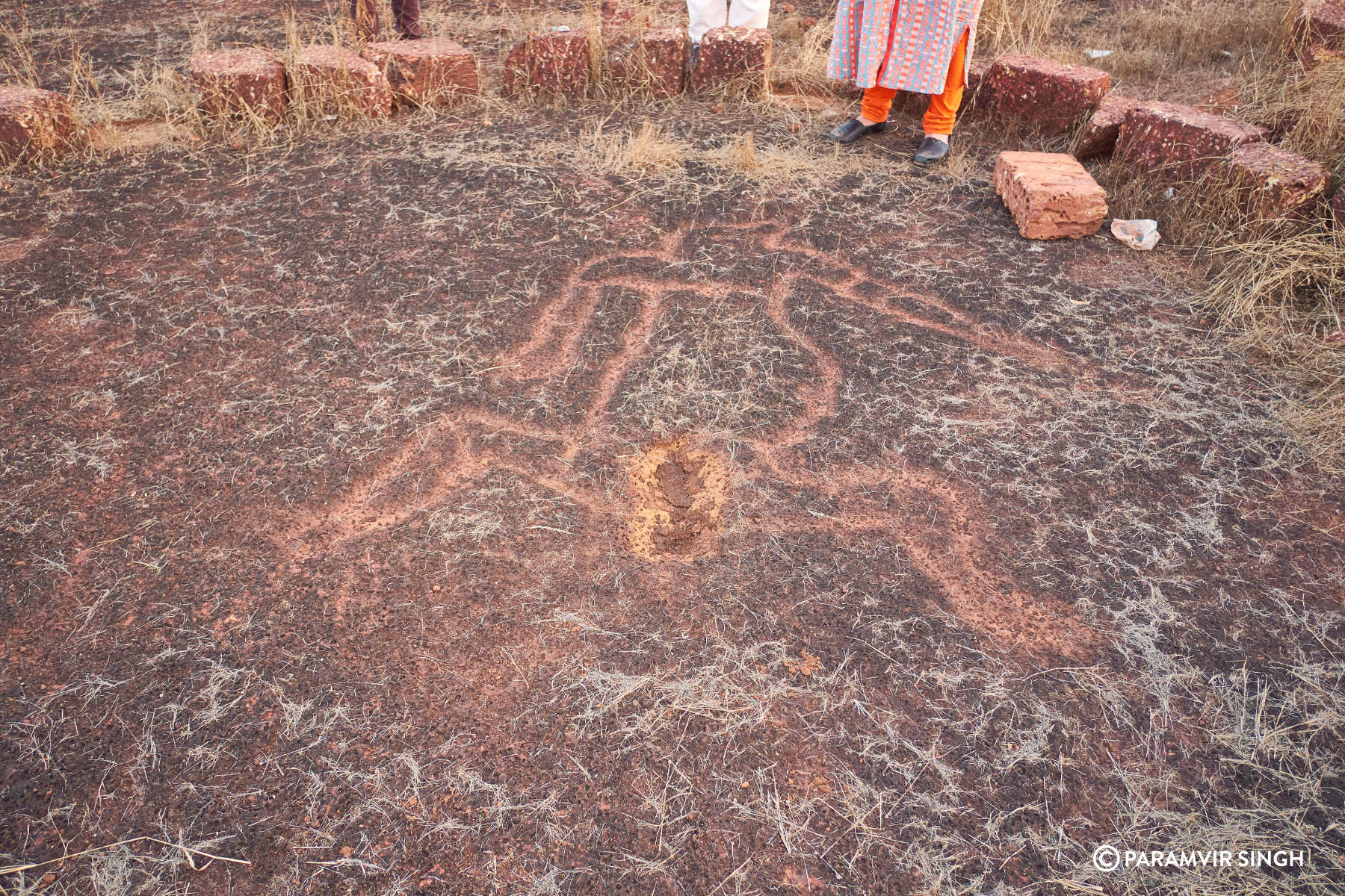
गावातून पायवाट तुडवत अर्धा तासांच्या चढतीनंतर पठारावर पोहोचता येते. अंदाजे साडे सात ते आठ फूट माणसाची प्रतिमा येथे कोरलेली आहे. हे गूढ कातळशिल्पे पाहण्यासाठी हजारो पर्यटक, अभ्यासक याठिकाणी येतात. या मानवाच्या प्रतिमेवर विविध ठिकाणी होकायंत्र ठेवल्यानंतर उत्तर – दक्षिण अशी अशी दिशा स्थिर होत नाही. शिवाय होकायंत्र गोल गोल फिरत राहते. या खडक चुंबकीय विसंगती दर्शवतो. या मानवाच्या पूर्ण प्रतिमेवरचं हे होकायंत्र काम करत नाही. मुळात चुंबकसूची (सुई) पृथ्वीच्या चुंबकीय उत्तर-दक्षिण दिशेने स्थिर होते. पण या प्रतिमेवर होकायंत्राची सुई कधी सुलट तर कधी उलट आपोआप गोल फिरत राहते. या मानवाच्या पायाजवळ तर होकायंत्राची सुई अजिबात दिशा दाखवत नाही. या आकृतीपासून होकायंत्र बाजूला नेताच पुन्हा होकायंत्राची सूई दिशा दर्शवते.
त्या आकृतीमध्ये काही चुंबकीय क्षेत्र तयार होते आणि होकायंत्र चुकीची दिशा दाखवते. तो चौकोन अंदाजे वीस चौरस फूट लांबीरुंदीचा आहे. तेथे कोठेही होकायंत्र नेले तरीसुद्धा दिशा चुकीची दिसते. कातळशिल्प खोदताना त्या मंडळींना याची माहिती होती हे तर नक्कीच. मग त्याच ठिकाणी असे का खोदले गेले असेल? वर्तमानकाळात प्रसिद्ध असलेली चुंबकीय चिकित्सा त्याकाळी ज्ञात होती का ? त्यासाठीच झोपलेल्या मानवाची ही आकृती आणि तेथे होकायंत्राची गडबड यांचा काही संबंध असेल का? मुळात त्या काळी होकायंत्रे होती का? हे सगळे प्रश्न येथे प्रेक्षकाला भंडावून सोडतात. परंतु त्या खोदचित्रामागे काही ना काही संकेत नक्की आहेत. या चित्ररचनेच्या आजूबाजूला आणखीही काही रचना आहेत; पण त्या फार अस्पष्ट आहेत.
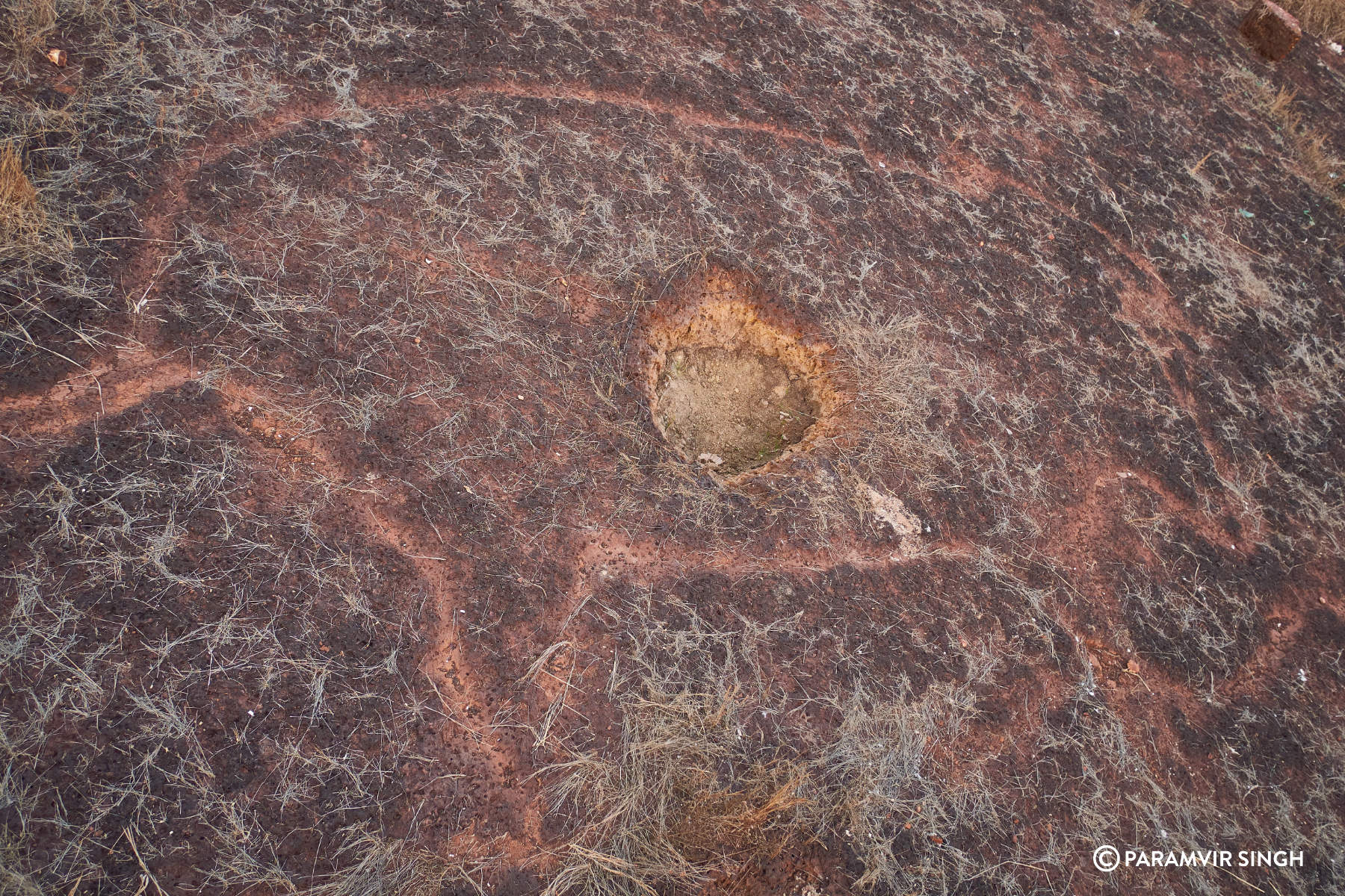
त्या कातळ खोदचित्राच्या जवळ विहीर नाही, मात्र पाण्याचे छोटे कुंड आहे. संशोधकांना तेथे मोठे भुयार सापडले आहे. बाहेरून तरी ते खूप खोलवर गेलेले दिसते.


स्थानिक लोक हि कातळ खोदचित्र असणार्या सड्याला रावणाचा सडा असे म्हणतात. या सड्याचे हे नाव पडण्याचे कारण म्हणजे वर वर्णन केलेल मानवाचे खोद चित्र. स्थानिक लोक या चित्रासंदर्भात एक कथा सांगतात. दंतकथा अशी आहे की सीतेच्या शोधात निघालेला रावण या ठिकाणी ठेच लागून उताणी पडला. त्याचा उमटलेला हा ठसा, अशी मजेशीर आख्यायिका या चित्ररचनेच्या बाबतीत सांगितली जाते. पण खरं तर ते एक कातळखोदचित्र आहे . जांभ्या दगडात चुंबकीय विस्थापन दाखविणारी ही जगातील एकमेव जागा आहे हे अभ्यासातून समोर आले आहे. कोकणाच्या भौगोलिक व पर्यटनदृष्ट्या ही फार मोठी उपलब्धी आहे, यात शंका नाही.


देवीहसोळ :-
राजापूर तालुक्यातील देवीहसोळ हे मुचकुंदी आणि बेनी या नद्यांच्या संगमावर वसलेले गाव. राजापूरच्या पुढे असलेल्या ‘भू’ या एकाक्षरी नाव असलेल्या गावापासून नऊ किलोमीटर अंतरावर देवीहसोळ हे गाव येते. गावाला निसर्गाचा वरदहस्त लाभला आहे. या वैभवात भर घालणारी मुचकुंदी नदी एका बाजूला आणि दुसऱ्या बाजूला ऋतुमानानुसार विविध रूपे दाखविणारा विस्तीर्ण सडा अशी वैशिष्ट्यपूर्ण भौगोलिक रचना या गावाला लाभलेली आहे. देवीहसोळ गावच्या सड्याच्या सुमारे तीन चौरस किमी परिसरात सुमारे पंधरा ठिकाणी आढळून आलेल्या तिनशेहून अधिक चित्र वैशिष्ट्यपूर्ण रचना स्वतःचे वेगळेपण जपणाऱ्या आहेत. या बाबी या भागात अश्मयुगीन मानवाचे दीर्घकाळ वास्तव्य होते हे निर्देश करत असल्याचे सांगितले जात आहे. आकाराने सर्वात मोठ्या आणि आश्चर्यकारक कातळ खोदचित्र रचनांचा समावेश असलेले आणि एवढ्या मोठ्या संख्येने एकाच ठिकाणी कातळशिल्प आढळणारे देवीहसोळ हे बहुधा एकमेव गाव आहे.


गावच्या सड्यावर ग्रामदेवता जाकादेवी आणि आर्यादुर्गा देवीचे मंदिर असून हे देवस्थान रत्नागिरी जिल्ह्यासह राज्यभरामध्ये प्रसिद्ध आहे. येथील आर्यदुर्गा मंदिराजवळ कातळखोदचित्रे आहेत. कऱ्हाडे ब्राह्मण कुटुंबांची ती कुलदेवता आहे.
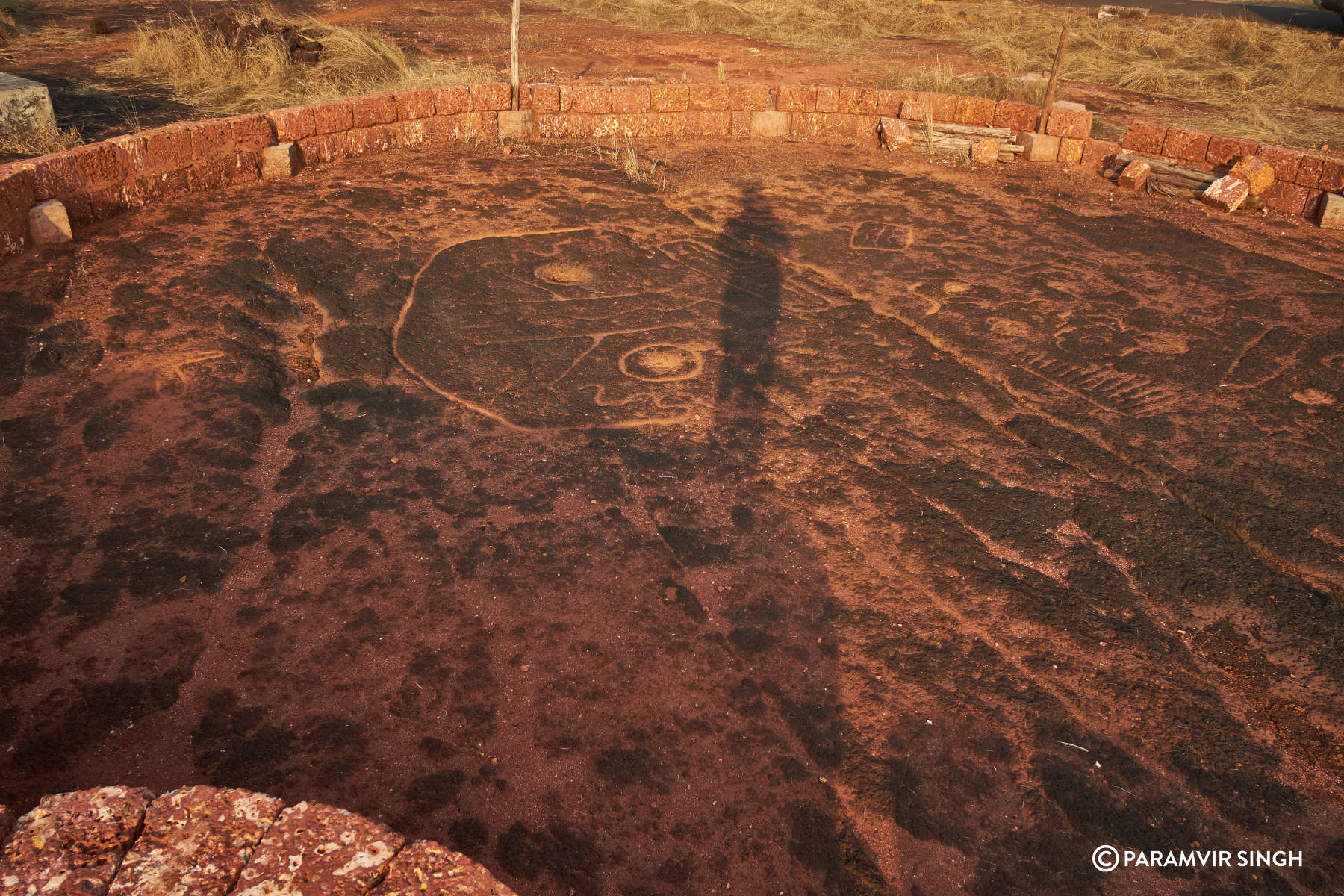
या मंदिरालगतच भलेमोठे पटसदृश कातळखोदचित्र असून चित्राचा आकार ८.५० मीटर x ८.५० मीटर आहे. इथले चित्र खरंच अनाकलनीय आहे. आयतामध्ये वेगवेगळ्या भौमितीय रचना असून त्यात कुठेही प्राणी अथवा पक्षी दिसून येत नाही. या चित्राचा चर ८ ते १० सेमी आहे. अत्यंत ठसठशीत, उठावाचे चित्र असावे असा भास निर्माण करणारी आणि आपल्या तर्क शक्तीला आव्हान देणारी ही चित्र रचना अनोखी आहेत.
त्या कातळशिल्पांपासून जेमतेम दोनशे मीटर अंतरावर कातळात खोदलेली मोठी विहीर बघण्यासारखी आहे. अंदाजे चाळीस फूट खोल विहिरीला उतरण्यासाठी एका बाजूने पायऱ्या खोदलेल्या आहेत. कातळशिल्पाशेजारी विहीर हे सूत्र तेथे तरी पाहण्यास मिळते.

कातळ खोद चित्रांच्या सुरुवातीच्या केलेल्या संशोधनामध्ये देवीहसोळ गावातील अनेक वैशिष्ट्यपूर्ण अशी कातळशिल्प प्रकाशात आली. संशोधनानंतर दहा वर्ष या परिसरातील कातळशिल्पांचे संशोधनाचे काम सुरू आहे. या सर्वांचे समग्र दस्तऐवजीकरण, सखोल संशोधन प्रक्रिया चालू आहे.
या कातळ खोदचित्राचा आणि परिसराचा समावेश जागतिक वारसा स्थळ प्रस्तावित यादीमध्ये केला आहे.
निवळी गावातील बारव आणि कातळ खोदचित्र :-
भारतात ब्रिटीश राजवट येऊन स्थिरावण्यापूर्वी शतकानुशतके आपल्या ज्ञानातून आणि परंपरेतून भारतीय समाज जलविज्ञानाचा वापर दैनंदिन गरजांसाठी करीत होते. त्याचा एक उत्तम नमुना म्हणजे रत्नागिरी जिल्ह्यातील निवळी फाट्याजवळ रस्त्यालगतच जांभ्या कातळात खोदलेली ही बारव ! प्राचीन काळापासूनच सिंचन आणि पिण्यासाठी, पाण्याचा साठा वर्षभर रहावा यासाठी काटेकोर व्यवस्थापन धोरणांची अंमलबजावणी अशा विहिरींच्या माध्यमातून केलेली दिसते. जांभ्या खडकात खोलवर खोदलेल्या विहिरी भर उन्हाळ्यात सुद्धा थंड पाण्याचा आनंद देतात. साधारणतः ४० ते ५० पायऱ्यांची ही नंदा बारव (एकाच बाजूने विहिरीत उतरण्याचा मार्ग असलेली) प्रकारातील बारव आहे. कोकणात अशा प्रकारच्या विहिरींना घोडबाव सुद्धा म्हटले जाते. विहिरीच्या बाहेरील बाजूस दोन फूट लांब आणि दीड फूट रुंद दगडी भांडे पाहायला मिळते.जयगड आणि रत्नागिरी यांसारख्या प्राचीन बंदरांमधून जाणाऱ्या मार्गावर वाटसरू आणि व्यापारी या दोन्हीसाठी ही विहीर म्हणजे एक वरदान असणार यात काही शंकाच नाही. पावसाळयात तुडुंब भरलेली निळ्याशार पाण्याची विहीर बघताच क्षणी मनाला भुरळ पाडते. निवळी फाट्यापासून ७५० मीटर अंतरावर असलेली विहीर आजूबाजूला नव्याने बांधलेल्या हॉटेल आणि रिसॉर्टमधूनही आपलं अस्तित्व टिकवून आहे.


विसाव्या शतकाच्या शेवटच्या दशकात (1990) कोकणातील रत्नागिरी जिल्ह्यात निवळी येथे रस्त्याच्या रुंदीकरणाचे काम सुरू असताना जांभ्या दगडाच्या सड्यावर/कातळावर 'कातळशिल्प' नावाची कोरलेली चित्रे दिसून आली आणि कोकणातील इतिहासाला नवी कलाटणी मिळाली. ही चित्रे म्हणजेच अश्मयुगीन मानवी वावराच्या पाऊलखुणाच आहेत.
गोवळ :-
राजापूर तालुक्यातील गोवळ गावाचा सडा. गावातून सड्यावर येण्यासाठी असलेली पाखाडी आहे. पाखाडी चढताना आजूबाजूच्या निसर्गसौंदर्याचा आस्वाद घेत सड्यावर पाऊल टाकावे .एवढ्या मोठ्या सड्यावर कातळखोदचित्र शोधणार कसे ? असा प्रश्न पडतो. गावकर्यांना विचारावे तर ‘‘हे फडे तिकडे सातवीण त्या अंगाला खरी’ असे उत्तर मिळते.

सोलगाव :-
राजापुर तालुक्यातील या गावातून घाटीने चित्रपरिसरात पोहचण्यास सुमारे अर्धा तास चालत जावे लागते. या ठिकाणी असलेल्या रचनांना एक आख्यायिका चिकटलेली आहे. सड्यावर वावरणारी गावातील वृद्ध मंडळी चित्रपरिसराला भोपळिणीचा वेल म्हणून ओळखतात. या वेलाचे मूद (मूळ) ज्याला सापडेले, त्याला संपत्ती मिळेल अशी धारणा. या समजापोटी या चित्रपरिसरात एका चित्रावर पहारीने खणल्याच्या खुणा आहेत. या रचनांमध्ये गवा रेडा, वाघ व एका अनाकलनीय चित्ररचनेबरोबर मोठ्या आकाराची भौमितिक रचना दिसून येतात.


विशेष म्हणजे ज्या परिसरात हि कातळ खोदचित्रे आहेत ती जागा मूळ मालकाने काही कारणास्तव विकायला काढली आणि असलेल्या चित्रांचे संरक्षण करण्याच्या अटीवर नवीन माणसाने ती जागा विकत घेतली. ग्रामस्थांच्या सहकार्याने त्या चित्रांभोवती तात्पुरत्या स्वरूपात का होईना, चिऱ्यांच्या दगडांची रांग लावून ती जागा कायमस्वरूपी अधोरेखित केली आहे. योग्य माहिती मिळाल्यावर पुरातन ठेवा जपण्यासाठी तेथील लोकांची धडपड खरेच कौतुकास्पद आहे.
भालावली :-
राजापुर तालुक्यातील या गावाच्या सड्यावर कातळ खोदचित्रे आहेत. मात्र बहुतांशी चित्रपरिसर बाजूच्या रस्त्यामध्ये व गटारामध्ये नष्ट झाला आहे.
जुवाठी-उपळे :-


मेर्वी :-
 |
गावखडी :-

साखरकोंबे :-


करबुडे :-


रुढे :-


भडे :-
उमरे :-

सोगमवाडी :-

चवा :


देऊड:


परचुरी :-
गुहागर जवळ असलेल्या या गावाच्या सड्यावर १५-१६ चित्ररचनांच्या ठिकाणी एक आख्यायिका ऐकायला मिळते. मुलीच्या लग्नाचे संपूर्ण वऱ्हाड कोवळ्या कातळात बुडाले. त्यांच्या उमटलेल्या खुणा म्हणजे इथली कातळचित्रे. चित्ररचनांमध्ये दिसणाऱ्या आकारांना ‘ही दागिन्याची पेटी, हातातला नारळ,’ वगैरे पद्धतीने वृद्ध मंडळींकडून ओळखले किंवा सांगितले जाते.
रानवी :-
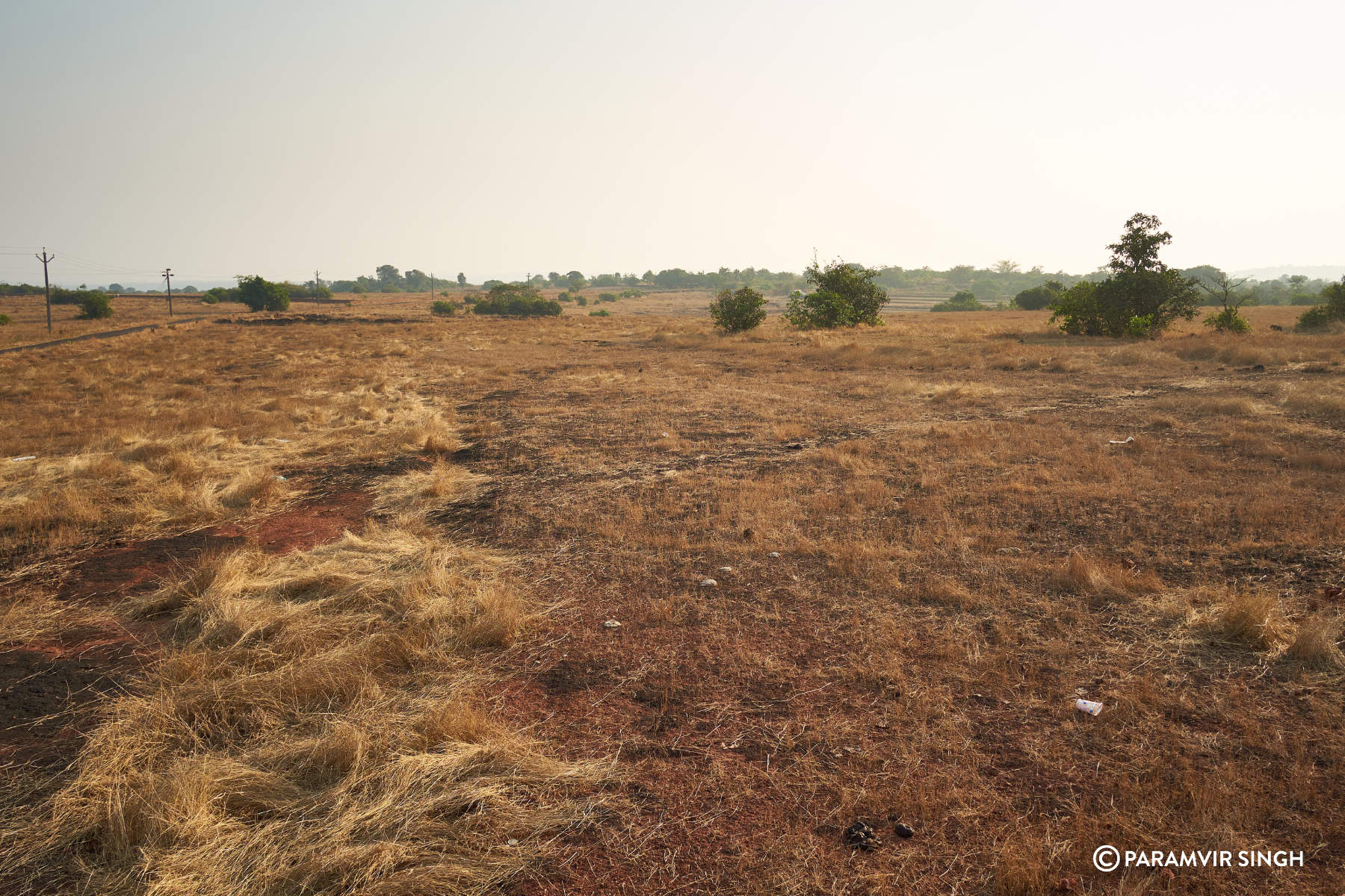
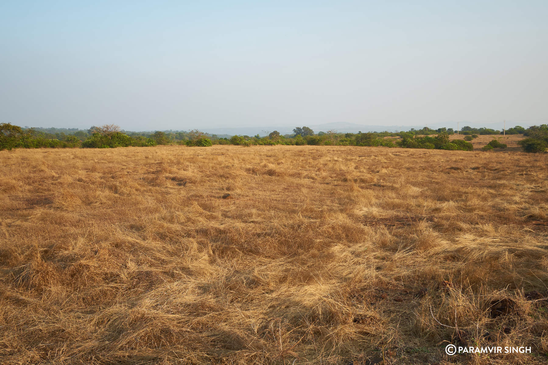
गुहागर तालूक्यातील रानवी गावाला विस्तीर्ण कातळसडा तसेच देखणी किनारपट्टी लाभली आहे. पावसाळ्यात खुलून येणारे, जैवविविधतेने नटणारे हे माळरान फार लक्षवेधी असते. तेच माळरान पावसाळ्यानंतर मात्र उजाड दिसू लागते. पण अशाच या उजाड आणि निरुपयोगी वाटणाऱ्या माळरानाने अशा प्रकारचा अनोखा ऐतिहासिक वारसा आपल्या कुशीत जपलेला आढळून आला आहे. जंगल भटकंती करत असताना रानवी येथील जंगलात मधोमध असलेल्या कातळावर ही चित्रे आढळून आली आहेत.
जांभरुण :-
मुंबई- गोवा महामार्गावरील जाकादेवी जवळ असलेल्या जांभरुण या ठिकाणी २५ मीटर बाय २५ मीटर क्षेत्रफळात जवळपास ५० आकृत्या कोरल्या आहेत. त्यापैकी ८ मानवाच्या तर इतर जलचर प्राणी आणि चार पायाच्या प्राण्याचे आकार आहेत.

उक्षी :-
मुंबई-गोवा महामार्गावर हातखंब्याजवळ उक्षी हे गाव आहे. या गावाचा सडा परचुरी, करबुडे, जांभरुण यांच्या मधला. या सर्व ठिकाणी चित्ररचना आहेत. उक्षी गावाच्या सड्यावर चार-पाच ठिकाणी मिळून सुमारे चाळीसेक चित्ररचना आहेत. एके ठिकाणी फक्त लहान-मोठ्या भौमितिक रचना आहेत.


.jpg)


कोळंब : -


कापडगांव :-

वाडाजून :-
रत्नागिरी- गणपतीपुळे मार्गावर आरे गावातून एक रस्ता सडये-पिरंदवणे-वाडाजून गावाकडे जातो. गावात भव्य घाटी लागते. गर्द झाडीच्या छायेतून पदयात्रा करत कातळ सड्यावर प्रवेश होतो. वाडाजून या गावापासून सुमारे ८ किलोमीटर अंतर पार केल्यानंतर विस्तीर्ण कातळावर हा कातळ खोद चित्रांचा समुह आहे. अत्यंत सुबक, ठाशीव, सुस्पष्ठ अशा अनेक आकृत्या आहेत.त्यातील काही आकृत्यांचा अर्थबोध होत होता, तर काही गुढ आहेत.
रानकमळांची बाग
विस्तीर्ण पसरलेल्या आणि रणरणत्या उन्हात तापलेल्या कातळावर एकेठिकाणी पांढर्याशुभ्र रानकमळांची सुरेख बागही द़ृष्टीपथास येते.
.jpg)

रेड्याचे ८ फुटांचे पाऊल.

.jpg)


.jpg)

या जागेला ‘रेडेबावलं’ असे म्हणतात. या कातळ खोद चित्रांच्या शेजारीच एक शेतजमीन आहे. या शेतजमीनीत मोठ्या प्रमाणात नाचणी, वरी, भातशेतीचे उत्पादन पुर्वी घेतले जाई, मात्र प्राचीन काळी एकेवर्षी लावणी करत असताना केलेल्या चिखलात बारा रेड्यांची जोते, बारा नांगर्यांसह रुतली, आणि गतप्राण झाली, आणि तेव्हापासून या जागेला गुढ वलय निर्माण झाले. म्हणून या जागेला रेडेबावलं म्हणतात. रेड्यांच्या पावलांची चित्रे म्हणूनही कदाचित या परिसराला ‘रेडेबाऊल’ असे नाव पडले असेल,


.jpg)

रेडयांची मोठाली पावलं

या कातळशिल्पांचे निरीक्षण करता याठिकाणी रेडे किंवा घोडा यांच्या पायांचे ठसे कोरलेले दिसून आले. काही ठसे हे छोटे, काही मध्यम तर काही मोठाले कोरलेले आहेत. मोठाल्या पावलांची लांबी ८ फूट, आणि रुंदी ६ फूट इतकी आढळून येतात. अशी दहा पावले सुस्थितीत दिसून येतात. एका पावलाशेजारी ‘भाला’ या शस्त्राची आकृतीही कोरलेली दिसून येते. याशिवाय मानवाची पावलंही आढळून आली आहेत. मानवी पावलांची संख्याही १० आहे. ती चांगली खोलगट असून, काही ठिकाणी जोडपावलं, तर काहीठिकाणी चालीची पावलं रेखाटलेली आहेत. या सार्या पावलांची दिशा ही पश्चिमेकडे जाताना दिसत आहे.
तीन लंबाकृती प्राणी
याशिवाय तीन प्राणीही चितारलेले आहेत. तिन्हीही प्राणी लंबाकृती आहेत. एकाचे तोंड निमुळते आहे. त्यांच्या डोळ्यांची खोबणी खोलगट आहे. एक प्राणी विमानाच्या आकृतीसारखा आहे. एक माशासारखा प्राणी आहे. एक शंखाकृती आकृतीही आहे. एक मडकेही चितारलेले आहे.
गुढ चावीकृती आकृत्या
या सार्या आकृत्यांमध्ये दोन आकृत्या या ‘चावी’ आकाराच्या आहेत. दोन्ही चाव्या मोठाल्या आहेत. चावीचा पुढील काडीचा लांब भाग ६ फूट लांब आहे. चावीचा मागील भाग आयताकृती आहे. हा आयतही ६ फूट लांब आणि ४ फूट रुंद आहे. या आयताच्या मध्यभागी २ चौकोन असून त्यामध्येही काही आकृतीबंध काढण्यात आलेले आहेत. अशी एकूण ३० चित्रे दृष्टीपथात आली, प्रत्यक्षात त्यांची संख्या अधिक असण्याची शक्यता दाट आहे. काही ठिकाणी गवत रुजल्यामुळे ती झाकली गेली आहेत, मात्र काही ठिकाणी त्यांची सुस्पष्ठता, सुबकता आणि रेखीवपणा नजरेत भरण्यासारखा आहे.
कशेळी :-
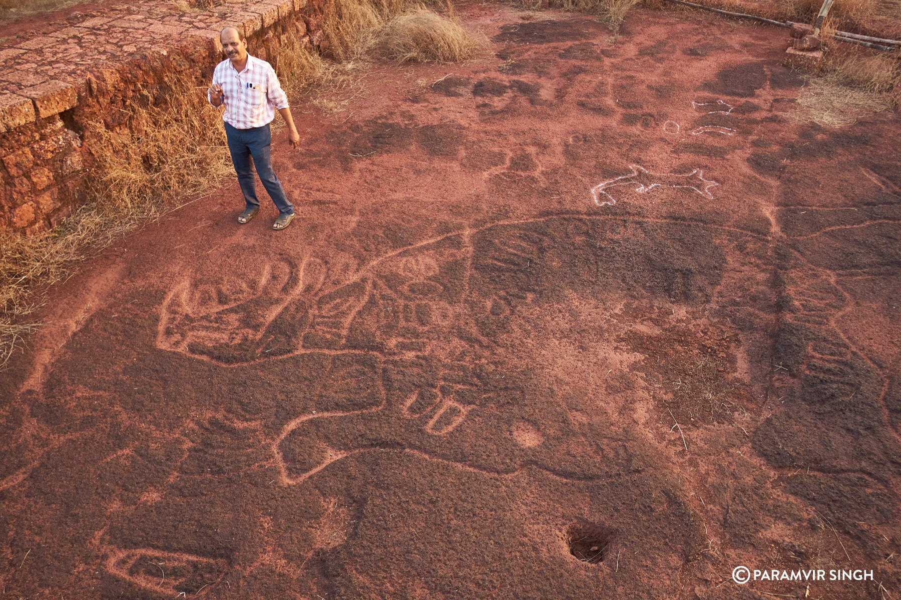
राजापूर तालुक्याच्या उत्तर टोकावर वसलेले हे गाव. हे स्थळ थोडे दुर्गम भागात असून रत्नागिरी-राजापूर रस्त्यावर गावखडी-गावडेवाडी बसस्टॉप पासून पाऊल वाटेने जावे लागते. दोन्हीकडून हे ४० कि.मी. अंतरावर आहे. या गावाच्या सड्यावर सुमारे ५० फूट लांब व ४० फूट रुंदीची ही हत्तीची चित्ररचना आहे. ही चित्रे नीटनेटकी पाहायची झाल्यास आपल्याला हवेत किमान ५० फूट जावे लागते. या रचनेमध्ये विविध प्राणी, पक्षी, जलचरही कोरलेले आहेत. हत्तीच्या आकृतिबंधाच्या पोटात वाघ, माकड, शार्क, गेंडा, स्टिंग रे, पक्षी, मोर यांसारख्या ७०/८० प्राणी व पक्षी आकृत्या आहेत. तब्बल ८० चित्रांचा एकत्रित समूह. भारतातील या प्रकारातील एखाद्या प्राण्याचे हे सर्वांत मोठे चित्र. या परिसरात एकंदर १२५ चित्ररचना आहेत. आजपर्यंत आमच्या शोधात मिळालेला हा सर्वांत मोठा समूह.
रानडूक्कर, कशेळी


कशेळीच्या डोंगरसड्यावरचा हा अजस्त्र हत्ती… आणि त्यात कोरलेली असंख्य चित्रे … विविध प्राणी … काही जलचरही .. काय सांगत असतील ही चित्रे?
मध्यंतरी बीबीसी मराठी आणि अगदी न्यूयॉर्क टाइम्स ने ही या विषयाची दखल घेतली आहे. या जमिनीला कॅनव्हास करून खोदलेल्या कातळशिल्पांचा आकार इतका मोठा आहे की फोटो काढायला काही ठिकाणी ड्रोन असेल तरच त्यातील रेषा आणि चिन्हे एका दृष्टीक्षेपात नीट दिसतील.
दापोली-मंडणगड परिसरातील कातळ खोद चित्र :-
दापोलीमधील उबर्ले गावात काही कातळ खोद चित्र आढळली आहेत.'गाढवाचा खडक' म्हणून ओळखल्या जाणाऱ्या उंबर्ले गावामध्ये ही कातळशिल्प जांभ्या सड्यावर आढळली आहेत. यामध्ये ६ कातळशिल्पांचा देखील समावेश आहे. मानवासह तीन हरीण आणि २ बैल देखील आढळले आहेत. सातपैकी एक कातळशिल्प सुमारे १७ फुट लांबीचं आहे. .मानवाकृती सुमारे साडेचार मीटर लांबीची आहे. तिच्या डोक्यावर शिरस्त्राण अथवा पागोट्यासारखा आकार असून त्यावर झाडाच्या सरळ फांदीसारखी रचना दिसते. कोकणात आतापर्यंत आढळलेल्या कातळशिल्पांमध्ये बैल हा प्राणी आढळला नव्हता. शिंग आणि वशिंडधारी असे हे दोन बैल आहेत.
सिंधुदुर्ग जिल्हा :-
सिंधुदुर्ग जिल्ह्यातील ५० गावांमध्ये अशी कातळखोदचित्रे आहेत.साळशी :-
देवगड तालुक्यातील साळशी गावाला ऐतिहासिक महत्व आहे. हे गाव आदिलशाहीपासून तालुक्याचे ठिकाण म्हणून ओळखले जात होते. स्वराज्यात सामील झाल्यानंतर या गावाचा दबदबा आणखीनच वाढला. याठिकाणचे पावणाई देवीचे मंदिर हे ८३ खेड्यांचे अधिपती असलेले देवस्थान म्हणून ओळखले जाते. मंदिराची भव्यदिव्यता इतिहासाच्या पार्श्वभूमीची साक्ष देतात. याशिवाय अनेक अशा ऐतिहासिक पाऊलखुणा या भागात सापडतात.
धामापूर :-
धामापूर, साळेल आणि मोगरणे गावच्या सीमेवरील सड्यावर आणखी कातळशिल्पांचा शोध लागला आहे. या ठिकाणी प्रथमच शिकारी आणि रानडुक्कर यांचे कातळशिल्प, तसेच अश्मयुगीन गुहा आणि काही दगडी हत्यारे सापडली आहेत, साळेल येथील स्थानिक युवक अळंबी शोधण्यासाठी गेले असता धामापूरच्या सड्यावर गोड्याची वाडी हद्दीत दोन कातळशिल्पे आढळून आली होती. विशेष म्हणजे प्रथमच शिकारी माणसाचे कातळशिल्प आढळून आले आहे. एका मानवाकृतीच्या हातात कुऱ्हाडसदृश शस्त्र असून ती व्यक्ती कोणाचातरी पाठलाग करीत आहे, असे हे कातळशिल्प पाहिल्यावर लक्षात येते.याच्या बाजूलाच एका रानडुकराचे कातळशिल्प खोदलेले आहे. याचबरोबर गोड्याची वाडी येथे याआधी सापडलेल्या कातळ खोदचित्रापासून सुमारे पाऊण किलोमीटर अंतरावर २४ बाय १८ फुट आकाराचे एक भव्य कातळ खोदचित्र दिसून येते. हे कातळखोदचित्र अत्यंत आकर्षक आणि भौमितिक रचनांचे आहे. अमूर्त शैलीतील ही एक मानवाकृती आहे, असे प्रथमदर्शनी वाटते. मात्र अन्य ठिकाणी आढळलेल्या मानवाकृती आणि या आकृतीमध्ये पुष्कळ फरक आहे. ज्या ठिकाणी शिकार करणारी व्यक्ती आणि रानडुकराचे कातळखोदचित्र सापडले, तेथील परिसरात शोध घेतला असता तिथून अगदी जवळच एक नैसर्गिक गुहा आढळून आली. साधारणपणे चार ते पाच व्यक्ती बसू शकतील, अशा आकाराची ही गुहा आहे. या गुहेच्या परिसरात १४ ठिकाणी ‘वॉटर होल्स’ म्हणजे कातळात असलेले पाणी साठवण्याचे खड्डे सापडले आहेत. हे खड्डे खोल असतात आणि त्यात पावसाचे पाणी साठून राहते. हे पाणी अगदी एप्रिल, मे महिन्यापर्यंत उपलब्ध असते, असे आढळून आले आहे.
कुडोपी येथील ‘बाहुल्यांचे टेंब’ येथील कातळखोदचित्राच्या ठिकाणीही अशा प्रकारचे वॉटर होल्स आढळून आले आहेत. प्राचीन काळातील ही पाणी व्यवस्थापन प्रणाली आहे. तथापि कातळखोदचित्र, गुहा आणि वॉटर होल्स एकाच ठिकाणी सापडण्याची ही पहिलीच वेळ आहे. यादृष्टीने धामापूर-मोगरणे सडा हे पुरातत्वीय महत्त्वाचे ठिकाण आहे,


साळेल, मोगरणे आणि धामापूर या तीन गावांच्या सीमेवर असलेल्या या विस्तीर्ण सड्यावर आणखीही कातळखोदचित्र असण्याची शक्यता आहे. कुडोपी, वानिवडे, वाघोटण, कुणकेश्वर, दाभोळे पोखरबाव, बापर्डे, किर्लोस, हेदुळ, ओवळीये, खुडी, आरे यासह सुमारे वीस ठिकाणी कातळखोदचित्राचा शोध आतापर्यंत लागला आहे.
धामापूर, खोटले येथील कातळशिल्पांपासून चिरेखाणी तर काही फुटांवर आल्या आहेत. याकडे असेच दुर्लक्ष राहिले तर पुरातत्वीय वारसा आणि पर्यटन यादृष्टीने महत्वाचा असा हा प्राचीन मानवी वारसा नष्ट होण्याची भीती आहे.
कुडोपी :-
मालवण पासून ३० किमीवर असलेले कुडोपी गाव थोड आडबाजूला आहे. डोंगराततून वहात येणार पाणी पाटाने गावात खेळवल आहे. त्यावरच गावाची शेती -बागायती व धुण - भांड्यांच्या पाण्याची गरज भागते. गावात कातळखोदचित्रांबद्दल आहेत, मात्र गावकरी त्यांना पांडवाची चित्र अस म्हणतात. याचा संदर्भ गावात असलेल्या दगडात कोरलेली प्रचंड विहिरीशी आहे. ही विहिर पांडवांची विहिर म्हणून ओळखली जाते. (आपल्या भारतात गावातल्याच सामान्य लोकांनी पिढ्यान पिढ्या खपून काही अचाट, प्रचंड काम केलेलं असल तर त्याला पांडवांच नाव दिले्ले आढळते.) त्यामुळे या कातळखोदचित्रानाही सड्यावर पांडवाची चित्र म्हणतात. गावातल्या तरूण पिढीला या पांडवांच्या चित्राबद्दल फारशी माहिती नाही. (हि खरतर आपली शोकांतीका आहे. आजवर अनेक ठिकाणी फिरतांना मला असा अनुभव आलेला आहे, आपल्या गावात पहाण्या लायक एखादी ऎतिहासिक गोष्ट आहे, हेच बर्याच जणांना माहित नसते.)
गावाच्या मागचा डोंगर चढायला सुरुवात केली कि डोंगराच्या माथ्यावर पोहोचल्यावर क्षितिजापर्यंत पसरलेला सडा व त्यावरच गवत नजरेत मावत नाही. पंधरा मिनिट सड्यावर चालल्यावर अचानक आदिमानवाने कातळात कोरलेली चित्र दिसायला लागतात. त्यांचे आकार व गुढरम्यता पाहून थक्क होतो. यातील एका मानवाकृतीची लांबी ३.५ मीटर भरली तर, एका वर्तूळाकृती चित्राचा परिघ ३ मीटर होता. काही चित्रांचे आकार मात्र गुढरम्य होते. आदिमानवाने काढलेल्या या चित्रात दैनंदिन जीवनात आजूबाजूला दिसणारी माणस, प्राणी, निसर्ग चितारण्याचा प्रयत्न दिसत होता. एकूण ६० चित्र त्या माळावर विखुरलेली आहेत.


.jpg)


मानवाकृती

त्रिशूळ


मानवाकृती

कातळशिल्पाच्या परीघावर ३ जण उभे आहेत.


खोटले धनगरवाडी :-
सिंधुदुर्ग जिल्ह्यात कसालपासुन अवघ्या दहा किलोमीटरवरील खोटले (ता. मालवण) गावच्या धनगरवाडी सड्यावर आढळलेल्या या शिल्पांमध्ये मनुष्याकृती, प्राणी, मासे, अमूर्त रचना यांचा समावेश आहे. विशेष म्हणजे येथे आढळलेले ‘लज्जागौरी’सदृश कातळखोदचित्र आश्चर्यकारक असून आधुनिक काळातील लज्जागौरी हे या प्रतिमेचे उन्नत रुप असावे, अशी शक्यता आहे. मात्र या सर्व कातळखोदचित्रांचे अस्तित्व या परिसरातील चिरेखाणींमुळे धोक्यात आल्याचे धक्कादायक चित्र समोर आले असून अनेक कातळखोदचित्रे चिरेखाणींमध्ये नष्टही झाल्याचे समोर आले आहे, खोटले येथील माळरानावर ‘वेताळा’चे चित्र कोरलेले आहे अशी स्थानिक लोकांची समजूत होती. खोटले आणि पोईपच्या सीमेवर एका टेकडीच्या उतारावरील झाडाझुडपांमध्ये जांभ्या दगडात कोरलेली मानवाकृती हे एक कातळखोदचित्र असुन येथील लोकमानस त्याला ‘वेताळ’ म्हणुन ओळखते. यासंदर्भात काही लोककथाही या भागात प्रचलित आहेत. या ‘वेताळा’ला नवसही बोलले जातात,.


या सर्व परिसरात चिरेखाणींचे साम्राज्य पसरले आहे. या खाणींमध्ये कितीतरी ‘पांडवांची चित्रे’ नष्ट झाली असे स्थानिकांनी सांगितले. याचठिकाणी असणाऱ्या सुमारे २० फुट लांब व २० फुट रुंद कातळखोदचित्रावर चिरेखाणीतील खराब तुटके चिरे व माती टाकून दिल्याने ते अत्यंत महत्वपूर्ण कातळखोदचित्र मातीखाली गेले, असे स्थानिकांनी सांगितले. या चिरेखाणी अशाच अनिर्बंधपणे सुरु राहिल्यास भविष्यात यापैकी अनेक कातळखोदचित्रे काळाच्या उदरात गडप होण्याची शक्यता आहे.
हिवाळे–असगणी :-
मालवण तालुक्यातील हिवळे आणि असगणी या गावांच्या मध्ये असलेल्या धनगरवाडी या छोट्या वाडीत काही ऐतिहासिक वास्तू आणि कातळशिल्पे आढळतात. हिवळे – मालवणहून मासुरे मार्गे असगणी गावात पोहोचावे लागते. तेथून एक कच्चा रस्ता हिवळे सड्यावर असलेल्या धनगरवाडीकडे जातो. याच परिसरात आणि पुढे काही ठिकाणी कातळशिल्पे आणि वास्तू पहायला मिळतात.


.jpg)


हा सडा खूप मोठा असल्यामुळे कातळखोदचित्रे असलेल्या जागा ओळखण्यासाठी तेथे दगड रचून ठेवलेले आहेत. त्यामुळे आपल्याला कातळखोदचित्रे शोधायला मदत होते.
हिवळे–असगणी येथील कातळशिल्पे असलेल्या स्थळाचे अचूक स्थाननिर्देशांक (coordinates) पुढीलप्रमाणे आहेत:
16.201567, 73.616061
ऊसगळीमळ, गोवा येथील कातळ खोद चित्र :-
गोवा म्हणले कि बहुतेकांच्या डोळ्यासमोर नीळ्याशार पाण्याचे समुद्रकिनारे, गर्द वनराई, चर्च आठवतात. पण याच गोव्यात थेट आदिमानवाशी नाते सांगणारा परिसर आहे. तो म्हणजे सांगे तालुक्यातील कुशावती नदीच्या काठाचा परिसर .मानवी संस्कृतीच्या इतिहासातले आणखी एक महत्त्वाचे ठिकाण म्हणजे रिवण-कोळंब जवळचे उसगाळीमळ-पणसईमळ. या आदिम लोकांच्या उगमस्थानाविषयी अनेक तर्क वितर्क असले तरी प्राचीन काळात म्हणजे अगदी मानवी संस्कृतीच्या जन्मानंतरच्या लगेचच्या काळात गोव्यात मानवी वस्ती होती हे निर्विवाद.उसगाळीमळ आणि काजूर इथली अश्मयुगीन दगडी रेखाचित्रे आवर्जुन बघण्यासारखी आहेत. काजूर इथली प्रस्तरचित्रे एका काळ्या ग्रॅनाईट पाषाणावर कोरलेली आहेत. अनेक प्राण्यांचे आकार इथे सापडतात. सांगे तालुक्यात आणि सत्तरी तालुक्यात भारतीय पुरातत्त्व खात्याने केलेल्या उत्खननात अश्मयुगीन आणि अगदी प्राथमिक स्वरूपातली दगडांची ओबडधोबड हत्यारे, हातकुर्हाडी सापडल्या आहेत. तर सत्तरी तालुक्यात 'म्हाऊस' आणि सांगे तालुक्यात रिवण-कोळंबच्याजवळ 'उसगाळीमळ-पणसईमळ' आणि 'काजूर' इथे कातळखोदचित्रे अर्थात 'पेट्रोग्लिफ्स' सापडले आहेत.


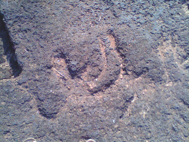
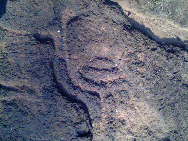


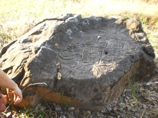
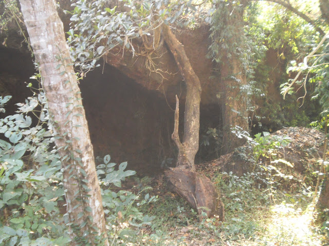
हा सगळा प्रदेश अजूनही दुर्गम आहे. सगळीकडे जंगल आहेच. कर्नाटकची सीमा जवळ आहे आणि लोहखनिजाच्या खाणींनी सगळा परिसर व्यापलेला आहे. या प्रस्तरचित्रांपासून फक्त ५०० मीटर्स अंतरावर सध्या बंद असलेली एक खाण आहे. 'ती चालू करायचं उद्या जर कोणाच्या डोक्यात आलं तर?' या विचारानेच अस्वस्थ व्हायला होतं.
या प्रस्तर चित्रांच्या जवळ, ४ ते ५ कि.मी. च्या परिसरात काजूर आणि रिवण इथे मोठ्या नैसर्गिक गुहा आहेत. इथलं नदीचं पात्र काहीसं उथळ आहे. एकूणच अश्मयुगातल्या मानवांना रहायला एकदम आदर्श परिसर आहे! ही सुंदर कोरीव चित्रं तयार करणार्या या आदिम रहिवाशांना जंगलातल्या विपुल प्रमाणात उपलब्ध असलेल्या प्राण्यांमुळे खाण्यापिण्याची ददात नसावी. खाणं जमा करून उरलेल्या वेळात आणि त्यांच्या काही धार्मिक रीतीरिवाजांसाठी ही चित्र खोदून काढली असावीत असा एक अंदाज आहे. सगळ्या जगभर अशा प्रकारची चित्रं सापडली आहेत, भारतातील भोपाळजवळचं भीमबेटका हे त्यातलं एक प्रमुख स्थळ. पण ही बरीचशी चित्रं ग्रॅनाईट किंवा वालुकाश्मावर आहेत. मात्र उसगाळीमळची ही चित्र जांभ्या दगडात आहेत, हे त्यांचं विशेष. कारण या दगडात लोखंडाचा अंश असतो, त्यामुळे कोरायला हा दगड अत्यंत कठीण! अश्मयुगातला हा आदिम रहिवासी हळूहळू शेती करू लागला. प्राणीपालन करू लागला. डोंगर उतारावर पाहिजे तेवढी झाडी, गवत काढून तिथे जरूरीपुरतं भात, नाचणी पिकवायची. पुढच्या वर्षी तो तुकडा रानासाठी सोडून देऊन दुसर्या जागी गरजेपुरतीच शेती करायची.
पणसायमळ येथील भूपृष्ठचित्रे
कातळ शिल्प
ज्यांना ऐतिहासिक गोष्टी आवडतात ते गुजरात,राजस्थानला भेटी देतात. पण, तुमच्या माहितीसाठी सांगतो की, गोव्यातही ऐतिहासिक खजाना दडलेला आहे. गोव्यातील अनेक पठारांवर कातळशिल्प पहायला मिळतात. गोव्यातील रिवोना येथील कुशावती नदीच्या काठी वसलेले उसगलीमल हे असेच एक ठिकाण आहे.
.jpg?w=640&auto=format%2Ccompress)
विदर्भातील कातळखोदशिल्प :-


अहिल्यानगर जिल्ह्यातील कात़ळखोदचित्रे :-
कामरगाव नगर तालुक्यातील गाव. या गावाच्या भोवती सह्याद्रीची एक तुटक रांग आहे. यातील विठ्ठलवाडी कडून अस्तगावच्या दिशेने जाणाऱ्या रस्त्यावर अहिल्यानगर पुणे महामार्ग पासून साधारणतः३ किमी अंतरावर एका टेकडीला मावलयाचा डोंगर म्हणतात. या डोंगरावर काही उभ्या शिळा ठेवलेल्या आहेत आणि एका बाजूला मध्ययुगीन काळातील कोणतीही मूर्ती नसलेले बांधकाम आहे. याचा बारकाईने अभ्यास केला असता हे इतिहास पूर्व कालीन थडगे असावे. ज्याचा संबंध मातृ देवतेशी असतो. त्यानुसार आणखी निरिक्षण केल्यावर काही पुरावे सापडले . त्यात सात उभ्या शिळा होत्या , यांची मावलया नावाने पूजा केली जात आहे. या शिळांचा आकार वेग वेगळा असून त्यावर स्थानिक लोकांनी शेंदूर लावला आहे.

कोकणातील काळ्या कातळावर कोरलेले हे शिल्प दख्खनच्या पठारावर नव्याने सापडले आहे . या शिल्पातील व्यक्ती प्राण्यावर बसलेली आहे म्हणजे ते एका वीराचे शिल्प असले पाहिजे. या परिसरात सात अप्सरांचे अस्तित्व आहे असे स्थानिक सांगतात. याचा संबंध सप्तमातृकांशी येतो. यावरुन कदाचित ही वीरांगना सुद्धा असू शकते.
या परिसरात काही अश्मयुगीन दगडी हत्यारे सुध्दा सापडली आहेत. याबरोबरच अश्मयुगीन राखेची टेकडीही परिसरात सापडली आहे. दख्खनच्या पठारावरील काळ्या कठीण बेसाल्ट खडकावर असे शिल्प नव्याने सापडत आहेत.
सिंहगड परिसरात कातळशिल्पे


कातळ खोदचित्र आणि इतर संस्कृतीतील चित्र यांच्यातील साम्य :-


प्राण्यांचा स्वामी :-


कोंकणचे भूरुप मोठे विलक्षण. डावीकडे निमुळती होत जाणारी किनारपट्टी तर उजवीकडे सह्याद्रीची भिंत. ह्या दोन भागांत वसलेले आहे ते दऱ्याखोऱ्यांनी बनलेले कोंकण. रायगड जिल्ह्यात प्रामुख्याने कोंकण लहानलहान टेकड्यांनी बनलेले दिसते तर सिंधुदुर्ग जिल्ह्यात सह्याद्रीची मुख्य रांग आणि किनारपट्टी जवळ आलेली आहे त्यामुळे त्याभागात कोंकणात डोंगर कमी आहेत. मात्र मधल्या रत्नागिरी जिल्ह्यात कोकणाचा अनोखा भाग सामावलेला आहे. सह्याद्री उतरुन जाताच अनेक डोंगररांगा कोंकणात ह्या भागात आहेत. कशेडी, भोस्ते घाट, परशुराम घाट ह्यासारखे अवघड घाट येथेच आहेत. मगरांनी युक्त असलेल्या वाशिष्ठी नदीचे विस्तीर्ण पात्र येथीलच. रत्नागिरी जिल्ह्यातले कोंकणचे हे भूरूप मोठे वैचित्र्यपूर्ण आहे. येथील मानवी लोकवस्ती वस्ती वसली आहे ती किनाऱ्यानजीक असणाऱ्या दऱ्यांत, घळीत. कारण सह्याद्री उतरुन कोंकणात आल्यावर पठारी भाग पुन्हा उंचावलेला दिसतो. हा पठारी भाग बनलाय जांभ्याने युक्त असलेल्या कातळांपासून. जांभा सच्छिद्र असल्याने ह्यात पाणी राहात नाही. गवत उगवत नाही, त्यामुळे मनुष्यवस्तीला हा भाग योग्य नाही. ह्या भागाला सडा म्हणतात. दगडधोंड्यांचा खच सड्यासारखा येथे पसरल्यामुळे हा सडा. हे सडे किनारा जवळ येताच परत उतरणीला लागतात आणि पुढे दऱ्याखोऱ्यात कोंकणचा भाग नारळीपोफळींनी भरलेला हिरवाकंच दिसू लागतो. रत्नागिरी जिल्ह्यात तुम्ही कुठेही गेलात तरीही तुम्हाला असेच भूरूप दिसते. केळशी, आंजर्ले, मूर्डी, हर्णै, कर्दे, मुरुड, दाभोळ, अंजनवेल, गुहागर, वेळणेश्वर, हेदवी, जयगड. मालगुंड, गणपतीमुळे, गणेशगुळे. ही सर्वच गावे दरीत, घळीत अशीच वसलेली दिसतात. अजून फरक समजावून घ्यायचा असेल तर अलिबाग पासून येता केळशीपर्यंत गावे चौकोनी किंवा आयताकृती अशी दिसतात. ३/४ समांतर रस्ते आणि त्याला छेदणारे चौक. दिवेआगरात तर हे प्रकर्षाने जाणवते. मात्र केळशीपासून पुढे रत्नागिरीच्या शेवटाशी येता येता कोंकणातील सड्यांच्या भिंती किनारपट्टीला जवळजवळ लगटून येतात त्यामुळे ही गावे एका पट्टीसारखी लांबलचक झालेली दिसतात. एकच समांतर रस्ता, त्याच्या दोन्ही बाजूंनी घरे, एका बाजूस समुद्र, दुसऱ्या भागात डोंगर. उदा. गुहागर, अगदी लांबलचक ३/४ किमी उभे असलेले गाव, मात्र मुख्य रस्ता एकच. पुढे सिंधुदुर्गात मात्र सपाटीमुळे गावे विस्तारलेली दिसतात. तिथे जरी जास्ती करुन सपाटी असली तरी तिथेही सडे दिसतातच.
हे तसं नमनाला घडाभर तेलच झालं. आपल्याला ह्यात मुख्य करुन बघायची आहेत ती ह्या सड्यांवर खोदली गेलेली, कोरली गेलेली कातळशिल्पे. मार्चमध्येच कोंकणात रत्नागिरी जिल्ह्यात ५ दिवसांची सहल झाली त्यात कोंकणच्या ह्या अनोख्य भूवैशिष्ट्याचा आस्वाद घेत येथील गणपतीपुळे, उक्षी आणि चवे देवूद ह्या ठिकाणी असलेली कातळशिल्पे पाहता आली. सर्वसाधरणपणे इंग्रजीत ह्या कातळशिल्पांना petroglyphs म्हणत असले तरीही त्याना नुसतेच कातळशिल्पे न म्हणता भूशिल्पे अर्थात Geoglyphs असेही म्हटले जाते. कारण कातळशिल्पे म्हणजे नुसतेच कातळावर लहानसे कोरणे मात्र ही भूशिल्पे म्हणजे थोडक्या उंचीवरुन ह्या शिल्पांचा आवाका ध्यानी येणे. कारण ही शिल्पे लाईफ साईझ (प्रत्यक्षातील वस्तूंच्या आकारात) बरेचदा दिसतात. आता ही शिल्पे कोरली कुणी आणि कोणत्या काळात? तर ह्याचे उत्तर असे आहे की इसवीसनपूर्व १५००० वर्षे ते इसवीसनपूर्व १००० इतक्या प्रदीर्घ काळात अश्मयुगीन ते ताम्रपाषाण युगांतील मानवांकडून ही कोरली गेली. आता ह्यांचा काळ कसा ठरवला गेला तर कार्बन डेटींग येथे निरुपयोगी ठरते तर दस्तावेजांचा येथे काहीच उपयोग नाही. येथे काळ ठरवण्यास मदत झाली ती थोड्या उत्खननाची, येथील कातळशिल्पांच्या साधेपणाची, त्यांच्या एकरेषीय शैलीची. येथे प्रागैतिहासिक मानवांची दगडी हत्यारे आढळली आहेत. अजून एक महत्त्वाचे कारण म्हणजे येथील भागांतून नामशेष झालेल्या प्राण्यांची कातळशिल्पेही येथे आढळतात.
अन्नाच्या, निवाऱ्याच्या शोधात जागोजागी हिंडणाऱ्या प्रागैतिहासिक मानवांनी त्यांना दिसलेले विविध प्राणी, मानवी आकृत्या, अमूर्त आकार येथील विस्तिर्ण कातळांवर आपल्या फावल्या वेळात कोरले आणि आज तोच आपला जागतिक वारसा होताना दिसतोय. रत्नागिरी आणि सिंधुदुर्ग जिल्ह्यात जवळपास ३००० कातळशिल्पे आत्तापर्यंत सापडली असून त्यात वाढच होताना दिसतेय.
आता आपण मी पाहिलेली काही कातळशिल्पे पाहूयात.
चवे देवूदची कातळशिल्पे
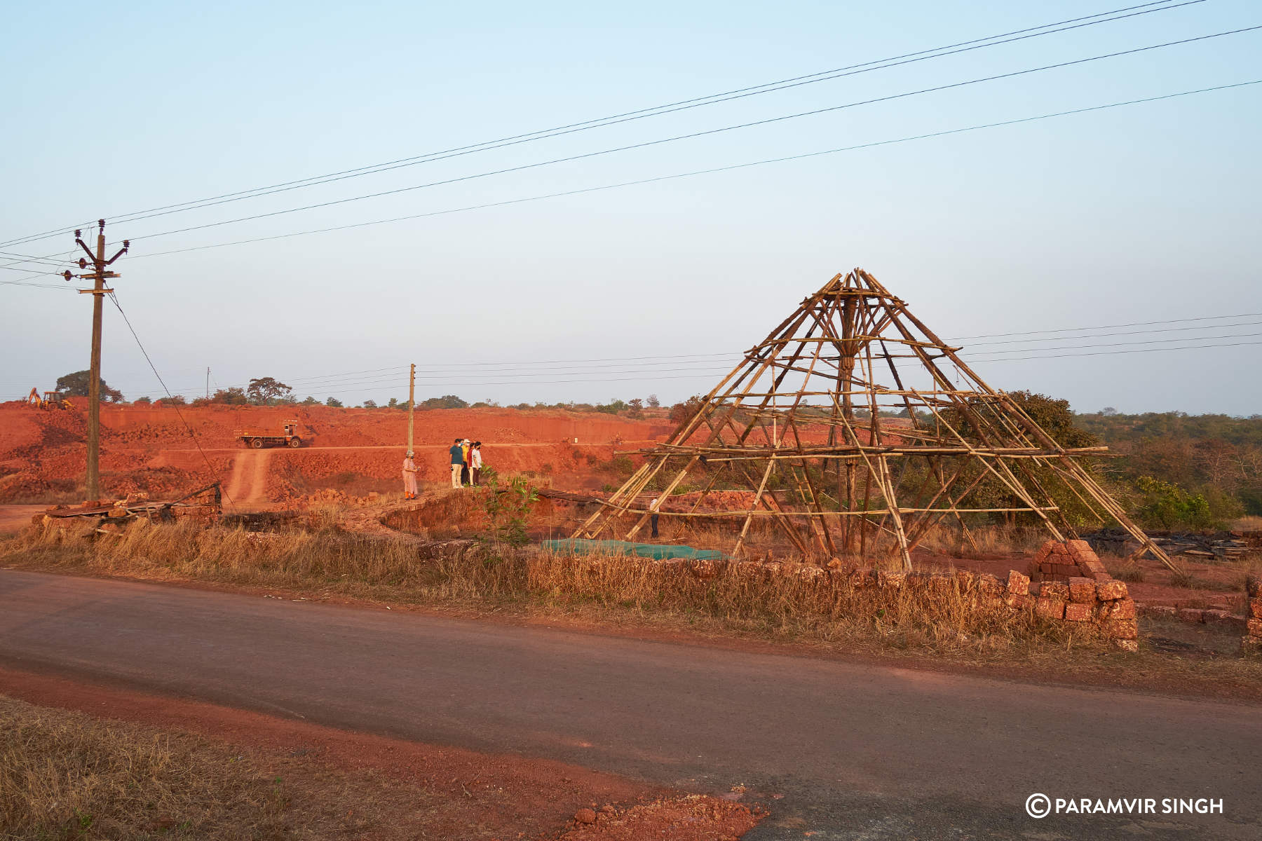
गणपतीपुळ्याला जाताना जाखादेवी हे गाव लागतं त्याच्यापासून जवळच एका विस्तिर्ण सड्यावर येथील अनोखी कातळशिल्पे आहेत. भोवताली सगळ्या जांभ्याच्या खाणी आहेत. त्यामुळे येथील अजून अज्ञत असलेली कातळशिल्पे देखील नष्ट होऊन जातील असे वाटते. मात्र येथील दोन ठिकाणांचे उत्तम संवर्धन केल्याचे दिसते. आजूबाजूला संरक्षक भिंत बांधून तीन चार फूट उंचीचा एक फलाट येथील शिल्पे नीट ध्यानात येण्यासाठी बांधला आहे.
येथील सर्वात महत्त्वाचे आहे ते एकशिंगी गेंड्याचे कातळशिल्प. कोंकणातून गेंडा सुमारे १५००० वर्षांपूर्वी नामशेष झाला. तर तो येथील शिल्परुपात कसा आला आणि एकदम अचूकपणे, ह्याचे कारण तो येथील मानवांनी तो त्याच काळात प्रत्यक्ष पाहिलेला होता.

आपले पुढचे पाय उचलून आणि मागच्या मागचे जमिनीवर रोवून हा गेंडा झेप घेण्याच्या पावित्र्यात उभा आहे. गेंड्याच्या शरीवर त्याच्या जाड कातडीची रेषा तर आहेच ह्याशिवाय अनेक अमूर्त आकार देखील ह्यात कोरलेले दिसतात.


येथे गेंड्याच्या सोबतीला आहे ते हरणाचे शिल्प

येथे नीट निरखून पाहिल्यास आपल्याला दिसते ते वाघाचे शिल्प.
वाघाच्या अंगावरचे केस उभे राहिले असून आखूड कानांचा आणि थोटक्या शेपटीचा वाघ जमिनीवर उभा राहिलेला आहे.

अगदी नीट पाहिल्यावरच हे ध्यानी येते.

ह्याशिवाय येथे आहे ते माश्याचे कातळशिल्प

ह्याच्यापासून पुढे अगदी दोन मिनिटांवर कातळशिल्पांची अजून एक साईट आहे. येथे काही मानवी आकृत्या आणि प्राण्यांची कातळकोरीव शिल्पे आहेत.
कातळशिल्पे संरक्षित केलेला भाग

हा गवा असावा

येथील अजून एक वैशिष्ट्यपूर्ण मानवाकृती दोन्ही पाय फाकवलेल्या अवस्थातील आहे. हे एक गतिमान शिल्प आहे.

ह्याशिवाय येथे इतरही आकृत्या आहेत पण त्या सर्वच येथे देणे शक्य नाही.
गणपती पुळ्याची कातळशिल्पे.
गणपतीपुळ्यापासून जेमतेम ४ किमीवर असलेल्या सड्यावर ही कातळशिल्पे आहेत.
एक प्रचंड मानवाकृती, एक नामशेष झालेल पक्षी (Elephant Bird) अशी अनोखी कातळशिल्पे येथे आहेत.

दोन्ही हात पाय एकत्र जुळवलेली साधी सारळ उभी मानवाकृती

नामशेष झालेला पक्षी

हे बहुधा माकड असावं

तर हे रानडुक्कर

पूर्ण दृश्य

ह्यानंतर आपण पाहू ती उक्षीची कातळशिल्पे
उक्षी कातळशिल्पे
गणपतीपुळ्यापासून २५ किमी तर जाखादेवीपासून १०/१२ किमीवर उक्षीच्या सड्यावर कातळशिल्पांच्या २ जागा आहेत. एका जागेवर पूर्ण अमूर्त शैलीतील शिल्पे आहेत. त्यात निरनिराळ्या आकृत्या, चौकोनी, गोलाकार इत्यादी विविध आकारांच्या नक्षी तर ओळखता न येणारे पशुपक्षी अशी विविध शिल्पे आहेत.
हा बहुधा कुठलातरी पक्षी असावा

विविध अमूर्त कातळशिल्पे


ह्या जागेच्या पुढेच काही मिनिटॲंवर आहे ते उक्षीचे एक अत्यंत महत्त्वाचे कातळशिल्प ते म्हणजे हत्तीच्या पूर्णाकृतीचे.
येथे शिल्पांचा भडीमार नाही, एकच एक शिल्प आहे जे ५.८.मी. ते ५.१२ मी. च्या आकारात कोरलेले आहे. हा हत्ती जरी द्विमितीय स्वरुपात असला तरी त्याचे दोन्ही कान, पाय आणि सोंड हे त्रिमितीय भास करुन देतात. लांबलचक सोंड आणि दोन्ही सुळे हत्तीने मान वळवल्याचे दाखवतात. जणू काही हा एक खराखुरा जीवंत हत्तीच आहे.

जवळून


कोंकणात गणपतीपुळ्याला आलात तर ही कातळशिल्पे अगदी आवर्जून बघाच. पुळ्यापासून अगदी जवळ आहेत. जायचा रस्ता चांगला आहे, गूगल नकाशांवर ती प्रमाणित देखील आहेत. आपल्या पूर्वजांनी सोडलेला वारसा आपल्याला पाहायला मिळाल्याचे समाधान नक्की मिळेल.
अश्मयुगीन इतिहासाच्या पाऊलखुणा; चंद्रपूर जिल्ह्यात आढळले दुर्मीळ खडकचित्र - ROCK PAINTING CHANDRAPUR
जिल्ह्यातील गोंडपिपरी तालुक्यातील वढोली गावात, उंच खडकांवर प्राचीन खडकचित्र आढळली आहेत. इतिहास अभ्यासक अरुण झगडकर यांच्या संशोधनानुसार या खडक चित्रांची संख्या ६० ते ७० आहे.
चंद्रपूर : चंद्रपूर जिल्ह्याला मोठा ऐतिहासिक वारसा लाभला आहे. प्राचीन काळातील अनेक पाऊलखुणा इथं आढळून येतात. त्यात आणखी भर पडली आहे, ती अश्मयुगीन खडकचित्रांची. गोंडपिपरी तालुक्यातील वढोली या गावाजवळ अशी तब्बल ६० ते ७० कोरीव खडकचित्रं (Petroglyphs) आढळली आहेत. महापाषाण युगात येथील भूभागावर मानव टोळ्या करून वास्तव्य करीत होते हे या संशोधनातून समोर आले आहे. "प्राचीन खडककलेचा समृद्ध वारसा हा सिंधू संस्कृतीइतकाच पुरातन आहे," असा दावा इतिहास अभ्यासक अरुण झगडकर यांनी केला आहे.
प्राचीन खडककलेचा वारसा सिंधू संस्कृती इतकाच पुरातन : गोंडपिपरी तालुक्यातील वढोली गावाजवळ तब्बल ६० ते ७० कोरीव खडकचित्रं (Petroglyphs) आढळली आहेत. भारतातील प्राचीन खडककलेचा समृद्ध वारसा हा सिंधू संस्कृतीइतकाच पुरातन असून, त्याचे अनेक अवशेष महाराष्ट्राच्या विविध भागांत विखुरलेले आहेत. 'पेट्रोग्लिफ्स' ही प्राचीन खडककलेचा एक प्रकार आहे. यात खडकाच्या पृष्ठभागावर विविध रेषात्मक, चित्रात्मक आकृती कोरण्यात आलेल्या असतात. चंद्रपूर जिल्ह्यातील गोंडपिपरी तालुक्यातील वढोली गावाजवळ नुकत्याच सापडलेल्या अशाच प्रकारच्या पेट्रोग्लिफ्समुळं या भागात एक नवा पुरातत्त्वीय संदर्भ पुढं आला आहे.
प्राचीन काळात मानवी वस्ती असण्याची शक्यता : वढोली हे गाव विदर्भाच्या दक्षिणेकडील चंद्रपूर जिल्ह्यात, जंगलविस्तार आणि खडकाळ भूभागाच्या सीमेवर वसलेलं आहे. या गावात सापडलेले 'पेट्रोग्लिफ्स' हे एका छोट्याशा खडकाळ उंचवट्यावर उघड्यावर आहेत. या परिसरात सध्या कोणतीही नदी किंवा पुरातन जलस्रोत नाही. परंतु प्राचीन काळात याठिकाणी मानवी वस्ती असण्याची शक्यता नाकारता येत नाही.
दगडावर असं बनवलं खडकचित्र : याठिकाणी अंदाजे ६० ते ७० दगडांवर कोरीव आकृत्या स्पष्ट दिसून येतात. मुख्यतः या आकृत्या सरळ, आडव्या आणि तिरक्या रेषांनी बनलेल्या आहेत. काही ठिकाणी क्रॉस, चौकोन किंवा जाळीप्रमाणं रचना दिसून येते. कोरण्याची शैली पाहता, दगडावर टोकदार वस्तूनं ठोकून किंवा घासून या आकृती बनवल्या असाव्यात.
स्थानिकांकडून होते पूजा : वढोली गावाजवळ आढळलेल्या खडकावरील कोरीव कामांमध्ये कोणतेही स्पष्ट मानव, प्राणी किंवा देवतेसदृश चित्र दिसून येत नाहीत. परंतु रेषात्मक जाळ्यांमुळं हे संकेतचिन्ह, दिशा सूचक नकाशा किंवा एखादे धार्मिक प्रतीक असण्याची शक्यता आहे. विशेष म्हणजे या ठिकाणी स्थानिकांनी एका मोठ्या दगडाला शेंदूर लावून देवस्थान म्हणून पूजाअर्चा सुरू केली आहे. ही बाब खडककलेच्या आणि लोकपरंपरेच्या संगमाचे उदाहरण आहे.
खडककला ४,००० ते १०,००० वर्षे जुनी असण्याची शक्यता : विदर्भात विशेषतः गोंड आणि कोरकू आदिवासी जमातींची परंपरा आहे. त्यांच्या पिढ्यानपिढ्यांच्या सांस्कृतिक सवयींमध्ये निसर्ग, खडक, वृक्ष यांची उपासना महत्त्वाची आहे. त्यामुळं या कोरीव खडककलेचा संबंध पूर्व-इतिहासातील आदिवासी प्रतीकात्मक संवाद प्रणालीशी असण्याची शक्यता आहे. अशा प्रकारच्या खडककलेची तुलना रत्नागिरी (कोंकण) मधील पेट्रोग्लिफ्स किंवा मध्य भारतातील भीमबेटका येथील भित्तिचित्रांशी करता येते. काही विद्वानांच्या मते, ही खडककला सुमारे ४,००० ते १०,००० वर्षे जुनी असू शकते, विशेषतः जर ते नवपाषाण किंवा मध्यपाषाण काळातले असतील.
संशोधन अहवाल होणार सादर : या महत्त्वपूर्ण शोधाची दखल घेत झगडकर यांनी शासन आणि पुरातत्त्व खात्याकडं संवर्धन आणि संरक्षणाची मागणी केली आहे. लवकरच एक सविस्तर संशोधन अहवाल संबंधित विभागांकडं सादर केला जाणार आहे.
अश्मयुगातला हा आदिम रहिवासी हळूहळू शेती करू लागला. प्राणीपालन करू लागला. डोंगर उतारावर पाहिजे तेवढी झाडी, गवत काढून तिथे जरूरीपुरतं भात, नाचणी पिकवायची. पुढच्या वर्षी तो तुकडा रानासाठी सोडून देऊन दुसर्या जागी गरजेपुरतीच शेती करायची. अशा प्रकारची शेती गोव्यातले आदिवासी आता आता पर्यंत करत होते. या शेतीला कुमेरी असं नाव आहे. वारुळं, नाग, भूमी, लिंग, जागेचे राखणदार पुरुष अशी त्यांची दैवतं होती. या वारुळांना सांतेरी असं नाव आहे. गोव्यात सगळीकडे आढळणारी सातेरी देवी म्हणजे आता 'शांतादुर्गा'. पण सांतेरी हे नाव अजूनही प्रचारात आहे. तर वेताळ, पाईकदेव, रवळनाथ हे सगळे राखणदार देव. तर लिंगदेवांना नंतर शंकर हे नाव मिळालं. या नैसर्गिक देवतांना त्यांच्या भोळ्या भक्तांनी कोणत्याही उपचारांशिवाय केलेली पूजा मानवत होती. त्यांची देवळंही कुठे नव्हती. तर वारुळं, जमिनीतून वर आलेला एखादा दगड यातच त्यांना त्यांचे देव दिसत होते. सुरुवातीचे कोळ-मुंड म्हणजे नंतरच्या काळातले कुळ-मुंडकार आणि कोळी, गावडे-गावकार हे गोव्याचे आद्य रहिवासी.
Usgalimal Goa
Goa is known for its beaches, but did you know it’s also home to one of India’s richest rock engraving sites?
Located on the serene banks of the River Kushawati in Sanguem Taluka, this historic site showcases stunning prehistoric petroglyphs — from human and animal figures to a striking labyrinth (चक्रव्यूह) pattern.
In Marathi, we call these carvings “कातळशिल्प”, and they’re believed to be thousands of years old, offering a rare glimpse into the minds and lives of our ancestors.
A truly unique, informative, and awe-inspiring place that proves Goa is more than just sand and sea.
“Far from the crowds, yet so close to our roots
https://www.evivek.com/Encyc/2020/12/24/Petroglyphs-in-Konkan.html
रणजित रमेश हिर्लेकर
9423303670
The Konkan Petroglyphs – Introduction
In the late 1980s whilst cycling around his neighbourhood, Sudhir Risbud recalled seeing as a schoolboy a strange and enigmatic rock relief pattern just off the road near the village of Niwali, 15 km from Ratnagiri, Maharashtra.
The mesmerising pattern caught his attention, with the strange geometric shapes, interlocking curls and concentric circles, and this relief seemingly cut short prematurely by the recent road construction. At the time he had absolutely no idea that what he was seeing was a prehistoric petroglyph, although he did know that the local tribal people identified it as a legacy from their ancestors and treated it with reverence.
In the following 25 years Sudhir, now an electrical engineer and avid bird watcher, would often go out exploring the Konkan landscape with colleagues Dhananjay Marathe and Surendra Thakurdesai. In that time they identified more examples of these strange rock carvings, but it wasn’t until a historian accompanied them on one of their trips that they finally learned the significance of their discoveries.
Fired up by this revelation, in 2010 Sudhir created an informal group called Adgalnavarche Konkan (Unexplored Konkan), and started a campaign to explore the Konkan region more systematically and informally record the sites. This plan was expanded yet further in 2012, engaging with the local villages who had knowledge of the landscape they would travel over long before new roads were built.
This new strategy was sparked by a chance meeting with a local shepherd at Barsu Sada, who recalled seeing similar rock carvings at a place called Gowal. Subsequent investigations of this site by Sudhir and his friends resulted in the discovery of a new petroglyph site consisting of 42 figures, including animal representations and geometric patterns.

Six years later, and as of January 2019 there have been 52 confirmed and explored sites, and over 1,000 petroglyphs discovered. A further 16 sites have been confirmed but yet to be fully explored and recorded.
Although some of the petroglyphs (primarily at the road side Niwali site) had made it to the archaeological record as far back as the 1990s, it took an astonishing two decades before the state archaeological department finally got involved in exploring and recording the sites, an effort that commenced in 2018. A fund of 240 million rupees ($3.2m; £2.5m) has been set aside by the state government to study and record in detail 400 of the identified petroglyphs.
An ongoing project to visit local schools is also underway, not just to learn of potential new sites, but also to educate the children on the significance of these petroglyphs and how they need to be identified, recorded and protected in the landscape.

The majority of the petroglyph sites are in quite remote locations, away from villages on the laterite plateaux. They are believed to date to the mesolithic and neolithic period, potentially as far back as 10,000 BC. Some of the carvings may be associated with the period in human history when we transitioned from a hunter-gatherer lifestyle (mesolithic) to a more settled existence when farming started (neolithic), but the lack of material culture associated with these petroglyphs has thus far prevented us from making any firm conclusions.
This lack of concrete dating evidence is unfortunately a by-product of the way in which they were discovered. Whilst amateur archaeology probably accounts for up to a quarter of all the world’s archaeological discoveries, the removal of soil from around the carvings by keen and enthusiastic discoverers has probably removed key evidence that was locked away in a sealed context for thousands of years.
The sites themselves are also at huge risk of being lost or damaged from road construction, mining, plantations (mango and cashew), erosion (human and natural) and, somewhat ironically, from the well natured attempts by locals to preserve the sites themselves.
I cannot stress enough how critical it is for the state archaeological department and the local community to work together in ensuring these sites are properly explored, recorded, and then protected for future generations to see and research further.
In the case of new sites that are still being discovered, there needs to be a process in place where targeted archaeological excavations occur at the time of discovery, so we can tease out as much evidence as possible from that thin layer of soil that sits on top of and around the laterite carvings.
Similarly for preservation, a clear strategy needs to be in place that ensures the right course of action is taken. Many of the local communities are rightly proud of the discoveries on their land, and can see the opportunities it may present in terms of visitors, tourism, and the subsequent boost to the local economy. However, all this enthusiasm channelled in a slightly misguided direction can result in the permanent and irreversible damage to the areas around the petroglyphs and to the carvings themselves. Everyone involved needs to pull together and jointly ensure the safeguarding of these sites under often challenging circumstances.

Over the course of a weekend I visited just 7 of the 68 confirmed sites around Rajapur and Ratnagiri, and they are all utterly astonishing. The links below will take you to a separate blog post on each of the sites, giving a brief overview of what there is to see, and some of the risks that currently hang over them.
What struck me when visiting these sites is the huge variety of carvings they have. Some sites have clear and obvious depictions of animals such as elephant, rhino, buffalo, pig, tiger, deer, rabbit, varieties of bird, aquatic animals (fish, sharks, stingray), and humans – often life size, whilst other sites have abstract geometric patterns that are often incredibly complex and symmetrical. . Thus far there has not been any correlation between the types of petroglyphs found and their geographical location in the landscape.
In a wider context, similar petroglyphs have already been discovered in Usgalimal, south Goa, and just last month a new site in Kollur, Kanataka has been reported. I get the feeling that we may be just scratching the surface (no pun intended!), there are likely to be many more discoveries yet to be made.
Please ensure you read my advice on visiting these sites at the end of this blog post.
Click on a tile below to read more about the sites I visited.
If you decide you’d like to visit any of the petroglyph sites in the Konkan region, here’s a few pieces of advice :
- Do not attempt to visit the sites by yourself.
The petroglyph locations are on private land, and I strongly recommend
you have a guide to help you both locate them and help interpret
carvings. You are welcome to contact the following people:
- Sudhir Risbud
- bhairisbud@gmail.com
- Tel: 9422372020
- Rutwij Apte (State Archaeology Department)
- rutwigapte@gmail.com
- Tel: 7507134624
- Sudhir Risbud
- Do not walk on any of the carvings. Some may think that laterite is a very hard rock that is not prone to erosion, but you only have to look at pathways and tracks across the plateaux to see the irreversible damage human activity has on the landscape. Besides, these are wonderful works of art and should be treated with the utmost respect, would you walk all over the Mona Lisa ?
- Do not take any drone photography. The environment needs to be respected, and regardless of how good you might be at flying your drone, a crash land by mistake on the petroglyphs will damage them.
- Do not make any attempt to mark out the carvings with paint, chalk or by some other method. Not only will you be walking over the petroglyphs to do this, but applying substances to the carvings can itself damage them.
- Do not attempt to clean the carvings with abrasive brushes. Again, you might think that the laterite can take this activity, but over the years and decades it will have an impact on the petroglyphs.
- Be aware of snakes. The laterite plateau is the perfect habitat for snakes that will not like being trod on. Wherever possible please stick to the paths.
- Take your litter home home with you. Always.
Finally, I would like to thank the following people who made my trip both possible and unforgettable. That weekend was definitely a highlight of my 21 visits to this amazing country.
References for this series of blog posts:
- Tejas M. Garge, B.V.Kulkarni, Rhutvij R. Apte and Sudhir Risbud. December 2018. Petroglyphs In Konkan : Historiography, recent discoveries and future endeavours.
- Derek B. Counts, Bettina Arnold. 2010. The Master of Animals in Old World Iconography.
- BBC News Marathi. October 2018. Prehistoric art hints at lost Indian civilisation.
- The Hindu. October 2018. The petroglyphs of Ratnagiri.
- Wikipedia. 2019. Master of Animals.
- Wikipedia. 2019. Aquarius (constellation).
Please ‘Like’ or add a comment if you enjoyed this blog post. If you’d like to be notified of any new content, just sign up by clicking the ‘Follow’ button.
If you’re interested in using any of my photography or articles please get in touch. I’m also available for any freelance work worldwide, my duffel bag is always packed ready to go…
KevinStandage1@gmail.com

 |
| Fig 1: Ratnagiri, Maharashtra on the Konkan coastline. Source: Google Maps |
While some of the petroglyphs were known to the locals and regarded as holy, most of them were hidden beneath layers of mud and soil deposited during the intervening millenia. They were discovered due to the diligent efforts of a group of explorers led by Sudhir Risbood and Manoj Marathe, who began searching for the images in earnest after observing a few in the area.
When I looked at these pictures, I was astonished to find 3 images which depict sacred symbols of global importance, which have been found in the art and culture of many subsequent civilizations.
This large petroglyph depicts what appears to be the Winged Scarab, a symbol that was very popular in ancient Egypt and symbolized creation and rebirth. The symbol appears on Egyptian tomb paintings, carvings, and manuscripts. Miniature scarabs carved from stone or moulded from faience were worn as amulets and jewelry, and used as impression seals.
|
| Fig 2: Petroglyph in Ratnagiri, Maharashtra, India, depicting the Winged Scarab. Source: bbc.com |
|
| Fig 3: Winged Scarab on the breastplate of Tutankhamun. Source: Egyptian Museum, Cairo. |
Just as the scarab beetle pushes or rolls a ball of dung across the earth, Khepri pushed the sun across the sky every day. The ancient Egyptians believed that Khepri renewed the sun every day before rolling it above the horizon, then carried it through the other world after sunset, only to renew it, again, the next day. This reinforced the scarab’s association with creation and rebirth.
The visual similarity between the petroglyph discovered in India, and the Egyptian symbol of the Winged Scarab or Khepri is quite striking. Although the “sun-disk” being pushed by the scarab is not very clear in this image, it can be made out from the aerial view shown below.
|
| Fig 4: Aerial view of the Ratnagiri Petroglyph depicting the Winged Scarab. Source: bbc.com |
It is now well known that Younger Dryas comet impact initiated a vicious cold snap, accompanied by fires, floods, and black rain, which brought about the extinction of a large number of North American megafauna and a prehistoric culture. In 9703 BCE, the cold snap ended as abruptly as it had started, for reasons not clearly understood. The sudden transition out of the Ice Age to a warm interglacial climate may have precipitated a global flood of mythic proportions, which is recounted in the flood legends of many ancient cultures.
|
| Fig 5: 12,000-year-old petroglyph at Ratnagiri, India, depicting the Egyptian Winged Scarab |
Another exquisite petroglyph discovered at Ratnagiri depicts a man who appears to be holding two animals by their hind legs. This is a symbolic motif in ancient art that is referred to by scholars as the “Master of Animals”.
|
| Fig 6: Petroglyph in Ratanagiri, Maharashtra, depicting the Master of Animals. Source: bbc.com |
|
| Fig 7:
Horus standing on crocodiles and holding a lion and a jackal by their
tail, along with scorpions and serpents, An Egyptian Faience Cippus,
304-30 BCE. Source: www.christies.com |
|
| Fig 8: A relief of the Master of Animals from Mesopotamia. 9th - 8th century BCE. Metropolitan Museum of Art, New York. Source: www.my-favourite-planet.de |
|
| Fig 9: Mistress of Animals holding in each hand a lion by its tail. Gold plaque pendant. Kamiros, Rhodes, 720-650 BCE. Ashmolean Museum, Oxford. Source: www.my-favourite-planet.de |
|
| Fig 10: Ratnagiri Petroglyph showing a figure lifting up a pair of tigers. Source: bbc.com |
|
| Fig 11: Mohenjo-Daro seal depicting a man grappling with two tigers. Source: www.harappa.com |
|
| Fig 12: Master of Animals depicted on the Gebel el-Arak knife, c.3300-3200 BC, Abydos, Egypt. Source: Wikimedia Commons / ALFGRN CC BY-SA 2.0 |
|
| Fig 13: Chalcedony cylinder seal showing a divine hero wrestling two bulls from the Neo-Babylonian period, late 8th-7th century BCE. Source: Yale Babylonian Collection |
The depiction of this motif on 12,000-year-old Indian petroglyphs indicates that the symbol had its origin in remote antiquity, and was used by an Ice Age civilization to represent its heroes. Did the people of this time really have such immense physical strength, so as to subdue two large wild animals with their bare hands? If so, it would lend credence to the assertions of our ancestors that human beings have reduced in stature and strength , as we "devolved" from the Golden Age to our current age of discord and strife known as the Kali Yuga (or Iron Age) in the ancient Hindu texts.
 |
| Fig 14: 12,000-year-old petroglyphs of Ratanagiri, India, depict the Master of Animals |
Another intriguing petroglyph discovered at Ratnagiri depicts a pair of fish facing opposite directions, connected by some kind of a strap. This symbol has been used for thousands of years to depict the Pisces constellation. The Pisces astrological symbol consists of a pair of fish swimming in opposite directions, with a chord connecting the two fishes so that they remain together.
|
| Fig 15: Ratnagiri Petroglyph depicting the Pisces constellation. Source: bbc.com |
|
| Fig 16: Roman era relief carving of Pisces symbol. Credit: Kleon3 CC BY-SA 4.0 |
However, the discovery of this petroglyph changes all of that. It pushes back the date for the origin of astrological symbols to the period around 10,000 BCE or earlier, and raises the very real possibility that our astrological knowledge is a legacy of a lost civilization that flourished during the Ice Age.
|
| Fig 17: 12000-year-old Ratnagiri Petroglyph depicting the astrological symbol of Pisces. |
This petroglyph shows a man holding an object above his head with both hands, looking similar to Aquarius, the Water Bearer, who pours out a stream of water from a Water Jar held above the head (or on the shoulder).
|
| Fig 18: Ratnagiri Petroglyph depicting the Aquarius constellation. Source: bbcmarathi.com |
|
| Fig 19: 12000-year-old petroglyph of Ratnagiri, India, depicting the astrological symbol of Aquarius. |
While there may be additional petroglyphs in the Ratnagiri area that depict the other signs of the zodiac, it is a curious coincidence that the first two constellations that caught my eyes were those of Pisces the Fish and Aquarius the Water Bearer. As per the doctrine of the Astrological Ages, we are currently in the Age of Pisces, and about to transition into the Age of Aquarius, sometime in the near future. Perhaps, these 12,000-year-old petroglyphs are giving us a timely reminder of this very important upcoming transition into an Age where wisdom and intuitive understanding will blossom once again in the minds of men.
The very fact that the petroglyphs of Ratnagiri have been dated to c.10,000 BCE, when humanity had just emerged from the terrible devastation of the Younger Dryas epoch, suggests that these symbols might encapsulate the esoteric wisdom of a civilization that flourished during the Ice Age, and which perished during the Younger Dryas cataclysms.
The survivors of this “lost civilization” would have settled at many places around the globe, and one of the settlement zones was the Konkan coast of India. Having witnessed their erstwhile civilization being reduced to rubble, the survivors may have refrained from building large monuments. Instead, they etched their sacred symbols on the hard, rocky landscape, which could have transformed into open-air altars.
One of the mysteries of the Ratnagiri petroglyphs, which the BBC report has pointed out, is that they show animals such as the rhinoceros and hippopotamus which are not found in the region. The report states,
“But this begs the question of why some of the petroglyphs depict animals like hippos and rhinoceroses which aren't found in this part of India. Did the people who created them migrate to India from Africa? Or were these animals once found in India?”
The depiction of the hippopotamus is more curious. The Hexaprotodon – a family of hippopotamus relatives – flourished in India from around 5.9 million to 9000 years ago. The last known specimen of the Hexaprotodon lived in the Narmada Basin in Madhya Pradesh, around 16,467–15,660 years ago. This was determined on the basis AMS dating of a fragmented tooth unearthed in 2003. What this implies is that, the people who carved the hippopotamus petroglyphs on the Konkan coast must have done so at least 9000 years ago!
I noticed that there is at least one petroglyph that looks like a kangaroo! The kangaroo is believed to be indigenous to Australia, and are not found anywhere else. Does this mean that the people who made these petroglyphs had oceanic contacts with Australia? Or perhaps, just like the hippo, the kangaroo was also found in India in the past, and it became extinct sometime around the beginning of the Holocene epoch?
|
| Fig 20: Ratnagiri Petroglyph depicting a kangaroo. |
Overall, these ancient petroglyphs have the potential of completely overturning the current beliefs regarding the origins of civilization. There are hundreds of petroglyphs in the Ratnagiri area which depict animal and human figures, as well as complex geometric forms, which could help us unlock the mysteries of humanity's past.
Earlier in 2002, nearly 60 petroglyphs were discovered in the Sindhudurg district of Maharashtra in the Konkan (coastal) region, which were tentatively dated to between 7000 BCE – 4000 BCE.[3] One of the images found here resembles the “Imperial Eagle” symbol which has served as an insignia of royalty and has been displayed on the Coat of Arms of many nations throughout history.
|
| Fig 21: 9000-year-old Sindhudurg petroglyph depicting the Imperial Eagle symbol. |
|
| Fig 22: 9000-year-old Sindhudurg petroglyph depicting the Staff God of the Andes |
The oldest known depiction of the Andean Staff God was found in 2003 on some broken gourd fragments dated to c.2250 BCE, which means that this Sindhudurg petroglyph predates the earliest known depiction of the Staff God by thousands of years.
Conclusions
Evidently, the petroglyphs of the Konkan region of Maharashtra, stretching from Ratnagiri in the north to Sindhudurg in the south, contain some of the earliest depictions of the sacred symbols used by ancient cultures around the world. The dating of these petroglyphs to around 10,000 BCE, on the basis of some Mesolithic tools found at the site, pushes back the date for the beginnings of astrological lore and sacred symbolisms to the beginning of the Holocene epoch, when humanity had just emerged from the cataclysms of the Younger Dryas period.
The depiction of animals such as the rhinoceros and hippopotamus gives us some idea of the antiquity of these petroglyphs. The rhino became extinct in the Indus Valley at around c.2000 BCE, and may have become extinct in the Konkan at that time. The hippopotamus (Hexaprotodon), on the other hand, became extinct in India more than 9000 years ago, which means that these petroglyphs must have been carved prior to that date. The depictions of an animal resembling the kangaroo raises questions about the existence of this animal in India in the remote past.
Due to the far-reaching implications of these symbols, the dating of the petroglyphs to around 10,000 BCE is bound to come under scrutiny. More evidence needs to be collected using different techniques such as radiocarbon dating, thermoluminescence etc. to ascertain the period of carving more precisely. The petroglyphs of the Konkan coast have been discovered over the past couple of decades, and they have always been recognized as being extremely old, predating most of the known ancient civilizations of antiquity.
This analysis is based on a small sample of petroglyph images contained in the BBC report and a video on the BBC News Marathi TV Channel. Hundreds of petroglyphs have been found till now in the Ratnagiri and Rajapur area, which need to be studied in detail, in order to better understand this ancient Konkan culture, and to identify symbolic and cultural connections with other cultures. There is no doubt that this is an extremely significant discovery which can fundamentally alter our current perceptions about the origins of sacred symbols and astrological lore. .
Petraglyphs in Ratnagiri
One of our recent trips to Ratnagiri, Konkan Maharashtra, yielded an unusual discovery. Thousands of years old rock carvings made by early humans. Such carved drawings on rocks are called Petraglyphs, and we must be thankful to Mr Sudhir Risbud, who has painstakingly discovered, documented and made (continues to make) supreme efforts to preserve these and bring some public attention to these.
Our hosts told use as part of “what to do”, to speak to Sudhir Risbud on what we can see around the area and that he has interesting visits in mind. We had no idea we would be seeing rock carvings, made around 20,000 BCE to 2000 BCE! (Mr Sisbud says it is very difficult to accurately time these peraglyphs, but we can get a fair idea from the materials used and the animals portrayed. We find drawings of Rhinocerous, but they have been extinct from this area for 10s of thousands of years. Elephants have been carved as well, which are not found here for many years now).
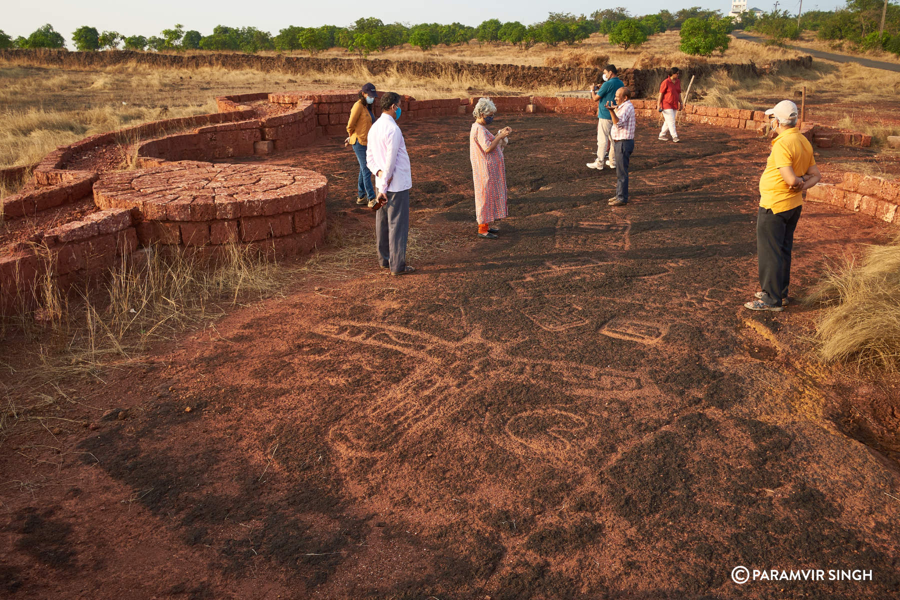
We fixed a date with Sudhir Risbud he asked us to come to a certain location where he would be bringing other visitors. These locations are as yet not mapped on popular apps (thankfully, since many of these are not yet properly protected), so we kind of lost our way. Weak phone signals further complicated things. Finally we managed to speak to Mr Risbud, waited for him at a village crossing and when his car reached we followed him to the interiors of the plateau region. Walking through the tall grass we saw this spot with a aesthetic brick boundary built around it and a small raised podium where one can stand to get a toppish view of the carvings.
We saw a rather well detailed drawing of a male tusker with 5 toes. I was wondering the person who carved it knew how to count and had remarkable observation.
Mr Risbud and Dhananya Marathe have been searching for and documenting about 1200 such carvings since 2012, when Mr Risbud accidentally came across one site, and rightfully wondered there must be many more. These are carvings from the stone age, when woman (and man, for that matter) was a hunter gather. Most of the drawings art of animals : elephants, rhonocerous (which are no longer found here), deer, fish, birds, wild boar. Some carvings look like human figures. Some are abstract. Were these just observations? Were they meant to convey something to the next bunch of hunter-gatherer teams coming from behind? Will we ever know?
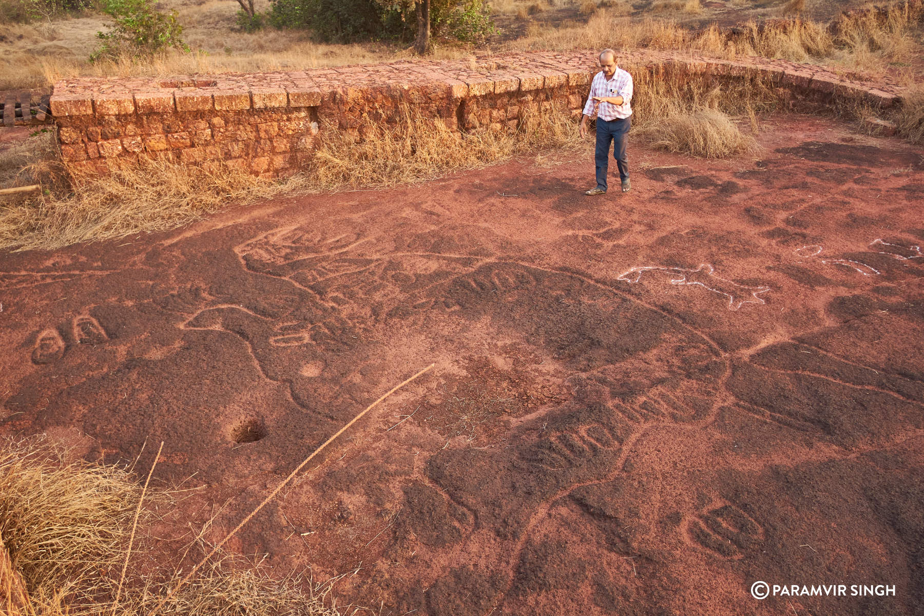
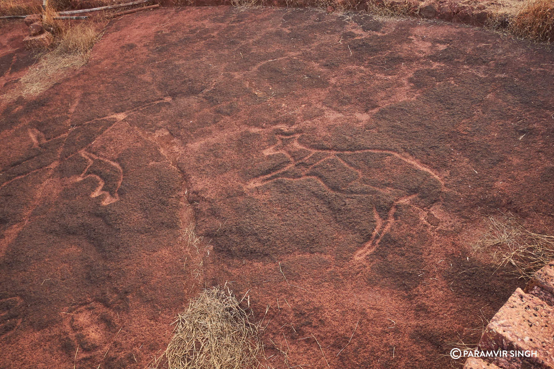
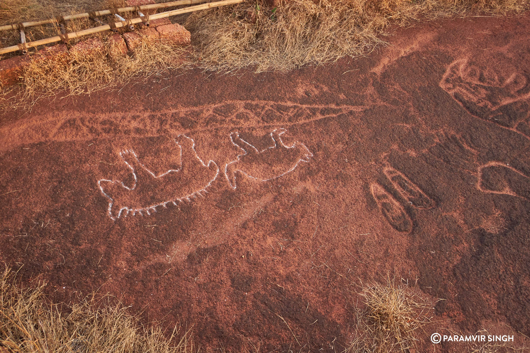
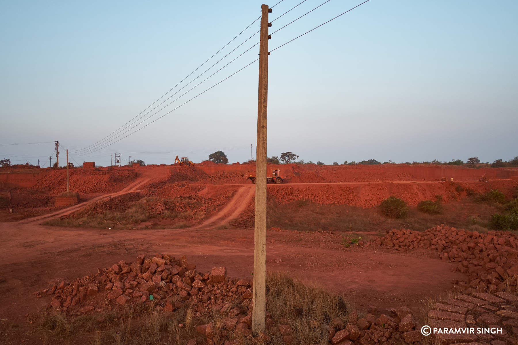
What is Petroglyphs? Ratnagiri petroglyphs.
Petroglyphs are carved into rock surfaces by scraping, rubbing, or chipping.
Geoglyphs are larger ground markings created by trenching or removing away rocks and the top layer of soil in patterns or lines that contrast with the surrounding natural surface. and geoglyphs are only visible from sky.1
As nouns the difference between petroglyph and geoglyph
Is that petroglyph is (archaeology) a rock carving, especially one made in prehistoric times while geoglyph is a large-scale drawing made on the ground by scratching or arranging lines of stones etc.

Ancient Rock Art in the Plains of India
Two amateur sleuths have uncovered a collection of mysterious rock carvings on the Indian coastal plain south of Mumbai.
Credit…
By James Gorman
Photographs by Atul Loke
- May 7, 2019
RAJAPUR, India — In the evening breeze on a stony hilltop a day’s drive south of Mumbai, Sudhir Risbud tramped from one rock carving to another, pointing out the hull of a boat, birds, a shark, human figures and two life-size tigers.SIGN UP FOR SCIENCE TIMES: Get stories that capture the wonders of nature, the cosmos and the human body.Sign Up
“They’re male,” he said with a smile, noting that the carver had taken pains to make the genitalia too obvious to ignore. He was doing a brief tour of about two dozen figures, a sampling of 100 or so all etched into a hard, pitted rock called laterite that is common on the coastal plain that borders the Arabian Sea.
The carvings are only a sample of 1,200 figures that Mr. Risbud and Dhananjay Marathe, engineers and dedicated naturalists, have uncovered since they set out on a quest in 2012. The two men are part of a long tradition of amateur archaeologists, according to Tejas Garge, the head of the Directorate of Archaeology and Museums for the state of Maharashtra, and the petroglyphs they have uncovered amount to a trove of international significance.
They are the most recent collection of rock art to join other images left by Stone Age peoples around the globe. Like paintings and carvings in Australia, the American Southwest, Africa and elsewhere, the carvings are cryptic messages left by people whose lives are lost in the mists of deep time.
Dr. Garge estimates the oldest of the ground carvings are 10,000 to 40,000 years old, but dating such images is imprecise, particularly since rigorous study of the whole collection is just beginning.
Some of the images appear to relate to a life of hunting and gathering — deer, fish, turtles. Others depict animals of great power, like tigers and elephants. And there are humans, probably fertility figures, images of a mother goddess like those found elsewhere in India and around the world. The fertility images are usually accompanied by abstract designs, and some of the carvings are all abstract.
Even now, they can stir the emotions and the imagination the way they must have ages ago.
Some are worn, others still vivid, especially where they have been sprinkled with sand to fill the deep grooves. Dr. Garge said the state had earmarked about $3 million for preservation of the drawings and for research to narrow their age and try to learn about the people who made them.
Unlike most other Stone Age rock carvings around the world, these images are not drawn on walls or standing rocks, but cut into the exposed stone of flat hilltops along what is called the Konkan coastal plateau. Their style is realistic for the animals, and more stylized for humans. Most of the animals, including elephants, are life-size and one site with multiple carvings is the largest in South Asia, Dr. Garge said. He believes it should be a national monument.
The discovery so far has not received a great deal of academic attention, but Jean Clottes, an expert on cave art and the editor of the International Newsletter on Rock Art, said in an email that the collection of images “is an important discovery, no doubt.” He said well-preserved carvings on the ground have been found elsewhere, but are unusual.
Meenakshi Dubey-Pathak, a freelance researcher and artist who has published extensively on Indian rock art said the carvings share imagery with other Indian rock art and rock art worldwide.
“These were hunter gatherers,” she said and the carvings were not art for art’s sake. “They had meaning and purpose,” she said.
Indian tourists have been visiting the sites, since published reports of the epic journey of discovery by Mr. Risbud and Mr. Marathe first appeared last fall. But the sites are not easy to locate. You can find images on the tourism website for Ratnagiri, but there are no directions to or GPS locations for the various sites.
To find the carvings, a tourist needs to ask local town and village residents; Dr. Garge, Mr. Risbud and Mr. Marathe would like to keep it that way. Most of the carvings are on private land, and it would be costly to buy all the sites to preserve them. Dr. Garge hopes to make the sites a source of income to local residents.
He described an encounter with a tea seller who had a small stall at a crossroads near one of the sites. The state had considered putting up signs with directions, Dr. Garge said, but the tea seller asked him not to do so.
Editors’ Picks
How a Herd of Elephants Won China’s InternetCheers for Carl Nassib Show a Changing Football CultureDoes the Job of Talk-Show Sidekick Even Make Sense Anymore?Continue reading the main story
People stop, they have at least a cup of tea and they ask directions, the tea seller told him. And his income has climbed as word of the carvings has gotten out. Now, Dr. Garge’s department is working on pilot projects for 15 sites to provide a comfortable viewing area with an elevated platform, a concession stand and a way for a village to sell tickets.


Some of the carvings were known to locals before Mr. Risbud and Mr. Marathe began their investigation. And researchers had done a study on one site in 1980. Amateur historians and some academics had written a bit about the few that had been identified. But it was only after the two engineers began to explore systematically and recruit other searchers, that the number and richness of the carvings became clear. Indian newspapers and the BBC reported on the extent of their finds last year.
The two friends are both avid naturalists. Mr. Marathe has published a guide to birds of the Konkan plateau. They met while participating in a bird survey. Both had recollections of seeing the drawings when they were younger and a general interest in everything about the Konkan plateau. So the search began.
It wasn’t easy at the beginning, Mr. Marathe said. For the first two years, he said, “we had no luck.” But then one day they encountered an old shepherd who told them about a newly discovered carving. They began to seek out herders who bring cattle or sheep onto the plateaus after the monsoon season when the sparse vegetation of the hot months gives way to a burst of lush grass and flowers. The herders and their families pointed them to other sites, often adding mythological stories of how the carvings came to be.
For instance, Mr. Marathe pointed to one depression in the rock that could be taken to be an impression left by someone lying down. According to villagers the impression was left by Sita, Lord Rama’s wife, who was stolen away by the demon king Ravana in the epic poem the Ramayana. This was where Ravana, while on the run, lay with Sita.
From December 2012 until now, Mr. Marathe, Mr. Risbud and other friends have not only sought out new carvings, they have pursued government support at all levels for the recognition and preservation of the carvings.
“They have tremendous passion,” Dr. Garge said. “They could extract this information from locals and they could find all this, so we are really grateful.”
Dr. Garge, whose specialty is historical archaeology, met the men after coming to Maharashtra in 2017.
He visited some of the sites and appointed a member of his staff, Rhutvij Apte, to oversee research. Dating rock carvings is not easy, but there are clues, Dr. Garge said. One is that once agriculture appears, people carve images of bulls. There are no such images in the drawings from Maharashtra, he said, which feature every variety of wild animal, suggesting that these carvings were made by people who hunted and foraged for wild plants.

If the carvings were made before the development of agriculture, that would date them to at least 10,000 years ago. Another clue is that the carvings include images of rhinoceroses and hippopotamuses. That suggests that the drawings date even farther back, to 20,000 or 30,000 years ago because fossil evidence indicates that’s when those animals lived in this region. The realistic details in drawings, like the shape and placement of horns suggest personal knowledge of the animals, not creation from hearsay.
Finally, there are stone tools. When Mr. Apte started coordinating research he found microliths, small stone tools, characteristic of the Mesolithic period, which stretches as far back as 40,000 years ago. Without definitive dates, Dr. Garge puts the range at 10,000 to 40,000 years.
The next steps in research, he said, are to document each figure with drone photography, photographic mapping, and, if the budget permits, three-dimensional laser scans, so that if the carvings were lost to erosion or construction or mining of the laterite stone for brick, they could be recreated not only in outline, but in-depth, which can give an indication of carving technique.
Dr. Garge’s department will also be looking for evidence of the people who made the carvings. The figures are found only on windswept hills that are flooded during monsoons, places where there would have been no shelter. The carvers would have had to come to these places on purpose to make the drawings.
This year researchers began excavating a cave about 20 miles away and found microliths like those on the hilltops, as well as other, larger stone tools. “We are hoping to find more shelter sites in closer proximity to the petroglyphs,” Dr. Garge said.
For now, the carvings are mysterious and pose interesting questions about the people who lived during that time period. “Do you think society was advanced enough that they would pay for artistic work” in the form of food sharing, for example, Dr. Garge wondered, or were they freeing a group member from hunting or gathering to sit and dig into stone?
And he noted that worldwide, rock carvings come from a time when humans were beginning to grapple with the meaning of the forces that affected their lives, perhaps when the first religious ideas were forming. Many of the animals featured in the drawings could have been objects of fear, he said, “elephants, rhinos, sting ray, shark,” not to mention tigers.
It would make sense, he said, if these potentially dangerous creatures were invested with some spiritual power. “You always worship malevolent gods first,” he said.

Petroglyphs of Sindhudurg
District of Sindhudurg is a narrow stretch of land running 110 km North to South and 50 km West to East. To its west is Arabian Sea and Eastern boundary is Sahyadris (Western Ghats). Sindhudurg is the southernmost district of Maharashtra, India.

Entire district of Sindhudurg is made up of Laterite stones plateaus. Height of these plateaus vary from 120 meters to 200 meters. Plateaus are generally barren and only the surrounding slopes have forestation. These days special techniques are used for planting mangoes on such plateaus successfully. Water bodies flowing between gaps of two adjoining plateaus form rivers which are flooded during rains. Today typically dhangars have settlements on such plateaus, who stay with their sheep, goat and cattle. They have also prepared some part of the plateau where farming can be done. But when agriculture was not started and forestation would have been very thick on slopes, these plateaus could have been places for staying for then man. Susrondi cave (17.436121, 73.224176) near Palshet/Guhagar is suggested to be used for living from 90,000 BCE. Recent excavation in 2019 at Koloshi Tal Kankavli , 52000 years old stone tools have been found in laterite cave.
Cross section of laterite near hiwale village sindhudurg. one can see only top portion is turned laterite mostly due to heavy rainfall.

Since many years we have been cutting bricks from Laterite for construction. Angkor Vat in Cambodia uses Laterite bricks which are 1000 years old. I have also seen laterite bricks used in Vat construction in Thailad, even Buddha statues carved out of it. Today we use machines to cut these bricks but until recently it was done using metal hand tools. So this stone can be cut easily.
Due to heavy rains (average 3300 mm) corrosive red laterite stone can be abraded or carved without metal tools. Laterite is used for rock arts including pictographs and petroglyphs. Pictographs are painting and drawings on the rock walls mostly in caves. Petroglyphs are images carved into rock. Oldest known laterite monument is from Upper Paleolithic period (50,000 to 10,000 BCE). Bhimbetka(sand stone) is perhaps oldest known cave in India 1,00,000 years old. Its paintings are dated from 30,000 BCE. Petroglyphs are mostly from Neolithic age and can be stated as next step after pictographs.
Kudopi - Malvan is a famous tourist beach town in the state of Maharashtra. From Malvan motorable road via Achra goes to Padekap (16.238269, 73.501018) From this place 1.5 km trek towards North East brings you to a smaller hamlet (16.247424, 73.511209). Now there is a kaccha road to this place. This is the closest settlement where you can seek guide and water. Another half an hour walk with a local guide brings you to the Petroglyphs site of Kudopi. Height 120 meters. Other than images Kudopi also has a square well with steps.
Image Set Kudopi

Hiwale - From Malvan via Masure one has to reach Asgani Village. From here kachcha road takes you to the dhangarwadi on Hiwale sada 16.201567, 73.616061. One can also do a trek from Navamboli Hiwale 16.201567, 73.616061. This ascend would take 45 minutes. Once reached at dhangarwadi you can seek guide and water. Other than images Hiwale also has a Laterite brick dome temple, well and a pushkarni.
Image Set Hiwale
Barsu (Ratnagiri District) - From Rajapur towards Adiware take left turn to kachcha road at 16.668447, 73.475607. From here another 2km drive takes you to the petroglyphs site 16.650000, 73.475125.
Image Set Barsu
Common images are that of Animals and Fish. They are lifesize images. So mostly these animals were hunted and meat was cut and distributed here. Even today in Kokan villages when wild boar is hunt, meat is cut and distributed in equal parts. This activity takes place typically on sadas. So what about human figures or Elephant figures. Fish are not available on plateaus. They are in rivers and sea. So were these people fishing. Were they using boats.
The image at Barsu resembles that of boat and also anchor. No but metal was not yet discovered. so that arrow indicates something else. It is very similar to harappan image. And this is not a surprise. This is clearly a hunting image.


In Goa the images are carved near the flowing river. Fishing with spears is a possibility. Fishing with wooden traps or by removing water from fish holes is a possibility.
Animals and fish mostly they are seen in pairs. Some images can also be identified that of mother goddess. Is this part of sex worship and fertility deity? This is the extension of cave paintings / art. But is it also part of some religious rituals? Are they part of God and Goddess image evolution?
There are also images of Rhino and Hippo carved. These animals were not known to be existed in recent past in Kokan. But may be they existed. Then the age of these carvings go back to todays estimated dates. They why and how these images are carved here?
At devihasol
the carving is near the famous aryadurga temple. Palakhi of devi is
placed here on the petroglyphs during processions. There is concept of
Mand of every village in Sindhururg where Palkhi or Nishan or Tarangs
are placed during annual processions of the God / Godess.
Although humans were speaking languages they were not writing language
as a script till such time. So are they practicing some script? Are they
marking it for ownership of area. Agriculture and Metal age is about to
start. Possibilities are enormous.
Such images are also found in Karnataka and Kerala.
More and more such sites need identification, classification and preservation. For this more and more enthusiasts have to visit. I hope this article will serve that purpose.
- Madhukar Dhuri.
Other sites nearby -
Virdi - These site is now destroyed.
Usgalimal (Goa) 15.1233113,74.1278133
Devihasol (Rajapur) 16.7399309,73.4359902
Dangmode (Malvan)
Ratnagiri District has many such sites including Barsu, Devache Gothane,
Devihasol, Nivali, Kasheli, Rundhe, Ukshi and many others. Ratnagiri
local team is working on this documentation.
Laterite Petroglyphs are also found in the Coastal Karnataka and Kerala. So they are spread in entire West Coast of India.
Time chart (citation needed with respect to Deccan)
Upper Paleolithic 50,000 BC
Mesolithic 20,000 BC
Neolithic 10,000 BC
Bronze Age 3,300 BC
References
https://en.wikipedia.org/wiki/Laterite
http://www.comparerocks.com/en/laterite-types-and-facts/model-34-9
https://en.wikipedia.org/wiki/Cave_painting
https://en.wikipedia.org/wiki/Petroglyph
https://en.wikipedia.org/wiki/Usgalimal_rock_engravings
http://pashankala.blogspot.in/
https://www.nps.gov/petr/learn/historyculture/why.htm
https://victorspen.wordpress.com/2014/12/24/sex-worship-in-the-ancient-world/
https://kevinstandagephotography.wordpress.com/2019/03/14/the-konkan-petroglyphs-rundhe-tali/


No comments:
Post a Comment